The Modern Antiquarian
Log in
|
Register
Home
Latest Posts
Forums
Maps
Help
Browse Sites
News
Blog
Contributors
The Books
Select
-
Belgium
Denmark
Eire
France
Germany
Greece
Italy
The Netherlands
Norway
Portugal
Republic of Malta
Spain
Sweden
Switzerland
United Kingdom
County Cork
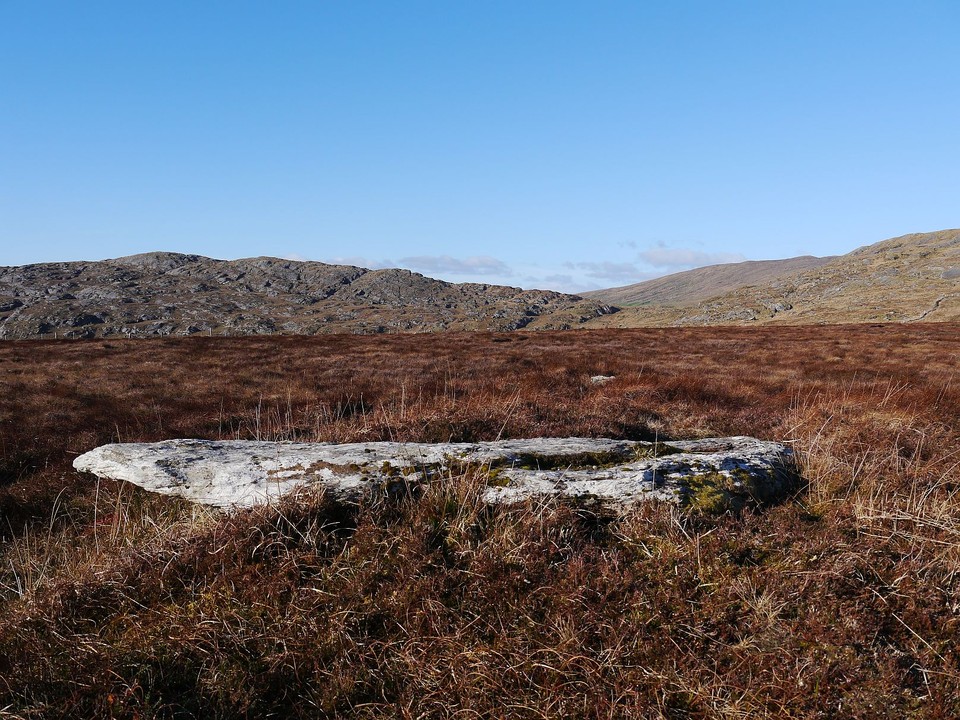
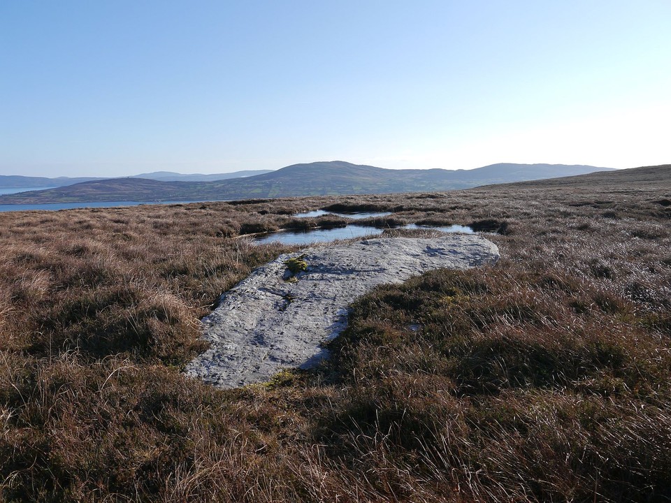
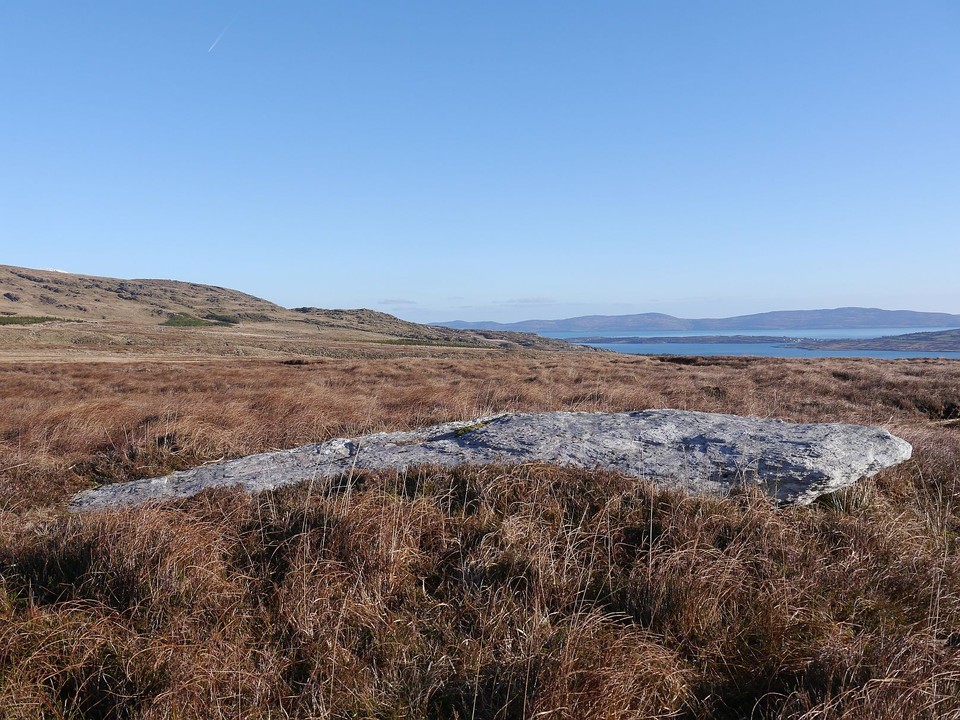
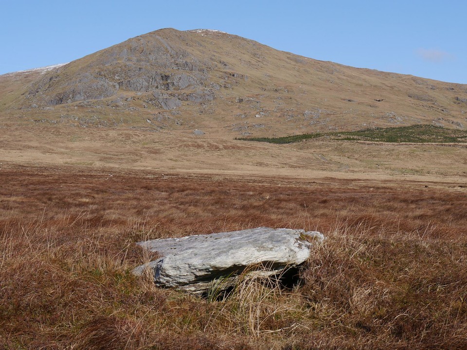
Rodeen 3
Standing Stone / Menhir
Rodeen 3 (Standing Stone / Menhir) on The Modern Antiquarian, the UK & Ireland's most popular megalithic community website. 4 images, plus information on many more ancient sites nearby and across the UK & Ireland.
Image © Michael Mitchell
Nearest Town:
Sneem (18km NNW)
OS Ref (IE):
V694484 /
Sheet: 84
Latitude:
51° 40' 22.9" N
Longitude:
9° 53' 17.4" W
Added by
Meic
Images (4)
0 discussions
Start a topic
Show |
Hide
Web searches for Rodeen 3
Flickr
Google
Google Images
The Megalithic Portal
Bing
Stone Pages
Wikipedia
Show map
(inline Google Map)
- Sites within 20 km -
-
Rodeen 2 (0.36km E) (5 posts)
Rodeen 1 (0.41km N) (3 posts)
Cloontreem (0.5km NNW) (15 posts)
Kilmackowen (1.64km WNW) (17 posts)
Kilmackowen (1.78km WNW) (9 posts)
Derrymihin West (1.82km S) (3 posts)
Derreenataggart Middle (3.45km SW) (2 posts)
Derreenataggart West (3.46km SW) (31 posts)
Fanahy (5.53km SW) (4 posts)
Ballycrovane (5.81km WNW) (18 posts)
Coulagh (5.88km W) (1 post)
Teernahillane (5.89km WSW) (4 posts)
Teernahillane (5.97km WSW) (9 posts)
Teernahillane (5.97km WSW) (1 post)
Teernahillane (5.97km WSW) (3 posts)
Coulagh (6.28km W) (5 posts)
Ardgroom Outward (7.01km N) (34 posts)
Knockoura (7.28km WSW) (2 posts)
Ardacluggin (7.37km WSW) (1 post)
Hag of Beara (7.43km WNW) (9 posts)
Ardacluggin (7.51km W) (4 posts)
Gour (7.57km SW) (10 posts)
Glashananinnaun (8.46km NNE) (5 posts)
Urhin (8.67km WSW) (5 posts)
Coomgira (8.81km ENE) (6 posts)
Shronebirrane (9.2km NE) (22 posts)
Kealoge (9.67km WSW) (3 posts)
Kealoge (9.98km WSW) (6 posts)
Cashelkeelty NW (10.6km NNE) (12 posts)
Cashelkeelty SE (10.73km NNE) (13 posts)
Clogherane (11.71km NE) (3 posts)
Clogherane (11.73km NE) (3 posts)
Cahermore (11.77km SW) (5 posts)
Reenkilla (11.86km NE) (5 posts)
Cappaleigh North (12.92km ENE) (4 posts)
Kilcaskan (12.95km ENE) (5 posts)
Drumlave (12.99km ENE) (11 posts)
Kildromalive (13.39km ENE) (5 posts)
Killough West (14km WSW) (9 posts)
Peakeen (14.56km ESE) (6 posts)
Lehid (14.71km NE) (2 posts)
Caherurlagh (14.92km ESE) (6 posts)
Ballynahowen (15.18km ENE) (15 posts)
Lehid (15.27km NE) (3 posts)
Lehid (15.39km NE) (1 post)
Drombohilly Wedge Tomb (15.49km NE) (2 posts)
Leitrim Beg (15.64km ENE) (21 posts)
Drombohilly (15.65km NE) (32 posts)
Staigue Bridge (16.06km WNW) (13 posts)
Staigue (16.14km WNW) (0 posts)
Killenough (16.38km ENE) (5 posts)
Farranamanagh (16.43km ESE) (6 posts)
Farranamanagh (16.63km ESE) (2 posts)
Loughane More (16.67km WSW) (6 posts)
Kilcrohane (16.82km ESE) (9 posts)
Staigue Cashel (17.02km NW) (21 posts)
Caherdaniel (18.42km WNW) (4 posts)
Coomnahorna East (18.49km WNW) (0 posts)
Gorteanish (18.68km E) (14 posts)
Darrynane More (18.99km W) (8 posts)
Uragh West (19.57km NE) (12 posts)
- Add -
-
Add news
Add an image
Add fieldnotes
Add folklore
Add miscellaneous
Add a link
-
Add a site
Add a nearby facility
Add an alternative name/spelling
Images
(click to view fullsize)
Add an image
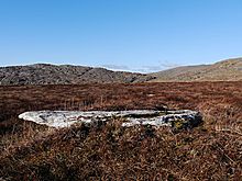 Image © Michael Mitchell