The Modern Antiquarian
Log in
|
Register
Home
Latest Posts
Forums
Maps
Help
Browse Sites
News
Blog
Contributors
The Books
Select
-
Belgium
Denmark
Eire
France
Germany
Greece
Italy
The Netherlands
Norway
Portugal
Republic of Malta
Spain
Sweden
Switzerland
United Kingdom
Scotland
Highland (Mainland)
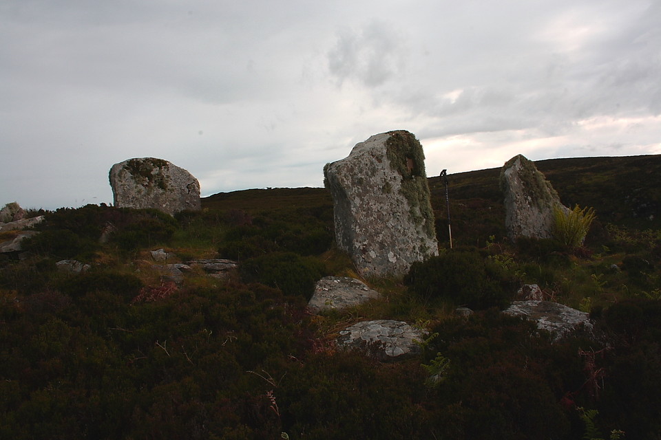
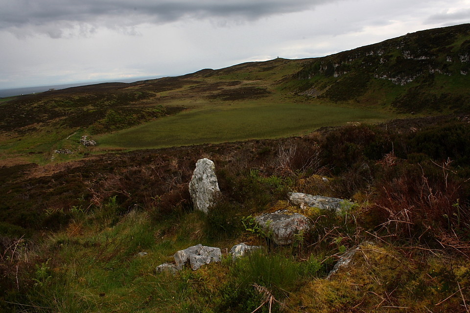
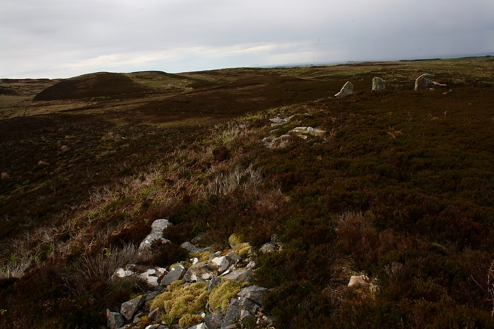
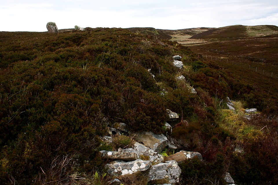
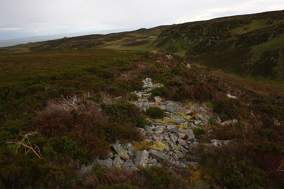
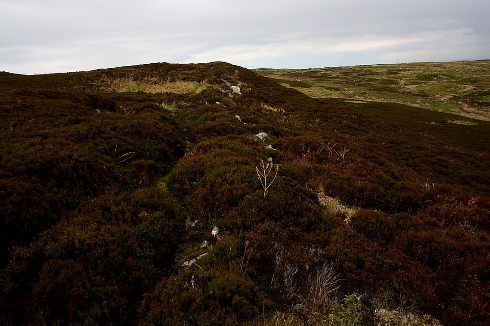
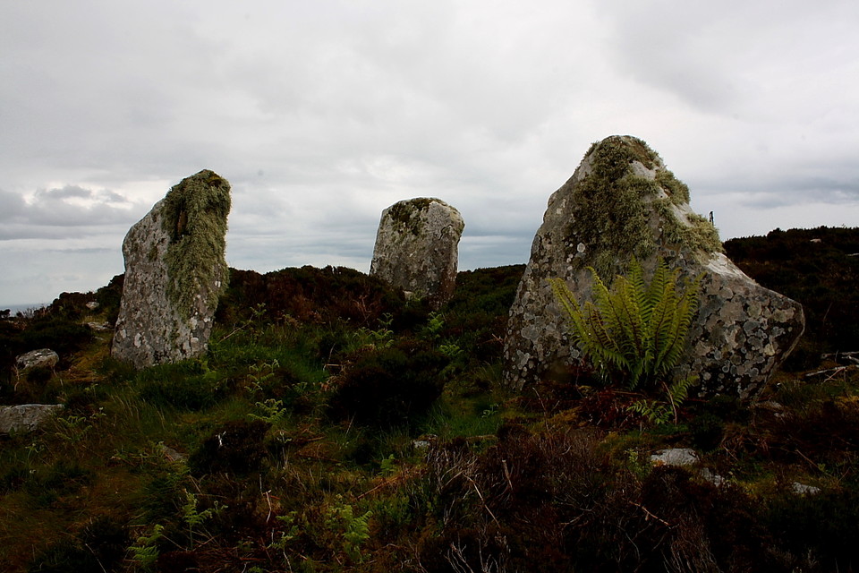
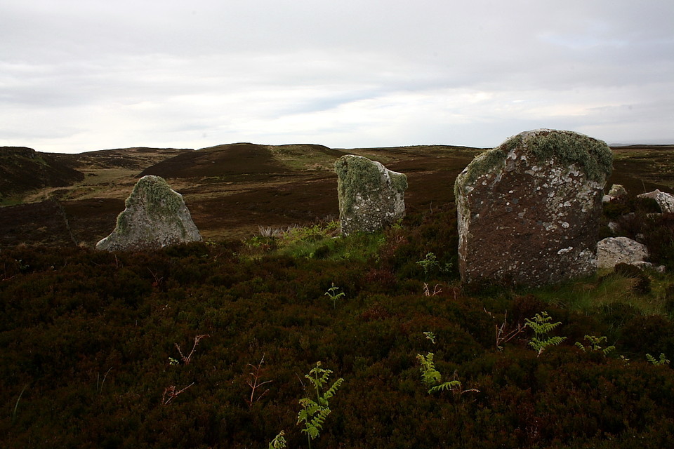
Garrywhin
Hillfort
Garrywhin (Hillfort) on The Modern Antiquarian, the UK & Ireland's most popular megalithic community website. 9 images, plus information on many more ancient sites nearby and across the UK & Ireland.
Image © Robert Gladstone
Nearest Town:
Wick (11km NNE)
OS Ref (GB):
ND3125341377 /
Sheets: 11, 12
Latitude:
58° 21' 20.27" N
Longitude:
3° 10' 29.54" W
Added by
GLADMAN
Images (9)
0 discussions
Start a topic
Show |
Hide
Web searches for Garrywhin
Flickr
Google
Google Images
MAGIC
The Megalithic Portal
Bing
Stone Pages
Streetmap.co.uk
Wikipedia
Show map
(inline Google Map)
- Sites within 20 km -
-
Garrywhin Cists (0.28km SSE) (10 posts)
Garrywhin Stone Rows (0.28km SSE) (5 posts)
Garrywhin (0.28km SSE) (29 posts)
Watenan South (0.52km E) (7 posts)
Kenny's Cairn (0.63km SSW) (14 posts)
Warehouse S (0.97km WNW) (14 posts)
Warehouse E (0.99km NW) (10 posts)
Warehouse N (1.11km WNW) (8 posts)
Bruan (1.91km S) (6 posts)
South Yarrows S (1.92km NW) (16 posts)
South Yarrows Broch (2.07km NW) (15 posts)
Loch of Yarrows Archaeological Trail (2.12km NW) (1 post)
South Yarrows N (2.19km NW) (6 posts)
Borrowston (2.7km NE) (5 posts)
Hill O'Many Stanes (3.45km SW) (29 posts)
Thrumster Mains (4.09km NNE) (8 posts)
Gansclet (4.22km NE) (1 post)
Burn Of Swartigill (4.44km N) (3 posts)
Thrumster Little (5.05km NE) (6 posts)
Camster Stone Row (5.76km W) (4 posts)
Grey Cairns of Camster (5.85km W) (81 posts)
Lower Camster (6.85km WNW) (9 posts)
Cirn of Humster (8.15km NE) (1 post)
Rumster (10.91km WSW) (3 posts)
Golsary (11.42km WSW) (5 posts)
Forse, Latheron (11.6km WSW) (6 posts)
The Pap (11.85km NE) (1 post)
Forse House (11.98km WSW) (1 post)
Achkinloch (12.34km W) (8 posts)
The Great U of Stemster (12.41km W) (37 posts)
Forse House (12.43km WSW) (2 posts)
Wag of Forse (12.59km WSW) (9 posts)
Elsay (12.87km NE) (3 posts)
Loch Rangag (13.21km W) (13 posts)
Ackergill Mains (13.45km NNE) (2 posts)
Buldoo (13.64km WSW) (18 posts)
Rangag West (13.97km W) (11 posts)
Guidebest (14.61km WSW) (15 posts)
Watten (14.64km WNW) (7 posts)
Upper Latheron (16.15km WSW) (6 posts)
Houstry Broch (South) (17.09km WSW) (3 posts)
Knockinnon (17.12km WSW) (4 posts)
Minera (17.12km WSW) (6 posts)
Tiantulloch (17.17km WSW) (7 posts)
Burn of Houstry (17.88km WSW) (5 posts)
Cuag (17.88km WSW) (4 posts)
Buoldhu (18.04km WSW) (3 posts)
Tulach Mor (18.27km W) (12 posts)
Tormsdale Stone Rows (18.37km W) (1 post)
Tulach Beag (18.68km W) (5 posts)
Ballone, Mybster (18.85km W) (5 posts)
Dunbrae (19.1km WSW) (2 posts)
Dunbeath Broch (19.14km WSW) (15 posts)
Carn Liath (19.52km WSW) (13 posts)
Loedebest (19.53km WSW) (2 posts)
Loedebest Wood (19.76km WSW) (5 posts)
Cnoc Na Maranaich (19.77km WSW) (6 posts)
Cnoc Na Maranaich (19.78km WSW) (6 posts)
Cnoc Na Maranaich (19.79km WSW) (15 posts)
Balantrath (19.88km WSW) (4 posts)
Loedebest West (19.98km WSW) (8 posts)
- Add -
-
Add news
Add an image
Add fieldnotes
Add folklore
Add miscellaneous
Add a link
-
Add a site
Add a nearby facility
Add an alternative name/spelling
Images
(click to view fullsize)
Add an image
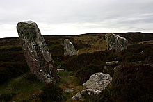 Image © Robert Gladstone