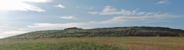
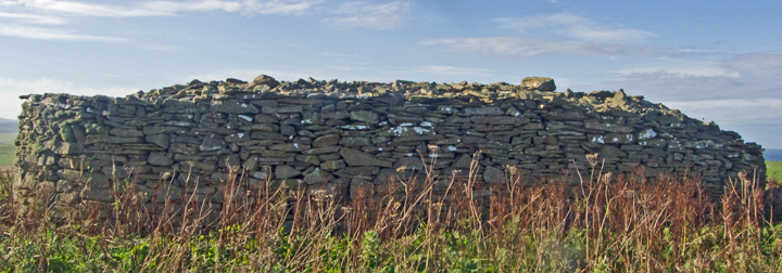
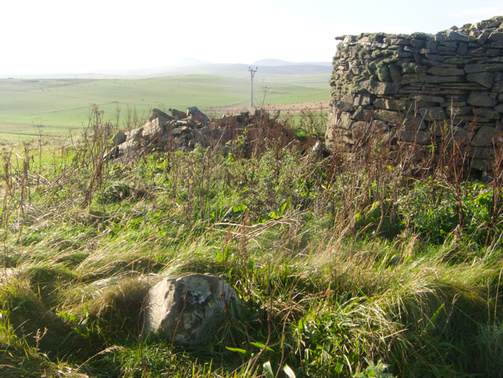
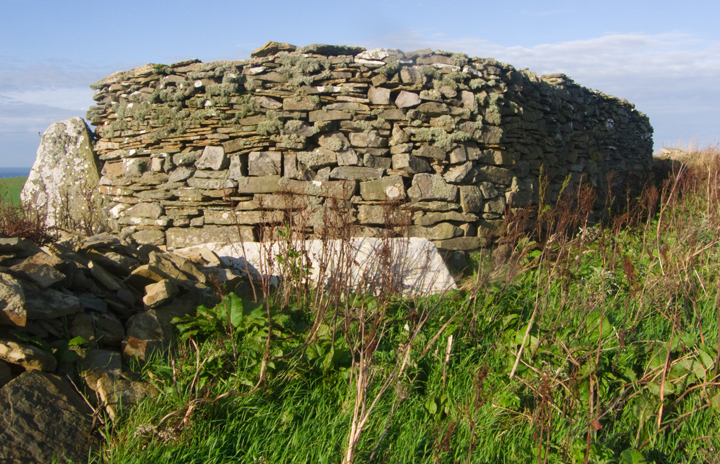
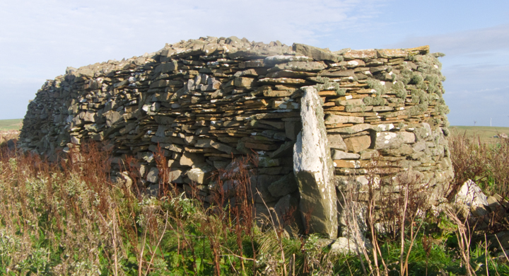
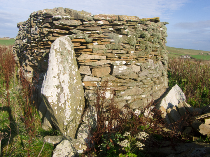
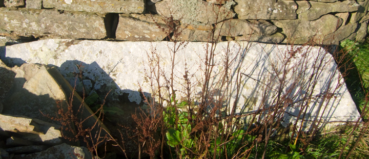
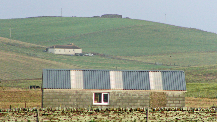
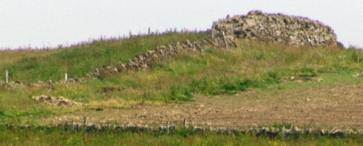
Just north of the Sandwick war memorial take the road going east through the Midstowe and Netherstove. Before reaching Netherstove take the diagonal track up to the minor road and turn right. The Rossel Howe wall is plain to see two fields east of the road. I didn't realise you can walk straight up to it (the fence is practically gone) and so came around the edge ofa field. Looking at the rise atop the hill the cairn sits on I woner if it isn't man-made. At the southern end is a pile of stones that could be the remains of the second cairn, badly robbed for stone. Rossel Howe cairn is a rectangle with well rounded corners, feeling almost oval to me. There is another pile of stones at the other end of the cairn, buth this is obviously leftovers and parts that have come off the wall. The stones are very different from the two slabs, which are mostly white. It doesn't come out well in my photos that the erect slab sticks out from the cairn material at an angle of, say, 45 degrees. It is said the two slabs could have been parts of a cell. But there must have been a reason why they are where they are, and given the angle of the slab it strikes me that whoever built the wall was surely marking for posterity the place where the entrance had been (in which case could it even be in its original position ?). Standing at Rossel Howe there is a grand view almost the whole way around, and the mound is easily seen coming up to Skail. Indeed, because this day the hill was distinctly multi-coloured I was ablt to see it as I walked several miles towards Twatt and retracing my steps several more going to Stromness. If you wish to avoid the roads the set of tracks going by the site of the 'Snusgar' excavations takes you to the Netherstove farm road.
Coming up towards West Bain in Sandwick (near the Bay of Skaill) and two fields to your left a wall made of oversized stones can be seen at the high point. The side facing the road there is still a rise, and I wonder if the cairn overlay something else or if this is the ONB's other tumulus.
It does seem strange that having bothered to clear the cairn they then undid their work by building this massive wall - perhaps they had thought the mound purely natural, and on discovering their error constructed a memorial over the cist ?
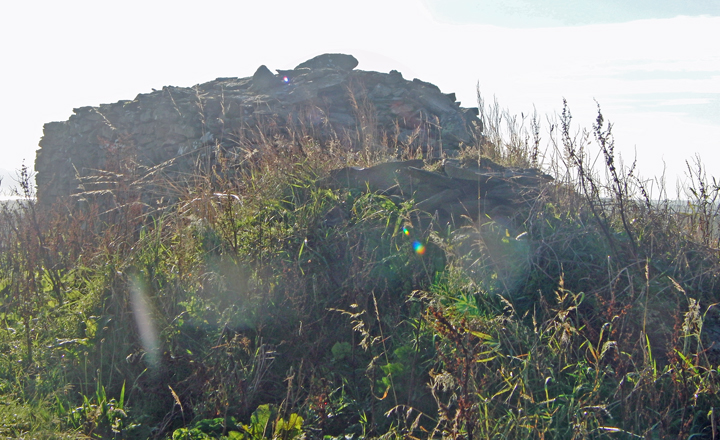
A 13m x 3m x 2m wall was constructed from the Rossel Howe Cairn material (HY22SW 5) some time after the Orkney Name Book of 1880 (the ONB actually places two tumuli here). During the demolition human remains were found in a cist. At the south-east end two stones, one approx 2.3x0.6 m fallen but the other approx 2.3x0.8 m still erect, are thought likely parts of a chamber.