|
|

|
|
Carneddi LlwydionCairn(s)
|
||||||||||||||||||||||||
|
|
|
Images (click to view fullsize) |
|
|
Fieldnotes |
|
|
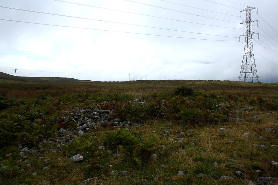
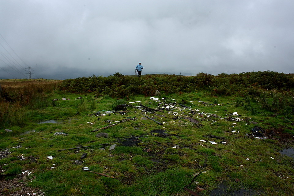
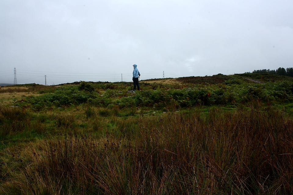
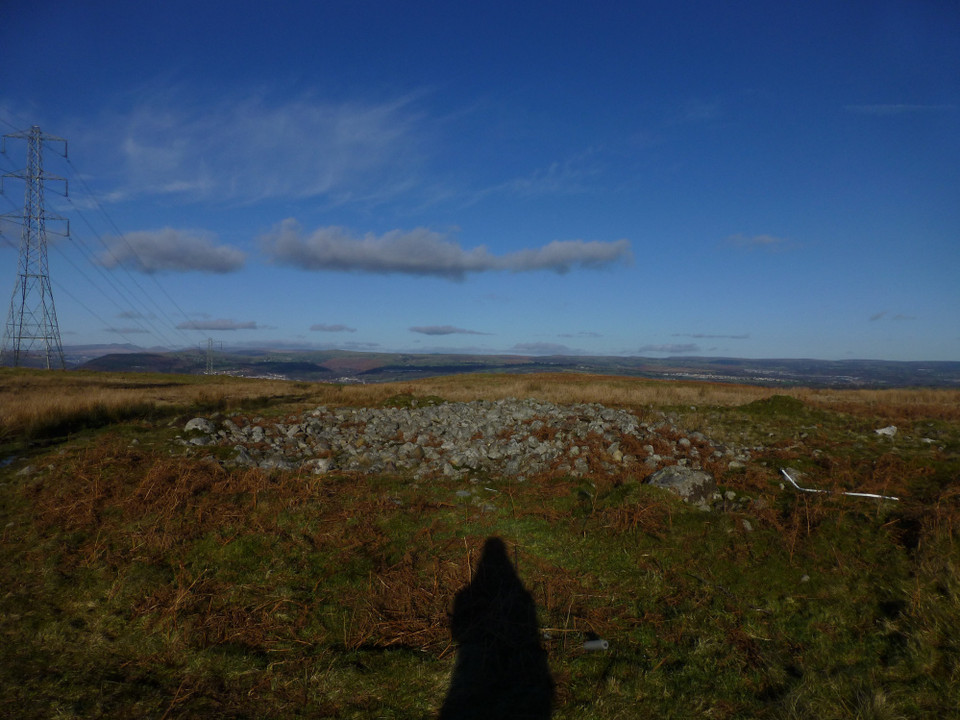
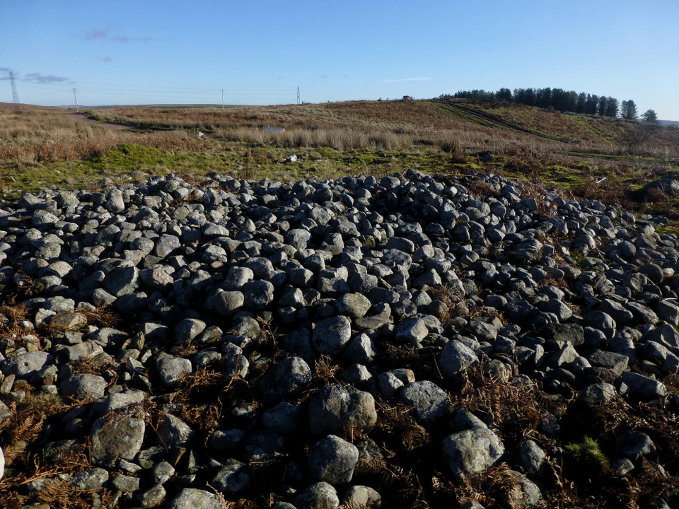
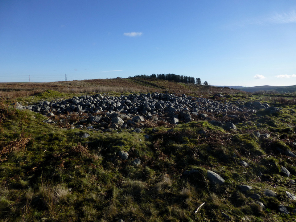
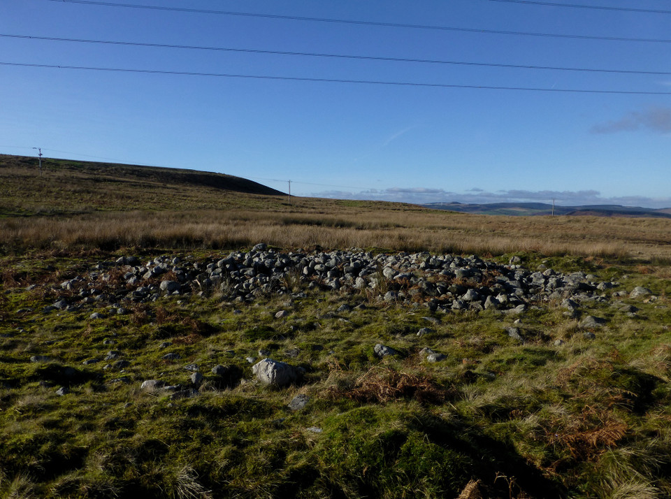
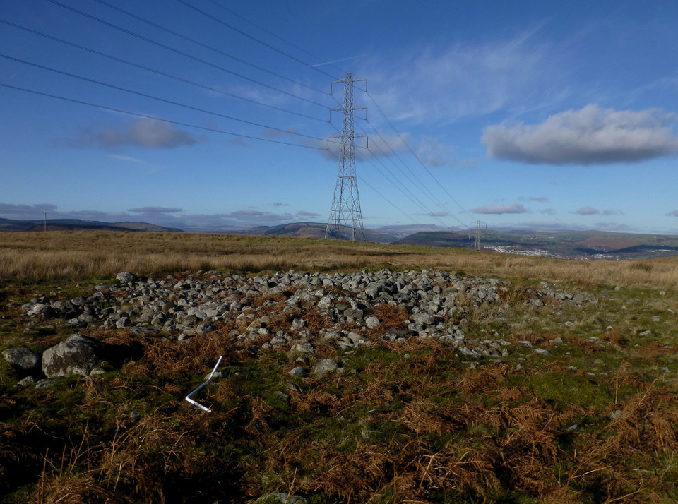
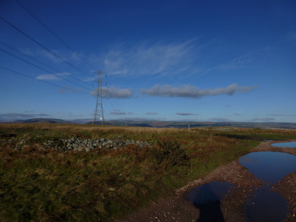
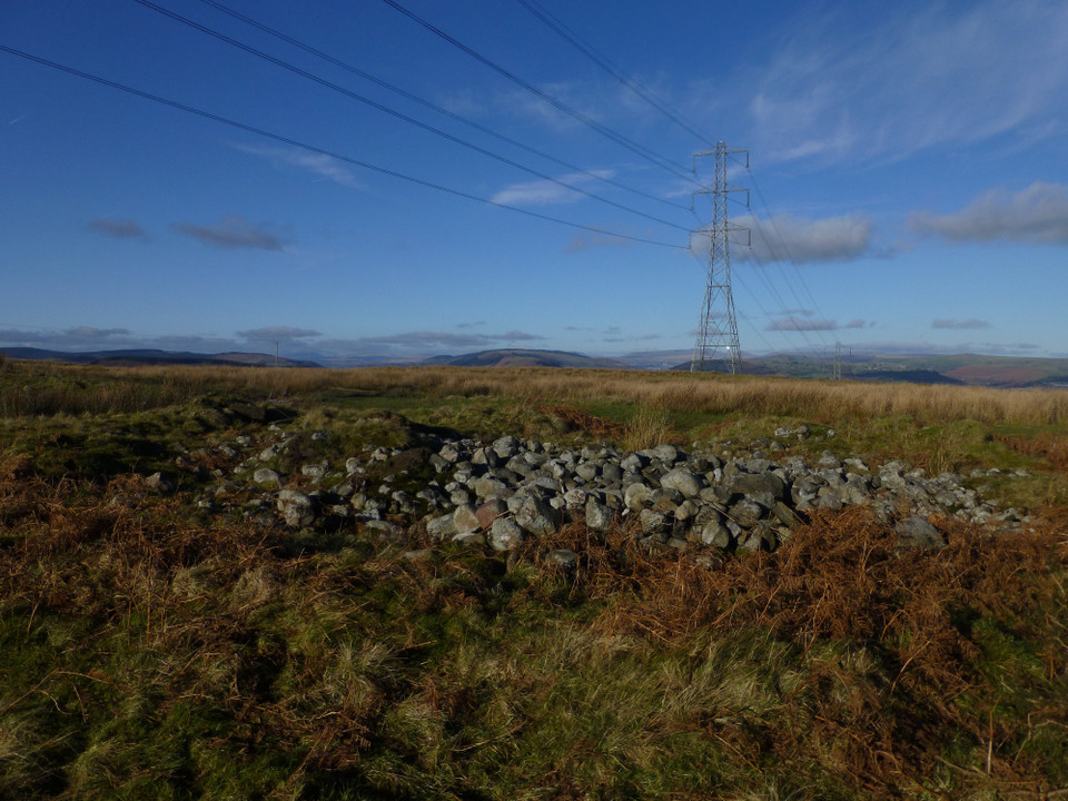
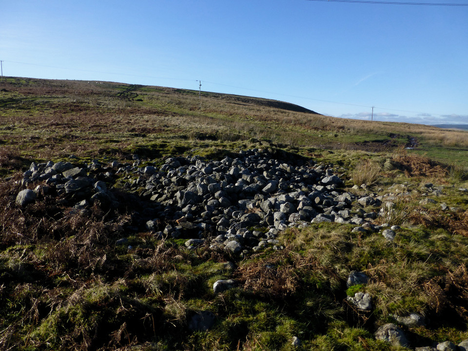
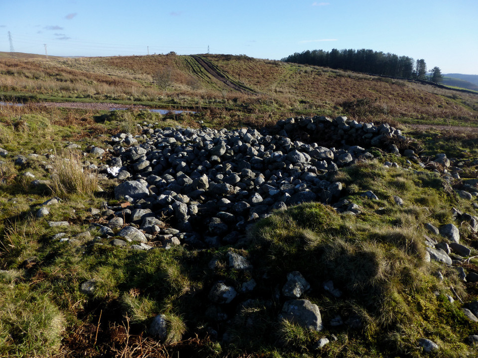
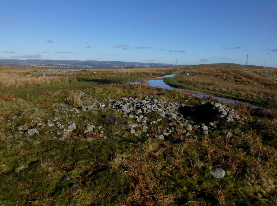
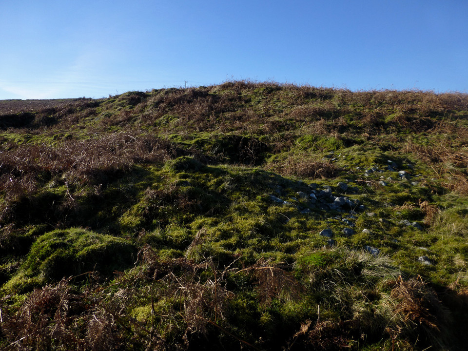
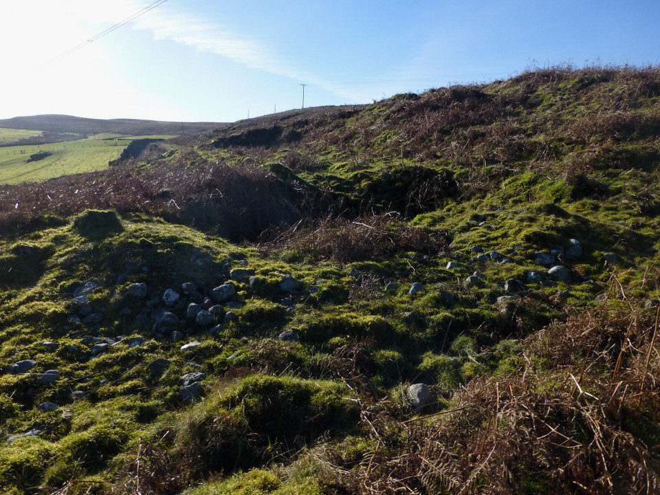
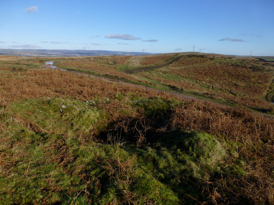
Visited 29.11.12 Directions: Take the B4263 north through Abertridwr and then Senghenydd. Continue through Senghenydd and take the minor road across Eglwysilan Common. Just past the brick building/fencing on the left there is a large parking area (near the pylons) – park here. All you then need to do is follow the track west towards the next set of electric pylons – about a 10 minute easy walk. It was a beautiful day. Dark blue sky, not a cloud in sight. High above jets formed a criss-cross of white vapour trails. There was no wind and all was silent. Even the sheep seemed to equally be enjoying the day. The rutted track had many large puddles, all frozen solid after the overnight frost. It was a great day to be out ‘old stoning’. On such a clear day the Brecon Beacons could be easily seen in the distance. More closely the windows on the houses in the village of Senghenydd sparkled in the afternoon sunlight. The only things to spoil the atmosphere were the pylons (which I guess we have to accept) and yet again, the amount of litter, beer cans and burnt out mattresses etc (which we most certainly do not have to accept). What is it with some Valley’s folk? I have been to many sites in the South Wales Valleys and they all have one thing in common – dumped rubbish. Why do people do this? After all, it’s not exactly an easy place to dump rubbish. Why not take it to the tip or call the council out like normal people? The older I get the more despairing of people I get. I know it’s only a minority but illegally dumping rubbish in South Wales seems to be a popular hobby! Anyway, onto more positive things. Before visiting this site I had a look to see what COFLEIN had to say: ‘On Eglwysilan Common several tumuli opened in 1753. The urns were all broken by the workmen – they each lay upon a flat stone and another over them. One of a group of 3 cairns located on Mynydd Eglwsilan’. Sounded promising. The first Cairn you come to is very easy to find. Next to the track on the right, just before the electricity cables, near the wooden footpath sign. It consists of a large deposit of grey stones, spread out to a diameter of about 15m and a height of 0.5m. Patches of ferns growing through the Cairn. Several kerb stones could be seen – some covered in grass. The kerb stones above the ground were covered in moss. The Cairn has a pronounced ‘rim’ surrounding it. The second Cairn is another easy to spot – about 20m further along the track on the same side. It was more ruined than the first and was approximately 8m across x 0.3m high. Basically another file of grey stones, partly grassed over. The third Cairn is also straight forward to find (although I went too far uphill and it took me a while!). Walk along the track and as soon as you come under the electricity cables it is immediately on your right. The centre of this Cairn has a large hollow dug out of the middle and again, is very ruined. You could hear the buzz and crackle of the electricity running through the cables. I wonder what the ancients would have thought of it all? On such a nice day, in such a nice location (ignoring said pylons and rubbish) I sat for a while and contemplated the meaning of life. No, I didn’t come up with any answers! All in all an easy site to access and well worth a visit when in the area. |
Posted by CARL 30th November 2012ce |
Miscellaneous |
|
|
Linear-ish group of cairns on the Senghenydd Ridge. Coflein descriptions for each (west-east): Cairn A (ST10479193) measures 9m diameter, 0.7m high on the SE, 0.1m on the NW. The centre has been dug out to ground level. Uncertainly a round barrow; if it is the location looks unusual.Cairn B (ST105920) measures 15.2m in diameter and 0.6m high. The ring-like perimeter measures 1.5m-1.8m wide, possibly an integral part of construction but possibly a feature of erosion.Cairn C (ST10529204) measures 17.1m in diameter and 0.9m high. The pronounced ring-like rim measures 2.1m-2.8m wide and 0.3m high. |
 Posted by thesweetcheat
12th March 2014ce Edited 12th March 2014ce |