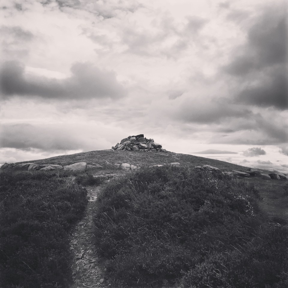
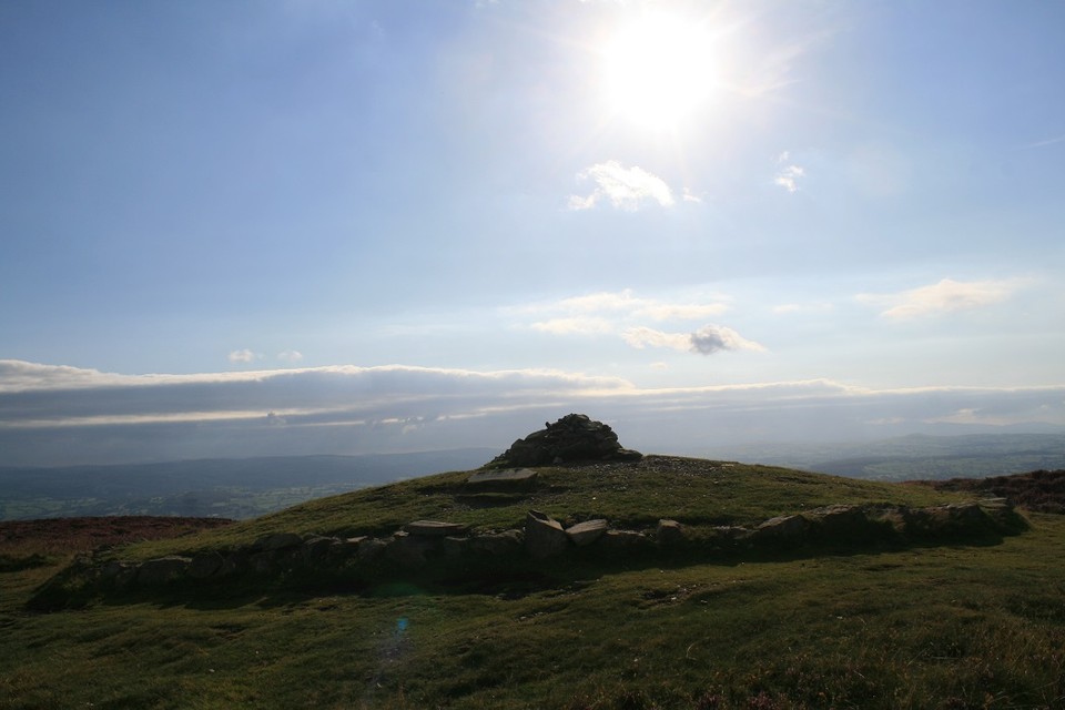
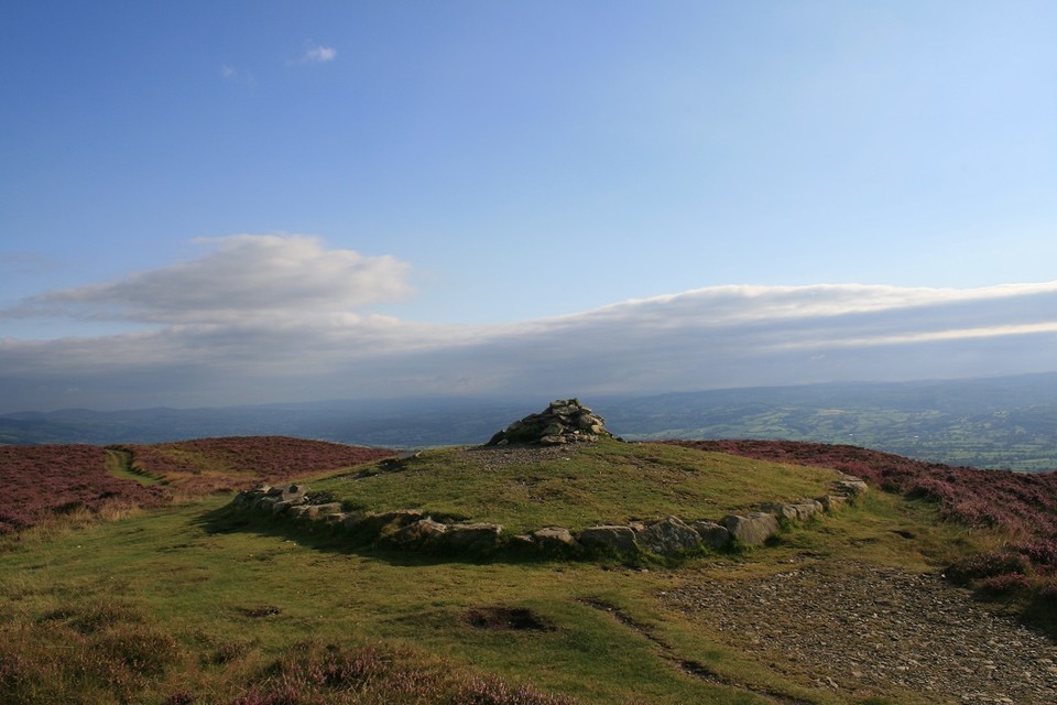
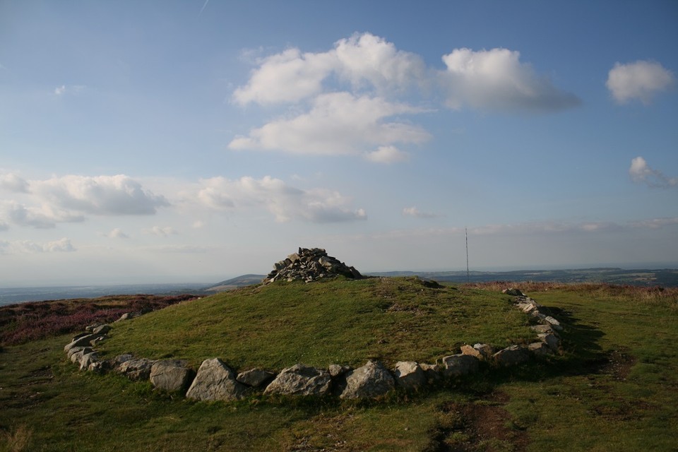
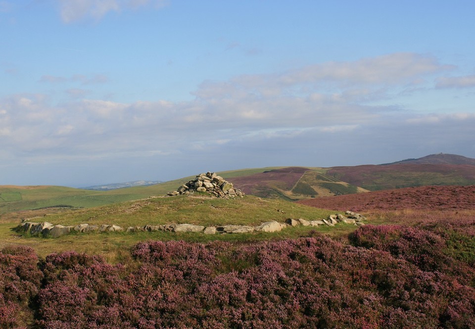
When I came here in 2007 I stood right next to if not on top of this bronze age cairn, and never noticed it. Of course I noticed there was the predictable small walkers pile of stones on the highest ground but, apart from that I remained clueless. Until Thesweetcheat went up there and found that the thing had been restored, of course that means I'll have to go back for another look, four years it took since I found out about it. Not bad.
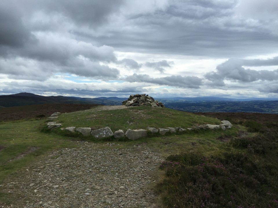
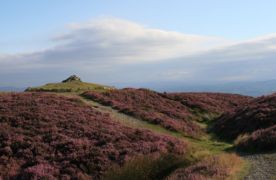
The cairn is right at the northern tip of the fort of the same name, and right next to one of the busiest footpaths in North Wales. It looks good but I'm not sure about it though, the stones of the kerb are loose and simply placed on the ground in a circle around the slight mound. Some of the stones have already started to spread, I replaced a few but they leave a big brown mark where the grass has died. Honestly, I cant really see it remaining long in the shape it is now, which is a shame because it looks good, from a distance.
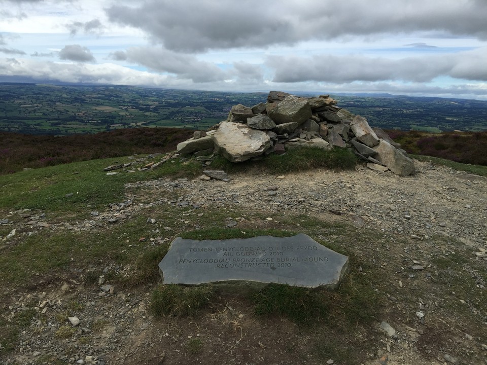
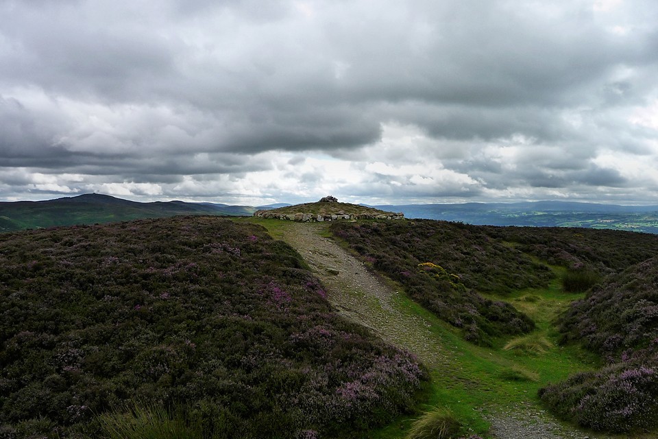
Restored Bronze Age summit cairn at the northern end of Penycloddiau fort. Coflein details prior to reconstruction:
A mound of rubble stone, 2m diameter and 0.7m high, formerly summounted by a triangulation point, marked on 1st edition OS map. Due to erosion from the nearby Offa's Dyke Path, an evaluation excavation was undertaken in 2008 to test the origin and date of the mound. Based on these results a more extensive investigation was conducted in May 2009. Both programmes of work were undertaken by CPAT. The excavations showed that the mound was artificial and had a large pit at its centre, possibly a robbed Bronze Age cist but also possible as a more recent disturbance. The general conclusions, despite the lack of dating evidence, was that the mound was a former Bronze Age burial cairn although it was heavily disturbed in later times by the erection of a triangulation point and a walker's cairn. A report has been deposited in the NMRW archive. The monument will now be reconstructed by the Heather and Hillforts Project.

 Posted by postman
 Posted by thesweetcheat