The Modern Antiquarian
Log in
|
Register
Home
Latest Posts
Forums
Maps
Help
Browse Sites
News
Blog
Contributors
The Books
Select
-
Belgium
Denmark
Eire
France
Germany
Greece
Italy
The Netherlands
Norway
Portugal
Republic of Malta
Spain
Sweden
Switzerland
United Kingdom
County Wicklow
St. Kevin's Bed (Hollywood)
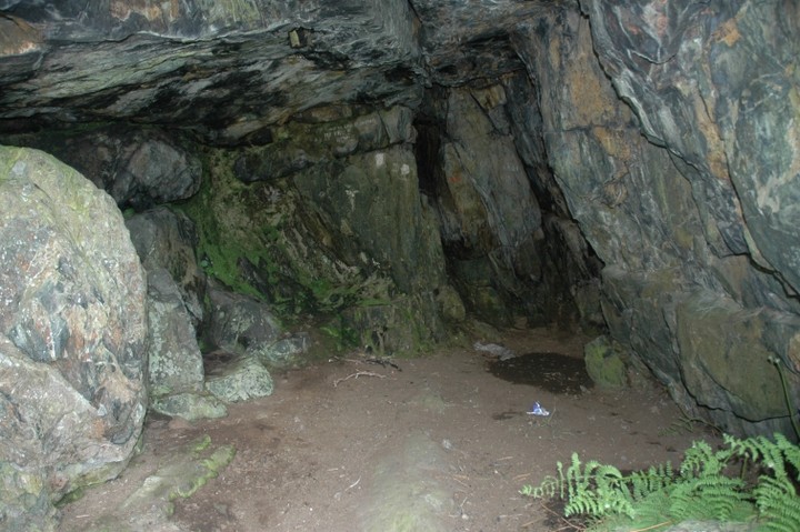
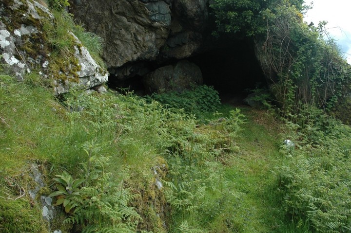
Cave / Rock Shelter
St. Kevin's Bed (Hollywood) (Cave / Rock Shelter) on The Modern Antiquarian, the UK & Ireland's most popular megalithic community website. 4 images, plus information on many more ancient sites nearby and across the UK & Ireland.
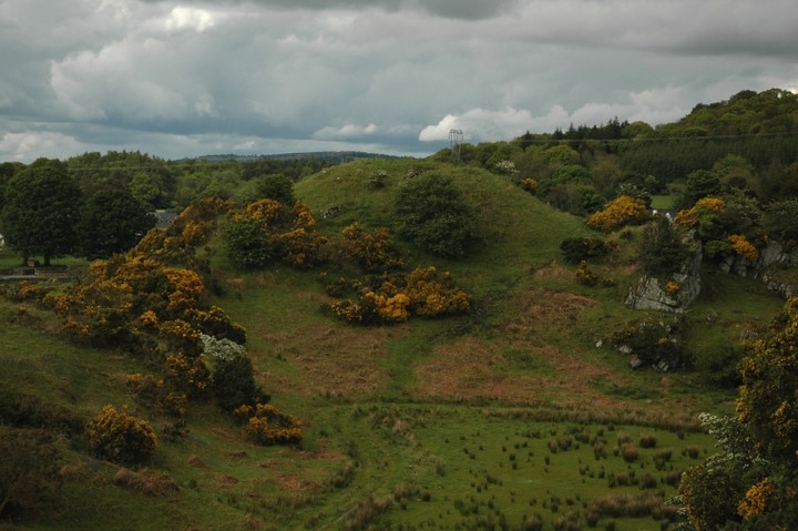
Image © ryaner
Nearest Town:
Ballymore Eustace (5km NNW)
OS Ref (IE):
N940052 /
Sheet: 56
Latitude:
53° 5' 20.96" N
Longitude:
6° 35' 48.53" W
Added by
ryaner
Images (4)
0 discussions
Start a topic
Show |
Hide
Web searches for St. Kevin's Bed (Hollywood)
Flickr
Google
Google Images
The Megalithic Portal
Bing
Stone Pages
Wikipedia
Show map
(inline Google Map)
- Sites within 20 km -
-
Scalp (0.82km SSW) (6 posts)
Scalp Rath (0.85km SSW) (2 posts)
Broughills Hill (1.3km ENE) (11 posts)
Slievecorragh (1.36km ESE) (6 posts)
Kiernans Hill (1.48km ENE) (4 posts)
Johnstown (1.61km ENE) (2 posts)
Johnstown Hut Site 1 (1.78km ENE) (2 posts)
Whiteleas (2.08km WNW) (11 posts)
Athgreany (2.1km SSW) (49 posts)
Crehelp II (2.31km W) (4 posts)
The Dailteen Stone (2.34km ESE) (3 posts)
Broadleas (2.5km NW) (34 posts)
Blakestown Upper (2.55km NE) (3 posts)
Athgreany standing stone (2.57km SSW) (5 posts)
Athgreany Rath (2.57km SSW) (5 posts)
Lugnagroagh (2.69km NE) (3 posts)
Kinsellastown II (2.72km WSW) (2 posts)
Crehelp (2.82km SW) (6 posts)
Crehelp (2.82km SW) (1 post)
Kinsellastown (2.86km WSW) (3 posts)
Toor (3.16km ESE) (0 posts)
Ballybought (3.32km WNW) (5 posts)
Lugglass Upper I (3.47km ESE) (2 posts)
The Piper's Stones (3.51km ESE) (4 posts)
Toor (3.51km ESE) (3 posts)
Longstone (3.62km NW) (0 posts)
Toor (3.68km ESE) (5 posts)
Lugglass Upper II (3.85km ESE) (5 posts)
Ballybought (4.03km WNW) (3 posts)
Church Mountain (4.09km SSE) (4 posts)
Bishopsland (4.15km NNW) (3 posts)
Kilbaylet Upper (4.49km S) (4 posts)
Ballymore Eustace West (4.55km NW) (5 posts)
Plezica (5.43km SW) (9 posts)
Carrigacurra (5.59km ENE) (6 posts)
Blackmoor (6.29km SSW) (6 posts)
Kilbaylet Lower (6.31km S) (5 posts)
Kilbaylet Lower (6.41km S) (5 posts)
Togher (6.45km E) (0 posts)
Kilcoagh East (7km SSE) (3 posts)
Kilcoagh East/Levern (7.2km SE) (1 post)
Ballyknockan (7.25km ENE) (4 posts)
Donard (7.54km S) (6 posts)
Broomfields (7.81km SSW) (12 posts)
Tornant Lower (8.27km SW) (2 posts)
Tornant Upper (8.36km SW) (8 posts)
Sroughan (8.48km NE) (1 post)
Sroughan (8.49km NE) (6 posts)
The Ring (8.56km NNW) (0 posts)
Carrig Wedge Tomb (8.82km NE) (11 posts)
Carrig Rath (8.86km NE) (0 posts)
Carrig Cairns (9km NE) (7 posts)
Carrig Standing Stone (9.06km NE) (2 posts)
Lackan (9.65km NE) (4 posts)
Kilbeg standing stone (9.82km ENE) (5 posts)
Knockiernan (9.86km NE) (0 posts)
Newtown Great (10.13km N) (0 posts)
Lugnagun Cairn (10.3km NE) (4 posts)
Kelshamore (10.39km S) (5 posts)
Blessington Demesne 2 (10.41km NNE) (4 posts)
Blessington Demesne 1 (10.54km NNE) (18 posts)
Lugnagun (10.56km NE) (14 posts)
Butterhill (10.6km NE) (0 posts)
Brewell's Hill (10.71km WSW) (3 posts)
Brewell's Hill (10.71km WSW) (1 post)
Brittas III (10.8km SE) (4 posts)
Brittas V (10.8km SE) (3 posts)
Brittas (10.8km SE) (7 posts)
Brittas IV (10.8km SE) (7 posts)
Brittas II (10.8km SE) (2 posts)
Blackrock (10.84km NE) (4 posts)
Kingsland (10.87km WSW) (5 posts)
Old Kilcullen (11.1km W) (1 post)
Castleruddery Lower (11.14km SSW) (4 posts)
Knickeen (11.14km SE) (9 posts)
Castleruddery (11.14km S) (48 posts)
Punchestown (11.14km NNW) (6 posts)
Newtown Park (11.21km N) (4 posts)
Brewell's Hill (11.22km WSW) (13 posts)
Kilgowen (11.26km WSW) (12 posts)
Kilbeg Cairn (11.39km ENE) (4 posts)
Butterhill (11.4km NE) (0 posts)
Craddockstown West (11.43km NNW) (9 posts)
Punchestown Standing Stone (11.51km NNW) (15 posts)
Oldcourt (11.65km NE) (4 posts)
Ballinagee (11.69km E) (1 post)
Leitrim (11.79km SE) (7 posts)
Dun Ailinne (12.09km W) (5 posts)
Woodend Hill (12.15km NE) (0 posts)
Sorrel Hill (12.16km ENE) (7 posts)
The Ballintruer Long Stone (12.78km SSW) (0 posts)
Ballintruer More (12.78km SSW) (6 posts)
Killeen Cormac (12.83km WSW) (4 posts)
Baltracy (13km NNW) (1 post)
Eadestown North (13.08km SSW) (0 posts)
Caureen (13.57km NNE) (7 posts)
Spinans Hill (13.69km S) (14 posts)
Coan (13.73km SE) (0 posts)
Spinans Hill (14.01km S) (0 posts)
Brusselstown Ring (14.21km S) (22 posts)
Goldenhill (14.43km NE) (13 posts)
Goldenhill mound (14.43km NE) (2 posts)
Forenachts (14.89km NNW) (3 posts)
Keadeen Mountain (15.33km SSE) (4 posts)
Forenaghts Great (15.38km N) (8 posts)
Keadeen Cursus (15.43km SSE) (5 posts)
Keadeen (15.48km SSE) (3 posts)
Keadeen (15.58km SSE) (0 posts)
Keadeen (15.58km SSE) (3 posts)
Boleycarrigeen (15.88km S) (57 posts)
Ballynabrocky (15.9km ENE) (0 posts)
Knockatillane (16km NE) (2 posts)
Tinode II (16.07km NNE) (2 posts)
Kilranelagh (16.11km S) (0 posts)
Colvinstown (16.19km S) (3 posts)
Tinode (16.2km NNE) (3 posts)
Muckduff Upper (16.25km SSE) (5 posts)
Keadeen standing stone 2 (16.33km SSE) (2 posts)
Maudlings (16.35km NNW) (4 posts)
Colvinstown Upper (16.35km S) (4 posts)
Tuckmill Hill (16.37km SSW) (3 posts)
Colvinstown Upper III (16.37km S) (2 posts)
Kilbeg (16.41km E) (14 posts)
Kilbride (Talbotstown Lower By.) (16.42km NE) (2 posts)
Kilbride (Talbotstown Lower By.) (16.42km NE) (4 posts)
Colvinstown Upper II (16.44km S) (2 posts)
Kilbride (Talbotstown Lower By.) (16.44km NE) (2 posts)
Dowery (16.44km NE) (0 posts)
Carignagower (16.46km NE) (0 posts)
Kilranelagh Graveyard (16.56km SSW) (6 posts)
Kilteel (16.62km NNE) (2 posts)
Cloghleagh (16.65km NE) (3 posts)
Baltinglass Hill (16.79km SSW) (2 posts)
Baltinglass Hill 'Basin' Stone (16.83km SSW) (3 posts)
Muckduff Upper 2/Carrig Mountain (16.86km SSE) (4 posts)
Baltinglass Hill Cairn - Standing Stone (16.89km SSW) (2 posts)
Baltinglass Hill - Cairn (16.89km SSW) (2 posts)
Baltinglass Hill - Tombs (16.89km SSW) (19 posts)
Baltinglass Hill - Standing Stone (16.89km SSW) (1 post)
Rathcoran Hillfort (16.89km SSW) (3 posts)
Curragh (16.94km W) (1 post)
Carrig Mountain (16.96km SSE) (0 posts)
Tinoran Hill (17.04km SW) (0 posts)
Curragh (17.11km W) (1 post)
Seefin 2 (17.23km NE) (7 posts)
Lybagh (17.28km SE) (0 posts)
Seefin Hill (17.35km NE) (56 posts)
Daw (17.49km ENE) (0 posts)
Ballyfolan (17.96km NE) (10 posts)
Cromwellstown (17.97km NNE) (2 posts)
Ballyfolan (18.12km NE) (4 posts)
Curragh (Kildare ED) II (18.61km W) (4 posts)
Seefingan (18.64km NE) (11 posts)
Curragh (Kildare ED) I (18.76km W) (1 post)
St. Kevin's Bed (Glendalough) (18.83km E) (1 post)
Gibbet Rath (18.86km W) (7 posts)
Butter Mountain (18.97km NE) (3 posts)
Hughstown (19.03km SW) (4 posts)
Mullamast Long Stone (19.11km WSW) (5 posts)
Slievethoul I (19.17km NNE) (9 posts)
Mullamast Barrows (19.19km WSW) (2 posts)
Mullamast Rath (19.22km WSW) (6 posts)
Slievethoul II (19.25km NNE) (0 posts)
Curragh Racecourse (19.3km W) (1 post)
Glenaraneen (19.46km NNE) (7 posts)
Humewood Castle (19.47km S) (4 posts)
Barretstown Hill (19.52km NW) (1 post)
Sevenchurches or Camaderry (19.89km E) (2 posts)
Glendalough Cottage (19.89km E) (4 posts)
Brockagh (19.98km E) (8 posts)
The Seven Fonts (19.98km E) (10 posts)
- Add -
-
Add news
Add an image
Add fieldnotes
Add folklore
Add miscellaneous
Add a link
-
Add a site
Add a nearby facility
Add an alternative name/spelling
Images
(click to view fullsize)
Add an image
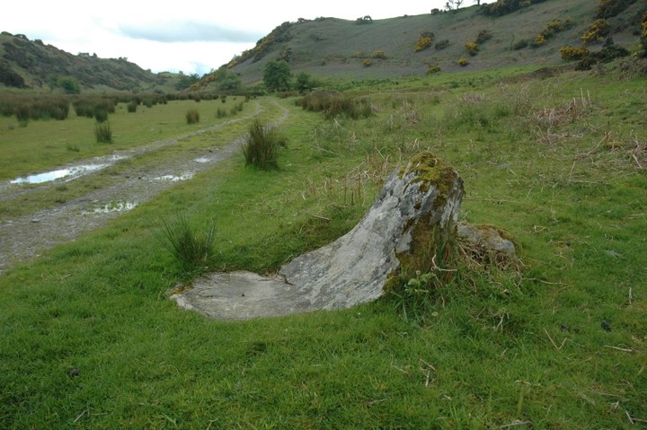
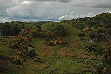 Image © ryaner