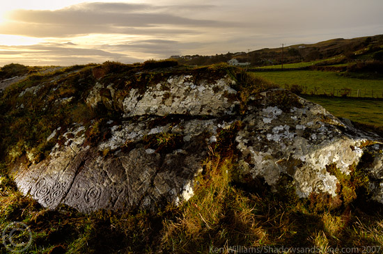
We asked for permission to visit the rock at the small cottage on the right hand side of the lane as you head down. We were met with suspicion and hostility and told that no, we couldn't visit the site. I asked why was that and the old farmer told of how many people had come and damaged the fences and crops around the stone. The field that you would have to cross is too wet to be a tillage field so half of his argument was bull'. I explained that the people who had pissed him off previously maybe didn't have the same respect or reverence for the site and that me and my four year old daughter would do our best to leave his place exactly as we found it. I pressed him a bit, and felt then and feel now that if I had pushed a little further, he'd have relented, but I wasn't up for the argument, annoyed at his small-mindedness and suspicion. I'm not in Donegal that often and will probably never come back this way again. Shame.

 Posted by ryaner