
A modern cairn has been constructed on Loch an Dun fort to complete its indignity.
Image credit: Mark Johnstone
A modern cairn has been constructed on Loch an Dun fort to complete its indignity.

Leskernick North Circle captured in 2014 with a large recumbent and two stones visible. An additional stone breaking the surface can be seen in the left foregound beside a small mound. According to Historic England turf was cleared round the stones in 2018 so the circle will perhaps look more complete now.

The recumbent stone, c. 4 metres long, lies inside the circle, N of the centre in Leskernick North Circle.
Leskernick North Circle was added to the Historic England List (go to Links) on 16/10/19.
‘The stone circle comprises a recumbent stone (4m long) a little north of the circle’s centre with 25 stones in an almost-perfect circle approximately 23m in diameter.‘
The above quote is an extract from Historic England’s summary of Leskernick North Circle. A more detailed account is contained therein.
According to Historic England turf was cleared round the stones in 2018 so the circle will perhaps look more complete now.
Historic England Entry for Leskernick North Circle
Dranigower Hut Circles aka Fauldinchie/Hardcroft Hut Circles

Dranigower Hut Circle W viewed from S. Note the proximity of beef cattle. They can be dangerous but on this occasion they ignored me.

W arc of Dranigower Hut Circle W.

E arc of Dranigower Hut Circle W.

S Entrance of Dranigower Hut Circle W.

SE Bank of Dranigower Hut Circle W.

Earthfast stone incorporated into SW Bank of Dranigower Hut Circle W.

Dranigower Hut Circle E viewed from S.

Interior of Dranigower Hut Circle E viewed from SE.

E arc of Dranigower Hut Circle E.

Scattered stones on E arc of Dranigower Hut Circle E.
Dranigower Hut Circles lie on unimproved moorland 1 mile E of New Luce just off the Southern Upland Way (SUW). The ground is wet and tussocky so wellies are strongly recommended. Watch out for Beef Cattle in the area within 200 yards of the Hut Circles.
Dranigower Hut Circle E is smaller and less defined than its companion. It is around 7 yards internally on a N-S axis with a surrounding stony earth bank up to 2 feet high & 4 feet wide. The earth bank is intermittent and covered in ferns. The interior of the circle is also covered in ferns. On the E arc there is a large scatter of stones which Canmore ID 61638 (go to Links) has interpreted as the remains of a small hut or pen.
Dranigower Hut Circle W lies 75 yards W.
Directions: At the S edge of New Luce, beside the church, take the un-signposted turn up the hill. Stay on this narrow lane for c. 1.1 miles until you reach the sign for the Southern Upland Way (SUW) at NX19106500. There is room to park here. Follow the SUW path for c. 0.5 miles to reach a SUW Post halfway up Knockcraven Wood at NX1937564690. Head W for 70 yards from this point to reach Dranigower Hut Circle E. Walk 75 yards W from here to reach Dranigower Hut Circle W.
Dranigower Hut Circles lie on unimproved moorland 1 mile E of New Luce just off the Southern Upland Way (SUW). The ground is wet and tussocky so wellies are strongly recommended. Watch out for Beef Cattle in the area within 200 yards of the Hut Circles.
Dranigower Hut Circle W is slightly larger and better defined than its neighbour. It is around 9 yards internally on a N-S axis with a surrounding stony earth bank up to 3 feet high & 4 feet wide. There is a 4 feet gap in the bank in the S quadrant denoting a probable entrance according to Canmore ID 61638 (go to Links). The SE perimeter has many exposed stones and there is a large earthfast stone incorporated into the SW bank. The interior of the hut circle is relatively flat and clear of vegetation however the S arc is partially obscured by ferns.
Dranigower Hut Circle E lies 75 yards E.
Directions: At the S edge of New Luce, beside the church, take the un-signposted turn up the hill. Stay on this narrow lane for c. 1.1 miles until you reach the sign for the Southern Upland Way (SUW) at NX19106500. There is room to park here. Follow the SUW path for c. 0.5 miles to reach a SUW Post halfway up Knockcraven Wood at NX1937564690. Head W for 70 yards from this point to reach Dranigower Hut Circle E. Walk 75 yards W from here to reach Dranigower Hut Circle W.
Lamford Burn Cairn


Scattered stones on the S quadrant of Lamford Burn Cairn.

Lamford Burn Cairn looking W towards Loch Doon. It has been razed to ground level from an original height of 6 feet.
Lamford Burn Cairn is a cairn in Dumfries and Galloway c. 1 mile from the border with East Ayrshire. According to Canmore ID 63853 (go to Links) in 1963 it was a ‘cairn 48 feet in diameter and circa 6 feet high.’ A subsequent report from 2004 gave the following detail: ‘The Scheduled Lamford Burn cairn was substantially damaged in July 2004. Unauthorised excavations at the cairn had left it severely truncated.‘
When I visited in 2012 I found the cairn razed to ground level on the N hemisphere and up to 1 foot high on the S hemisphere. There was a perimeter of earth and stones delineating the original footprint of the cairn with a stripped interior on the N side and scattered stones on the S side.

Lagganmullan 4 Panel with several Cup & Ring Markings and a small group of peck markings exposed.


S Chamber of King’s Cairn (Water of Deugh).

N Passage of King’s Cairn (Water of Deugh).

N Chamber of King’s Cairn (Water of Deugh).

Low Curghie Standing Stone (but not for long ...)

Low Curghie Standing Stone with a curious onlooker. (09.07.11)

Low Curghie Standing Stone guarded by stirks (09.07.11).
Google Maps Glenesslin Schoolhouse
Glenesslin Schoolhouse Cairn near Dunscore.

Glenesslin Schoolhouse Cairn viewed from the roadside.

Glenesslin Schoolhouse Cairn has two mature trees sprouting from its summit.
Glenesslin Schoolhouse Cairn is a small cairn located in a narrow wood 2 miles W of Dunscore. The cairn is c.100 yards SE of Glenesslin Schoolhouse in a patch of woodland beside the road. It measures around 50 feet across by 5 feet high. It is covered in vegetation with 2 mature trees sprouting from the summit.
The cairn is listed as Canmore ID 74892 (go to Links).
Directions: From the centre of Dunscore take Kirkgate which leads onto Black Brae at the outskirts of Dunscore. Keep on Black Brae for 1.5 miles then take a R turn to Corsock after a row of cottages. Go through a crossroads after 0.6 miles, continue straight for 500 yards until there is a narrow wood on your L just before a dead end R turn at Glenesslin Schoolhouse. The cairn is in the wood 50 yards back from the junction.


Google Maps view of Arden Fort
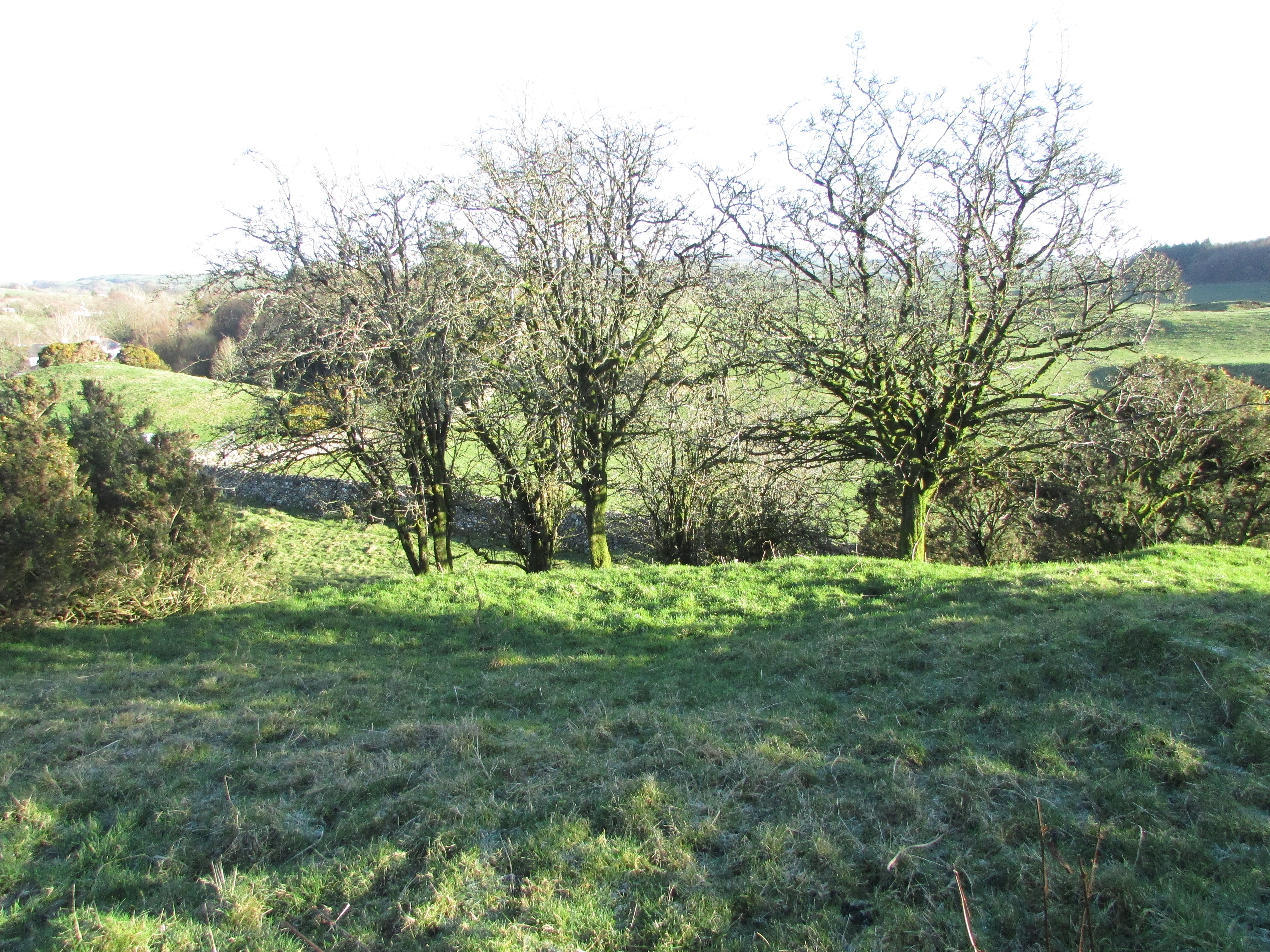
Arden Fort near Twynholm.
Arden Fort is an oval fort 0.5 miles W of Twynholm, a village in Dumfries and Galloway. It is situated on a natural hillock covered in gorse and hawthorn. The interior measuring c. 25 by 10 yards is protected by double ramparts and ditches and an elevated location. The fort measures c. 60 yards on the NE-SW axis and 40 yards on the NW-SE axis.
Canmore ID 64045 (go to Links) describes Arden Fort in more detail.
Directions: Take the A75 then turn off into Twynholm. From Twynholm Main Street take the minor road to Kirkcudbright on Burn Brae beside the Star Hotel. Stay on this road for 0.25 miles passing a church to reach the crossroads on the edge of Twynholm. Turn R into Arden Road. After 0.25 miles you pass the last house on this lane to reach the 60 mph speed limit. Around 250 yards later there is a wide gateway on the L with room to park. Arden Fort lies around 200 yards SE of the gateway, hidden under gorse and hawthorn.

A large enigmatic carving on the Idol Rock.

A graffito, possibly a Masonic Blazing Star, on the Idol Rock

Hough Stone Circle S viewed from N. The hill in the centre background is Carnan Mor, the highest point of Tiree, 5 km away.


Hough Cairn is not a large cairn however its proximity to Hough Stone Circle S gives it a greater significance in the landscape. What is the relationship between the cairn and the stone circle? Which site was erected first?
Canmore ID 21432 assigns the Hough Stone Circle S to the Neolithic or Bronze age but Canmore ID 21433 leaves the age of Hough Cairn unassigned. Excavation of the Hough Cairn would provide the answer but there are no archaeological records. The mystery remains.