King’s Cave on BRAC Updated
markj99
Knock Rock Art on BRAC
An invaluable catalogue of Rock Art sites and photos collated by Gus van Veen & Jan Brouwer up to 2011.
In my experience Rock Art is the most frustrating of all the categories (except possibly Burnt Mounds). It is hard to find due to erosion, being covered by turf or a 6 figure grid reference accurate to 100 square metres. I walked past the Clarksburn Wood stone several times in dry weather only to see the cup and rings marking appear on a rainy day.
Rockartuk were Rock Stars in the Rock Art world. Gus van Veen and Jan Brouwer travelled the length and breadth of the United Kingdom unearthing hidden gems, cataloguing sites and taking exceptional pictures of Rock Art.
Sadly, Jan Brower passed away in 2011. The last post of Rockartuk on TMA was on 29th January 2011 . The free archive of photos had to be rescued due to Fotopic.net’s demise. They are now available on UKRA.net (go to Links).
Mossyard was investigated by Rockartuk and they found 6 separate sites in the location. I was only able to find Mossyard 1,3 and 6 on my visit in 2017 but 50% is a good result in the search for Rock Art.
I have just notice that the grid reference for this site is rather closer to Mossyard 1 than Mossyard 3. The officially recorded grid reference in Canmore ID 63739 (go to Links) is NX 5469 5204 for Mossyard 3.
Mossyard on BRAC
Middleton Standing Stone is a granite standing stone erected in a field WNW of Barrapol, Isle of Tiree. It has a broad base c. 1.0m x 0.7m according to Canmore ID 21473 (go to Links) rising to a broad point at 1.6m. The stone is 200m NW of Clachan Dubh, a thatched roof house in Barrapol.
Directions: From Scarinish, the largest village in Tiree, take the B8065 coast road heading W for c. 5 miles until you reach a junction with the B8066. Turn right for Heylipol. After c. 130 yards bear sharp left avoiding the B8066 Cornaig. Continue on the B8065 through Heylipol for 1.25 miles until you reach a crossroads. Go straight on following the B8065. Continue through the sparse community of Barrapol for c. 1.1 miles until you reach a thatched cottage, Clachan Dubh, on the right. There is room to park at the croft buildings adjacent to the cottage. A farm track starts just W of the cottage. Follow parallel to the road for 70 yards then turn right following a farm track NW for 150 yards. Middleton Standing Stone is 20 yards W from this point.
Middleton Standing Stone on Isle of Tiree
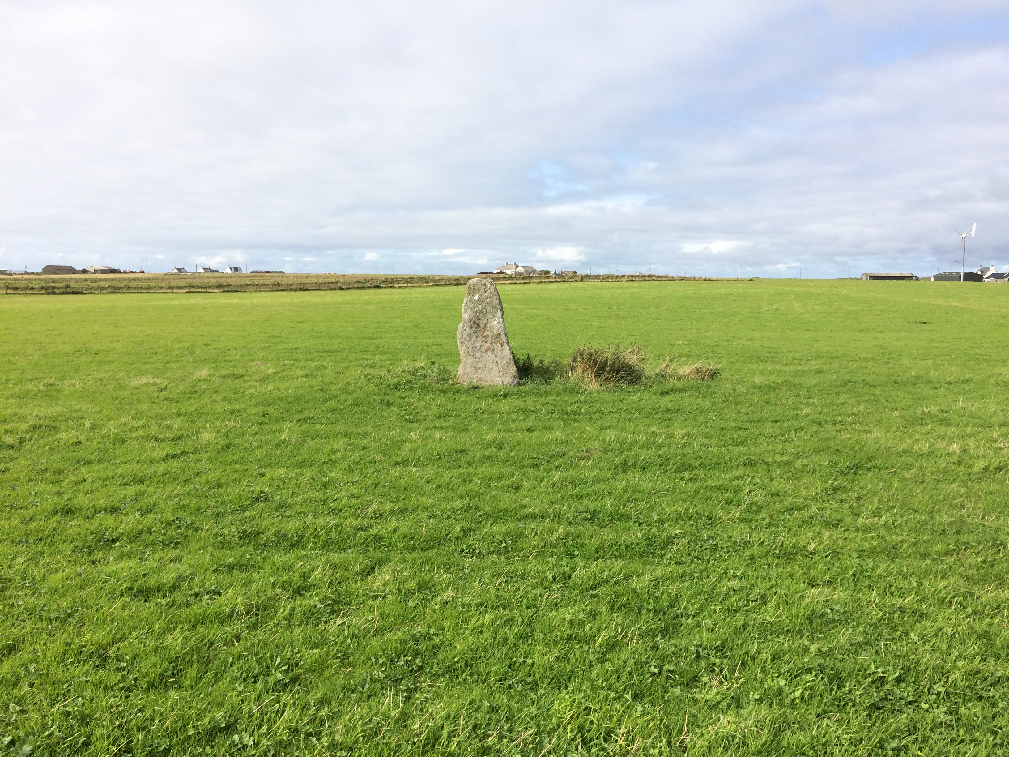

Middleton Stone looking NW towards Middleton.
Image credit: Mark Johnstone

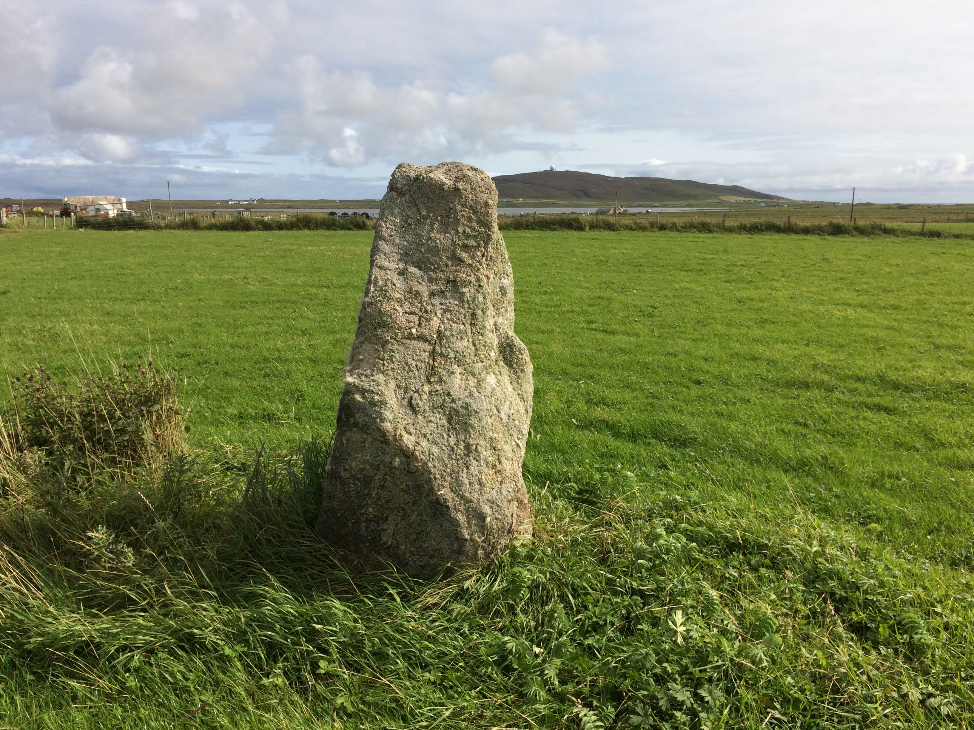
NW face of Middleton Stone looking SE towards Carnan Mor Radar Station across Loch a’ Phuill.
Image credit: Mark Johnstone
Mid Float W glacial erratic stone.

Mid Float Standing Stone W looking NE.
Image credit: Mark Johnstone

Mid Float Standing Stone W looking SW to the gate.
Image credit: Mark Johnstone

Mid Float Standing Stone W has an irregular conical shape.
Image credit: Mark Johnstone

Mid Float Standing Stone W looking S to Mid Float.
Image credit: Mark Johnstone

Mid Float Standing Stone W and a curious cow.
Image credit: Mark Johnstone
Mid Float W is a standing stone c 100 yards N of Mid Float Farm. It is a roughly conical stone up to 15 feet round at the base tapering to a rounded top at c. 4.5 feet.
Canmore ID 60457 (go to Links) considers it to be an earthfast glacial erratic. This seems likely as the stone doesn’t conform to the usual standing stone pattern.
Directions: From Stranraer follow the A716 Drummore for 6.5 miles until you reach Sandhead. Turn R onto the signposted B7042 Portpatrick road for 0.3 miles. Turn L onto the unsigned road at the end of the wood. Follow this road for 1.4 miles until you pass Auchentibbert Cottage on your R, then turn L after 100 yards. Follow this narrow lane for 0.7 mile to the next junction. Turn L for 0.25 miles to reach a gateway with room to park just before Mid Float Farm. Mid Float W is c. 70 yards NE of the gate.
Mid Float W is 250 yards W of Mid Float E.
Mid Float W is not on OS mapping.

Mid Float E Standing Stone has it’s own security guards.
Image credit: Mark Johnstone

Mid Float E Standing Stone guarded by stirks.
Image credit: Mark Johnstone

A warning to stay away from Mid Float E Standing Stone.
Image credit: Mark Johnstone

The SW face of Mid Float E Standing Stone shows signs of cattle rubbing.
Image credit: Mark Johnstone

The flat irregular E face of Mid Float E Standing Stone.
Image credit: Mark Johnstone
Mid Float E Standing Stone
Mid Float E is a standing stone 250 yards NE of Mid Float Farm. The base of the stone is triangular c. 3x3x3 feet in cross-section. It rises to a rounded point at 5.5 feet. The flat SW face shows signs of cattle rubbing. The E face is flat and irregular. The N side of the stone is angular with sheared faces.
Canmore ID 60456 (go to Links) suggested there were 4 cup marks on the SW face in 1970 however a later visit in 1984 came to the conclusion that they were probably natural.
Canmore also proposed the stone may be a glacial erratic which was placed in a vertical position, presumably as a rubbing stone. However the shape of the stone and the fact that it is has a footing in the ground leads me to think it may be prehistoric. If we consider the nearby, now recumbent, standing stone at Whirlpool c. 550 yards N, it is possible there may have been an alignment.
Directions: From Stranraer follow the A716 Drummore for 6.5 miles until you reach Sandhead. Turn R onto the signposted B7042 Portpatrick road for 0.3 miles. Turn L onto the unsigned road at the end of the wood. Follow this road for 1.4 miles until you pass Auchentibbert Cottage on your R, then turn L after 100 yards. Stay on this narrow lane for 0.6 miles observing the 3 wind turbines on Whirlpool Farm on the R. You can park at a double gate at the base of a hill. Turn R in the field following the field perimeter SE for c. 0.33 mile until you can see Mid Float E on your R in an adjacent field.
Mid Float E is 250 yards E of Mid Float W.
Mid Float E is not on OS mapping.

Merrivale Stone Circle with Merrivale Standing Stone 50 yards S. This well preserved stone circle has been neglected due to the presence of the nearby stone rows.
Image credit: Mark Johnstone

The foliage dominating Menevagar Longstone was somewhat reduced on my visit in 2017.
Image credit: Mark Johnstone

The flat N face of Mayon Standing Stone.
Image credit: Mark Johnstone
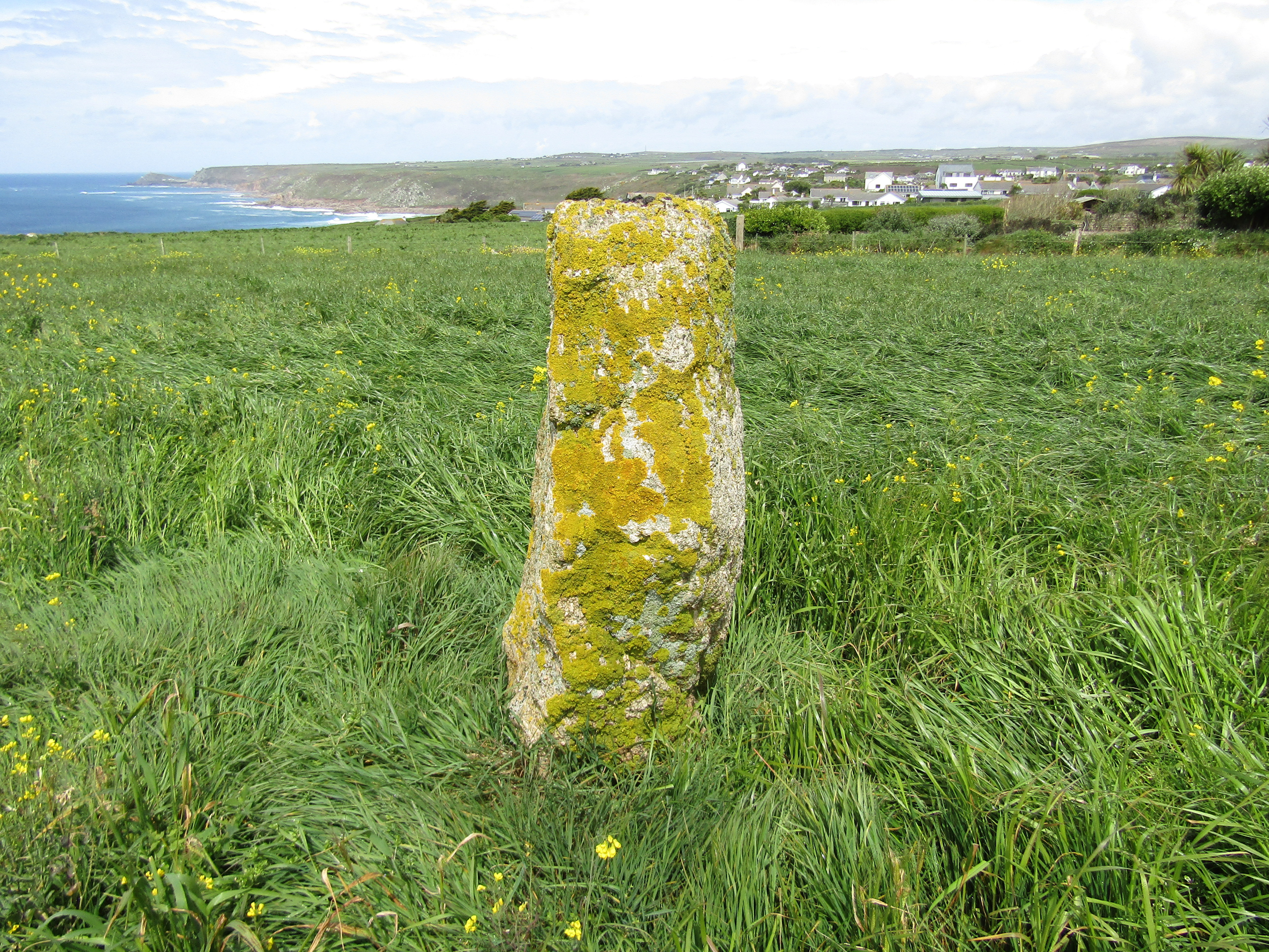
The S face of Mayon Standing Stone has a patina of yellow lichen and a rounded profile.
Image credit: Mark Johnstone

The E face of Mayon Standing Stone as seen from the path.
Image credit: Mark Johnstone
There is a standing stone in a field NW of Mayon, a hamlet adjacent to the N edge of Sennen. The stone is a rough slab c. 5 feet high. The cross-section is c. 2 x 1.5 feet at the base tapering to a broad point at the top. The N face is flat and the S Face is rounded with a patina of yellow lichen.
Mayon Standing Stone has the look of an ancient stone but it is not included on OS maps.
Directions: On the way to Lands End the A30 passes through Mayon. A public footpath heads NW 50 yards after the Mayon Garage. Parking is available on the street near the Spar Shop. Follow the path for 100 yards and Mayon Standing Stone will appear on your left, 30 yards from the path.


N kerb of Manor Common Barrow N with large earthfast stone.
Image credit: Mark Johnstone
While on an annual trip to Cornwall in 2019 I attempted to find the Manor Common Barrows. I found a possible candidate for Manor Common Barrow N but failed to find anything at the Manor Common Barrow S grid reference.
My proposed Manor Common N Barrow is located at SX 1293 7433 adjacent to a path on Manor Common.
The barrow measures c. 20 yards across with an intermittent kerb 3-4 feet high. One possible kerb stone measuring c. 3 feet high by 4 feet wide is earthfast in the N perimeter of the barrow. There is also a Recumbent Slab measuring c. 4 feet by 2 feet lying c. 5 yards NE of Manor Common N Barrow. The barrow is grass covered with a hollow centre.
Directions: At the Temple/St Breward junction of A30 take the St Breward turn off. After c. 0.6 miles park in a large passing place beside a body of water at SX 1311 7435. Walk 50 yards N on the road until you reach a path heading E into Manor Common. Stay straight on this path following an ESE bearing for c. 130 yards. At this point take a faint path heading SW for 20 yards. Manor Common Barrow is on your left.

Mains of Kilcoy SE and Mains of Kilcoy NW in situ.
Image credit: Mark Johnstone

Mains of Kilcoy SE, a verdant island in a dark sea.
Image credit: Mark Johnstone

Mains of Kilcoy SE Cist, measuring c. 1m x 0.5m.
Image credit: Mark Johnstone

Mains of Kilcoy NW Excavation Trench left by A A Woodham in 1961. All remnants of a 8x2 feet cist are gone but the cairn has been scarred.
Image credit: Mark Johnstone
Mains of Kilcoy SE Cairn
Mains of Kilcoy NW Cairn
I visited Mains of Kilcoy in 2012 after visiting Carn Glas (Mains of Kilcoy). Mains of Kilcoy NW is c. 200m SE of Carn Glas. The field was ploughed and the Mains of Kilcoy cairns were verdant islands in a dark sea.
Mains of Kilcoy SE is the more impressive of the pair, looking like a long cairn. However only one cist was visible on the surface, an off-centre shallow cist measuring c. 1m x 0.5m. According to Canmore ID 12840 (go to Links) the centre of this c. 30m cairn was excavated but no cist or chamber were found. It does seem to be a contradiction; all this construction for one shallow burial.
Mains of Kilcoy NW was excavated in 1961 by AA Woodham (Canmore ID 12836 (go to Links)). He found a large cist, 8 feet by 2 feet containing traces of cremated bone. However, his restoration of the cairn was incomplete, leaving a trench 4-5m wide bisecting the cairn. No remnants of a cist were found in the trench.
Canmore ID 12837 contains an account of the cleaning and restoration of Carn Glas (Mains of Kilcoy) from 2014 to 2015.
I visited this site in 2012. It was in a poor state with still impressive exposed chambers. The site was not being maintained. This changed in February 2014 with the vegetation being cleared by local volunteers. A Brookes photos in late 2014 reflect the improved condition of the cairn at this time.
Subsequent to this it was decided to partially restore the chambers of Carn Glas (Mains of Kilcoy). Between November 2014 & September 2015 work was carried out on the chambers by the Adopt-a-Monument team. The chamber floors were then covered with chipped stones, and a new display board erected on the edge of the cairn. Further details of the restoration can be found in Canmore ID 12837 (go to Links).
No pictures of the restored cairn have been submitted so we will see if it has been a sympathetic restoration all in good time.

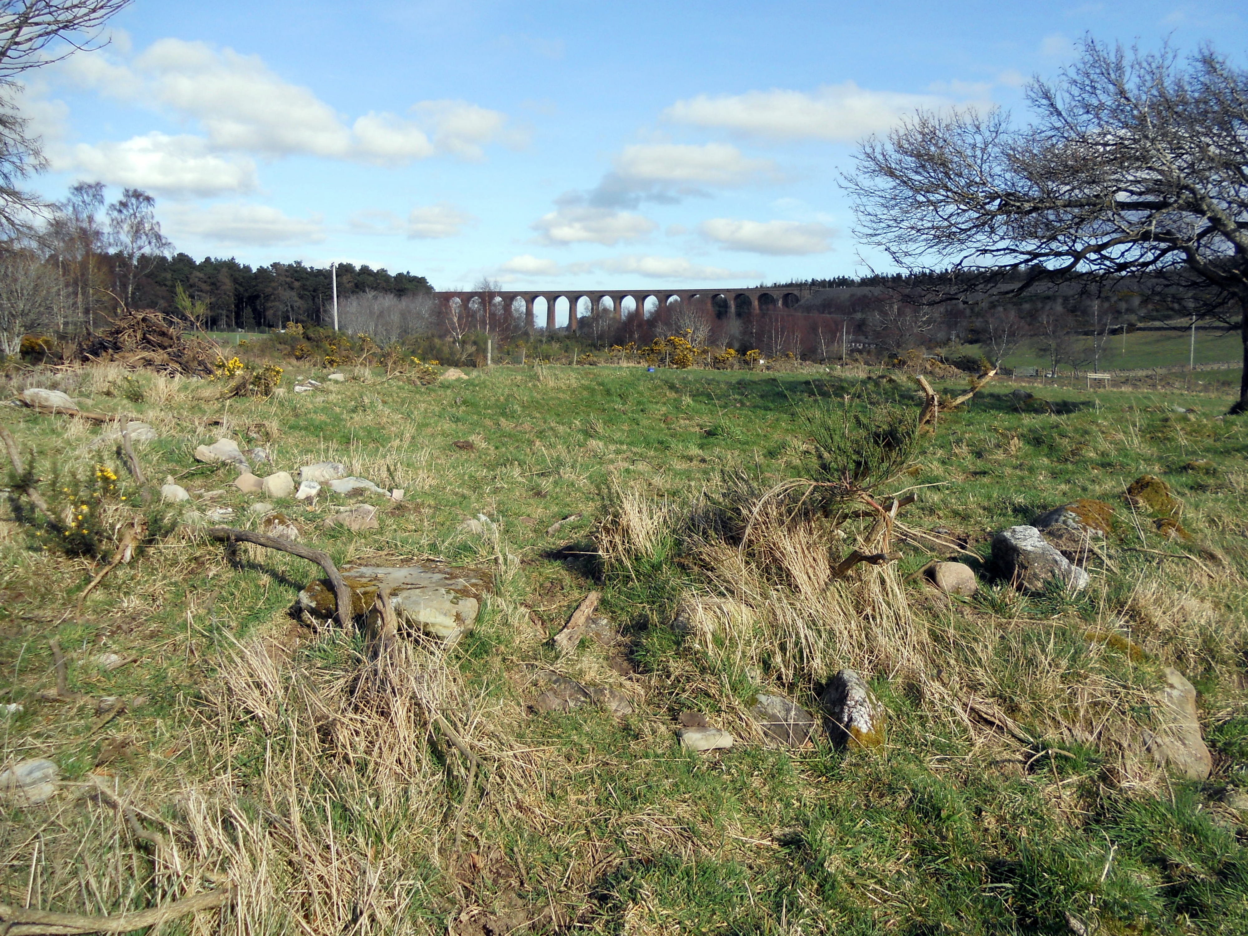
Mains of Clava SW viewed along SW-NE Axis towards the Culloden Viaduct.
Image credit: Mark Johnstone

A large stone, c. 4 feet x 3 feet, in the Interior of Mains of Clava SW.
Image credit: Mark Johnstone

Approaching Loch an Dun Fort the causeway is clearly visible above the water.
Image credit: Mark Johnstone

As CARL observed wellies are advantageous in crossing the ramshackle causeway to Loch an Dun Island.
Image credit: Mark Johnstone

Almost all traces of Loch an Dun fort have been obscured except for a course of stone on the right where the causeway meets the island.
Image credit: Mark Johnstone