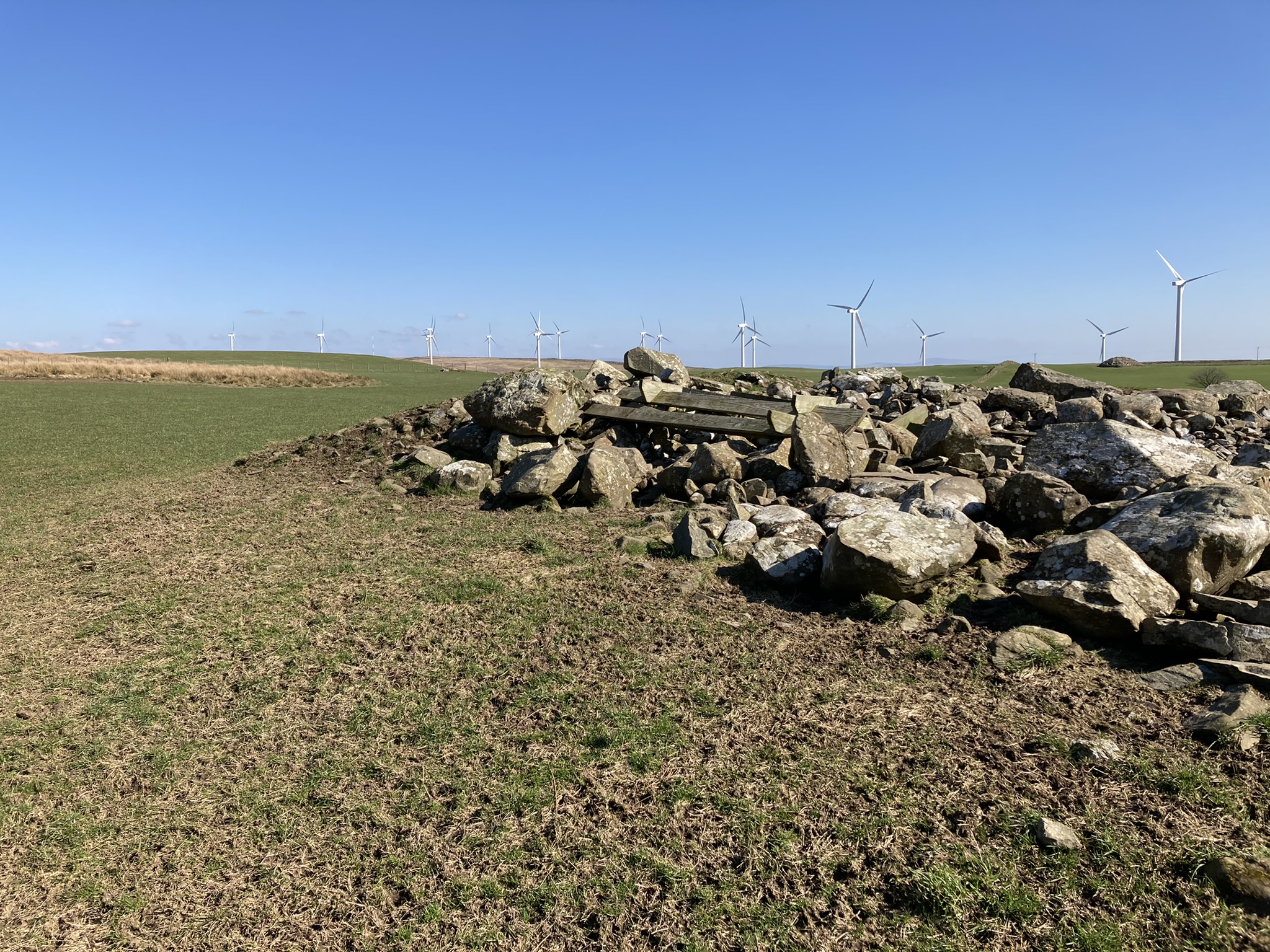
Robbed Out Centre of Stroanfreggan Cairn viewed from E.

Robbed Out Centre of Stroanfreggan Cairn viewed from E.
Directions: Take the Three Lochs turn in the centre of Glenluce heading N. Stay on this road for c. 2.5 miles to reach a lay-by at NX 21619 60922. Head W into the field opposite for c. 50 yards. Turn left following the rough farm track for c. 200 yards to a gate. Benlaight South Cairn is c. 300 yards W of the gateway. Retrace your steps along the margin of the field go through a gate onto moorland. Walk up a steep slope on a ENE bearing for c. 250 yards to NX 21190 61119 to reach Benlaight North Cairn.
My route to Benlaight Cairns is viewable on the following link: explore.osmaps.com/route/11741000/benlaight-cairns?lat=54.911435&lon=-4.790394&zoom=15.7231&overlays=&style=Aerial&type=2d
Benlaight North Cairn on Canmore


Benlaight North Cairn is an oval green spot in brown moorland at NX 21190 61119. It measures c. 20 feet E-W and 15 feet N-S up to a height of c. 1 foot in the centre. Small earth-set stones protrude from the centre. It is probably a robbed out small cairn.
There is a cairn c. 25 yards W at NX 21170 61117 on a W facing slope. The shape is irregular and there are scattered small stones in the centre indicating that it could be a clearance cairn.
Canmore ID 62411 (go to Links) has an account of some low cairns and hut circles in this area.
Directions: Take the Three Lochs turn in the centre of Glenluce heading N. Stay on this road for c. 2.5 miles to reach a lay-by at NX 21619 60922. Head W into the field opposite for c. 50 yards. Turn left following the rough farm track for c. 200 yards to a gate. Benlaight South Cairn is c. 300 yards W of the gateway.
My route to Benlaight Cairns is viewable on the following link: explore.osmaps.com/route/11741000/benlaight-cairns?lat=54.911435&lon=-4.790394&zoom=15.7231&overlays=&style=Aerial&type=2d
Benlaight South Cairn on Canmore


Large Clearance Stone Set Upright on W Arc of Benlaight S Cairn.

Benlaight South Cairn is a robbed out cairn on a natural knoll in a pasture field c. 2 miles N of Glenluce. The circular footprint of the cairn measures c. 25 yards in diameter and c. 5 feet high. It has been converted into a clearance cairn with large stones concentrated on the N and W Arcs. There is a bed of small stones in the centre. There are also several wooden feed troughs dumped on the N Arc. Canmore ID 62412 (go to Links) has a detailed listing of Benlaight South Cairn.
Benlaight South Cairn is c. 500 yards W of Ballach-a-Heathry cairn, a large robbed out cairn which has been similarly mistreated. Benlaight North Cairn is a small robbed out cairn, a green spot in brown moorland c. 500 yards N.
Directions: Take the minor road for Anwoth off the A75 c. 0.5 miles W of the Cardoness Castle Gatehouse of Fleet junction with the A75. Stay on this narrow road for c. 0.6 mile passing by the current Anwoth Church to reach the ruins of Anwoth Old Kirk. A path heads E from the car park S of the graveyard. Follow the path across a field to the edge of the wood. Rutherford’s Well is visible c. 40 yards N of here.


Rutherford’s Well on Canmore.
Rutherford’s Well is a natural spring associated with Samuel Rutherford who was appointed Minister of Anwoth Old Kirk in 1627. It rises c. 100 yards E of Anwoth Old Kirk on the W margin of Bog Hall Wood. According to Canmore ID 63639 (go to Links) a 19th Century Well House with modern repairs and a turfed roof covers the spring. It reaches a height of c. 6 feet.


Peristalith Stone on S Arc of Reineval Chambered Cairn.


Peristalith Stone on W Arc of Reineval Chambered Cairn.

Peristalith Stone on NW Arc of Reineval Chambered Cairn.

Exposed Capstone E of Centre of Reineval Chambered Cairn.


Possible Kerb Stones on NW Arc of Lingdowey Burn E Cairn


Possible Kerb Stone on SW Arc of Lingdowey Burn Cairn

Possible Kerb Stone on W Arc of Lingdowey Burn Cairn.

Irregular stony centre of Lingdowey Burn Cairn.