
The rain-soaked cap stone with, I presume, a bit of modern graffiti.
Image credit: A R Cane

The rain-soaked cap stone with, I presume, a bit of modern graffiti.

180 degree view of the ring looking South West(ish). The tiny dot in the middle is the passage grave.

Looking north east with one of the stones at the foot of the barrow.

View from the top of Gib Hill and the stone on top of it, looking back towards the henge.


Long barrows in Sussex are few and far between but I thought it worth mentioning them as they form part of the abundant collection of earthworks within the Kingley Vale Nature Reserve north of Chichester. The other notable relics being the enormous round barrows on top of Bow Hill and Goose Hill Camp Iron Age Hill Fort. You can find them quite easily by following the trail next to the dyke that runs alongside the round barrows north-east for about half a mile. You’ll come to an opening in the woods to your left and the first long barrow sits in a field beneath you. The other lies in an adjacent field and the pair of them are bisected by a footpath leading down to the village of Stoughton itself.
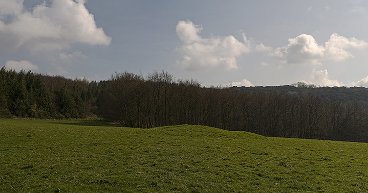
The more southerly of the two long barrows with Bow Hill in the background to the right.


A minor nuclear explosion above the southerly long barrow. The yew forested Kingley Vale stands in the background.

X marks the spot. The more northerly of the two compact and bijou long barrows at Stoughton Down.
I find it a little surprising that nobody has written any fieldnotes for Kingley Vale before. These are probably the largest barrows in the whole of Sussex, the highest being about four metres high, bigger even than the probably more famous ‘Devil’s Jumps’ directly due north from here. Not the easiest place to get to and few signs to aid your navigation it’s well worth a visit whether you’re into lumps and bumps, walking or just being plain spaced-out. The views are also something else as you look south towards the cities of Chichester, with it’s landmark cathedral spire, and Portsmouth further west. You can also quite clearly see the Isle of Wight in the distance. To the north are superb views of the spine of the South Downs. There’s an absolute wealth of material to look at here within an area of about two square miles including the various ditches and banks around the four main barrows, two very moderate long barrows on Stoughton Down, an un-named rectangular enclosure slightly further north-east and about a mile further from there is the almost hidden and slightly inaccessible small Iron age hill fort of Goose Hill Camp. Nearest parking if you’re coming from the south is near the village of West Stoke.
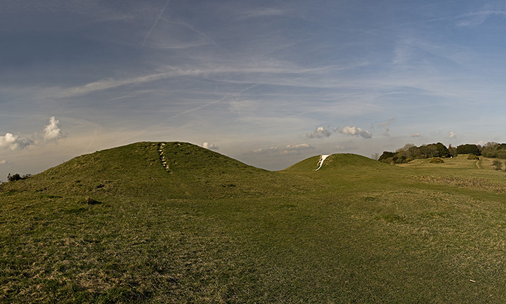
The two largest barrows to the south west and the other two only just visible on the extreme right.

The two slightly smaller barrows to the North east. The one on the right is slightly misaligned with the other three.

The two largest barrows viewed from the east with figure to give a sense of scale-these babies are BIG!

The dyke which runs along the north-western edge of the four main barrows with the two largest in the background to the left.
I recall trying to find this fort a few years ago on a previous visit to the Kingley Vale Nature reserve but it had been difficult to make out due to the excessive undergrowth. This time around it proved much easier as there has been a lot of clearance throughout the reserve recently and after stumbling over a few dead vikings we found it once again. It’s an interesting site as the outer and inner banks and ditches are unusually far apart and the whole thing is filled with a profusion of ancient yews. The day we were here was splendidly sunny and warm and peaceful but having been here at other times when the weather was less clement the whole reserve has a rather sullen and slightly oppressive feel to it which I think is largely due to the dense yews. The fort sits on a hillside, not quite at the top, looking east over the downlands and is roughly oval in shape. Interestingly there’s another earthwork about half a mile from here as you walk back to the huge barrows on Bow Hill, but it’s not named and is distinctly rectangular in shape. Can’t seem to find any information about this.
Link to UCL survey carried out on the West Dean Estate in 2008


Standing just outside the outer ring looking vaguely north


The beautiful sweeping valley of Standean Bottom beneath the enclosure on top of Castle Hill.

Panoramic view looking south with the sweeping valley of Standean Bottom visible on either side.

Looking north east to the brow of the hill and the edges of the rectangular enclosure.
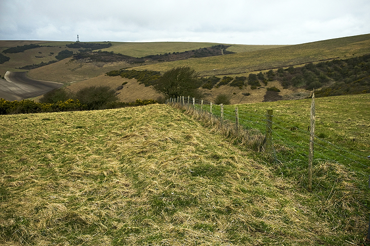
Looking south west down the bank and ditch on the western side of Castle Hill enclosure.
Castle Hill is situated in a stretch of downland between Brighton and Lewes in an area of outstanding beauty owned by the National Trust. The easiest way to get to it is to leave your vehicle near the houses on the northern edge of Woodingdean (off the Falmer Road, B2123) and then make your way round the hideous radio mast towards the valley at Standean Bottom. You can either follow the valley all the way round until you come round to the northern edge and then up the hill towards the enclosure or you can take a short cut down to the bottom of the valley and straight up the hill. The enclosure is at the top of the hill, roughly rectangular in shape and has splendid views back across the majestic valley and south towards the cliffs and sea between Brighton and Newhaven. The banks are only a couple of feet high now but still quite distinct with a few depressions visible inside them, possibly from huts. There’s a bank and ditch which extends from the western side of the enclosure for a short distance down towards the valley. It feels like an outpost from the slightly more busy South Downs Way but you’re really not that far from other major earthworks at Whitehawk and Hollingbury on the outskirts of Brighton and indeed it’s not difficult to come across something on almost any hilltop in this area. Obviously a very populace place even thousands of years ago.

The cross dyke west of the ring (in the background) with the South Downs Way path snaking from the right.

The round barrow on the western side of the ring, much larger than the cluster of bell barrows on the eastern side which have all but disappeared.


Standing in the ditch on the eastern side of the ring looking south

A solitary sarsen across the road from the Ditchling Beacon car park. I’ve added this because they’re such a rarity in this part of the world. Does anyone know where it came from, whether it is of any significance, part of a long-gone circle or a marker of some sort?

The Sanctuary concrete slabs with artful additions from local moles, looking south towards East Kennett Long Barrow through hazy winter sun and mist.

The fourth barrow in this group, in splendid isolation, viewed from the path leading down from the Ridgeway back to the Avenue.

The group of three barrows with their beautiful beech crowns further north along the Ridgeway from Overton Hill. You also get a great view of these as you proceed south along the Avenue from Avebury.

Panorama looking South West with the A4 separating the most southerly barrow from the group (on the left).

Looking South at four of the main barrows with a dinky one between the front two. The sixth lies slightly further to the North East and the seventh further North still, adjacent to the Ridgeway path.

Another group of 3 round barrows on the South Downs Way East of Ditchling beacon.

The Westmeston Bostal which winds its way up southwards on to the South Downs Way and emerges between two groups of (now barely visible) round barrows.

A small group of 3 round barrows sited between the Clayton windmills and Ditchling Beacon, looking East on the South Downs Way.

The footpath along the edge of the escarpment leading up to Ditchling Beacon. Not sure if this was some sort of low dyke along the edge as it would hardly have been necessary given the drop to the North.

Part of the northern edge of Ditchling Beacon next to the escarpment (looking South).

The south western ramparts looking west towards Newtimber Hill and Devil’s Dyke.

Another view of the ravaged insides of the fort/henge (?) which has been attributed to flint mining, WW2 mortar firing practice or possibly looted barrows.

The north eastern ramparts looking east along the South Downs with the Jack & Jill windmills just about visible

The bowl barrow looking north with the top of Wolstonbury just in sight to the right.

The cross ridge dyke that comes up the hill from the south viewed from the barrow.

The ruined round barrow that sits on top of North Hill (part of Newtimber Hill) with the Devil’s Dyke and South Downs in the back ground, disappearing off to the west.

The huge defensive dyke at the southern entrance to Devil’s Dyke which then sweeps down the hill to the west.
Quite by chance we stumbled upon this barrow cemetery while walking a section of the South Downs Way last weekend. Its not as large and impressive as ‘The Devil’s Jumps’ which is a few miles further west from here and the largest barrows are only a couple of metres high at the most, but there are actually two more barrows and a couple of cross dykes intersecting the group. They’re aligned roughly East/West unlike The Devils Jumps which are apparently aligned to the setting sun at the summer solstice. The best access point is probably from Cocking and a brief walk east along the SDW footpath. It’s not signposted but appears on the OS explorer map 121 (Arundel and Pulborough) and you have to look hard through the hedgerows to spot it. It’s also interesting to note that along this section of the SDW there are few solitary barrows and that they always seem to be in linear groups. There is another example near Westburton Hill near Bignor of a group of four barrows which lie in a valley(!), but sadly are no longer visible having been ploughed out over time.

Panorama of the barrow cemetery and cross dykes