
Panorama of the whole circle. It actually seemed a lot foggier than it appears to be here!
Image credit: A R Cane

Panorama of the whole circle. It actually seemed a lot foggier than it appears to be here!
Bit controversial this one. The stones that make up the base of the fountain on The Old Steine in Brighton allegedly once stood in a circle in close proximity to the Goldstone. Some of these same stones now surround The Goldstone in Hove Park, though it was always believed to have been a large solitary stone in its original position. They’re certainly of the same material as The Goldstone and its attendant circle, a sandstone and flint conglomerate, except one or two which are genuine sarsens. However, according to other sources, the fountain stones were part of a circle near the Wellsbourne (or Whalesborn, the now hidden river) in the valley which constitutes The Old Steine and which gives the area it’s name (Steine – Stone). Yet another source states that they were simply stones scattered along the banks of the river and that they were gradually tidied up over the centuries until they came to their present resting place and had no sacred or special significance whatsoever. Whatever the truth is, it’s testimony to the gradual destruction of ancient relics in the area over a long period, but I guess that it still acts as a central meeting place, albeit one where most of those gathered the day I was there were clutching cans of lager.


The stones which make up the base of the fountain. (See fieldnotes for explanation)

Looking South towards the sea with what looks like faint traces of field systems at the base of the hill and those darned sheep in the foreground.

Long shot of the dimples left by filled in mine shafts and the Bronze Age enclosure on the crest of the hill.

Looking West with that beautiful windswept Hawthorn behind on a very drab and foggy day.


Looking back towards the Hardy Monument (the admiral who allegedly kissed Nelson, not the author and poet!)

Very easy to find as the B3180 passes straight through the middle of this handsome Iron Age fort. We happened to be staying about half a mile from here while working in Honiton and were vaguely aware of it’s presence the first night of our stay as we drove through. The next morning gave us more tantalising glimpses as we made the return drive to Honiton with perfect low sunlight filtering through the copper coloured leaves of the beech trees on and within the banks of the fort. The fort itself sits just slightly atop a wild and open area of common land and the OS map shows evidence of a number of tumuli in the surrounding area but sadly, we never had time to investigate these. The banks which are quite substantial in places are made up largely of smooth rounded pebbles from an ancient river bed and a little further down the road from here is a company extracting the same material for aggregate. This area must once have been a large alluvial plain stretching between the River Exe in the West and the River Otter to the East. A great place to wonder around on a sunny autumn day with stunning views across the common in all directions

The entrance to the fort from the carpark on the Southern side. Mrs Cane, making a swift ascent of the substantial banks on the left hand side, for scale!


Panorama of the interior looking South with the main road off to the right.


Looking East back from the top of the bank next to the B3180.

Looking South West from the SDW footpath with the three large barrows prominent on the skyline.

Panorama of the interior of the fort looking South East.

The middle of the three large barrows in the interior of the fort looking South East.

Panorama looking South West from the SDW footpath.

Looking South from the main road/South Downs Way.
This is a lone barrow just off the South Downs Way track, but perhaps more interesting are the earthworks alongside it. On MAGIC it merely states ‘field system’. Not sure if they are contemporary with the barrow but could be medieval as a few miles further on just beyond Millbarrows, also on the track, is Lomer Medieval Village (remains of) which has a similar feel and look.


Looking South East. The South Downs Way track runs right past it and there are a couple of bumps slightly further East on the other side of the track before you approach Cheesefoot Head.

The largest barrow looking back west to Winchester.

The ransacked barrow and the view west of the Devil’s Dyke and the South Downs.

The faint line of what may have been a small enclosure on the hill top.
This is not just your usual wimpish ‘cross dyke’ that you find over most of the South Downs but quite a sizeable beast more in line with Rackham Banks near Amberley. The easiest approach is from the mindless racetrack of the A27 between Worthing and Lancing. Take either the Sompting Abbotts Church turn off for Steyning or the Dankton Lane turn just after, then it’s just a short walk along tracks from either of these roads. The main dyke runs for almost half a mile up the hill and consists of a ditch which is mainly overgrown, and probably served as a track in the past, and the dyke itself which in places is about 4 feet above the level of the surrounding fields. From the top are spectacular views across the South Downs to Cissbury Ring to the west and the chapel of Lancing College in the east. Oh, and if anyone finds a 77mm lens cap around there it’s mine.

A smaller cross dyke which comes almost to the summit of Steep Down with Cissbury Ring in the distance on the right.

At the end of the dyke which nestles in a dip between Steep Down and Lancing Ring.


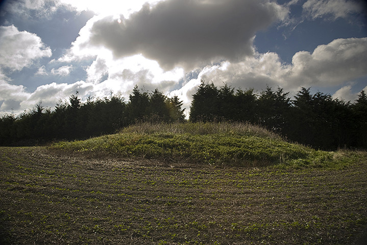
Barrow 7 with additional gate.


Barrows 7 and 6 from the B3170

The interior of the fort with some of the later Norman fortifications. The Norman castle at the Northwestern end fell into ruin a long time ago and now there’s a farm occupying the site.

View into the interior from the bank running alongside the road to the car park.

The ramparts on the South Eastern side and the entrance/exit to the car park on the right.


The Iron Age ramparts that now butt up against the road to the car park.


One of the immense gnarled stones in the valley bottom as you come from the Manton race circuit end. This one was neatly segmented in three.