
Large sandstone(?) block at the base of a corner of the Church. Difficult to know if these were part of a circle that was destroyed in the building of the church or not.
Image credit: A R Cane

Large sandstone(?) block at the base of a corner of the Church. Difficult to know if these were part of a circle that was destroyed in the building of the church or not.


Hard to say if this was part of a circle/setting or from the Church.

Looking from just below WKLB just after sunrise.

Panorama of the WKLB in it’s landscape. Shame it wasn’t 13 days later!

Sunlight flooding the interior of the barrow.

Looking back through the entrance to the North East.


The monolith in its strange churchyard setting at dusk.

Back early the next morning at sunrise.

The minilith facing forlornly towards the road to Bridlington.

The white lichen covered minilith with the monolith in the background. I wondered if there was an alignment at the Summer Solstice. This appears to be the only remaining stone in what may have been a circle and the monolith certainly seems to face towards it.

The pathway/boundary(?) which runs North-South between two gates.


In the shadow of the stone in the early morning light.

The banked section which runs SW/NE along the back of the graveyard. Not sure if this is natural or there’s been a bit of human intervention.

Blackpatch Hill from the path down from Church Hill beyond Long Furlong.

Buy one, get two free! Cissbury Rings and Church Hill to the left.

The barrow at the summit of Blackpatch Hill with Cissbury Rings just visible behind the Trig point.

A solitary barrow as you approach from the North West with the echo of Harrow Hill in the background.
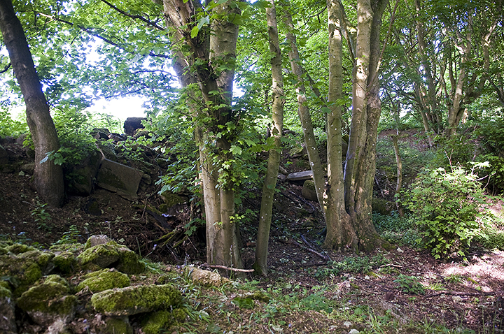
Pitting on the edge of the woods. It’s very hard to say if this is due to flint extraction or just a farmer’s hole full of rubbish and if there was ever any evidence in the field behind this it has long been ploughed out.

More disturbance in the undergrowth.

Looking back from the North West. The mines, according to the map, would have been just to the right of the photo over the crest of the hill near the tree line.

The Howe in all it’s glory, though I’d forgotten how flat this part of the world is compared with the North York Moors!

View from the South. Note the dark mark in the middle ground which indicates (I think) where the ditch and bank once ran. It’s more evident on aerial photographs.


Looking back up the hill the cross dyke follows the line of bushes.

Looking at it sideways on as you descend from Duncton Down
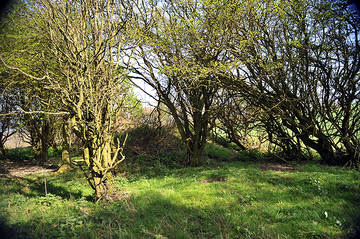
Hard to find and partially hidden in bushes but interestingly there’s a drop to one side and the top of the hill is scooped out and quite flat like a large natural(?) paddock.
Although this is listed as a dyke (why is there no other option?) it is in fact a ditch as the name suggests and not just a small thing but a ditch which extends over 2 miles, though a little broken in places. The coordinates start in the west in ‘The Valdoe’ a small wood about a mile below The Trundle but it eventually peters out near Halnaker on Boxgrove Common as it meanders along the bottom of the South Downs. What it’s original purpose was nobody seems to be in agreement over and research has suggested that it was a defence against the Saxon invaders of the 5th Century but more commonly it is believed to have been built in the Iron Age and was either a boundary marker or again a quite sturdy piece of defence work. A lot of the middle section is difficult to get a look at as it’s mostly on private land and people are rather fond of guns in this neck of the woods. Judging by the state of the section in the Valdoe it’s also pretty silted up, but I’m hoping to have a look at the sections in the east some time soon.

The ditch stops just the other side of the road where it comes up against a stream and the edge of the grounds of Goodwood House.

Looking west through ‘The Valdoe’ from the main road near Goodwood House.

‘Artemis’ which was installed in June 2010 (why did I not know of this?!) looking south over the Downs towards Chichester.

The ‘Artemis’ sculpture in context to the barrow in the centre of the hill.

The lower earthwork or boundary marker on the northern side.

The ditch/track which is almost a continuation of the road as it swings around the base of The Trundle on the northern side.

Looking back up towards the fortifications at the top of The Trundle


Cissbury Ring is one of my favourite walking places in West Sussex. Standing on the South Downs and within walking distance of my home town of Worthing it’s an excellent place to wander and refresh yourself. Even in the depths of winter you’ll find some hardy folk along with their canine companions walking the ring or brivetting about in the undergrowth. It’s quiet seclusion also offers spectacular views in all directions covering the Downs, the sprawl of the south coast conurbation from Brighton to Bognor Regis and on a clear day you can even see the Seven Sisters to the east and the Isle of Wight to the west.
Hard to believe then that this was once one of the powerhouses of Neolithic industry in the UK. Though entered on TMA as an Iron Age hillfort it actually began it’s fantastically varied life as a source of raw flint in the Neolithic era and the south western area of the hill bears testimony to this with it’s hundreds of shallow, and sometimes enormous, pits. This ‘moon-cratered’ surface represents the backfilled shafts of flint mines dating back some 5000 years and although not visible today some of them were between 40-45 feet deep and gave onto galleries and chambers that sometimes connected to other shafts. Cissbury and the nearby Church Hill and, slightly further afield Harrow Hill and Blackpatch, were some of the primary sources of flint throughout the Neolithic period. Only the slightly later mines at Norfolk’s Grimes Graves were any significant rival. The quality of the flint mined here was obviously very high as mining continued well into the Bronze Age and tools created from the flint have been found across Britain and mainland Europe. Between the four Sussex locations there were probably in excess of 400 shafts. Some of these were the subject of a number of archaeological digs between Victorian times and as recently as the 1970s. The earliest interest for the Cissbury site comes from 1849 when the Reverend Edward Turner, addressing the Sussex Archaeological Society, stated confidently that the hollows were formed for ‘Druidical celebrations’ but didn’t specify what these might be! The first excavations were carried out in 1857 by George Irving, but he failed to get to the bottom of the pits both physically and metaphorically and interpreted them as ‘animal pens’ due to the finds he came across. In 1867 Colonel Augustus Lane Fox was the first person to suggest that the pits were associated with flint mining while investigating hillfort construction on the South Downs, but he too failed to fully excavate the mines to their actual bottoms. However, the discovery of shafts beneath the fort’s ramparts made them realise that the shafts pre-dated the Iron Age and discovery of a polished axe within the ring and to the east of the pits firmly planted the shafts in the Neolithic era. Ernest Willet, who in 1868 had been looking at similar features to Lane Fox on nearby Church Hill, began working at Cissbury in 1873 and was the first person to get to the bottom of a shaft after digging down 4.2m through the back-fill in one of the earlier excavated pits where he discovered a series of chambers and galleries. Sadly his site notes from the dig were lost. More diggers came and went for the next 60 years but one of the more interesting figures to explore Cissbury was a local working class self-taught archaeologist named John Pull. He’d already achieved notoriety in the area following his discoveries at Blackpatch in the early 1920s and suffered at the disparaging hands of the Worthing Archaeology Society for his methods and site recording procedures. Most of this was down to pure snobbery on the Society’s part and given the towns Conservative nature hardly surprising. He did however rejoin the Society in 1947, taking over as president in 1952 and started new works at Cissbury the same year which gave rise to the most comprehensive studies of the Cissbury mines ever undertaken. Sadly he was shot dead in a bank raid in 1960 while working as a security guard at the Durrington branch of Lloyds Bank. For further intriguing reading on the subject take a look at Miles Russell’s fascinating book ‘Flint mines in Neolithic Britain’ (Tempus Books, 2000).

A 360’ panorama within the interior of the fort showing some of the numerous pits left by back-filled Neolithic flint mines.


You only get an idea of just how large these pits are after a bit of scrub clearance.

One of the larger hollows looking West towards Church Hill across Findon Valley.

The rather fabulous model of a flint mine in the Worthing Museum & Art Gallery!


