
A double row of barbed wire. They very obviously don’t want visitors.
Image credit: A R Cane
A double row of barbed wire. They very obviously don’t want visitors.

View from the South West. The flag just to the left gives the game away.


Looking East. This section is near the main road from the car park at West Stoke (nearest parking for the Kingley Vale Nature Reserve).

As you can see this section is reasonably tall, just about two metres high at this point, but there are places where it’s barely visible and actually a ditch in other sections, as it’s name suggests.


Panorama looking South West. Shame you can’t see the fantastic view below because of the trees, but they were quite welcome that day as it was blowing a gale up there!


Looking East to the (very close!) main road from the back of the barrow.


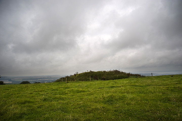
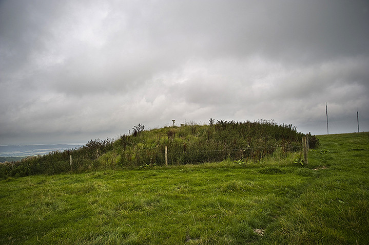
The re-opened tump with small concrete stumps and additional wooden posts. I guess these are to stop the infringement of agriculture and slightly better than the old fence that once surrounded it.

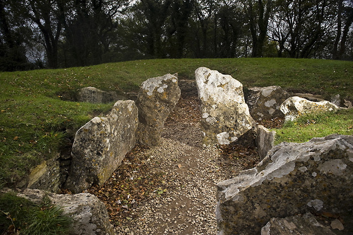
Long shot from the rear of the tomb back towards the entrance.

Rear left stall with the notch in the stone and, presumably, some new graffiti.


The more Easterly and slightly larger barrow of the two bell barrows hidden in the forest.

Western barrow viewed from the top of the Eastern barrow.

Looking Eastish from the top of the Western barrow.

View of both bell barrows with the more easterly barrow in the background.

Possibly quite exciting this. The darkish area in the middle between the path on the right and the lighter line running sort of diagonally from left to right indicates the edge of either a small earthwork or a very large disc barrow hidden in the Brighstone forest.

Looking back in an Easterly direction. The dark line in the middle-ground showing the barely perceptible ditch and bank.

Looking West. There are, according to the OS map, three barrows here, but it’s difficult to make them out individually and you could be mistaken for thinking it was a rather ragged long barrow.

Looking North West back towards Brighstone Forest.


This, I think, is the isolated barrow near the footpath.


View from the top looking West. The soporific sunset belies the barrow’s somewhat ugly history.


The strange juxtaposition of ancient and modern. The view, from the top of the mound, back to the main road with the set up for ‘Bestival’ taking place on the left and an old quarry on the right full of skips!

Some of the flint tools held in the collection of Rochester Museum.
Looking North back towards the mainland. Shame about the barbed wire fence around it, but the field was full of cattle so maybe the farmer was trying to preserve it.
Looking East. Sure must be a lot of dead Frenchmen in there!


What a wonderful place to be buried! This barrow, the largest, still retains a small ditch around it and Mrs Cane for scale.

View looking north from the valley below. These are possibly the most prominent barrows on the island, visible for miles around.


Wide shot of the NE stone with one of the many massive recumbent stones in close proximity. Was there ever another structure here as there are a lot of massive stones close by in the hedgerow which have gradually been cleared?

NE stone with SW stone just visible on the hedge line and in alignment with the Merry Maidens just down the road.


