
All that can be seen is a slight bump in the field from the Bokerley Dyke. Here it appears as a bump at the top of the dark green maize, one-thrid of the way in from the right of the photo.
Image credit: Copyright waived UncleRob
All that can be seen is a slight bump in the field from the Bokerley Dyke. Here it appears as a bump at the top of the dark green maize, one-thrid of the way in from the right of the photo.

Looking up to Gussage Down from the cursus as it crosses the tarred road near the river cliff on Down Farm.

Here is the view from the eastern end of the cursus up to the Gussage Down long barrow. I have zoomed in and in reality the barrow occupies a space on the skyline about half the width of my little finger if I extend my arm fully. Nevertheless I reckon you could see someone standing on top as the sun goes in. Shades of Callanish ritual as re-enacted on the TMA TV show (see YouTube)? The cursus crop mark in below the barrow. The bank to the left ends about one barrow-length away from it, leaving plenty of space for people to gather around an opening or forecourt on the SE end. The dogleg bend in it is quite visible here. On maps the bends are slight but on the ground they zig-zag around. The bank on the right is less obvious, passes closer to the barrow and has less of a kink to it.

Jumping for joy at my destination, the focal point of the Cursus as solar ritual. You can see some areas at the base of the mound where cows (I presume) have scraped away the grass.

Getting low down at the famous Bottlebush Dpwn spot where the cursus bank is visible by the roadside. The earth on the left was heaped up around 3200 BC!

Seen from the B road on Bottlebush down, looking East. Pembury Knoll is the hill in the background. The bright green strip of crops in the centre of the photograph is the cursus. The current farmer has planted different crops on the cursus for some reason, which helps modern antiquarians spot it, if nothing else.

Here it is, looking back from Gussage Down to the NE. The crop marks are faintly visible. For explanation of my annotations, see my blog “First visit to the Dorset Cursus”.


The impressive bulk seen from the Bokerley Dyke

Also on the inside of one of the uprights, a small flat surface with what appears to be lines scratched into it, like a plant or fishbones sort of shape. Man-made or natural? Significant to our ancestors or not?

On the inside surface of one of the uprights is this rhomboid recess. Man-made or natural? Siginificant to our ancestors or not?

This small sarsen pokes out of the ground on the left side of the original “burial” chamber. It is near the pockmarked stone seen in Hob’s photo. This one is just visible in jimit’s photo looking south.

Like Hamish’s 2002 photo but without the zoom that makes the hill seem closer than it really is. These are clearly intended to align directly with that hill. It was certainly the focus of activity here all those centuries ago.

Another few having a lie-down. The one in the foreground points straight down the axis joining the centres of the two main circles.

What are all these bumps and holes? This one is between the two most complete circles.

This one near the east end somewhere (got disoriented in all that mist and all those circles) seems too cuboid to be prehistoric. Even the sheep have gotten over-familiar snuggling up to it.

One recumbent stone within a circle. Hmmm.

Down at the base of one of the uprights (nearest the houses – I lost all sense of compass directions in those lanes) is a fair concentration of quartz intrusion. The stone was perhaps chosen to show this off.

A blurred glimpse under the fallen stone. Don’t tell me some potholing nut has crawled in there. It would give me the willies. There were some weird pale green plants (or maybe they are mushrooms?) and a tuft of sheep’s wool.

Nice topographic image at the info board by the quoit. The landscape includes of course the Hurlers and the Cheesewring (at top right).

Two stones together in a field just north of the hamlet of Crow’s Nest. Perhaps natural and too big to be moved, perhaps not. I didn’t go clambering about in the field for a closer look. Compare with the more upright pair posted by Mr hamhead which are to the west of the quoit.

Close-up of the recent damage to the southern member of this group of barrows. The earth has been removed from about 1 foot outside the ditch to about 2 feet inside the bowl, but in the bowl does not go down as far as surrounding ground level. There is no sign of any man-made material. Given the growth of only a couple of little grasses, I think this was done in January or February 2009.

The southern member of the group with that strange chunk dug out of it...

The northwest member of the group, also the largest at about 5 foot high and about 14 foot diameter.

Two barrows on the East side of the group, looking towards the road. Shallow and narrow ditches are visible, right up against the bowls.

Looking uphill, you can see the profile of the barrow and the odd brick still scattered about.

The foundations of the hut. Normally I’d express some indignation, but this is just daft.

Looking out from the top of the hillock. As the barrow is right on the top of the slope, there is hardly any height to it on this side.

The shared bank between the barrows can be seen with a path snaking across it like a sort of causeway.

Fence posts dumped in the ditch and against the bank

Looking east at both barrows (oil refinery in the distance)

The depth of the ditch and the height of the barrows are still impressive. This must have been a very significant monument in the area. We can only speculate about why they are together in this unusual pattern.

Feasting to commemorate the ancestors is still observed by local folk.

The large barrow at the south end of the line


I’m holding the camera over the East chamber to give the impression of looking out between the portal stones toward the East.

Looking up the passage from West to East. Contrast with Chris Collyer’s photo of the site overgrown in 2003!

Winter makes the woods all the more dramatic, and brings out the ditch nicely in the low light through the bare trees.

How old is that bank out of which the yews are growing? Well, as old as a middle-aged yew tree, which rules out the last 200 years at least, and possibly much longer. This appears and disapears at exactly the points where one would expect to see the enclosure ditch-and-bank appear on t’other side of the path.
This path, incidentally, is the one that passes close to Withering Corner bowl and saucer barrows. They are clearly Bronze Age by typology. Is the enclosure even older?

Looking East, the intersection of ditch and track is at the point where the track curves to the left, echoing a bend in the path (behind trees off left).

Looking across the point where the ditch crosses the farmer’s track, i.e. looking West. About one-third of the way up from the bottom of the photo is a thicker tuft of grass in the middle of the track. That’s the ditch! You can see slightly darker shade in it from the slope and between it and you, viewer, is what remains of a little bank.

As with the other dead wildflowers photo, this is the ditch in the NW corner, again looking south. Here they form more of a J shape across the 2-D of the photo.
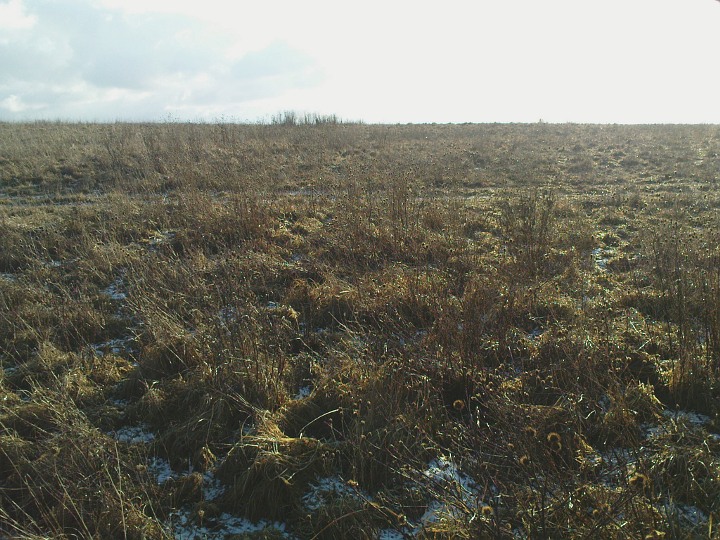
Dead exciting this. See the taller plants in the immediate foreground? There is a curving line of them, heading off to the left of the photo, where they cross the farmer’s track, then they curve backing to the skyline where you can see the little tuft in silhouette. A shape across the photo like a letter C. That, my friends, is the mark on the surface that best reveals the ditch of this mysterious enclosure. This is the NE corner, looking south.
For those who like this sort of thing: this photo was automatically numbered 00666. Smack my ditch up! (It had to be said sooner or later)

Three barrows, centre of photo in the nearest field, which was recently sown so they are still visible.

30 Dec 08: freezing fog covering Salisbury Plain, minus 2 degrees when we arrived at 2:30, shivering and running to keep warm but pleased to be back at old Avebury after several years’ absence. Going round anticlockwise, entering the NE quadrant.

30 Dec 08: freezing fog covering Salisbury Plain, minus 2 degrees when we arrived at 2:30, shivering and running to keep warm but pleased to be back at old Avebury after several years’ absence. Looking west across the SE quadrant.

Two small barrows together at the top of this steep slope, here looking towards the NE. The road is fairly quiet so it’s safe to gazeover the gate if you are on foot or bike but parking would be tricky round here – probably need to go for some nearby field entrance and keep an eye open for the farmer needing in – or walk down from the pub (I haven’t been and can’t endorse it yet).

Looking over the barrow along its alignment to the ESE, and a gap in the surrounding hills.

The barrow seen from the gap in the lane (looking North).