tjj

tjj

All posts expand_more 251-300 of 887 posts

English Heritage to consider banning alcohol ...

English Heritage look set to ban alcohol and charge for parking at future Summer and Winter Solstice Gatherings.

bbc.co.uk/news/uk-england-wiltshire-35500528

Revellers at Stonehenge could face a ban on alcohol and parking charges at this year’s solstice celebrations. English Heritage, which manages the ancient site, wants to introduce “significant changes” in response to “repeated and consistent” feedback. Stonehenge manager Kate Davies, said an alcohol ban would “help everyone to have a better experience of solstice”.

But senior druid, King Arthur Pendragon, said English Heritage was “looking for confrontation”.
In December, large crowds gathered at the ancient monument in Wiltshire to watch the sunrise and mark the winter solstice.

And an estimated 23,000 people descended on the site to celebrate the summer solstice last June.
Despite it being illegal to damage the monument, last year the Heritage Journal wanted revellers banned from getting close to the stones in a bid to prevent the “annual vandalism”.

West Kennett Long Barrow re-opened.

A beautiful winter’s day, the fairground ride of Christmas over – sigh of relief for another year. So today ventured out to Avebury to walk over to West Kennett Long Barrow. Having heard it was open to the public again, wanted to see the improvements. The ground levels inside the barrow have been raised slightly and covered with a sandy gravel. The unsightly sky-light has been sealed and replaced with two port holes in the middle and at the end of the barrow. I bumped into an old friend over there (as you do) who told me the plan was for water to drain out through a small gap in the entrance stones.
Just at the moment the walk up to the barrow is very muddy as a vehicle has churned the rubber meshing.

Out of control hunt damages hill fort and long barrow

The National Trust has written to the Portman Hunt amid claims its horses and hounds damaged Hambledon Hill, one of the finest examples of an iron age hill fort in Dorset. It is claimed the hunt left the recognised bridleway and came across the hill during a half term hunt last month.

National Trust volunteer Jerry Broadway, who believes this is the second time the hunt has damaged the hill fort, added: “After leaving the bridleway the hunt scattered livestock which were panicked by the hounds who were completely out of control.

“On this occasion extensive damage was done by the horses to the hill generally, and most worryingly the Neolithic Longbarrow which is over 3,000 years old. They have now twice been guilty of blatant and wilful damage to a scheduled ancient monument. What, I wonder will it take to make them actually take real notice?”

Meanwhile, National Trust West & North Dorset general manager Helen Mann confirmed complaints had been received that a hunt crossed Hambledon Hill. She said: “It appears that the hunt, while crossing the hill on a bridleway, left the track to round up some dogs which had got out of control.

“Hambledon Hill is a remarkable and important site for both wildlife and archaeology and we have written to the hunt to remind them that they must stay on the bridleway when crossing the hill. Any horses being ridden off the bridleway risk damage and erosion to the fragile Iron Age ramparts which give the hill its distinctive appearance.”

Hambledon Hill was acquired by the National Trust last year. Built over 2,000 years ago, the massive earthwork defences lay over one of the most significant early Neolithic landscapes in Western Europe, dating back almost 6,000 years, and is a place half of British butterfly species call home.

The Portman Hunt was unavailable for comment.

bournemouthecho.co.uk/news/14021300._Out_of_control__hunt_did__extensive_damage__to_3_000_year_old_hill_fort__says_National_Trust/

WKLB closed for conservation work

West Kennett Long Barrow is currently closed for conservation work. The entrance is fenced off while a small team of what looked like three people work on the drainage and 1950s concrete skylight. I was over there earlier today and spoke to someone who said he was an archaeology-engineer. The work, being carried out with care and precision, has been jointly commissioned by NT and EH.
A very strong plastic webbing ‘road’ has been laid up to the barrow and a portacabin is up there behind the fencing.

Mesolithic hazel nut shells found

archaeology.org/news/3822-151022-mesolithic-skye-nutshells

Hazelnut shells have been uncovered at a Mesolithic site on the Isle of Skye by archaeologists from the University of the Highlands and Islands, members of the Staffin Community Trust, schoolchildren, and volunteers. “We have found lots of fragments of charred hazelnut shells in the lower soil samples. They are the ideal thing to date as they have a short life span and were a Mesolithic favorite,” archaeologist Dan Lee told BBC News. The team also recovered flints and a piece of bone that may have been used as a toggle or a bead.

The Longstone (Exmoor)

Just had a short break in north Devon, walking on Exmoor; along the coastal path from Lynton; and the green paths around some of timeless, unspoilt villages. I was aware before going that apart from Bronze Age barrows there was no exceptionally impressive prehistoric archaeology on Exmoor – we did manage to find the Long Stone and associated barrows, Longstone Barrow and Chapman Barrows. The Long Stone stands in very boggy land about half way between them. A local man who worked in the Exmoor Visitor’s Centre down in Lynmouth told us he understood there was as much of the stone beneath the surface as there was above – the stone stands approximately three metres high (nine feet) and slim in width.
We started our walk by walking uphill towards the Pinkery Exploration Centre from Goat Hill Gate where there is a small road side parking area. The path up to Pinkery Pond was by and large a good one – once at the top it became considerably cooler and windier in the autumn sunshine. We then followed the fence line path to Wood Barrow Gate where we had to climb over a tricky barbed wire fence as the actual path was on the other side of the fence. At this point our progress was watched by a herd of Highland cattle as this was true moorland. The ground very boggy – good walking boots essential (I was very glad I changed my mind about going up there in light walking shoes). We stopped for a bit at the Long Stone Barrow to have a drink and a snack before going over to the Long Stone, which is quite well camouflaged against the moorland grass. It’s an intriguing stone and we couldn’t help speculating about why it was there, I imagine its purpose is closely related to the large barrows on either side of it. As we retraced our steps back to Pinkery Pond we saw a pair of red deer in the distance, one of them definitely a stag. Walking downhill into the warm afternoon sunshine following the course of a moorland stream made our walk an enjoyable experience indeed.

Ancient burial discovered during restoration/excavation work

irishexaminer.com/breakingnews/ireland/ancient-burial-site-discovered-in-kerry-697015.html

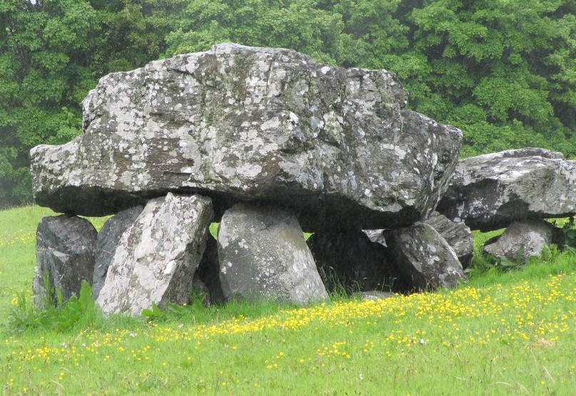
Excavations of what is thought to be the oldest surviving structure in Kerry have uncovered a burial site which dates back almost 6,000 years.

The dolmen or portal tomb at Killaclohane, Milltown is the oldest such structure still intact anywhere in Kerry according to the county archaeologist, Michael Connolly.
The tomb, on a site between Milltown and Castlemaine, dates from around 3,800 BC and had never been excavated before.

A team of archaeologists recently undertook conservation works to ensure that the capstone on the tomb – which had slipped off its supporting portal stones – would not fall completely and irreparably damage the two upright pillars.

Excavations of what is thought to be the oldest surviving structure in Kerry have uncovered a burial site which dates back almost 6,000 years.

According to archaeologist Michael Connolly “during the excavations, the cremated remains of at least two people were discovered along with a number of arrowheads, scrapers, neolithic pottery and a flint javelin head”.

The precise dating of those objects may take several months but they are believed to be from the early Neolithic period. The discovery suggests that one of the earliest settlements in the county was in the Milltown area when people began to farm and develop ties to the land. Connolly has described the discovery as “very important”.

Cadbury Castle (South Cadbury)

Visited Cadbury Castle a couple of days ago while driving back from the Somerset/Dorset area. The sun was sinking as we climbed up the steep stony track from the village of South Cadbury. When we reached the top everything was bathed in the glow of the setting sun. Fabulous views of the surrounding landscape, quite easy to imagine this may have been the site of a the mythical city of Camelot. Back down in the small car park, I tried to read the information board – the light was failing by now so I photographed it and have reproduced the text below. A fascinating potted history of England from the time of the Neolithic up to the 15th Century.
(Information based on the work of Leslie Alcock and the excavations at Cadbury Castle 1966-70).

From the Neolithic Age (3,000BC) to early 11th Century, the fortress of Cadbury Castle was in turn military stronghold, centre of trade and culture, and probably focus of a religious cult; by the early 16th Century folklore identified it with Camelot of Arthurian legend.

Iron Age Town – A modest Bronze Age settlement on the summit grew into a large and spectacular hill fort town, a centre of craft, trade and religious worship. The place was probably a ‘capital’ of the Durotriges whose territory included central and southern Somerset and Dorset. Dwellings within ramparts were wood, wattle and thatch. At first left alone by the Roman government, the town was forcibly cleared around 70AD by the Romans, an action which left some of the inhabitants dead and which removed others to settlements in the surrounding countryside.

The Dark Ages and Camelot – People returned to the site towards the end of the Roman period and by 500AD there was a massive refortification on the hill top. Defences of timber and dry stone walling replaced the earlier banks and posts of the new south-west gate were embedded in solid rock. Within the defences stood a large, aisled timber hall. The scale of the work and precious pottery found from the eastern Mediterranean imply a wealthy, sophisticated and highly organised military society.
The only surviving written record of the 5th Century shows Britain divided into tribal ‘kingdoms’ and later Celtic tradition tells of a series of battles against invading Saxons under the command of a figure called Arthur. Cadbury, strategically placed to defend south-west Britain, could well have been the base from which Arthur led his troops to the final victory of Mons Badonis, whether that was fought in Dorset, near Bath, or in north Wiltshire. Cadbury was first linked to Arthur by Leland in 1542:
“At the very south ende of the Chirch of South-Cadbryri standeth Camallate, sumtyme a famose toun or castelle … The people can telle nothing ther but they have hard say that Arthure much resortid to Camalat” (sic)

Saxons and Vikings – The threat of Viking invasion during the reign of Ethelred II (the “Unready”) brought the hill top into use again as an emergency administrative and commercial centre in place of Ilchester. Coind were minted at Cadanbyric between 1009 and 1019 in the safety of new defences, and a church may have been begun but the ramparts were again destroyed. Soon after the mint returned to Ilchester.”

Destruction of 3,000 year old bog road

irisharchaeology.ie/2015/08/the-destruction-of-a-3000-year-old-bog-roadway-in-co-westmeath/

“While Irish heritage is being celebrated and promoted this week, the destruction of a major archaeological monument, a major timber-built road of European significance at Mayne Bog, Coole, County Westmeath is continuing.

Although the National Monuments Service (NMS, the responsibility of Minister Heather Humphreys) has known since 2005 about the existence of the monument, they have failed to act to preserve it.

The road or Togher was discovered in 2005 and was reported by a concerned local resident, rather than the landowner or the industrial peat company Westland Horticulture who are extracting compost from the site.

The National Monuments Service subsequently instigated the excavation of a few meters of the 657m long roadway, which established that:

The monument was a substantial transversely laid plank built roadway. It was no mere trackway, it measured from 4.3m to 6m in width. The recorded length of the road was 675m, but it was seen to extend beyond both recorded limits.

A carbon 14 date of 1200-820 BC was obtained from the timbers, making it a remarkable structure of Bronze Age date, 1000 years older than the celebrated Corlea Bog roadway in neighbouring County Longford.

The excavators recommended further archaeological work but this was never acted upon. What did happen was that peat extraction work continued unabated. What is worse is that the monument was never even properly listed or given any legal protection ...”
(Contd.)

News from Rupert Soskin: stone pillar is blueschist

I don’t know whether Rupert Soskin posts here any more (if he does come on to discuss this I will delete this entry). I’ve just read this on the Facebook “Standing with Stones” page and, having not long since visited Bryn Celli Ddu, found it Very Interesting indeed.

Below is Rupert’s FB post:

“Hi folks, Rupert here.
I thought it important to share this as many of you have expressed an interest. I was contacted last night on Twitter by Ffion Reynolds who had been to Bryn Celli Ddu with a geologist who identified the ‘tree’ pillar as blueschist – i.e rock, not fossil.
Now, the interesting thing about blueschist is that it is a metamorphic rock which only forms in extremely particular circumstances, best explained by this quote from the United States Geological Survey’s website:
...................................
For many years geologists have been able to relate individual facies to the pressure and temperature conditions of metamorphism.
But they had no satisfactory explanation for the geologic processes that form metamorphic rocks, that is, until the theory of plate tectonics emerged.
One good example is this relatively rare metamorphic rock called “blue schist.”
Experimental work had shown that the minerals in blue schist form only under very unusual metamorphic conditions.
These conditions are a pressure range equivalent to a depth of 15 to 30 kilometers in the crust and a very cool temperature, only 200 to 400 degrees centigrade.
That’s the approximate cooking temperature of a kitchen oven or toaster.
At a depth of 15 to 30 kilometers, however, the temperature is normally about twice as hot, 500 to 750 degrees centigrade.
So the only way that rocks can be metamorphosed to blue schist facies , is to be quickly shoved down to those extreme depths and then rapidly brought back up before the rocks have time to heat up completely.
And that’s exactly what happens where two tectonic plates are colliding in a subduction zone.
In fact, blue schist bearing rocks normally occur in long linear zones that mark ancient plate subduction boundaries.
..................................
One of the principal reasons I clung to the fossil theory was the cylindrical tree-trunk shape which had clearly not been cut, despite all previous descriptions of it being ‘carefully worked’.
The formation of blueschist could allow a seam of cooling rock to literally roll up between the tectonic plates rather like a piece of seaside rock.
This leaves us with two, rather lovely points:
One: The builders of Bryn Celli Ddu would know no difference, it was still a magical stone tree.
And Two: Metamorphic rock does not form in conveniently sized pieces. There must be more.”

Exploring ancient life in the Vale of Pewsey

phys.org/news/2015-06-exploring-ancient-life-vale-pewsey.html

The Vale of Pewsey is not only rich in Neolithic archaeology. It is home to a variety of other fascinating historical monuments from various periods in history, including Roman settlements, a deserted medieval village and post-medieval water meadows. A suite of other investigations along the River Avon will explore the vital role of the Vale’s environment throughout history.
Dr Leary continued: “One of the many wonderful opportunities this excavation presents is to reveal the secret of the Vale itself. Communities throughout time settled and thrived there – a key aim of the dig is to further our understanding of how the use of the landscape evolved – from prehistory to history.”
Duncan Wilson, Historic England Chief Executive, added: “Bigger than Avebury, ten times the size of Stonehenge and half way between the Stonehenge and Avebury World Heritage Sites, comparatively little is known about this fascinating and ancient landscape. The work will help Historic England focus on identifying sites for protection and improved management, as well as adding a new dimension to our understanding of this important archaeological environment.”
The Vale of Pewsey excavation also marks the start of the new University of Reading Archaeology Field School. Previously run at the world-famous Roman town site of Silchester, the Field School will see archaeology students and enthusiasts from Reading and across the globe join the excavation.

The six week dig runs from 15th June to 25th July. Visitors are welcome to see the excavation in progress every day, except Fridays, between 10:00am and 5pm. Groups must book in advance

Great Orme Mine

Not sure what I can add to previous fieldnotes so this is just a record of my visit last week 2/6/2015.

Spent the morning walking up to Aber Falls which are truly spectacular. After lunch in Abergwyngregyn we made our way to Llandudno and the Great Orme. By now it was a bright afternoon but very windy – I mention this because the wind on the Great Orme headland was too fierce to stay out in for more than a short while.

However, the Great Orme mine was sheltered from the wind and needless to say non-existent underground. This was somewhere I’ve wanted to visit for a long time so was able to put my usual claustrophobia aside. Before going into the mine you have to select a hard hat and are invited to watch a short introductory video – which proved to be helpful, informing us that the ancient mines were unearthed in 1987. We were joined by a couple from West Yorkshire and let them lead the way down into the narrow 3,500 year old passages leading to a massive, prehistoric cavern which is lit by coloured lights. The passages eventually come back out into the 4,000 year old Great Opencast.
To say this place is awesome is no exaggeration – the visitors guide to Llandudno quotes Current Archaeology Magazine “Stonehenge is certainly a world class site but now it is joined by the bronze age mines at Llandudno.”

In the Visitors Centre there are displays and artefacts depicting mining, smelting and life in the Bronze Age. The gift shop and second hand book shop are staffed by archaeologists and historians working on the site – all profits go back into the project.

For anyone visiting from Llandudno without a car there is the Great Orme Tramway – which apparently is Britain’s only cable-hauled street Tramway. The first stop is Halfway Station and probably where you should get out for the ancient copper mine.

Capel Garmon

Visited Thursday 5th June, as part of a walk taken from ‘Best Walks in North Wales’ by Carl Rogers. The famous Victorian ‘Fairy Glen’ just above the Afon Conwy was at the start of this walk and of course a visit was compulsory on this beautiful warm June day (the best day of the week in weather terms). After visiting the Fairy Glen we crossed the lane to start the very steep zig zag walk up through a wooded area to eventually arrive on a peaceful lane leading to the village of Capel Garmon. Before entering the field to the tomb we had to run the gauntlet of a very barky border collie belonging to a nearby farm.

Capel Garmon burial chamber is described as “... one of the best examples of a Neolithic burial chamber in the locality and also has one of the finest settings – backed by a panorama of Snowdonia’s highest peaks.”
Very similar to some of the burial chambers to be found in the Cotswolds.
“The remains consist of a triple chamber faced with drystone walling as well as large upright stones using the post and panel technique.”
A wonderful site in a stunning location.

Penrhosfeilw

Last visit of the day on 31/5/15.

I was starting to feel tired by now when I spotted a sign pointing uphill. My companion (the driver) kindly turned the car around and we went to investigate. These stones pleased me as much as anything I had seen earlier in the day. Early Bronze Age, standing in the middle of a field on top of a very windy hill. Visually aligned with Holyhead Mountain in one direction and Snowdonia in the other. These stones reminded me of the stones at the Ring of Brodgar – their narrow shape and height. No circle though, just two solitary tall standing stones.

Barclodiad-y-Gawres

Visited 31/5/2015

The interpretation board informed us that Barclodiad-y-Gawres means ‘Giantess’s Apronful’. I cannot add much in the way of field notes as we were not able to arrange a visit inside the tomb and could only look through the metal gate (which gave the tomb a cave like ambiance). A fabulous spot on the headland by a small bay, the entrance of the tomb faces towards the Irish sea and Ireland. The walk up to it was lovely, strewn with sea pinks on the day of our visit.

I understand there are engravings on some of the stones inside the tomb and these can be viewed by prior arrangement. I’m afraid we weren’t that organised.

Bodowyr

This is a lovely ancient site to visit. Visited on 31st May as part of our little road trip around the south west side of Anglesey. Down a quiet, narrow lane with abundant wild flowers growing along the banks. The day was starting to warm up after a chilly start and it was a real pleasure to walk over to Bodowyr – the dolmen itself stands within protective railings but with the magnificent views towards Snowdonia, the railings melted away.

Wonderful!

Bryn Celli Ddu

This was the first site we visited on Sunday 31/5/2015. Easy access via quite a long path up to the burial chamber – to get to it involves crossing a small bridge and river, there was something about this that reminded me of Stoney Littleton. Anyway, suffice to say it lived up to expectations in spite of being extensively restored. The stone pillar was of course an enigma; the mysterious stone with spirals is in the National Museum of Wales in Cardiff – a day trip I can make from home soon to take a closer look (see photo of information board).

The midsummer solstice solar alignment is well documented on the interpretation board over in the small car park.

Plas Newydd Burial Chamber

I felt bit intimidated by the organisation of the National Trust on the Sunday morning we visited Plas Newydd – we didn’t particularly want to go into the house a it was shaping up to be a pleasant day weather-wise so viewed the dolmen from the top of the slope is has restricted access to the public. At that time we didn’t realise that unless you view Plas Newydd Burial Chamber from fairly close up it is not easy to see how splendid it is, certainly not from the path at the top of the slope where you can only see the top of it.
We went back the next day as the weather had turned wet and windy, it seemed like a good opportunity to have a look around the house. This time we asked to use the little motorised buggy that ferries less mobile people down to the house around the restricted access area. Nothing wrong with our mobility but it was a way of getting closer to the burial chamber. The driver of the buggy told us that the NT doesn’t encourage people to get close to it but will allow if you specifically ask. He kindly pulled up in front of the dolmen so I could take a photograph. By this time the rain was lashing down and I had rain on the lens – so my photos are not brilliant but they do show there are actually two dolmens – a large on and a small one. The smaller one is virtually hidden from view if you look from the top of the slope. Obviously, they were there a few thousand years before the house and would have looked out over the Menai Straights towards Snowdonia.

In spite of the rain, we didn’t stay long in the house ... that wasn’t what I come for.

Bryn-yr-Hen-Bobl

Not sure where to start with my trip to Anglesey and North Wales so decided on this enigmatic small burial chamber. We went to Plas Newydd with the prime intention of seeing the dolmen on the front lawn of the house. It was a pleasant day so we decided to walk around the extensive grounds starting with the arboretum. I had given up on seeing Bryn-yr-Hen-Bobl as no one I asked seemed to know what I was talking about – on the way back from the wooded area I spotted it in a field adjacent to the Plas Newydd Gardens. We walked up to a locked gate and, feeling furtive, climbed over. The burial chamber itself is protected by a wooden fence and locked gate but easy to see it clearly over the wooden fence. Very satisfying to spot it and manage a quick visit.

Bratton Castle & Westbury White Horse

Starting at Westbury White Horse today walked to Wellhead Springs which are approximately two miles from the White Horse along a well used bridleway. We didn’t see them at first but when they came into view it was – yes, a magical moment. They are in a deep wooded combe which was a bit slippery to get down (but fun too). The water from the springs looked clear and clean though I didn’t sample it. A dog walker told us that up until a few days earlier the place had been covered in litter. A solitary man had been down there over several days and cleared it all away with a wheelbarrow. What an unsung hero whoever he is.
Walking back uphill to a footpath which merges into the Wessex Ridgeway we came upon a massive hole in the side of the hill. A chalk quarry belonging to the concrete works in Westbury. I always wonder how this vandalism is allowed to occur to one place. I guess its just accepted in the name of commerce. So glad this hasn’t been done elsewhere (to my knowledge anyway) on the wonderful chalk downs of Wiltshire.

corridor-alliance.co.uk/latestnews.html

Link

Anglesey
County
Welsh History Month: A tale of two tombs ...

“The island of Anglesey has a personality all of its own. Sheltered in the lee of Snowdonia, it is the only area of fertile and accessible land in a region of high and barren mountains. It is, therefore, not surprising that settlers have been drawn to its shores from the dawn of history. And they have left us some of the most inspiring monuments in Wales.”

Miscellaneous

Stonehenge
Stone Circle

Entry taken from “A Complete and Universal DICTIONARY of the English Language” by Revd. James Barclay – dated 1812.

STONEHENGE, a remarkable monument of antiquity situated on Salisbury Plain. It stands on the summit of a hill, which rises with a very gentle ascent; and consists of stones of enormous size, placed upon one another in a circular form: many of which are really stupendous, and cannot fail of filling the beholder with surprise and admiration. All the stones added together make just 140. One, at the upper end which is fallen down and broken in half, measures, according to Dr. Hales, 25 feet in length, 7 in breadth, and, at a medium, 3 and a half in thickness. The stones are supposed to have been brought from the Grey Weathers, upon Marlborough Downs, but the difficulty in bringing them hither, and especially in laying them one upon another, is inconceivable, as no mechanical powers now known are sufficient to raise those that lie across to their present extraordinary situation. It is supposed to have been a temple belonging to the Antient (sic) Druids. Stonehenge is 2 miles W. of Amesbury, and 6 N.N.W. of Salisbury.