
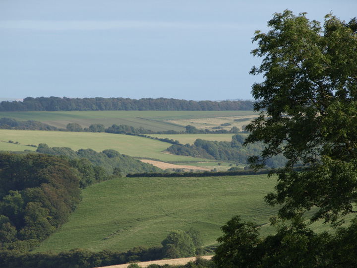
The southern range from the South Dorset Ridgeway, from a very damaged barrow, Bincombe 31.
Image credit: Mike Rowland 16/09/09
The southern range from the South Dorset Ridgeway, from a very damaged barrow, Bincombe 31.
This is an extensive set of square celtic fields on a south facing hill, south of the village of Sydling St Nicholas. These fields have never been ploughed and are a rare survival locally. They are only about a mile west of the large enclosure on Grimstone down. There were also settlements at nearby Shearplace hill and Smacam Down.

Celtic field system, south of the village of Sydling St Nicholas.
An extension of the field system on the hill to the east.

These three bowl barrows are just to the east of the hybrid bell/disc barrow.

Three northern outliers.

One of the northern outliers from the main group.
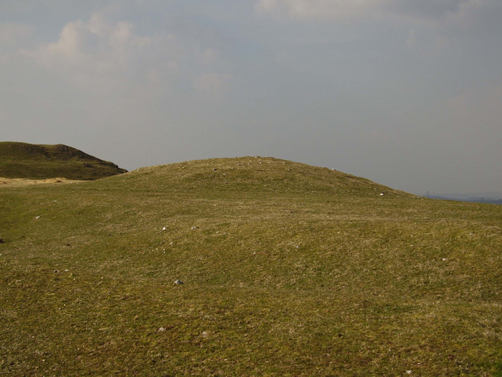
One of the central, medium sized bowl barrows.

This large hole is in the centre of the bell barrow, doubtless made by some 19th century antiquarian.

A very small barrow from the top of the bell barrow.

Looking west at the smallest and largest barrows on the site.

The large bell barrow with a smaller bowl barrow in the foreground.

These are the westerly barrows.

The ditch and berm of the big bell barrow.

The western, large bowl barrow.

The western most barrow on the site, also one of the largest.

Looking west across the site from the top of the eastern most barrow.

A shallow boudary ditch edged with slabs of stone.

What appear to be conjoined barrows.

This very battered round barrow is just next to Hardys’ monument, it has animal damage and is constantly walked upon.

The most westerly of the group, this overlooks the Valley of the Stones.

The larger of two bowl barrows, just below and to the north of the Hardy monument.

Two of the eastern bowl barrows from the path to Bronkham Hill.
This is one of a number of barrows on the East Holme Firing range. The range is on heathland between the river Frome and the coast, to the north of the Purbeck hills. The only way to see the barrow is from the hills above with binoculars or a long camera lens.
The nearby Povington barrow was not visible, at only a metre in height it is probably obscured by vegetation at this time of year.
It appears to be in good condition when viewed through binoculars, MAGIC says it is 2 metres in height and 27 in diameter.

The barrow is just right of centre in the photo, this is as close as I could get to it.

The hillfort from the east, above the deserted village of Tyneham.

Some of the group from the hill to the south.
There is very little information I can find about this small oval hillfort just to the north of the West Dorset village of Cattistock. The only written reference I can find is in a small book by Phil Wilton called the “Castles of Dorset”.
He says some people think it to be natural, but he thinks it to be clearly manmade. Having visited I am pretty sure he is right, also M.A.G.I.C and the OS describe it as a hillfort.
There appears to be a round barrow in the interior, which unfortunately I couldn’t see from the valley below.
There is no direct access to this site, as the only footpath is much lower down the hill, from it the hillfort is invisible. The hillfort appears to be on private land.
If anybody else knows any more about it I would be glad to know.

The hillfort from the valley below, looking north west.

This shows just how much archaeology is in this small corner of south west Dorset. The blue dots are round barrows.

The complete southern side of the fortress from Gould’s hill to the south.

A small, low round barrow to the south of the monument, the wooden posts are there to stop people parking on it!

The large round barrow adjacent to the Hardy monument on the summit of Blackdown hill.

The Hellstone and what appears to be either a round barrow or part of the original long barrow mound. The stones are in the left hand corner, the photo was taken from Hardy’s monument to the north.

Clandon barrow in the distance, from the west, with Lanceborough in the foreground.

This is a 1759 engraving by J.Newton and it hangs on my bedroom wall. The view itself would be impossible now as everthing is hugely built up.

A stitched together photo of the bell barrow.

The southern and western inner banks from the top of the barrow looking west.

The full length view of the western inner bank from the northern bank.

Looking east along the length of the north rampart.

The ditch between the two western ramparts.

The bowl barrow in the interior of the fort.


A slightly fuller picture of the barrow.

A group of 3 barrows in the eastern half of the cemetery.
This is an extended barrow cemetery of 11 barrows of various types which runs up a shallow valley to the north of Bere Regis. The single barrow in the photo is one of a group of three in the western side of the cemetery.
The group of three are on the east side of the valley, just north of Millum Head.

This single round barrow is one of 11 in this extended barrow cemetery north of Bere Regis.
This is a group of 8 barrows south of the Bincombe and Came group. One of the barrows is a rare oval type having a length of 40 metres and width of 20 metres. This is one of less than 50 recorded examples.

The green patch in the middle of the photo is a large oval barrow.

Most of the hillfort from the valley below it.