This is an extended barrow cemetery on military land. There is a footpath across the site and the two barrows photographed here so far are the most easily accessible.
The most prominent is to the north of the footpath and is a large low bowl barrow covered in heather at this time of the year.
The other one is to the south of the path is in worse condition, having been damaged by tanks in the past. Happily now it is fenced off. It has an O.S. trig point on top of it and a flint knife and bronze dagger were found when a flagpole was erected. The finds are now in Dorset County museum.
There is another barrow to the north of these two marked imaginatively on O.S. maps as “Round Barrow”. I couldn’t find it and didn’t look too hard as it appears to be on an explosives range used by the Royal Marines to practice blowing up stuff, so I didn’t fancy hopping fences to look for it.

formicaant
Visited the site today to see if I could find the long barrow to the north east, no luck I’m afraid. The undergrowth is very thick at this time of the year and I could easily have walked straight past it.
The barrow on this post is very easy to find, park on the other side of the road in the car park of Martin Down nature reserve. The road here is extremely busy and you can’t see very far either way. The barrow is a few hundred yards to the north on the east side of the track.


Another bowl barrow on the heath very overgrown with a trig point on top of it.
Image credit: Mike Rowland 26/07/2008.

The eastern bank and inner ditch with the Great barrow in the background.
Image credit: Mike Rowland 28/07/2008.

The western and northern bank and ditches and the northern entrance.
Image credit: Mike Rowland 28/07/2008.

A group of three barrows on Middlebere Heath from the north.
Image credit: Mike Rowland 26/07/2008.

Fenced off barrow on Turner’s Puddle heath.
Image credit: Mike Rowland 26/07/2008.

The huge pond barrow, looking east.
Image credit: Mike Rowland 08/02/2008.
This may look like a strange inclusion but the building actually stands on top of a barrow. The site is south of the village of Puncknowle, on a hill called the Knoll, from which the village takes part of its name. The name is pronounced punnel as in funnel.
The barrow itself is about 20 metres across and 4 feet in height. Grinsell very nicely describes it this way – as having a “Tiny hovel (watch-tower?) on it. Site of finding of cinerary urn in 1908.” Dorset Proc xxxv , p. Li.
The building is described in MAGIC as as lookout post built in about 1800 and is grade II listed. An earlier map calls the hill Punknoll Beacon.
The watch tower is well placed as the views go on for miles. To the east is Abbottsbury Castle hillfort and the barrows on Tulk’s hill and Limekiln Hill. To the west is Golden Cap to the north Chilcombe Hill and Shipton Hill.

From the summit of the knoll, Abbottsbury castle to the left and Tulk’s hill to the right.
Image credit: Mike Rowland 22/07/2008.

The watch tower which sits on top of the barrow. It’s not the local shop from the league of gentlemen.
Image credit: Mike Rowland 22/07/2008.
I had time to visit this site today, there is some doubt as to it’s being a barrow, Grinsell seems to think it natural. Given the name and its appearance it looks ok to me, I don’t know whether Grinsell visited the barrow, although he did get to see a great many. Anyway as it is today only the landward side in the photo is still in good condition, the seaward side having fallen away at some time. From it can be seen the nearby Sandy barrow on a hilltop about a quarter of a mile inland to the north. Behind can be seen the Island of Portland several miles to the southwest.
This barrow, seen from nearby Goggin’s barrow is on a hilltop just inland from the coast near to the village of Osmington. I didn’t have time to walk here today, but as a footpath runs close to it I will get closer to it soon.

Sandy barrow from the top of Goggin’s barrow.
Image credit: Mike Rowland 16/07/08

Goggin’s barrow looking south into the channel with Portland to the right in the photo.
Image credit: Mike Rowland 16/07/08
This is an intriguing site, which if it is genuinely megalithic would certainly add greatly to the small amount of stones in Dorset.
The site itself falls into three groups in a valley bottom south of the village of Corscombe. The whole area of the stones is about 50 metres north / south by about 20 metres east / west.
The southern are two recumbent stones laying next to each other, giving the appearance of having been toppled. These are the largest stones, one being 8 1/2 feet long, the other about 6 feet. The smaller of the two has a blackthorn tree growing around it’s base.
The three standing stones are to the north, the central and largest stone is 6 1/2 feet high and has a pointed top. The next in size leans against the other and has a broken lower corner. The smallest of the three is reputedly known as the “Devil’s Seat” or “Granny’s Armchair” and does resemble a chair.
To the west of these are a group of six smaller stones laying in the grass in an arc. In amongst these and between them and the standing stones are smaller stones or fragments of larger, broken stones.
This site has been variously described as a destroyed long barrow, a disrupted stone circle or just a random colection of stones at the bottom of a steep sided valley.
Whatever the answer to this place is, someone has made an effort to lean two of the stones against each other, and the two southern stones have been there long enough for an elderly tree to have grown around one of them. Although not a scheduled ancient monument, english heritage does give it the monument number 195903.
It may be pure coincidence but just to the north of the site is a road and track named barrow lane.
If anyone knows any more about these stones I’d be very interested to know about them.

The stone on the extreme left is reputed to be the “Devil’s Chair” or “Granny’s Armchair”.
Image credit: Mike Rowland 14/07/2008.

A detail of the southern stones showing a hawthorn tree growing around the base of the lefthand stone.
Image credit: Mike Rowland 13/07/2008

The two large southern recumbent stones.
Image credit: Mike Rowland 14/07/2008.

Five large stones to the west of the three standing stones.
Image credit: Mike Rowland 14/07/2008.


The whole site looking north along the valley bottom.
Image credit: Mike Rowland 14/07/2008.

A distant view of the two barrows from Drove hill, to the south.
Image credit: Mike Rowland 13/07/2008
This is another heathland barrow cemetery, the third I’ve visited today. These are the three most accessible on the site and all are in good condition. They vary in size from one of the smallest I’ve seen anywhere to a 2 1/2 metre high example. They are on a plateau which overlooks the valley of the river Piddle to the north and the Purbeck hills to the south.
There is another set of barrows on a lower slope of the heath to the east which I will try to visit soon.
Another visit to this barrow cemetery, this time with more success in terms of finding the mounds on it. I found another five bowl types and a bell barrow.
Four of the bowl barrows were strung out along a ridge at the southern edge of the site and were very overgrown. All appeared in good condition and were on the smaller end of the scale.
The most westerly was close to the first barrow I found last time and appeared to be the largest on the hilltop.
The bell barrow is lower down the hill, to the east of the main group and is behind a large modern reservoir. It is in reasonable condition with a wide berm and part of the outer bank is visible on the northern edge. This barrow is surrounded by trees and is difficult to get a decent photo of as you have to get very close to it.
This barrow cemetery is south of Whitcombe vale and southwest of Blacknoll hill. There are four bowl barrows in the group in a line which runs northwest to south east. The three most northern barrows are on prominent rises on the heathland. The most easterly is on pasture with horses grazing on it, from the fence which surrounds the field it appears to have a sarsen type boulder on top of it.
All the heathland barrows are fully covered with gorse and bracken at this time of the year and are difficult to get close to.


The most eastern barrow with what looks like a sarsen on top of it.
Image credit: Mike Rowland 13/07/2008

Blacknoll hill from the west.
Image credit: Mike Rowland 13/07/2008


The small southern barrow from the east.
Image credit: Mike Rowland 13/07/2008


The western half of the bell barrow on Black hill clump.
Image credit: Mike Rowland 13/07/2008

A nicely preserved bowl barrow.
Image credit: Mike Rowland 13/07/2008

The smallest of the group.
Image credit: Mike Rowland 13/07/2008

This is the largest of the three, on the west of the site.
Image credit: Mike Rowland 13/07/2008

Tree covered barrow in the middle of a field, with rabbits if you’re eyesight is good enough.
Image credit: Mike Rowland 07/07/2008.
A single barrow in the middle of a field in the former hamlet of Fryer Mayne. This is now a suburb of Broadmayne and is a farm and a large house. The barrow has some animal damage and is obscured by foliage at the moment.
This barrow is immediately north of the Poor Lot barrow cemetery. Magic says it is 23m across and just under a metre high. It is dwarfed by the horrible pylon behind it and was not easy to photograph, I had to stand in the boot of my car to see over the hedge!

The round barrow NNW of Field Barn.
Image credit: Mike Rowland 23/06/2008.
I have known about this for some time and have not posted it until I actually saw it for myself. I’m not suggesting for one minute that this is some sort of megalithic chair, but the large rear stone is intriguing. I know this must go in the dodgy category of postings and have e-mailed the Evershot village website to see if anyone knows how long this has been there in its current form, as yet I’ve had no reply.
Only the two side stones are slotted to take the concrete seat base, the rear stone is undamaged. The large stone is over a metre in height a must weigh several tons. The stone looks much the same from behind and has no obvious signs of modern tooling.
This site appears in Peter Knights “Ancient stones of Dorset”, a book of which I am quite wary, it’s emphasis on leylines doesn’t appear very sound historically.
I’d be interested in the opinion of anyone else who’s seen this or knows anything about it.

Now a seat, was this once a standing stone?
Image credit: Mike Rowland 23/06/2008.
I finally found the time to visit this site. I spent three hours here and barely scratched the surface. This is a massive place covering about one hundred acres. There is a lot to see, but like many similar sites it’s difficult to photograph, espescially when the grass is high.
Preserved in small woodland areas are several round barrows, two of which I managed to find. The most southerly is in fine condition with no obvious signs of damage. The second, near Jackman’s cross is very overgrown and difficult to get close to.
To the south across the valley of the Frome is the Penn hill / Seven barrow plantation, while to the north is Smacam down.
There is a good path up a gently sloping hill and stunning views for 360 degrees, well worth a visit for them alone.

A possible field margin or enclosure bank.
Image credit: Mike Rowland 23/06/2008.
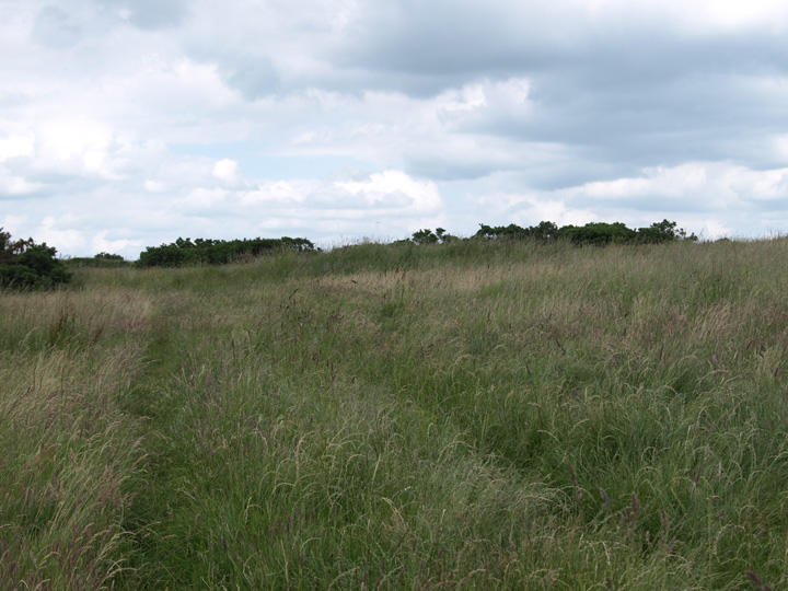
Part of the bank of an enclosure.
Image credit: Mike Rowland 23/06/2008.

A very overgrown bowl barrow.
Image credit: Mike Rowland 23/06/2008.

A nicely preserved bowl barrow inside a small wood.
Image credit: Mike Rowland 23/06/2008.