

The western end of the hillforts ramparts.

The small dip in the centre of the photo is the outermost defensive ditch or a cross ridge dyke.


This barrow is slightly north of one right next to the road.
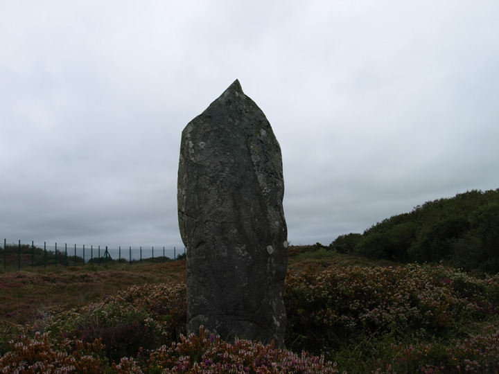
The menhir with the two barrows behind it.

This barrow is to the immediate north of Dry Tree Menhir.

This large round barrow is just over the fence from the menhir.

A small, low round barrow south of Croft Pascoe plantation.

Chun castle, with the quoit to the west from the Trewellard road.
This is a large oval hillfort which has had a lot of damage done to it by quarrying. I could see very recent signs of continuing damage in the form of crude “sculptures” made of piled stones. This was on the south side adjacent to a stone cross set up as a war memorial.
Having mentioned the amount of damage, there are still substantial remains of banks and ditches to be seen. Also on this hill are two further round enclosures below the hillfort to the north. There are entrances to the west and east.
To get here I parked in the tiny hamlet of Balwest and walked up the footpath. The path is made up of compacted stones and looks to have been built to serve the quarries to the east of the hillfort. One of the quarries was where china clay was first discovered.

The western ramparts, the structure is a war memorial.


The eastern outer bank and entrance.

The eastern inner bank and entrance.
Scissorman is absolutely right, the views from this hillfort are some of the best you’ll see anywhere. It appears to be made up of a single rampart on the south and east sides where the land falls steeply away. The northern and western sides appears more complicated with inner and outer walls/banks and ditches.
The hillfort was donated to the national trust and is dedicated to the memory of all the women who died locally in WWII.


The northern inner bank and what appears to be a further one.


This is a substantial hillfort, the banks of which are constructed from granite boulders. The construction is similar to others in the area but is considerably bigger than say, Chun castle. Also it appears to be formed of two concentric rings of ramparts and ditches (apparently there were four)
Within the interior is a dividing bank next to which is a stone built castle-like folly. The folly appears to built from stones robbed from the structure of the ramparts, they seem to be of similar size and there is a gap in the bank next to it.
The only obvious entance I could see was on the west side, there is a stagger in the ramparts here.
I got here by using a footpath about half a mile along the road from Chysauster. It’s not a very steep climb but was very wet and muddy after 24 hours of heavy rain. I was the only person there in the hour or so I was here.

Castle-an-Dinas from the pathway up to it.


This broken, holed? stone aligns on both of the barrow like structures on the distant hills.

The southern inner and outer banks and ditch.

The northern inner embankment.

What appears to be an internal dividing bank. The building is a folly, probably built out stones robbed from the fort.

The edge of barrow 7 looking towards barrow 6 to the west.

I think this is barrow 9a, it’s in roughly the right place.

Barrow 7 from the north.

Barrow 6 from the road, looking through a gap in the hedge.

The third and fourth barrows, the fourth is the smallest.

The largest of the barrows at the eatern end.

Two barrows joined together.

The barrow group from the west.

The westernmost barrow.
This is a group of ten barrows on Hardown hill above the hamlet of Ryall. The barrows are a group of six and four – five of the group of six are shown here. These are mostly very slight and are covered in gorse and bracken, even so they are visible except for the lowest.
The group of four are very small indeed – 9 paces across by 1 foot in height with exception of a possible Dorset disc type. I didn’t attempt to find these today, this is a winter job I think.
To the immediate south is the back of the Golden Cap cliffs, whilst to the west may be seen the top of Colmer’s hill. Also within sight are the hillforts – Pilsdon Pen, Lambert’s Castle and Coney’s Castle all to the north west.

Golden Cap from the Cobb at Lyme Regis.


The landward side of Golden Cap from Hardown Hill.

A gorse covered barrow on the flat top of the hill.


The Bincombe “bumps” barrows from the south east.
This is taken from Dorset Brrows by L.V.Grinsell and describes these long barrows/ bank barrow.
“Width includes probable berm ploughed to edge. Height of mound rises from NW to SE where 5ft. This and the last (II a) may in fact be one long barrow, as probing by R.J.C.Atkinson has shown ditches to be continuous.”
Grinsell gives the following dimensions for both barrows : IIa – 300 feet long by 72 feet wide by 4 feet high.
IIb – 175 feet long by 70 feet wide by 5 feet high.
I visited these large barrows whilst visiting the row of 5 to the north. They are much bigger than the northern set, the three still in exitence are sized as follows:
6- 36 yards by 8 feet high 7- 40 yards by 11 feet high
8- 36 yards by 71/2 feet high
9- destroyed.
9a- virtually destroyed.
Dimensions are taken from L.V.Grinsell – Somerset Barrows Part1 – South and West.
I visited these barrows today there are 5 in a row with a common bank surrounding them. The bank is probably not ancient, it is typical of the C.18. Norman Quinnell thinks they are confluent bell barrows.
They are sized from west to east as follows:
1- 24 yards by 5 feet high
2- 20 yards by 5 feet high
3- 24 yards by 61/2 feet high
4- 20 yards by 6 feet high
5- 30 yards by 7 feet high
This information is from L.V.Grinsell’s Somerset Barrows Part 1: West and South.

The Verne, now a prison, once the probable site of a hillfort.
A row of three bowl barrows on a slight rise on Stoborough heath. These are north of the Purbeck hills and form part of a spread out barrow cemetery covering most of the heathland in this area. They are on a farm and cannot be walked upon without permission. However they are easily visible from the narrow road which leads to the small village of Arne and its nature reserve.
Orientated roughly west to east, they vary in size from 27 metres by 2 in height to 13 metres by 0.8 in height. They are also known as Arne 13, 14 and 15.
This is an extended barrow cemetery on military land. There is a footpath across the site and the two barrows photographed here so far are the most easily accessible.
The most prominent is to the north of the footpath and is a large low bowl barrow covered in heather at this time of the year.
The other one is to the south of the path is in worse condition, having been damaged by tanks in the past. Happily now it is fenced off. It has an O.S. trig point on top of it and a flint knife and bronze dagger were found when a flagpole was erected. The finds are now in Dorset County museum.
There is another barrow to the north of these two marked imaginatively on O.S. maps as “Round Barrow”. I couldn’t find it and didn’t look too hard as it appears to be on an explosives range used by the Royal Marines to practice blowing up stuff, so I didn’t fancy hopping fences to look for it.