
South-east arc of three stones, looking south towards Seahan, Seefingan and Seefin.
Image credit: ryaner
South-east arc of three stones, looking south towards Seahan, Seefingan and Seefin.


The large, spit boulder with the north-east pointing quartz face.


Approaching the cairn across the bog from the south-east.

Small clochán/shelter in the southern arc of the cairn. I was grateful for the shelter from the gale it afforded today.

I was heading south for Church mountain and glanced down to my right as I entered Blessington. Seeing the temporary fencing I quickly diverted and decided to check it out. And oh dear, what a mess! Already a neglected and overgrown monument, with a kids’ playground butted up to its west side, now the ignominy of a skate park to its east.
Sounding desperately like a killjoy to myself here, let it be said that the more playgrounds and skate parks for our kids, the better. But come on – allow the ancient burial site a bit of room to breathe. The beginnings of the ground work on the east side cut right into the edge of the external bank.
The whole project seems to have gone ahead with a lack of thought – what’s going to happen to the barrow now, given that the council has already treated it with such disdain? I get the feeling that they’d prefer if it just went away. Shame.


Looking west. Whose idea was this, I wonder?

Looking east from on top of the barrow. What a tight squeeze it will be.
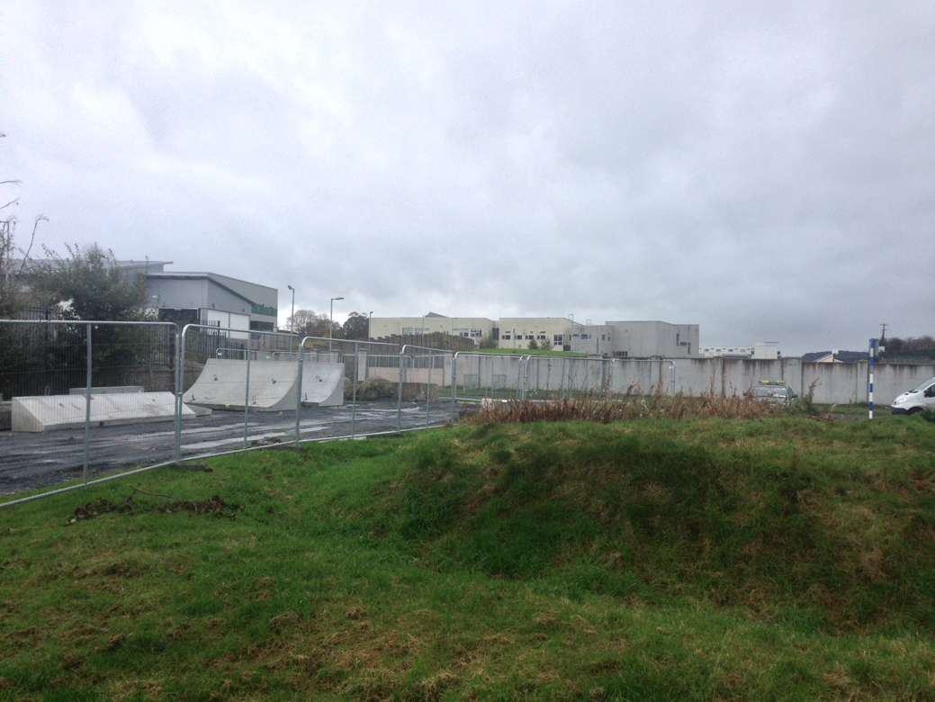
East side of the barrow, with digging works right up to the bank.
This is not listed in the SMR. As I ascended south towards the summit of Broughills Hill from the barrow in Johnstown, along the boundary line between Johnstown and Kiernans Hill and in turn Broughills Hill, I spied a large, rocky outcrop. Though I was making for the summit in driving wind and rain, I couldn’t resist investigating. The outcrop is made of huge earthfast granite boulders, but below it to the east is a seemingly man-made platform containing this intriguing monument.
I can’t make out what it is, so I’ve listed it here as a hut site/habitation site, though i suspect that it may be a burial/chambered cairn, ruined and lost to history, until now. There are lots of lumps and bumps in the small, 8 metre diameter area, some of which may be a chamber, or may be the hearth of an old hut site. In the north-west quadrant there is erosion leaving packed, cairn-like stone visible. The whole mound is about half a metre tall, rising to a metre in places.
A mystery, leading me to reckon that this ridge, leading down from Broughills Hill, has not been properly surveyed.

Enclosure? Hut site? Denuded cairn?

Cairn-like packing on what looks like a bank at the site.

The platform and the ‘hut site’. I think this may even be an unrecorded cairn.

Looking south over the site.

From a large outcrop and looking roughly north-east, the site is on a leveled platform.

The pitted stone, with bedrock below its overhang.

The ‘top’ of the stone with channels and runnels and solution pits. These are eroded in a pattern that could lead one to believe that this stone once stood erect.

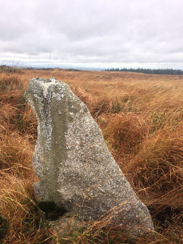
The possible standing stone, on the west-facing slope and leaning to the south-west. Horizon line adjusted.

The slab that is said to be a possible marker stone.


South towards Slievecorragh, over the gap and the Hollywood to Glendalough road.

The stone is on a west-facing slope in this small townland.


There are two listed standing stones in this small townland, west of the summit of the hill with the same name. I believe I found both, along with two other possibles. The terrain here is difficult – swampy, pitted, harsh and treacherous – boots a necessity if you wish to retain intact ankles.
All of the stones are being swallowed up by the peat. Of the four, the tallest, conical menhir is the only one that could be said to be definitely such. Another large, bulbous, craggy example, almost a metre and a half tall, is badly leaning to the south-west, but seems to have packing stones at its peat engulfed base.
The other two are similar, slab-like examples, one listed and said to be “Possibly a marker stone between the other Broughills Hill standing stone (WI009-030----), the Johnstown barrow (WI009-029----) and the Kiernans Hill standing stone (WI009-034----).”

East over the hut site in Johnstown townland.

Hut site in Johnstown, north-east of the barrow, now a dumping ground for field clearance.

North-east over Puolaphuca reservoir. There is a rather nice barrow there under the gorse and brambles.


South towards the summit of Broughills Hill.


North-east with the views blocked by the forestry on Lunnagroagh.

West over the plain of Kildare towards the Hill of Allen.

South towards Broughills Hill, Slievecorragh and Church Mountain.

Yes, this is the cairn, with trees planted on the main mound and also on and right up to the kerb.


On top of Ashtown barrow, with modern granite block.


I want to visit here in winter when there is less vegetation – but the sky won’t be as dramatic.

The barrow, with nearby Aldi as a backdrop.