
Morett bullaun stone with the shrine to St. Brigid at the holy well.
Image credit: ryaner
Morett bullaun stone with the shrine to St. Brigid at the holy well.


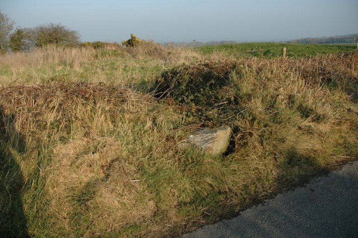
The stone peeping out at the side of the road is the edge of the large roofstone of the cist.

I walked right by this before finding it.
The structure in the upper right is the possible remains of a church.
Killone = Cill Eoin = Owen’s church.


Badly stitched together shot of the barrow, wide-angle lens coming soon.

What once was
A huge barrow in the grounds of Punchestown race-course, it’s close on 30 metres in diameter. The central mound is quite low but may have been taller in the past as the ditch and bank are of such a large size, the top of the bank being close on 3 metres above the bottom of the ditch in places in the northern arc of the barrow.
Punchestown race-course is popular with dog-walkers and access is through the gate-style at the entrance, opposite the field with the race-course standing stone. I arrived here late in the January evening and there were quite a few people about, but none in the vicinity of this forgotten monument. This could be a showcase part of the grounds with a little bit of tidying, but like so much of our ancient heritage, is now willfully neglected and overgrown.

Late evening, January 08. Access to the tallest standing stone in Ireland is now next to impossible, unless you have a large stick to beat the brambles back.

Artificial mound outside Clane, not much to see here. About 3 metres tall, 20 metres in diameter.
26/1/08


Tomb 4 in the foreground, with the remains of 3 and 2 and Tomb 1 to its right. The visitor centre, closed in winter, is across the road.

Taken from the north-west near Sligo Airport, this ‘side’ of Knocknarea is very dramatic with its sheer cliffs. Yet there is only the single court-tomb in this vicinity, in comparison to the mad clutter of tombs on the other ‘side’.


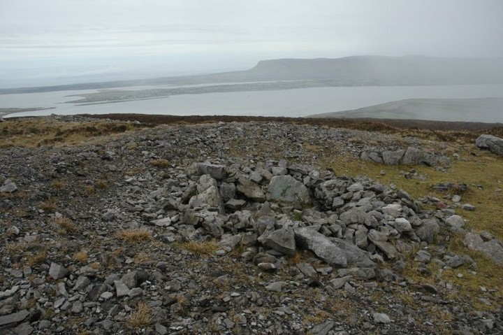
Looking over the chamber, across Sligo Bay, with Benbulbin (Binn Ghulbain) in the distance.

The ruins of a small passage grave to the north of Maeve’s cairn, with Maeve in the distance.

Tomb 26, with Tomb 27 behind it. We couldn’t enter the field they’re in as there were cattle there today.


The farmer was working in the field here today. It’s not practical for the OPW to buy up all of Carrowmore, but you’d think they’d buy the land around the ‘better’ ones.

59 is in the foreground, 58 to its left. Knocknarea, with Maeve’s cairn obscured by cloud, is nearly blotted out by the ugly green barn.


Knocknarea is visible behind the trees. Karl shows some scale

Beside the small road on the way to the small airport, all that’s left of this site is a smallish gallery.


We headed up from the road at the south-eastern end of Brusselstown. 100 metres into the field are the remains of the outer ramparts of the huge Spinnan’s Hill/Brusselstown complex. The Arch. Inventory of Co. Wicklow shows a line about 5 kilometres in circumference surrounding the two peaks and their respective hillforts. This line of rubble, at this point, is very low, less than a metre in height but with some larger stones standing proud of the remains. It’s hard to make out from here how much of the rest of the outer ramparts remain, and even from above it remains difficult to do so.
We headed up and entered the fort. What looks like chevaux de frise is in fact the old fortification of the hillfort. The landowners have built their field boundaries from this, and at this section in the south-east the wall is inside the ramparts. At the western end the field boundaries twist snakelike over the ramparts and are both inside and outside the old fortifications.
The interior of the fort has 3 large natural outcrop pinnacles. All 3 of these look to have been quarried and all 3 also seem to have been superb lookout points. There are many places showing the remains of structures, but none that we could find make any sort of layout sense.
It was very windy here today and we arrived about 2 hours before the expected rain. We could make out Lugnaquilla and had a commanding view of the whole of the Glen of Imaal. Keadeen to the east looks worshipful, towering above the hillfort and dominating the atmosphere. Spinnan’s Hill, Brusselstown’s twin hillfort, is now covered by forestry, but may be worth a look sometime soon.
There’s just a thin strip of trees surrounding the circle now. The cleared area to the north is well re-planted and the young pines are about a foot high. I looked down on Boleycarrigeen from Brusselstown hillfort today and wondered why they haven’t cleared the trees from around the circle. They’re of the same vintage as those already cleared. Some of the trees east of the circle in mulchy ground have fallen during the recent storms.
The very dead bracken around the stones took us about 5 minutes to flatten. The bank around the circle is easy to see at this time. The quietness here always brings peace to the soul an we had our lunch just outside the circle. Boleycarrigeen remains, huddled snugly in its small copse, waiting to be revealed by the tree-fellers. Let’s hope they’re very careful if and when they do decide to clear here.

Remains of the outer ramparts that encloses both Brusselstown and Spinnan’s Hill hillforts. This outer fortification is said to have been about 5 kilometres in length. Brusselstown is up the hill directly to the right, Spinnans Hill is the tree covered hill in the distance in the upper right.

Eastern ramparts, with the pinnacle of the hill top left.


The western ramparts, this time with the modern wall on the outside. Colvinstown Hill with its cairn cemetery is in the distance.

The southern ramparts of Brusselstown hillfort with Baltinglass Hill in the distance. The inner wall is modern, presumably built from material taken from the original construction.

We started our jaunt from the place where the Wicklow Way crosses the Tibradden to Glencullen road. It’s about a 200 metre ascent along a 2 kilometre walk. The first part is quite steep but gets gentler as you move away from the forestry and head east-north-east along the ridge.
This passage grave has been calling me for quite some time. I’ve eyeballed it from all over the city since reading about it here and elsewhere and thought – I have to head up there. The mound is still quite intact but is being eroded at a rapid pace what with all the hill-walkers and day-trippers. There’s no trace of a kerb and the supposed passage could just be an indentation left by continuous erosion.
The views from here are some of the best I’ve seen. The bay looks better here than from any place I’ve visited, its jaws gulping their way out into the Irish sea. Almost directly north Lambay is visible and it’s said that you can see the Cooleys and the Mournes on a clear day, though not today, 6/1/08.

The depression in the mound is said to have been a passage. If so it is aligned south-east. ‘Twas busy up there today.

Looking over the supposed passage towards Dublin Bay. The pile of stones to the left is a modern addition.


