


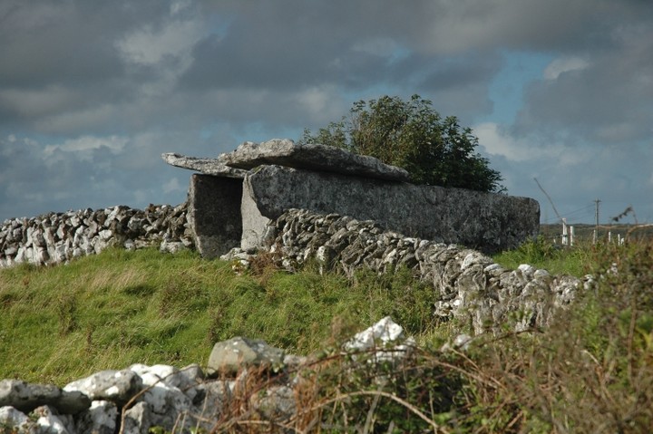
Trying to get all of this tomb into one shot if difficult


The upper chamber. The roof of this regularly withstands the weight of cattle, barely a metre above.
The best site on the Burren, bar none. I arrived there at 6.30pm on the 2nd last day of August, a miserable, misty, gloam-laden Clare evening. There wasn’t a sinner in sight, the last of the tourists back in their ranches long ago, so having the place to myself was a treat.
The 1km walk from the road is relatively easy going until the final push to surmount the plateau where the fort is situated. You’ve already descended into the ravine that protects the southern side of the fort only to have to ascend what is probably the easy approach, now and back when the fort was in use.
It’s handy to have a look at Hencken’s plans of the place before getting there. I think if I ever go back, which I’d like to do, soon, I’ll photocopy and laminate these as they really are detailed and expansive. Standing on the viewing platform, having traversed the decking that follows the outer wall from south to east, I could have done with a bit of a guide. But then my attention was pulled to the ravine, the yawning maw that made this place particularly defensible.
Hencken found 2 souterrains, both of which led down to exits in the wall of the cliff here. Without his plan to hand I couldn’t make out where these are.
The rain started to teem down so I gave the inner enclosure only a very cursory scout. The walls are still impressive and don’t seem to be overy restored. What with all the summer growth, it’s not so easy to make out the remains of the outer structures of this tri-vallate fort. By now I was soaked to the skin, one of those ‘from the outside in and the inside out’, so I beat a retreat to the car, defeated by Cahercommaun and its splendour.

The ravine that protects the fort’s northern side, viewed from the eastern walls.

What Hencken called a ‘niche’ in the western ramparts of the fort interior

Looking across the fort interior with the precipice to the left and the modern viewing platform to the right
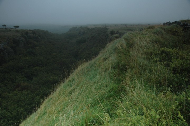
At the edge of the abyss. Easily the best site in the Burren.


Archaeological dig at Caherconnell. To the right is a kiln and flue from the late mediaeval, to the left, where they are currently working, is a possible neolithic habitation site.


This place is marked as ‘standing stones’ on the OS map.

From across the road. Quite the most peculiar site I’ve been to in a long time. Is it a barrow? A stone circle? A folly? There’s a house almost in the ditch beside the monument.


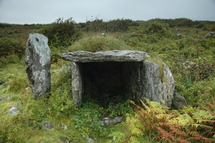
This is well worth the short diversion off the Galway road. I was in the vicinity looking for Toorclogher megalithic tomb (again, without any luck, again) and pulled over to have a look at the modern christian cross. Just behind this is the souterrain entrance. What a pleasant surprise! It’s quite well preserved, the opening in the mound leading into a corbelled chamber. From there a tunnel leads down. Where that leads to is anyone’s guess, I hadn’t got the bottle, or a torch, to check.
So, a souterrain in a mound, that’s at one end of a hill in a parish called Seefin. Hmmm.

Inside the upper chamber. The tunnel can clearly be seen to the left. Courage to go down there deserted me.


Cl. 3 with Cl. 4 about 40 metres away in the distance. Both tombs are very ruined.


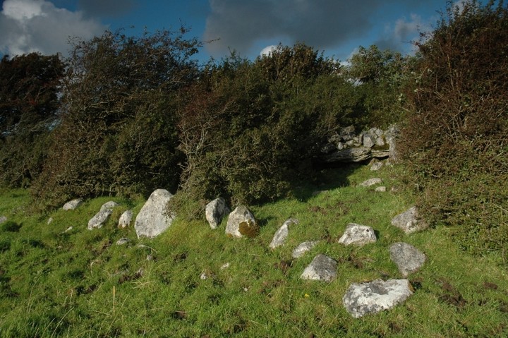
Collapsed tomb at rear with slight remains of cairn.


Lovely, if a little overworked, bullaun. One of the widest basins I’ve seen.

19/7/09
This one isn’t in the inventory. Its sister, beside the holy well, is.

Roadside bullaun (actually middle of the crossroads bullaun).


(Conspiracy theory alert!) There is a bullaun in there, and I reckon it’s an important one, but maybe not to the Clonmacnoise authorities, hence its quite wilfull neglect.
Arch. Inventory of Offaly says “A large rough stone with two hollows…” My theory is that it’s left like it is because it shows the pre-xtian provenance of such an important site. I made an attempt to clean it up but was beaten by the nettle roots. Ouch.


