The Modern Antiquarian. Stone Circles, Ancient Sites, Neolithic Monuments, Ancient Monuments, Prehistoric Sites, Megalithic MysteriesThe Modern Antiquarian

Get the TMA Images feed
minipixel's Latest Posts

Latest Posts
Showing 1-50 of 98 posts. Most recent first | Next 50

Cloghafadd (Court Tomb) — Fieldnotes

I visited this amazing site on a freakishly hot day in mid July. What a location! Probably the most impressive views from a tomb that I've seen.
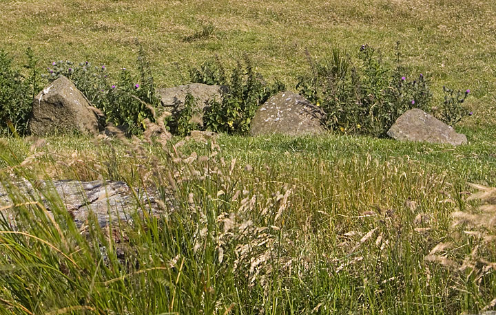
Unfortunately the tomb itself has seen better days, with only a few of the court stones still standing. The tomb is facing NE, and the court is about 6m wide, with the gallery stretching 9m to the SW. The cairn sits on top of a natural rise, and some of the kerb is still visible, dotted around the site. It seems to be about 11m wide, but its hard to be certain.

From around the site, I could see the Crannog at lough na crannagh, another little ruined wedge tomb, and with binoculars, several other tombs marked on the OS. a fun day indeed.

The site is marked on the OS map, and is about 2km NW of the top carpark at Murlough Bay, which is probably the easiest way to get to it, over pretty rough bog, past Lough Fadden and with no real paths, so be careful. Once at the site, the views are astonishing, and make up for the hike.

Cloghafadd (Court Tomb) — Images (click to view fullsize)

<b>Cloghafadd</b>Posted by minipixel<b>Cloghafadd</b>Posted by minipixel<b>Cloghafadd</b>Posted by minipixel<b>Cloghafadd</b>Posted by minipixel<b>Cloghafadd</b>Posted by minipixel<b>Cloghafadd</b>Posted by minipixel<b>Cloghafadd</b>Posted by minipixel

Clough Berragh (Standing Stone / Menhir) — Fieldnotes

A dumpy little 0.93m tall lump of basalt, perched on top of a little hill, overlooked by Knocklayd mountain. Not as impressive as the other standing stones in the area, but quite easy to find, and with great views to the west.

From the Round Tower at Armoy, head east, straight ahead at the crossroads, and take the second (concrete) lane on the left. (There's a little house at the bottom of the lane used to store wheely-bins) Just after a sharp turn in the lane, the road heads straight through a farmyard. The stone is directly behind the barn.

The stone is easy to pinpoint from the OS map, but I didn't spot it until speaking to the local farmer.

Clough Berragh (Standing Stone / Menhir) — Images

<b>Clough Berragh</b>Posted by minipixel<b>Clough Berragh</b>Posted by minipixel<b>Clough Berragh</b>Posted by minipixel

Coolanlough (Wedge Tomb) — Fieldnotes

A pretty poorly preserved Wedge tomb?? (I'm only guessing really), in a field just next to the road to Coolanlough Clachan, and Lough na Crannagh, with its Crannog. The cairn is aligned ENE-WSW, 7.5m long, narrowing on the WSW side to 2.5m, from 6m at ESE. Only one upright stone remains, about 1m tall, The rest of the site is a bit of a jumble of boulders, probably including field clearance stones.
According to the Northern Ireland Sites and Monuments Record, a porcellanite axe was discovered on top of the cairn in 1991.

Will return with camera and take some proper shots. This one was taken from the court tomb on the hill above.

Coolanlough (Wedge Tomb) — Images

<b>Coolanlough</b>Posted by minipixel

Ballylig (Standing Stone / Menhir) — Fieldnotes

Got a chance to search out another of the standing stones on the western slopes of Knocklayd mountain. A lump of basalt this time, almost 2m tall, and 1m thick, with a graceful angled cut towards the top. It stands about 1km north of the stone at Tober-bile.

According to the Northern Ireland Sites and Monuments Record;

The current owner stated that no finds had been made when ploughing close to the stone& that his father had found a similar stone many years ago buried in the adjoining field to NE. The upper shape of this stone suggest that it could be a remnant of a megalithic tomb, possibly a portal stone, but the owner had never heard of any other stones at this location.


Another easy one to access, just 200m or so from a farm lane, with great views all around.

Ballylig (Standing Stone / Menhir) — Images

<b>Ballylig</b>Posted by minipixel<b>Ballylig</b>Posted by minipixel<b>Ballylig</b>Posted by minipixel<b>Ballylig</b>Posted by minipixel

Tober-bile (Standing Stone / Menhir) — Images

<b>Tober-bile</b>Posted by minipixel<b>Tober-bile</b>Posted by minipixel<b>Tober-bile</b>Posted by minipixel<b>Tober-bile</b>Posted by minipixel

Tober-bile (Standing Stone / Menhir) — Fieldnotes

One of the many standing stones encircling Knocklayd mountain, with the possible passage tomb 'carn an truagh' (cairn of woe) on its summit. This cairn marks the intersection of the ten townlands surrounding Knocklayd.

The stone is quite easy to find, on a small B road which branches off the main A44 from Armoy to Ballycastle. Just beyond the little crossroads at the hamlet of Cape Castle, the stone can be seen on the slope of a field about 300m to the east of this road, behind a derelict house.

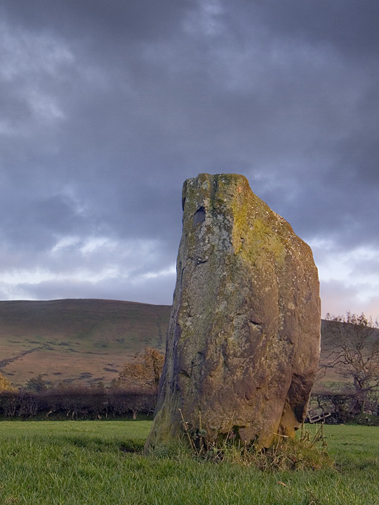
Impressively situated, and leaning slightly to the south, the stone, like many in the area is of schist/quartzite, and the top half is encrusted with lichen. It stands around 2.25m tall, just over 1m thick at the base, tapering to about 0.3m at the top. From the side it is around 0.4m thick, giving the stone a slightly slab-like apperarance from the WSW. In fact the stone seems to be aligned from WSW-ESE, in line with the cairn on the summit of Knocklayd, which looms over the site.

I visited the site on November 2nd, and was treated to a moonrise over the summit of Knocklayd, whilst the sun set opposite. Moments like these make all the trudging about worthwhile.

Wateresk Standing Stone (Standing Stone / Menhir) — Fieldnotes

Headed out to visit Wateresk portal tomb on a crisp October morning, but due to heavy ploughing activity going on in the surrounding field, I decided to pay this stone a visit instead. I'm glad that I did. Quite close to a couple of modern bungalows, just west of Slidderyford bridge on a slight bend in the lane, and incorporated into a scruffy hedge. There is another, fallen stone of megalithic proportions hidden from view amongst the undergrowth. According to the DoENI Environment and Heritage Service website, this could be the remains of a tomb.

Wateresk Standing Stone (Standing Stone / Menhir) — Images

<b>Wateresk Standing Stone</b>Posted by minipixel<b>Wateresk Standing Stone</b>Posted by minipixel

Corvally (Standing Stone / Menhir) — Links

Database of Irish Excavation Reports


Details of the re-erection of the stone in 1993. I take back what I said about the lack of finesse, the concrete was intended to be hidden. It just obviously didn't work out...

Corvally (Standing Stone / Menhir) — Images

<b>Corvally</b>Posted by minipixel<b>Corvally</b>Posted by minipixel

Corvally (Standing Stone / Menhir) — Fieldnotes

Situated in a sloping field in the Glenshesk valley at the foot of Knocklayd mountain, just under 2km from another stone in Breen forest. Unfortunately the stone was toppled by a bull, according to the resident farmer and has been very crudely reset in concrete, with no real finesse. According to the NI Environment & Heritage Service, it once stood on top of a small mound, 17m in diameterx0.3m high. The mound was excavated, and was found to predate the stone.

The stone is 1.9m tall, and approx 0.5m wide, appears to be basalt, and has a quite interesting shape from certain angles. I'm not sure if the stone broke when toppled, or if it has always been this way.

The site is marked in the OS map, about 3-400m up a gated farm track just off the B15 from Armoy to Ballycastle, which winds along the Glenshesk valley. I was lucky enough to catch the farmer at work, who was kind enough to point out the stone, which isn't visible from the road.

Breen (Standing Stone / Menhir) — Links

shee-eire.com


There is a photograph of the site on this page, which shows the field in a less overgrown state. The pile of stones around its base is much more clearly visible.

Breen (Standing Stone / Menhir) — Fieldnotes

A 1.7m tall vaguely pyramid-shaped schist stone, with four faces tapering towards the top, which has a natural split.
There is a small pile of loose stones around its base, which can be seen in one of the photographs. I'm unsure whether these are just from a field clearance, or have any significance.

The stone stands in a field, in a clearing of Breen Wood, just off the B15 in Glenshesk, about 5km west of the round tower in Armoy. The dense conifer plantation nearby somewhat blocks the view of Knocklayd mountain, which looms over this stone, and the many others in the area, which encircle it.

The site is easy to find, only 100m or so from a forestry track leading into the forest, and is marked on the OS map.
Worth taking a detour to visit, even on a dismal grey day like today.

Breen (Standing Stone / Menhir) — Images

<b>Breen</b>Posted by minipixel<b>Breen</b>Posted by minipixel<b>Breen</b>Posted by minipixel

Loughguile (Standing Stone / Menhir) — Fieldnotes

One of those chance driveby stone sightings. I spotted this nicely shaped stone silhouetted against the sky on a bank above the west side of Coolkeeran Road, which runs through the village of Loughguile.

The large basalt stone stands about 2m tall, tapering up to a point in a kind of wedge shape, and contains some small seams of quartz. As you can see by the photos, its not in the most spectacular setting ever, but a fine standing stone nonetheless.

According to details from DoENI Environment and Heritage Service, the stone was moved a short distance to the west when the road was widened, and now stands only about 0.5m from the field boundary, not ideal, but at least it was saved.
There is also a mention in their notes on the site of
1.8m S is a recumbent basalt slab c.1m long. Its relationship to the standing stone is unknown & no-one knew if it had ever been upright.

I didn't notice this stone on my visit.


Being right by the road, its a very easy site to get to, with only a gate to contend with. Loughguile is clearly signposted off the A44 (Drones Road), which branches off the A26, the main road between Ballymena and Ballymoney/Coleraine.

Loughguile (Standing Stone / Menhir) — Images

<b>Loughguile</b>Posted by minipixel<b>Loughguile</b>Posted by minipixel<b>Loughguile</b>Posted by minipixel<b>Loughguile</b>Posted by minipixel<b>Loughguile</b>Posted by minipixel

Ballyvennaght (Portal Tomb) — Images

<b>Ballyvennaght</b>Posted by minipixel<b>Ballyvennaght</b>Posted by minipixel<b>Ballyvennaght</b>Posted by minipixel

Ballyvennaght (Portal Tomb) — Fieldnotes

Visited the site carrying a camera with full batteries this time, which was a good start. After a short steep climb and a close escape from personal injury on a barbed wire fence, (farmers in North Antrim don't bother with stiles, they're more likely to be seen on a tractor the size of a small planet.) and a further short wander across pretty unspoilt bogland, I spotted the gleaming capstone of the still-standing tomb peeking above the peat and rushes.

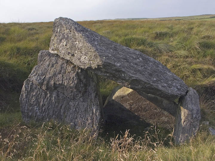
Two portal tombs lie just over 15m apart, oriented E-W. The larger tomb to the east has collapsed, and lies below the present ground level. The western tomb is pretty well preserved. All the stones contain large seams of quartz, and there are a jumble of assorted stones scattered between the tombs which i assume may be cairn material. The capsone of the collapsed tomb is truly massive, measuring 3.75x3.5m, and just over a metre thick. The intact tomb's is slightly smaller, about 2.5m square.

The site would be even more incredible if the peat surrounding the tombs was lowered a little more, although i guess i should just be grateful there isn't a fence and sign three feet from them.

I opted against climbing fences on my return to the forest drive carpark, walking down along the fence to the next gate. On the way down the sloping field by the river i noticed a distinctly man-made, but ancient stone structure. I uploaded a picture in case anyone with more knowledge could enlighten me as to what it could be.

p.s. i live nearby, and have never paid just to use the carpark, although the gates to it are rather zealously locked at 8pm during the summer. If you want to drive to the rather disappointing dual court tomb further along the 'forest drive' you will have to cough up.

Ballyvennaght (Portal Tomb) — Images

<b>Ballyvennaght</b>Posted by minipixel<b>Ballyvennaght</b>Posted by minipixel<b>Ballyvennaght</b>Posted by minipixel<b>Ballyvennaght</b>Posted by minipixel
Showing 1-50 of 98 posts. Most recent first | Next 50
retired monkey trainer, living on the north antrim coast.

My TMA Content: