viewed from the south.
Image credit: Philip Hay
viewed from the south.

View from the west. The stone looks very different from this angle.

view from the north showing the stone’s wedge-shaped profile.

viewed from SW, with the road below, and nearby houses.

view from NW, back into Loughguile village.
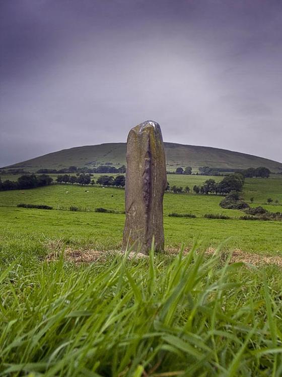
One of those chance driveby stone sightings. I spotted this nicely shaped stone silhouetted against the sky on a bank above the west side of Coolkeeran Road, which runs through the village of Loughguile.
The large basalt stone stands about 2m tall, tapering up to a point in a kind of wedge shape, and contains some small seams of quartz. As you can see by the photos, its not in the most spectacular setting ever, but a fine standing stone nonetheless.
According to details from DoENI Environment and Heritage Service, the stone was moved a short distance to the west when the road was widened, and now stands only about 0.5m from the field boundary, not ideal, but at least it was saved.
There is also a mention in their notes on the site of
1.8m S is a recumbent basalt slab c.1m long. Its relationship to the standing stone is unknown & no-one knew if it had ever been upright.
I didn’t notice this stone on my visit.
Being right by the road, its a very easy site to get to, with only a gate to contend with. Loughguile is clearly signposted off the A44 (Drones Road), which branches off the A26, the main road between Ballymena and Ballymoney/Coleraine.