

Looking south into the chamber interior from a position just outside the monument.

Looking north from the interior, perhaps to watch over what once existed below.

Part of the underside of the main chamber roof slab.

A joining section of wall and roof making a sandwich of daylight.

The balancing arrangement at the rear of the chamber.

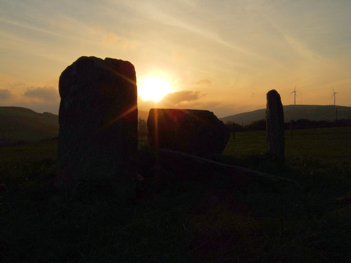
A very steep climb. 650 metres according to Carleton Jones’ gazzeteer (Temples of Stone: Exploring the Megalithic Tombs of Ireland, 2007), and straight up. The tomb is just the other side of the peak, at the end of the track.
Inside the chamber it’s diffcult not to engage with the salmon-pink flush of the stones, freckled with bits of quartz and this and that, pitted and alternatively smooth as you gaze along their features. Then the passageway pulls your attention out across the vast plain underneath. It points much too far north, at least on my compass, for a solar orientation but it’s tempting to imagine, having read Bawn’s bit of folklore below, some ancient crumble of bone staring out over his former domain.
A gorgeous place.

Looking south, in the direction of the Glashagleragh river valley.

The moon shall shine with a brightness like the sun’s, and the sun with seven times his wonted brightness, seven days’ light in one,..
Isaiah 30; 26.


Looking northwest towards the crest of the hill. The skyscraping line of Knockawaddra West is close above to the left, but invisible from this point.


The eastern stone, seamed with quartz and seemingly cut off at such a point.

A strong evening sun: 1 Feb 2008.

A significant reassessment by Helen Roche of the construction date for the Great Circle: ‘The dating of the Embanked Stone Circle at Grange, Co. Limerick’ in Roche, Grogan, Bradley, Coles and Raftery (eds.): ‘From Megaliths to Metal – Essays in honour of George Eogan’, 2004, 109-116.
The most recent pottery-type, found at a position which would have predated the monument – in this case beneath the bank on the old ground surface – was ‘Class II’ ware. This type, in the light of extensive comparitive studies with securely dated material over the years, is now judged to be a Late Bronze Age coarse ware. Therefore the circle, officially designated to have been constructed in the Neolithic, is actually a Late Bronze Age site, of a similiar age to the axial stone circles that I felt had a comparable skeletal stucture (see fieldnotes above).

The western side of the setting, showing the two quartz stones, one free and one buried in the hedge.

The eastern side of the arrangement showing the hedgefast quartz pillar rising over the prostrate sandstone.

Glanbrack is the pale shape in the corner of the field to the east.

Lettergorman South can be seen near the hilltop to the north.

The axial stone and its two remaining flankers.

Looking westnorthwest along the top of the axial stone, to show the cup shaped depression, similiar to that at (possibly) Carrigagrenane NE and Drombeg. Located here at the left hand side, from a position inside and facing the stone, it is regular and even in shape, measuring about two and a half inches in diameter and about a third of an inch deep.

Looking north – Lettergorman South can be seen with the eye, but is indicated here with a big helpful arrow.
Dating evidence, dependent on excavation and the retrieval of datable material, is scarce for the Cork-Kerry stone circle complex. Three ranges have however been produced and are as listed below:
Drombeg 1124BC-794BC
Reenascreena 1254BC-844BC
Cashelkeelty 1362BC-794BC
(O’Brien, ‘Aspects of Wedge Tomb Chronology’ in Shee Twohig and Ronayne (eds.), ‘Past Perceptions: The Prehistoric Archaeology of Southwest Ireland’, 1993, 70).
An assumed date of about 1000BC for the construction of Lettergorman South would probably be reasonable and Clive Ruggles has calculated the Winter Solstice sunset declination at this time to be -23.8 degrees (Astronomy in Prehistoric Britain and Ireland, 1999, 57).
Unlike the excavation record the archaeoastronomical survey history of the complex is comparatively extensive, if frustratingly incomplete. Somerville made some initial investigation in the early years of the last century, but the first large survey, of 30 circles, was undertaken by John Barber in the early 1970’s. He listed Lettergorman (Knockawadra) as -26.111 degrees, some 2.311 degrees, or over 4 diameters, off the solar event, and looked instead to the stars for an alignment (’The Orientation of the Recumbent-Stone Circles of the Southwest of Ireland’, JKHAS 6, 26). In fact the only Winter Solstice alignment he confirmed was the well-known one at Drombeg.
At the start of the next decade, however, a correction to his data was published by Patrick and Freeman (’Revised Surveys of Cork-Kerry Stone Circles’, Archaeoastronomy, no.5, JHA, xiv, 1983, 51) when their own survey revealed a systematic difference with that of Barber, a discrepancy which they proposed to have been caused by the metal in his theodolite and tripod. Their findings linked Lettergorman (Knockawadra) at -24.3 degrees to Drombeg (-22.68) in a duo demonstrating a midwinter sunset orientation.
This alignment is not widely known, even locally. A historian who lives a few miles away and has visited Knocks North for the Equinox and Drombeg for the Winter Solstice wasn’t aware of it when I mentioned it to him recently, but Jack Roberts does seem to have witnessed it (’Exploring West Cork’, 1988, 131).
Clive Ruggles was also attracted to this region’s monuments, but only surveyed the multiple stone circles, publishing data for 31 sites (’Astronomy in Prehistoric Britain and Ireland’, 1999, 217). A combination of the 2 sets of data means about 40% of the complex has now been accurately assessed, with three circles proposed to be in alignment with the Winter Solstice: Drombeg, Lettergorman South and Teergay (near Macroom).
In this respect Ruggles makes a slightly odd statement when he writes of Drombeg:
‘Although much-heralded, the solar alignment is not repeated at a single other example of this type of monument‘
(Ruggles, Prendergast and Ray (eds.), ‘Astronomy, Cosmology and Landscape’, 2001, 53)
Granted that he doesn’t include five-stone circles in his assessment, he still has Teergay measured at exactly -23.8 degrees in his table of data? I’m sure I’m probably missing something...
On its final dip the setting sun is about to be obscured by a northward rolling bank of cloud – 20 December 2007.

Meanwhile high in the east over the standing portal the moon waits for the show to be over – 20 December 2007.
One of Somerville’s five stone circles of West Cork (JCHAS 35, 1930; 79), Maulatanvally can suffer when placed in comparison with its more intact brethren. Lacking the more monumental construction and solar event alignments of Drombeg and Bohonagh, the beauty and seclusion of Reenascreena and the mystery of the lost world at Carrigagrenane SW, it could almost be the odd child of large local sites.
Situated on a platform, with the ground falling swiftly to the south and west, the circle is pushed fairly tightly against the eastern field boundary. The gap and deeply rutted track from the next field are right beside it and just on the rise to the north is a chicken factory. After the drop to the west the ground rises steeply again, over the Dunmanway-Rosscarbery road, to reach a hill summit that gives the townland its name. Beyond this lies the omnipresent Carrigfadda.
The rise of ground to the west pulls an axial azimuth of 256.5 back to a declination of -5.4 (Ruggles, Astronomy in Prehistoric Britain and Ireland, 1999; 217), offering no obvious solar or lunar event to a modern observer. What might be significant however is its direct line to the peak on the northern section of Carrigfadda, the imposing centre of the source forks of the Argideen river, a flow whose silver is mirrored in the quartz components of many of these monuments.
According to O’Nuallain (PRIA 84C, 1984; 21) there would have been originally 11 stones in the perimeter of a circle with a common local diameter of about 9.5 metres. Seven stones remain, with four in an arc at the western side and three in a group to the east. The entire northern side is missing, including what should have been the northern portal. Placed slightly off centre is the squarish, box-like quartz block, smaller than that at Lettergorman SW and Carrigagrenane NE but still dazzlingly white.
The western section contains the axial stone, long but low at just over knee height, its two flankers and the continuing stone to the north. The top of the axial is rather weathered and it has a curious seam running across the middle of its inner face. The eastern side still has the radially set southern portal, now leaning somewhat to the north, with a rather sharp looking stump and a round topped circle stone to the south. Despite the wrecked guttery look to the remains this circle hasn’t deteriorated since at least as far back as 1930 and possibly much further (see plan below).
A slightly unusual aspect to the ring is the position of the axial stone with regard to the remaining stones. It would seem to be positioned to be perpindicular to a line running between the stump to the south of the portal and that stone, rather than facing a line to the north of it, between it and the presumed northern portal. This stump can’t be a portal here because it is set with its long axis along the perimeter and it is well off the centre line of the circle as deduced from the remaining stones.
The whole eastern section seems to be flattened and pushed slightly too far north to make a true circle. If a secondary alignment was intended it would be closer to an equinox event than the mid-portals-axial line, but this has never been surveyed.
This site is located in the second field to the east of the road from Dunmanway to Rosscarbery, just down from the rim of the hill after Kippagh bridge. There is a little lay-by as the second indentation in the ditch after the chicken factory. Look over the brambles here.
Just before the summer I went to a talk given by Professor O’Brien on the prehistory of the Dunmanway area. While the first half of his presentation was a steady trot around the expected topic, he spent the rest of the time speaking about his excavation at Clashanimud, a townland that he ventured to translate as ‘the trench of the timber’. It’s possible that some folk memory remained into historic times of this massive wooden construction.
I’ve included the newpaper report from August in the miscellaneous section below, as a reasonable summary of his findings. On visiting the site myself in early June I found access to be easy, with a parking spot just up the hill from the entrance at the eastern side.

The remainder of the eastern side of the circle with the radially set portal to the left, the rather jagged stump in the centre and the shovel shaped circle slab to the right.

Taken from the bottom of the ditch, looking up at the reconstructed inner defence wall.

Reconstruction of the entrance timbers and the passage to the interior of the fort.

The ditch, with a plausible reconstruction of the oak posts of the inner wall above to the right.

Looking back towards the entrance with the timber palisade reconstruction to the right. The very slight curve, even at quite a distance, gives an indication of the scale of the perimeter.
Taken from the Irish Examiner dated August 21 2007. A front page article by, appropriately, Sean O’Riordan.
“Archaeologists uncover county’s ‘first capital‘
Archaeologists believe that they have discovered what may have been Cork’s ancient capital, built 3200 years ago at a time when Rameses III was pharaoh of Egypt.
A team of archaeologists from UCC, led by Professor William O’Brien, have carried out extensive research that sheds new light on what is the largest prehistoric monument in Co. Cork and the oldest dated ringfort in the country.
Their three-year project, funded by the Irish Research Council for Humanities and Social Sciences and the Royal Irish Academy, shows that huge wooden defence walls once surrounded the ringfort at Knockavilla, near Innishannon.
Radiocarbon dating shows that the ringfort was constructed about 1200 BC, confirming it as the oldest known prehistoric ringfort in Ireland and, according to Professor O’Brien, this puts its importance on a par with prehistoric sites such as Dún Aengus on Inishmore and Mooghaun, Co. Clare.
Archaeologists have concluded that several thousand timber posts surrounded the ancient structure, known as the “cathair”, which enclosed nearly 20 acres – enough space for today’s developers to construct about 300 houses.
It would have taken hundreds, if not thousands, of people to construct it and may have been built in a matter of months.
“The antiquity and immense size of this monument suggests that it was one of the most important prehistoric settlements in the south-west region, and arguably Cork’s first capital,” said Professor O’Brien.
The outer defence walls had a perimeter of more than one kilometre and were built with wattle fencing. These were erected behind a dug-out ditch defence.
The inner timber defence, built entirely of solid oak, was 800m at its perimeter. Archaeologists discovered evidence that part of the inner palisade fence had been burnt, which Professor O’Brien and his team believe “was a deliberate act of war”.
The people who built the ringfort may have been slaughtered. At any rate their kingdom seems to have disintegrated as no efforts were made to repair the fort and it was never inhabited again.”
According to Somerville (1930) ‘Meall an tsean baile’ translates as the ‘Hillock of the old place’. The former he presumed to refer to the high ground to the west of the circle and the latter to the monument itself.
While this would give a satisfying romantic colouring, it is of course possible that baile could indicate a long past (but not prehistoric) village or small settlement in the area of the hill.

Looking southwest through the open side of the circle. The right portal would presumably have been located at the clump of grass just below and to the right of the survivor at the far left.

The axial stone as seen from outside the circle and above, while facing roughly north.

The western side of the quartz block with the left portal to the rear.

Looking southwest at the intact arc that includes the axial stone.

Looking over the flat upper face of the quartz block to the sandwich-like inner side of the axial stone.

The inside faces of the axial stone and its two flankers.

The right flanker is the ivy covered shape to the left and the right portal just peeps through at the right.


The left flanker with the left portal in the background.

Moving anticlockwise; the axial stone, left flanker and left portal.
The remains of this probable five stone circle (O’Nuallain PRIA 84C, 1984; 44) are situated at the eastern end of a marshy field which slopes down gently north to a noisy and intensely overgrown stream. The ground rises towards Carrigfadda to the southwest but a view to the horizon in this direction is obscured by a line of trees near the southern field boundary.
Two hip-height stones; the axial and its northern flanker are all that is left to immediate sight. O’Nuallain noticed a quartz boulder 1.7m and a stone 90cm at their maximum placed against the fence a few yards to the east. I could only find the quartz stone, and then only by its brilliance speckling through the earth and growth now covering it. I dusted it off somewhat for the photograph and then covered it up again.
The axial stone leans outwards considerably to the west but looks as if it originally presented a level, flat top, pitted in the centre. The flanker leans inwards to the south giving it a rather bulbous look, tapering to the bottom. Its shading and shape are very striking to the eye.
O’Nuallain grants the possibility that the two stones at the fence originally formed part of the monument and it certainly would not be unusual for the coincidence of a sizeable quartz block with a stone circle in this area. Its dimensions are apparently in excess of the wonderful conglomerate in Lettergorman and I would have loved to have seen more than the foot-size patch I scratched open.
The site can be approached with courage or recklessness through the marsh, brambles, water traps, sheer drops and wire fences from the road to the east but may be better attempted from the Carrigfadda side.

Looking south from the riverbank to the remains of the circle.

The horizon line behind the axial is obscured by trees but may include Carrigfadda peak?
