
The full monument grouping, looking southeast. The two quartz blocks are in the field fance just behind and between the boulder burials.
Image credit: Gordon Kingston
The full monument grouping, looking southeast. The two quartz blocks are in the field fance just behind and between the boulder burials.

Looking roughly west. The huge standing stone, pressed tight against the eastern boulder burial, is aligned NE-SW. The western boulder is visible behind. Oh, that’s my distinctly non-archaeo builder’s level.

The western, larger, boulder burial.

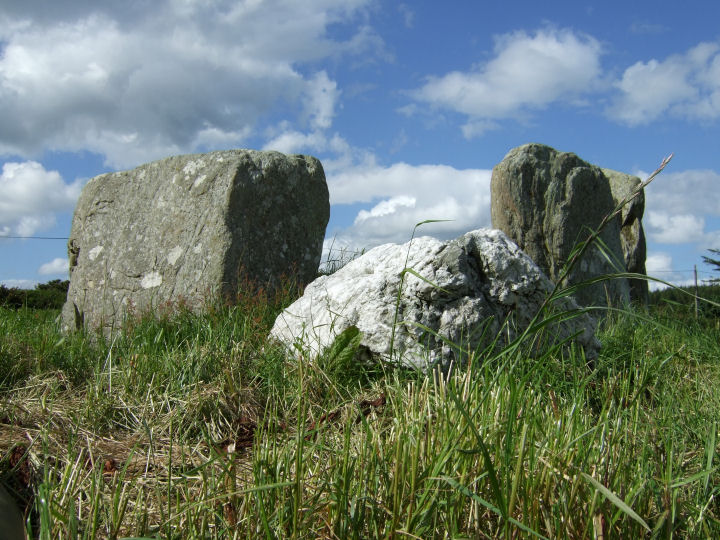
The two quartz boulders, about four feet apart, are integrated in the field fence.


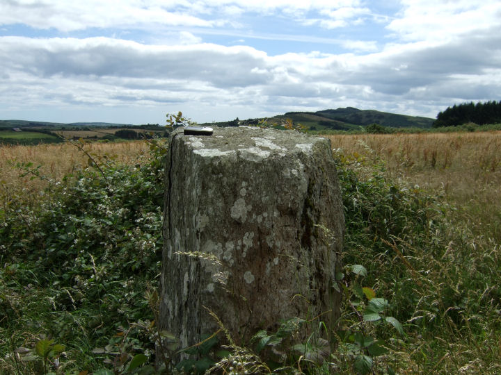
I’m starting to see these things in my dreams. Damn. The top of the stone.

The Carrigfadda mountain group, on the horizon, forms an eerie match to the top of the great monolith.
Nothing relevant to megalithia, but I was up past here today and my son shouted; “Look at the rabbits Daddy!” A pale brown patch in the hedge behind the stones had risen and separated into three wild deer. The rare warm day and the calm must have invited them out of the forest. Fauna, don’t ya love it?
Permission to visit both Knockawaddra rows should be obtained at the farmhouse at the beginning of the access-track, on the by-road to the east. Very nice people and interested in the monuments on their land.
Using the largest stone as a backrest, the view of the line back to Maulatanvally.
Well worth a visit, despite its rather gap-tooth appearance and easily accessible at the end of a farm track just north of the Argideen. Permission to nip in can be obtained from the farmhouse on the rise south of the river, on the first left hand turn. They will probably stress the importance of not leaving fences disconnected so obviously there have been some disasters in the past. Preaching to the converted, I know.

The possible full line of the monument, looking north. The recorded pair are on the left hand side of the picture and the substantial, yet ignored, block is to the right.

Looking south to the Stone Pair mentioned in O’Nualláin and the Archaeological Inventory.


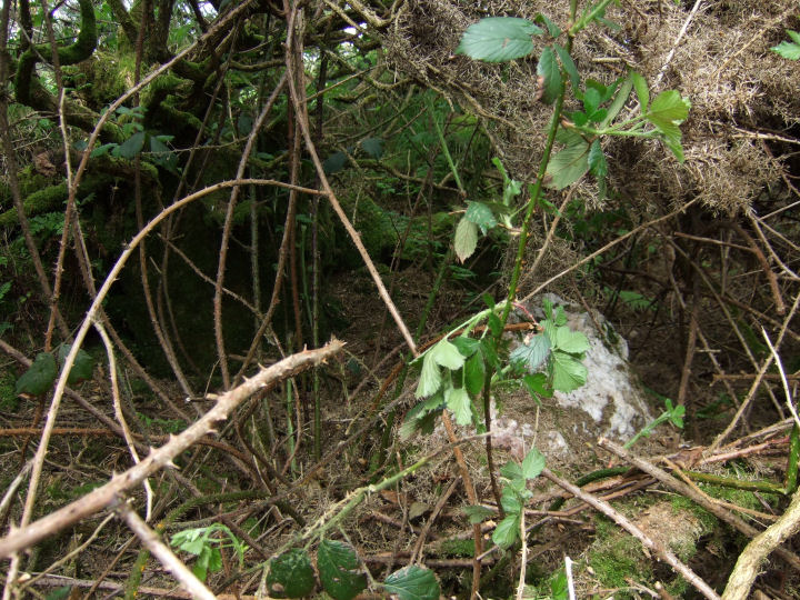
Blocks possibly fallen south from the structure?

Looking northeast along the line of the row.

Looking southwest along the line of the row.
Here lie the bones of a monster. The entry in the Archaeological Inventory, following O’Nualláin, describes a stone pair – two slabs of mismatched height, the taller over two metres – but doesn’t mention the brooding block swaddled in whitethorn, 20 metres to the east.(1,2) Or the others fallen south from the body of the fence. While these latter may be coincidental the eastern megalith, tall, thick and imposing, sits the line of the recorded pair in position and wide-face orientation.
Only Aubrey Burl, with a politely suggestive question mark after the ‘2 st st’ in his gazetteer, gives a published hint of the giant that must have stretched here.(3)
‘Sleep.
Do not fear the roaming.
eye.
Sleep.‘
Federico Garcia Lorca, from ‘Berceuse for a Sleeping Mirror’.
Permission to visit may be obtained from the farmhouse immediately south, on the left hand side of the road.
(1) Archaeological Inventory of Cork, Volume 1, West Cork, 1992, no.196; 42
(2) O’Nualláin, PRIA 88 C, 1988, no.133; 247
(3) Burl, ‘From Carnac to Callanish: The Prehistoric Stone Rows and Avenues of Britain, Ireland and Brittany’, 1993; 261.

One of the two sizeable quartz blocks that part-support the boulder burial.

The quartz circle stone, despite its fit with late Bronze Age ritual colour schemes, is placed on an empty socket position and is not an original feature. Two out of the three support blocks under the large boulder burial are quartz however, as was a large support stone at the base of the pillar to the north of the portals.
For those who like to let their imaginations run, here’s a roughly contemporary account of a similiar construction from Exodus 24, 4-8:
Moses wrote down all the words of the Lord. He rose early in the morning and built an altar at the foot of the mountain, and put up twelve sacred pillars, one for each of the twelve tribes of Israel. He then sent the young men of Israel and they sacrificed bulls to the Lord as whole-offerings and shared-offerings. Moses took half the blood and put it in basins and the other half he flung against the altar. Then he took the book of the covenant and read it aloud for all the people to hear. They said, ‘We will obey, and do all that the Lord has said.’ Moses then took the blood and flung it over the people, saying, ‘This is the blood of the covenant which the Lord has made with you on the terms of this book.‘

The axial stone provides an interesting comparison point to some of the other local circles. While the level table top is almost ubiquitous the backward tilt brings Templebryan to mind, though it lacks the smooth finish of that site, Drombeg or Glanbrack. Its height off the ground also calls Templebryan to mind, or Lettergorman if it lost its field clearance. A further similarity to the latter is the angled tail-off at the upper northern side.
There’s something just satisfying about the yellow of freshly cut fields – as redolent of the May/June cusp as hedges full of hawthorn blossom or the crisp heat, not yet turned heavy and dead on the senses.
A great time of the year for Bohonagh. The nettles and long grass around it only seem to enhance its wildness and great age, its dominance of what would be an overwhelming growth for a smaller site.
It’s an interesting test. Swap places in your mind with Drombeg. Would it be improved here, in these surroundings? Perhaps. Perhaps not. Bohonagh would certainly lose something by being tidied up.
The 30 odd heifers crying aggressively outside the fence give a reminder of the origin of the townland’s name.
The GPS reading above is for the obvious standing stone, though the first sight over the gate is the horned boulder. Sketched by Webster almost eighty years ago and described as a “demi-dolmen”, he proposed that it and the recumbent pillar immediately to the east were the remains of some type of monument.(1) Jack Roberts wrote that it could be “loosely classed as a cromlech”.(2).
My suspicion is that it may have been an upright block that has sagged and split. The main cut smoothly separates the centre, forming a sort of dry megalithic sandwich, while the upper portion is bisected into two further pieces, both resting on the lower.
The horn effect is quite striking. Bronze trumpets sounding a bull call while flames and figures dance. Maybe not, but who knows?
The “anomalous stone group” described by the Inventory is about 50m north and comprises a standing stone and a prostrate slab.(3) The compilers seem to have missed the stone described by Roberts, that now forms part of the hedge and which prompts the tantalising possibility of a three, or even four, stone arrangement. Webster’s sketch shows the field before the wall was erected; then containing the two standing stones, the grounded slab and a fine stretch of empty grass as far as the house at Quaker’s crossroads. From a position in the centre of the triangle, and looking southish – parallel to a line between the two uprights, your gaze travels straight across to the large boulder. Contact.
(1) Webster, ‘Rude Stone Monuments in West Cork’, JCHAS 35, 1930; 35.
(2) Roberts, ‘Exploring West Cork’, 1988, Ch(1) 39; 44
(3) Archaeological Inventory of County Cork, Voume 1, West Cork, 1992, 926; 113.
Something worth pointing out about Lettergorman, with regard to the quartz boulder. It has previously been noted, a belief held by the former owner, that the stone was probably moved in from the field, from a position either along the axis or in line with Carrigfadda.
However the stone has been in the same position since Windele’s survey in the mid 1800’s and when viewed from centre-circle crudely indicates the four stone grouping on the slope of Maulatanvally. An arrangement three-quarters composed of quartz.

You could really let your imagination run with that... The split (?) boulder from above, more or less, and from the south.

The horn-like protrusions on the western side of the boulder.


Looking west to the hills. Scoot over here and you’re into the Carrigfadda-dominated valley.

All three stones, including the fallen (?) slab, looking east.

The second erect stone is visible in the field fence, centre-image.

Standing in the centre of the stone arrangement looking south to the boulder, on a line parallel to the two erect stones.
There’s a metaphor there somewhere. Oh and that’s the field wall – I didn’t go in that way, needless to say.

The beautiful pink tint to the quartz made the torn flesh worthwhile. Seriously.
So, this is it for Garryglass – deserted, destroyed and now grown over. Like a frontier fort reduced to a limp point of rubble it left the last century with just one stone, presumably the central monolith – having entered it with eleven others. Meanwhile the ‘rough pasture’ mentioned in O’Nuallain’s 1984 survey has become a dense plantation of trees and the clearing left around the stone has filled with a head-high and almost impenetrable thickness of furze and bramble. When finally I fought my way through I was almost tempted to kiss it so it could wake up and make me its prince.
Don’t visit unless:
(1) You really like quartz
(2) You have a GPS and follow these coordinates. Even then there’s a probable reading difference and...
(3) You don’t mind a bit of discomfort and the probability of ripped clothing.
Something about nothing maybe... On the top of the knoll in the field to the west there’s a prostrate ‘orthostat-sized’ slab with one level end. A doorway for the little men or one of the missing stones...?
Pointing a touch further north than Bohonagh, in terms of declination, with a measurement of 1.22 degrees*, Knocks North provides a cruder alignment to the equinoxes, further hindered by the tree growth on the horizon. On the other hand the local historian that has witnessed it mentioned the sparkling of the falling sun on the big splash of quartz on the axial stone. Worth a visit, I think.
Permission can be obtained from the farm to the south, on the left hand side of the road.
* Patrick and Freeman, ‘Revised Surveys of Cork-Kerry Stone Circles’, Archaeoastronomy, no.5 (JHA, xiv (1983)); S51: Knocks/A.

The top of the axial stone, taken from inside the circle.

This picture, taken in 2006 so there’s a few shrubbery changes, shows the wide radial portal – a companion to Knocks North.


A closer view of the portals, seen side-on and from the north. Two close twins to the remaining portal at Knocks South – their enhanced width transforms the entranceway into a passage, similar in effect to the double-portalling at Carrigagrenane SW.

The low axial stone, viewed from outside the circle, with a heavily spilt stain of quartz on its table top.

The flat top of the axial stone viewed from inside the circle at it’s right hand side.

The tip of a quartz boulder lying just slightly south of the axis. There’s so many field stones and craters inside here that it’s difficult to assume any relationship to the circle.

A chunky belt of quartz spans the midsection of the northern flanker.

Sorry kids, but you’re not fitting much of a sacrifice on this.
Just a quick few words to inform anyone who may have visited this site previously that the land owner has removed the hedge that was about fifteen metres west of the complex. It’s a bit of a cold rinse to the senses if you’re used to seeing it the way it was, but it does open the view out. Less distraction in the eyeline I suppose.
The ground is intact, dry and solid for a distance of about ten metres from the monument but between this and the gates to the west and east it looks to have been turned over and reseeded, with grass growing in isolated clumps. This ground, even in the dry conditions at the moment, was excessively waterlogged. No change there then.

The view from inside the second gate to the new ‘open-plan’ site.

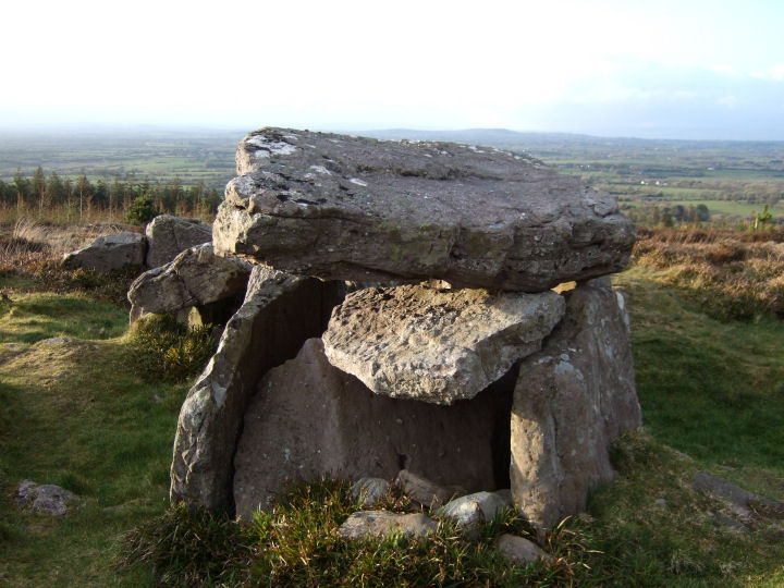
Looking north from behind the body of the tomb.