According to Mountainviews Knockshanahullion means ‘hill of the old holly’ or ‘hill of the old steep slope’.
Thankfully its an easy climb compared to Temple Hill. Knockshanahullion is readily reached the road at R 983 089. Incidentally, this road at 450m is easily the highest of the passes across the Knockmealdowns. Follow the Avondhu Way until you come to Knockclugga.
The cairn itself has really been tampered with a number of shelters in it now. Its bigger than the cairn on Temple Hill. It cant be seen from directly below but only from a few miles either side. To the south you can see out to sea.
The cairn is maybe 4m high with a diameter of 20-30m. I think with the amount of digging into the cairns middle it is unlikely that it could still contain a passage.

bawn79


Looking west you can a good bit of interference up here
Image credit: Bawn79

Mountainviews.ie records the name Temple Hill as meaning ‘hill of the church’.
Ive passed by this mountain so many times and wondered about the size of the cairn.
It is big but not as huge as I hoped. The cairn itself has been dug out in the middle to form a shelter. Normally you would be pretty pissed off with that but believe me you really need as much shelter as you can get up here. I climbed up on a nice warm calm day down at ground level but by the time I got to 785m some serious winds had whipped up. Going up here on any kind of windy day would be very dangerous so if anyone is thinking of heading up be careful.
Could the cairn conceal a passage tomb? I dont know really, there is a slight depression on the eastern side of the tomb nothing major really. The middle of the tomb is pretty robbed out but I would still think there would be sufficient depth below it to conceal a passage.
The cairn itself must be 3-5m high, diameter 20m?. Not sure really it was hard to tell with the wind, the western side seems to be very close to what looked like a drop so I didnt venture to close.
To get up there will take about 3-4hr round trip depending where you take off from and really there is no easy way up.
I drove up to a farmyard at R857203 and followed the Pigeonbrook River for about 0.5km and then decided to climb up via a dried out stream bed climbing about 300m in height. Then I just plodded along up the 2km at a fairly ok pace. Coming back down I followed the Pigeonrock river but beware because it is a V shaped valley and pretty hazardous.

Slight depression in the cairn, it would be aligned east-north-east
Image credit: Bawn79 © 2008


I believe the fort on this is marked as a ceremonial enclosure. What I find most interesting about this site is that it is the one major hill between Ballyhouras/Knockfeerina and the high lands around Lough Gur.
Knocktwo is about 105m high and really dominates the surrounding landscape.
The best way in seems to be to the rear of a stud farm so I havent been to the top yet.
There arent that many lakes in Limerick so it is interesting to see this site located near to one.


Its not every day you find an unmarked standing stone of this size and height.
This is about 3m high and probably the tallest stone in Limerick so you never know what is out there until you go looking for it.
Amazingly this site is just beside a back-road not far from Bruff and it also has the fairy hill of Knocfeerina in the background.
The stone itself has some unusual looking cup shapes on one side.
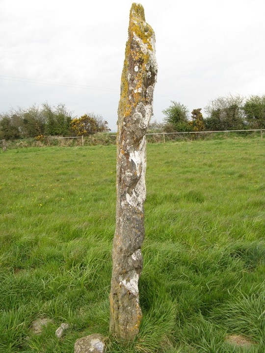
The cup features along its narrow edge
Image credit: Bawn79 © 2008


This is listed as a possible henge in www.archaeology.ie.
However after both looking at google earth and visiting the site there really doesnt seem to be any sign of this on the ground or from the air so I will be interested to see what the Limerick inventory says about it when it comes out.
The ruins on Bulgadenhall seem to be of medieval date however there is a long cursus feature to the east of the possible henge that is interesting.
This standing stone is about a mile south of Bruff. The stone is one of those thin ones that seem to be around this part of limerick and is about 1.2m high.
In the picture you can see Knockfeerina in the background.

Standing stone, angry bull & knockfeerina
Image credit: Bawn79 © 2008
This seems to be marked as a ring-fort for some reason but this has a water channel around it which to me would suggest barrow rather than ring-fort.
Also the size of it and its proximity to Ballinascaula make this a possibility of being another one of this part of Limericks jumbo size barrows.
It must be about 5m high and Im not sure of the diameter but its big.

This standing stone is about 2 fields in from the road and trickier to get to than the map suggests.
It is pretty non-descript maybe about 0.5m high just alongside a farm track.

I met the farmer who lives near here on the way back from this mound. He told me it was a motte, however judging by the size of it I’m not so sure. What he did tell me that was interesting is that there is a natural rock swimming pool near to this mound and this got me thinking of ceremonies and all that kind of stuff.
Another thing interesting by this bit of a mound is the echo effect that the river valley across from it produces.
The mound itself is covered in scrub and really could be anything!

This is an interesting looking standing stone about 1m high. Its very gnarled and phallic looking. It is adjacent to a lovely stream down a track that is used by the Kilfinnance Outdoor Pursuits centre so the farmer doesnt seem to mind people being in on his land.


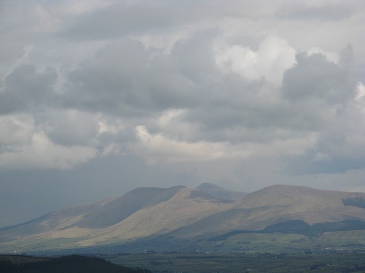
Knocknaterriff and Knocknateriffbeg or Hill of the Bull.
Image credit: Bawn79 © 2008
This is marked as two cairns on the OS map and the hill itself is over 500m. There is a good track up to the cairns and I believe it is part of a Kilfinnane Outdoor Pursuits area.
The cairn itself isnt that impressive about 1.5m high and could be mistaken from a climbers cairn very easily.
No sign of a second cairn however there was something that may have been the remains of a cist near the cairn.
Great views of the Galtees and two peaks that if im correct are actually called Cnoc an Tairbh and Cnoc an Tairbh beg. Hill of the Bull!


No sign of this standing stone.
This stone is tricky to find, I walked right by it because its so close to the tree beside it. It is to the rear of the village of Herbertstown and you have to cross a small river to get to it.
The stone itself is about 0.4m high and seems to be highly polished in the top right hand corner or maybe there is a clunk of metal in it. Im not sure really.

The stone looks to me like there may be a clunk of iron in the top right name of it. Didnt have a magnet to check.
Image credit: Bawn79 © 2008

Not marked on the OS map this standing stone is near the bridge in Rossadrehid. The stone itself is about 0.5m high.

Unmarked standing stone about 0.5m high
Image credit: Bawn79 © 2008

Kilmogue is a fabulous portal tomb and should be on anyones list if they are in the South-East.
Access is easy although you will need a map to find the place because unless your very close there are no sign-posts. It really is surprising how big it is, much bigger than it looks in the pictures.
Also you really have to ask yourself why and how they got that capstone up there.


The capstone is massive, I was comparing it to Brownes Hill in my head, that was until I saw the size of Kilmogue!
Image credit: Bawn79 © 2008

Looks like the weed-killer has really kicked in and the tomb is looking much better.
Image credit: Bawn79 © 2008


I was a bit disappointed by the site, it seems to only have one discernible ring around it. The hill itself is 242m high and has great views all around it. To the north you can see the shannon estuary. It is very near the village of Ardagh of the Ardagh chalice fame.
To climb it I just parked at the edge of the road and walked up thru the fields.
On looking at it I wouldnt think this hill-fort had any ceremonial function and I would think it was only for defence / keeping in the cattle.
