


The Dolmens of Tipperay by Henry S.Crawford
found from page 38 onwards of The Royal Historical and Archaeological Association of Ireland
VOl XL 1910
Also information and a picture of the bullaun stone at Gortavoher in the Glen of Aherlow showing the 2nd Bullaun stone that is beside the river not just the one beside the road – page 60
Includes pictures, plans and descriptions from this time.
The western Pap is harder to get to and looks to me to have been less tampered with.
From the eastern Pap you have to head into the bosom of the paps and back up again. The bottom of the bosom is pretty wet and this is after a really dry spell in Ireland so I think if the weather was wet at all this part could be very soggy.
Its about 0.8 of a km from the eastern to the western Pap and its a tough up and down.
The eastern Pap is smaller than the western one however the nipple is bigger.
Once you are on the eastern pap getting back to the car can be tricky so make sure and save some energy for the return trip.
The eastern pap is the bigger of the two and the one I feel that is the most visited.
To reach it drive up the long track that is marked on the OS map that leads up to the lake on the eastern side.
The track gets rough after the lake but keep going until you come to a gate and some forestry. This is the best place to set off climbing from and there are some tracks up the hill.
Saying that its a tough climb with a very steep slope.
The cairn itself is unusual in that it is built kinda in the style of a cathair with the stones laid horizontally on top of each other rather than just heaped randomly.
The nipple I would has been modified and built up recently but perhaps it is keeping to tradition.
The info board gives the size of the cairn as being 4m and a diameter of 20m so I will go with that.
There are panoramic views from up here to countless other hills. The info board also notes that it is thought that both these cairns are megalithic tombs and that they are aligned to the setting sun.
Taken from info board at The City of Shrone
‘On our right, we were much struck with the singular appearance of the two hills, called The Paps. They are smoothly formed to the fairest proportion, imitating the outline of a woman’s bosom‘
Diary of Traveller on Butter Road in 1797 from visit to Killarney Lakes
The Paps are named after Anu, prinicipal Goddess of pre-Christian Ireland and mother Goddess of the Tuatha De Danann, a legendary group of divine invaders who ruled Ireland until their final defeat at the hands of the Milesians. The Goddess Anu brought prosperity to Munster. Anu or Danu who appear to be one in the same divinity, was originally a European Goddess, her name being commerorated most famously in the River Danube. Anu is also identified with the Mor Riogach, a war fury or Goddess whose name means great queen, together with Badbh and Macha, she was one of the triad of War Goddesses known as the Morrigna, manifesting themselves as ravens. Immediately to the North East of the higher Pap is an area called Gleannfreagham “The Glen of the Crows” and a small lake of the same name. Such names in proximity with the mountains called after Anu shows how mythology lives on in place names. Ravens still inhabit this Glen and in suitable weather conditions can be seen gliding on the thermals above the cairns on the summits of the Paps.
The Paps’ cairns appear to be part of a deliberately placed series which overlook the plains of the southwest. The cairn on the eastern peak is a substantial monument, measuring a height of 4 metres and a diameter of 18m-20metres. The entrances of both cairns are aligned westwards, towards the setting sun. It is thought that the cairns contain Neolithic burial chambers. They are the subject of ongoing study and excavations to confirm such theories.

The paps from the well at The City of Shrone


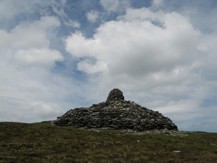
The City of Shrone is a very interesting site as the information boards attest due to its continous use since the Neolithic and its relationship with the Paps of Anu.
To get there best to head to Rathmore and there is a road to the west of the town that leads almost directly to the site.
It is interesting that the road itself form a circle leading to the cathair. Maybe this was once part of a pattern.
There is an information sign at the school just before the entrance to the road into The City and a second information sign just at The City.
The second sign kinda points you south to the Paps while The City itself is to the north of the sign in behind some old farm sheds. Not exactly the setting I expected for a “City”.
The OS map points to an ogham stone around the cathair but I couldnt find it.
The holy well just to the west of the cathair, although modernised’ is lovely as it contiunous bubbles up and the water tasted great.
The cross inscribed slabs are interesting because they look as if they have been ‘renewed’ or rescratched recently.
I met a few people around the site and they all seemed very friendly to people coming to The City.
Taken from the 2 information boards in the vicinity of the site.
Known locally as The City, an amusing name for such a rural site. However “City” is a modern translation of ‘Cathair’ the Irish word that meant “Stone Fort of Castle” eg Cathair na Steige – Staighe Fort in south west Kerry – as there were no “cities” in Ireland at that time. Ongoing site excavations are attempting to establish the relationship between this ancient site and the cairn-crowned Paps Mountains. They are also investigation, the possibility that The City may have evolved from a sacred Neolithic monument.
The site is known locally as Cathair Craobh Dearg, meaning Fort of the Red Claw, which is thought to refer to one of the triad of war goddesses, who manifested herself as a raven in battle. Despite its pagan origins the name was bestowed upon one of the area’s three sister saints (St. Craobh Dearg, St. Laitiaran, St. Gobnait), revered from Early Christain times. The site’s holy well which was previously used in pagan spirituality is now a source of Christian Holy Water.
One of the western worlds oldest centres of continued worship and celebration, The City is symbolic of Ireland’s transition from paganism to Christianity. May Day scenes at The City have included pagan rituals, trading, the herding of my kin and other traditional breeds of cow (such as the Driomnionn) for healing at the site and prayer recitals whilst doing ‘the rounds’ which remain an annual occurrence here.
This cashel, caher or stone fort is known locally as ‘The City’. In pre-Christain ritual, this site was associated with The Paps which represent Anu, the Mother Goddess. The cairns on the summits of The Paps are likely to date to either the Neolithic or Bronze Age (Connolly & Coyne 2002). The term ‘Crobh Dearg’ (“red claw”) suggests a triad of war goddesses who manifested themselves as ravens or crows.
In Celtic spirituality, The City was a Penitential Station. John O’Donovan (1841) reported that the peasantry performed stations (or rounds) there and drove their cattle to drink from the holy well in the west side of the site. In his book, “In the Shadow of the Paps” (2001), Dan Cronin gives details of the traditional manner of “paying the rounds”.
For much of the 20th century Christian piety and festive frolics attracted crowds on May Day. Traders came from as far away as Cork City.
In recent decades people came during May to pray the Rosary as they walk clockwise inside and outside the cashel wall.

The well itself, if you look closely you can see the water bubbling up to the surface.


Looking south thru entrance in the wall


You get an idea of the thickness of the walls of the cathair from this

These stones are described as megaliths on the plan on the notice board

Cross inscibed earth bound stones again within the cathair

Cross Inscribed stones within the cathair

Notice board at the road before you enter the city, it is interesting that the road into the city forms a circle or a pattern also.


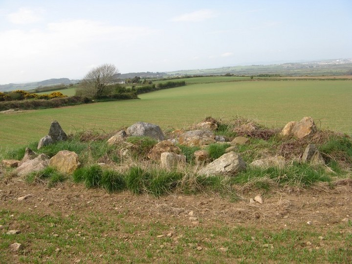


1.2m high standing stone near a lime kiln and an the outline of a rectangular shaped building so you would wonder about its date.

Not a lot to see here, looks to me as if the cairn that was up here was robbed to build a wall.
The Carraigapuckaun of the area name seems to be a big rock where a group from Kilfinnane outdoor adventure were learning how to absail.

This is also in the vicinity and much easier to see from the road. It looks like a worked stone of some sort or the other. There is some metal drilled into the top of it and the top is pyramid shaped. I happen to meet the farmer that owns the field and he told me that there was a mound around it and that as far as he knew it was very old. He also did a lot of contract work in the fields around Dromline and can never recall seeing a standing stone there that looked like the picture I have of it. However he did recall there being a standing stone in Dromline in Kavanaghs farm.
I was on the trail of Roth Ramach a standing stone that was meant to have been part of the druid Mogh Ruiths Flying Wheel in the townland of Dromline which is very near here. No sign of Roth Ramach but I did find this unmarked standing stone about 0.5m high with some quartz in the head of it. I met the farmer nearby and he did a lot of contract work in the fields around Dromline and can never recall seeing a standing stone there that looked like the picture I have of it. However he did recall there been a standing stone in Dromline in Kavanaghs farm.

