

bawn79

Two standing stones are marked to the south of Kilfinnane. However both seem to be gone. The first one seems to have been where a new house was built and the other one is no longer there. May have been that the other one was gone before the house was built but I dont know.
There are two standing stones marked on the west side of the town of Kilfinnane. Neither seem to here anymore. Unusually enough on the opposite side of the road to them there is a standing stone, however its not marked on the OS Map and so could be a scratching post.

This standing stone is just on the south side of the small town of Kilfinnane behind the soccer pitch and beside a large motte.
The motte is actually more interesting than the standing stone in that it has two semi-circular ditches around it. Dont know if that is common on Mottes or not.

Stubby standing stone with Motte in the background
Image credit: Bawn79 © 2008
These are marked behind the cush barrows.
It is accessed via some tough terrain plus the site would be on the other side of a high barbed wire fence. The hill is covered in heather now and unless the stones are 300mm tall I can say with certainty that they are no longer here.


A picture of a picture in Newgranges Interpretive centre
Image credit: Bawn79 © 2008

A picture of a picture in the Newgrange Interpreative centre.
Image credit: Bawn79 © 2008
This is said to be the burial place of Amhairghin. First of the Milesians to come to Ireland.
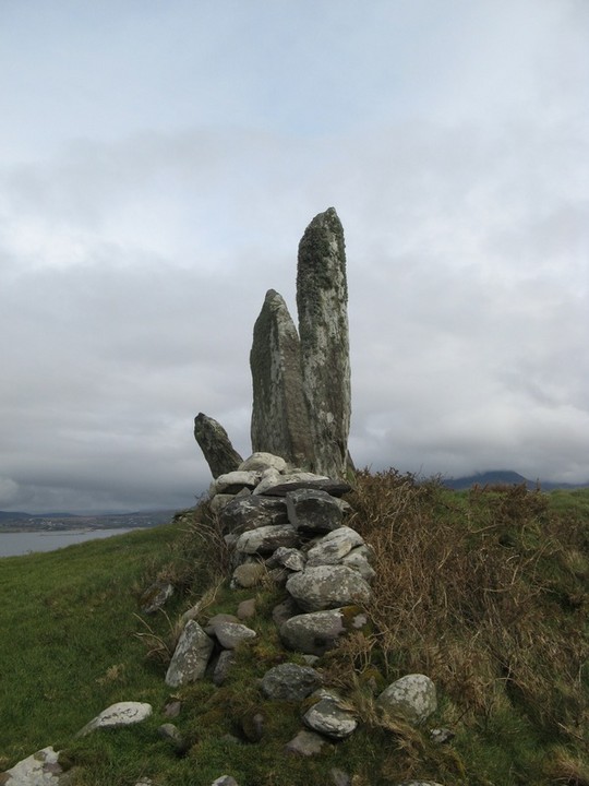
This standing stone is near the village of Caherdaniel, follow the signs for Derrynane House (Home of Daniel O’Connel). The standing stone itself must 2.2m high and there are two pieces of Ogham on it.

This side has Ogham in 2 spots that I have marked.
Image credit: Bawn79 © 2008

This really has to be one of the most beautiful locations for a stone circle ive ever been too. Plus the best thing is that it is off the beaten track and so if your lucky you can have this place all to yourself. Its in such an amazing landscape that this circle must have been some kind of nature temple.
Something I did notice was that the sound of the waterfall doesnt seem to be coming from the east where the falls were but to the southern bank of the lake.

This great stone row is located just to the south of the town of Waterville and is easily spotted from the road. The stones themselves are very tall maybe 3m high.
It seems to be forming the edge of a circular enclosure which im presuming was added on at a later date.
This stone circle is very tricky to find as it is located up a number of back-streets in the busy town of Kenmare. Maybe its just me but I hate asking for directions, all it needs is a few sign-posts from the main square.
Saying that we met 4 sets of tourist while we were there so it looks like people are finding this lovely stone circle despite the lack of help from Irish tourism.


The cashel with Cove harbour in the background
Image credit: Bawn79 © 2008


Showing some more of its placement in the lanscape, the sea can be seen on two sides of it.
Image credit: Bawn79 © 2008
This barrow is all that I could find of a barrow cemetery just on the eastern edge of the town of Hospital. There are seven other barrows marked however after a brief look the only one I could find was this giant.
This is another of the large barrows that are mentioned as part of the Discovery programme for this area.
This barrows outer diameter must be up around the 15-20m mark with two concentric rings and a small central mound. The mound and the diameter is a much smaller in size to Knockanny or Ballinascaula.
To find it park at the farm-gate just outside of the town of Hospital on the right. Follow the track that is shown on the map. When you come up to the disused farmyard that is shown at the end of the track you should be able to figure out where it is. Its lowlying and there are lot of rushes around it so can be difficult to spot.

Should be able to get an idea of the banks here
Image credit: Bawn79 © 2008


At this side the banks arent as defined
Image credit: Bawn79 © 2008

Shows how waterlogged the internal fosse has become
Image credit: Bawn79 © 2008
This standing stone is maybe about 0.75m high. I marked at an entrance to a farm yard on the right leaving hospital. You can check the barrow out at Coolalough from here. I walked in thru the farmyard and over a ditch to take a picture of it. Nothing special really.

The last time I was up here they had removed the ditches around the mound and barrows.
This seems to reveal a fourth barrow to the three barrows that are marked in a line on the OS map.
Ive heard it said that you can see the Paps of Anu from up here but Ive never been able to make them out.
You can clearly see where the ditches have been removed from the variance in the grass colour.


This standing stone is on the sacred hill of Aine between the mound on the eastern side and the ringfort on its western side.
It is about 1.25m high.


Taken from the information board in Rathmore
Danu, sometimes referred to as Anu, is the ancient Celtic goddess of fertility, prosperity and comfort, and has representation in other forms across Europe, such as Dennitsa (Russian, Danae (classical Greek) and Dinah (Hebrew), as well as linking her with the role of Earth Mother. Comparision have also been made by a number of scholars between Danu and the Greek goddess Demeter. Many place names thoughout Europe are derived from the name of Dany, examples being the River Danube, the River Donn and Denmark. In Celtic legend, it was thought that the Tuath De Dannann, the ancient Celtic warrior-race, were descended from her and her consort, Bile.
Danu’s primary associations are with the processes of the agricultural cycle, as throughout Europe, Britain and Ireland, in particular Munster, she was highly revered by pre-Christain agricultural communitites as the guardian of cattle and health. Farming and land cultivation were of vital importance to those ancient Celtic people providing food and sustenance to see them through the long bleak winter.
During the ancient festival of Beltane (celebrated on 01 May), which heralded he end of the long dark winter, and gave the promise of brighter summer days ahead, fires (known as Bel-fires or Need-Fires) were lit on high ground, and livestock were herded between these fires, tradition has it, to ensure their health and fertility for the coming year. The ashes from the fires were then scattered in the fields, to ensure a bountiful harvest. These rituals would be carried out to “appease” the ancient deities, particularly Dany, the earth Mother.
In Duhallow, Danu is associated with the two hills in its South Western region, known in Irish as Dha Chioch Anann or the Paps of Danu. Agriculture has very strong associations with this region, the fertile Blackwater valley playing a vital and integral part in the lives of the inhabitants from pre-Christain times to the 21st century. Habitation of this region during the pre-Christain era is strongly evident in the many ancient ring-forts and settlements to be found in Duhallow region and many place names beginning with Lios (e.g. Lisnashearshane (near Cullen) – Lios na Seirsean – Fort of the Arches) or Rath (Rathroe (near Derrinagree) – Rath Ruagh – Red Fort). Dromtariffe (Drom Tairbh – Ridge of the Bull) is another example of an agriculturally associated place name in Duhallow, signifying the value placed on cattle in the area then, as now.
A number of Holy Wells are also evident in the Duhallow area. Pattern Days were held to honour the saints associated with each well. The City in Shrone, at the foot of the Paps, known in Irish as Cathair Crobh Dhearg is a prime example. This area was named for a local saint, St. Crobh Dearg, who has been linked by scholars in a triad with St. Laitiaran (Cullen) and St. Gobnait (Ballyvourney). Many scholars believe that sites such as this were originally ancient pagan sites of worship that were subsequently Christainised. In the pre-Christain/Celtic era, a beautiful woman-Goddess Creide (the Celtic version of St. Crobh Dearg, or a derivative of Danu, perhaps?) was associated with the same area and legend has it that she was declared by Fionn MacCumhail to be “.... the greatest flirt in Ireland”