


A photo of the Hurlers ,taken from the small hill to the south,showing all three rings.The Rillaton Round Barrow is on the skyline to the right of the photo.

The group of round barrows opposite The Sanctury on Overton Hill.

Some of the group

A barrow of the group

A barrow of the group


Barrow in the Cursus Group


The eastern bell barrow in the cursus group.


The cairn at SX633729 is on the north east side of Royal Hill and around 600 metres to the south west of Sherberton stone circle.

The pound at Dunnabridge looking north fron Royal Hill.The pound is in the centre with laughter Tor in the background.

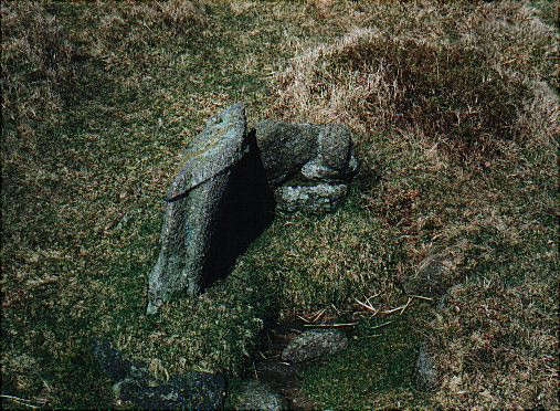
The kist at Upper Spanish Lake on the north east side of the Trowlesworthy Tors.


The fallen monoliths in the circle.

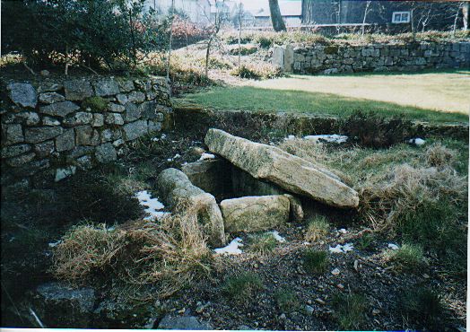
The kist that was removed from the Thornworthy Cairn and originally taken to Torquay Museum.It now resides in the garden of the High Moorland Centre in Princetown.

The kist at SX582653 is a few metres to the north east of the other one in the area.

The kist at SX582652 is to the east of the reave.

The kist at SX571647 is only a few hundred metres to the east of Trowlesworthy Warren farm and is also close to the leat that runs to the clay workings.

This kist is in the cairn at SX632632 and is to the north of the stone row.

The kist in the cairn at SX628623.This cairn/kist is to the west of the stone row.

The most southerly of the three cairn/kists on the southeast side of the hill.THis one is at SX620720.


This cairn/kist is at SX620723 on the southeast side of the summit.

The first of three kists on Royal Hill.This one is at SX621724 and is to the east of the summit.

This is the eastern kist of the three at SX605738 and is in the best condition with some of the cairn stones still remaining.

The most damaged of the three kists along the Blackbrook River at SX605738.

This kist is at SX605738 and is to the southwest of round hill and lies on the north bank of the Blackbrook River.There are two other kists only metres away from this one.

The cairn at the southwest of the summit at SX609741.This one is only metres away from the other at this grid reference.


The cairn at the southwest of the summit at SX609741.


This kist is in marshy ground close to the head of the Ranny Brook.It is at SX626635.
This kist is at SX621635 and is to the southeast side of the main settlement quite close to the wall.


The cairn/kist at SX612669 is on the hill to the east of the start of Deadman’s Bottom.There is still quite a large mound surrounding the kist.

This kist at SX609667 is only around 40 metres to the north of the one at SX609666 and is the most difficult to find as there is very little showing above the turf.It will soon disappear completely.

The kist at SX609666.This kist is on th hill up from the confluence of the Langcombe and Deadman’s Bottom.

The kist at SX604671 which is on the east side of the Langcombe on the side of a hill leading up from the confluence with the Plym.

The kist at SX603669.This kist is on the west side of the Langcombe nearer to where it meets the Plym.

The kist at SX608661.This kist is on the hill above the one at SX608664 and is to the west side of a small stream that runs into the Langcombe.
