
From the south(ish) – across the stream with a big lens!
Image credit: Tim Clark
From the south(ish) – across the stream with a big lens!


Just about all there is.... (Another probable stone in the wall behind me.)


Henge stones (inc errant ‘Pictish’ stone) & dog by stone on left – for scale....


Whole main site – henge & ‘avenue’ stone from road


Ocifant’s nightmare!!!! (The circle’s in the trees....)


The ‘groundbound’ rainbow seen on the way to Edinchip Chambered Cairn
Visited around June 1998
Just as we pulled up at the point on the small country road nearest to the circle, it began to drizzle despite the bright sunshine.
We headed across a field in the direction of the circle, but the rain drove my (less megalithacentric) companions back to the car.
I continued uphill, becoming drenched but focused on skirting the fields leading to the circle. Once I sighted the circle I was so wet that there was no way I was going to turn back!
This circle is fairly ‘knocked about’, with several of the stones leaning at various angles and a couple fallen. I must admit that to me that just added to the attraction, making the circle feel more ‘real’, more ‘used’, more ‘ancient‘.
As I reached the far side of the circle I turned to look back the way I’d come and was rewarded with the sight of a vivid rainbow arcing perfectly above it....

It’s a long time ago but I think this is looking north eastish. Ooh look, a rainbow...!

10 August 2003
We drove through Reeth up into the bottom of Arkengarthdale and parked around NZ027006, on the verge by the track to Castle Farm. We followed the track down to the river amongst trees (beautiful spot).
Across a bridge, back out into the now blazing sun and up the gentle slope towards the farm buildings.
In the fairly small enclosure to the right of the further farm house (Castle Farm itself according to the map), you can immediately see the ‘orthostatic’ walls of upright stones that the more modern walls seem to have been built onto – if I understand correctly.
As I know absolutely NOTHING about the subject, I suggest you read Brigantesnation’s fieldnotes.
Just to the left (north west) of the farm buildings is a stand of trees, on a bank littered with massive rocks, presumably from field clearance.
At the bottom of the bank where you approach it from the path leading along the valley, is a kind of ‘kerb wall’, possibly related to the orthostatic walls Brigantesnation talks about, or perhaps just a more modern effort to support the bank. We sat in perfect peace for a good few minutes before the walk (mainly uphill!) back to the car.
10 August 2003
I can’t believe how unknown this place is, despite being right on the Dales Way alongside the Wharfe. But I’m glad.
And the OS will have helped by seemingly having removed it from the 1:25,000 Explorer – my friend John is sure it was on the previous 1:25,000 of the area! (And I’m sure it’s never been on the Landranger.)
The position is beautiful, and having previously visited, I have to say it has a wonderfully open and light atmosphere on a sunny day, but it’s worth a visit in any weather!
Being a cairn circle, it’s certainly not a stone circle in the ‘true’ sense, but if you want a picturesque but accessible and peaceful circle of stones to sit and chill at, look no further.
Because of showery weather and time constraints, we parked by the road on the opposite (west) side of the river and leapt and splashed across. But it is vastly preferable to park near Yockenthwaite farm, cross the Wharfe by the bridge and turn left (north west) along the Dales Way for 10 or 15 minutes or so….
Back in the car we watched the ‘world’ passing the circle by for a while, wondering what the walkers and cyclists would have thought had they known what they were passing….
The circle is easy to spot from the road, but only if you know roughly where to look and what you are looking for.
If you don’t have time or inclination to walk from Yockenthwaite, drive west with the river on your right. Keep an eye on the wall separating the river from the fields on the far bank. The circle is right next to a place where the wall has (mysteriously?) tumbled….
Be prepared for damp toes unless you want to spend a goodly amount of time looking for a really dry crossing point!
*Also see weblog More Moth meanderings (starring the squid family).*
10 August 2003
Got here at the fourth attempt in about 2 years, having thrashed about within a few yards of the damn thing on every single previous occasion….
Well worth all the trouble it was though! A distinct circle of stones including one pretty big boulder, which looks as if it’s possibly in the position where it was found by the ancients, with the other stones placed to make a circle….
This is the ‘inner’ circle of what is allegedly 2 concentric rings.
The outer ring, however, is so irregular and ruined that I don’t think I’d have suspected it if I hadn’t known in advance – especially as the whole area is littered with ‘random rocks’. John and I spent some time pacing out distances to surrounding rocks and to be honest, remain slightly sceptical.
Ironically, the site did remind me very faintly of the double concentric ring I’d visited the day before, the Druid’s Circle of Ulverston. This had more to do with its size and atmosphere than the possibility of a double circle though.
Well, who cares? Single ring or double, the setting overlooking 3 dales is beautifully remote and infinitely calming. It won’t be long until I’m back now I know where it is!
10 August 2003
I went up to this one following Fitzcoraldo’s comments... and am in WHOLEHEARTED agreement.
Just my opinion, but if this really is what the OS has marked as a hut circle, all I can say is “is it HELL a hut circle “!
We all know the OS are flawed on this sort of thing – stone circles marked as cairns (Druid’s Altar to name but one), cairns marked as stone circles, you name it….
I was accompanied by my mate John, a man not easily impressed with ‘alleged sites’, having like most of us here, seen plenty of stones. He thought it was a stone circle too.
That’s 2 more necks out with yours Fitz!
The circle stands on a slight platform and is much wider than any hut circle I’ve ever seen or heard of. It shows no signs of ever having been even vaguely contiguous, which for me pretty much says it isn’t a cairn circle either.
Some of the stones aren’t firmly seated and may possibly not be in their proper positions, but some have what looked like very clear packing rubble and stones around them. Looks pretty damn authentic to me.
As well as the impressive ‘earthwork’ nearby, there are also what we thought looked like a few ruined cairns on the way to the circle.
To find the circle, we approached from Leyburn, heading for Grinton. Descending towards Grinton, we took a left turn signposted (I believe) to Redmire, a short distance after passing Grinton Lodge on the right.
This road goes gently uphill and pretty soon there is a sharpish bend left at approximately SE044974, by a barrier gate onto the moor. We parked here.
A track heads WSW onto the moor. We found that the simplest thing to do was to follow this until it crosses a small stream called Grovebeck Gill just after passing a fence leading off to the right. Cross the stream and leave the path to the right and follow the fence, leading just about north.
You will soon come to a very clear and quite spectacular earthwork ditch and bank. Follow the earthwork left (WNW) and where it peters out, continue straight on, along a projected line from the earthwork.
On the nearest crest almost exactly in front of you should immediately or soon see the outline of some small rocks. That is the circle.
Oh, and by the way, try not to jump out of your skin when the grouse shoot out of the undergrowth! I reckon I lost a good few minutes off my life….
9 August 2003
This was only the second time I’ve been to Long Meg, though it has to be said that there aren’t many sites I’ve been to more than once – there’re too many ‘new’ ones to see!
I must admit I’d forgotten just what a high profile site this is and, stupidly, I was a bit shocked, for a moment at least, to see other people there!
Luckily of course the circle is more than big enough to swallow up a few sets of visitors without it being a problem. It helped that all the visitors that came and went while we were there looked very interested in the stones and the site rather than just wandering around in the disinterested way you sometimes see.
This is such a beautiful site, despite the metalled farm road through it. I can’t imagine ever becoming used to its sheer size and general impressiveness. I got exactly the same feeling as my other visit, around 8 years ago – it seems a particularly peaceful spot.
No, that’s not right Little Meg is peaceful, Long Meg is… calm, if you see the difference. I know what I mean.
Tombo’s ‘zen cows’ were still in evidence.
9 August 2003
I’d never visited Little Meg before, as when I went to Long Meg before (around 8 years ago), I was only just becoming interested in stones. Having only used a road atlas to find Long Meg, I didn’t even know Little Meg existed.
Since first reading of Little Meg I’ve been expecting to visit but had never yet made it. The theory about the origin of the site as a barrow was particularly interesting I thought. We left Long Meg and her Daughters following the hedge away from the circle, to the right of the farm road, roughly north east.
Littlle Meg is in the next field you come to on the right. Go through the (new-looking) gate and keep right, heading towards the edges of 2 separate stand of trees. Even in long grass the stones are evident.
And as for the theories, it certainly doesn’t look much like an actual stone circle. Especially not a typical Cumbrian stone circle!!! Pretty difficult to see it as a ruined barrow either though!
As someone has previously remarked, it could easily be taken for field clearance, albeit field clearance made of significant rocks! I guess as it is generally accepted as a ruined barrow, the stones just happen to have ended up in particularly non-barrowy positions!
Whatever, the stones occupy a gorgeously out of the way spot of remarkable peace and tranquillity. And the spirals on the decorated stone really are stunning – and that from someone who doesn’t usually ‘get’ rock art….
9 August 2003
I’ll never get over the setting here. The circle itself is too spectacular and wonderful for words but is still completely overwhelmed by the natural beauty of the surrounding hills.
When we arrived the circle was teeming with people, but luckily, over the half an hour or so we stayed, they gradually dissipated and for the last 10 minutes there were only a few left.
The first time I went I was lucky enough to have the place virtually to myself and I think I’ve avoided revisiting fearing the crowds…but I found it much less off-putting than I expected.
I’m tempted to wish Castlerigg was harder to get to, but that wouldn’t be fair would it? Everyone should see this place. The circle’s actually just a (big) bonus…! This is one hell of a special place and I have to admit I’d kind of forgotten that because of its popularity and the crowds. I’ll not forget it again.
9 August 2003
Like a lot of people, this place used to remind me a lot of Castlerigg. Until visiting them in quick succession on Saturday that is. Maybe it was because when I first visited Sunkenkirk it had been a good few years since I was at Castlerigg...maybe not.
They’re certainly not dissimilar in some ways, but on Saturday I felt I’d been oversimplifying things by drawing such a strong parallel. There’s also a definite Rollright parallel in the proximity of the stones to each other.
The setting here is beautiful, but not half as stunning as Castlerigg when put in direct comparison. Even in sunny weather I find Castlerigg’s setting awe-inspiring, whereas with all but pretty forbidding conditions Sunkenkirk feels relatively welcoming to me and almost enclosed.
In good weather it would be possible for me to spend hours here, even alone (not something I feel very often), but at Castlerigg in similar conditions I can’t imagine spending more than about an hour at the most, leaving aside the irritating stream of people.
The circle itself is undeniably reminiscent of Castlerigg in size and style, but without the well-known internal setting. It does add a couple of external stones marking a probable entrance. Yet to me it seems to nestle in its field and embrace you, while Castlerigg stands bold but dwarfed on its open ground and you never truly feel inside.
Both wonderful places but certainly to me invoking very different feelings and atmospheres. I could happily visit Sunkenkirk every day.
9 August 2003
As we approached the site I was disappointed to see that the haze would mean that the usually beautiful views of Morecambe Bay would not be visible. In fact Bardsea and its church on their raised platform could barely be seen, never mind the bay itself.
The consolation though was that in more or less the opposite direction, the sun was just starting to set and bathing the white stones of the circle in a beautifully subtle (but apparently unphotographable) orange tint. The sky was photogenic though!
This visit confirmed that this is a lovely site and a perfect peaceful and picturesque end to the tour. I can’t agree that it doesn’t seem genuine and if it has been restored at all (and I don’t think it has) I can’t find much fault with it. Other than that if they were restoring it, why didn’t they do the outer circle too?!!
Admittedly I’ve visited both sites before, but I have to say that I didn’t find it an anticlimax after Sunkenkirk. No disrespect to anyone, but the sites are so different that there is no comparison. To me it’s like comparing, I don’t know… Arbor Low to Doll Tor.

9 August 2003
Looking towards the west as the sun starts to set


On top of the cairn – one of the chambers


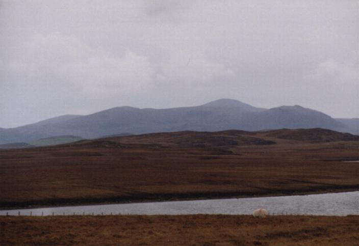
‘Sleeping Beauty’. Head on right of pic. She’s lying on her back and we’re on her left. Face, nose, breasts, pubic mound, thighs and rest of legs all clearly defined.... (This pic is taken from a few miles away from Callanish by the way, for example, her breasts are not so pronounced from Callanish – but then, I’ve always been fond of breasts!)


Thursday 1 May 2003
The ‘tumulus’ of Pitnacree is described in the ‘big papery’ version of TMA with no pics, and is lumped in with Lundin Farm. No photos here yet – I’ll have to get a scanner….
I’m not big on barrows, but it’s a fairly small rounded mound with fairly tall thin trees and a standing stone on top of it. (What a professional sounding description that one is….) Or perhaps CANMORE does it better…
rcahms.gov.uk/canmore/details_gis?inumlink=26384


