
broad face showing number of cracks – until fairly recently thay wondered how it stood as they saw no packing material
Image credit: wideford
broad face showing number of cracks – until fairly recently thay wondered how it stood as they saw no packing material


edge of stone with packing stones revealed by an arc of scouring


Found during work at the Finstown sub-station “A team from ORCA Archaeology, carrying out exploratory excavations at the proposed site of an electrical substation development in Orkney, has unearthed nine, half-metre tall stone-carved objects.” orkney.com/news/finstown-finds plenty of lovely images shown


what looked to be an interior structure revealad as wall with probable radial pier at left

the broch wall and what looked to be an interior structure


looking over mound with exterior? broch wall left of centre


The first time I went I came south from the Gloup via a group of minor earthworks only to be stopped by a field fence. Next time I walked the Sandside road and a track runs across the field to the promontory. Owing to its hazardous nature this is blocked by a fence. As I stepped over I saw my foot going below the level of the other, and having short legs and being alone I might get stuck for many hours. But a high-zoom camera worked wonders,
NMRS record no HY50NE. An excavation, cut short by the death of the director in 1982 , revealed on the N side a regularly curving segment of ground-galleried broch-type wall 13’6” thick which he thought could be a structure of the hypothesised ‘semibroch’ type adduced along the west coast of the Scottish mainland and in the Western Isles. Others suggesrted it might be a ‘forework’ or ‘blockhouse’ fort. In 2002 Euan Mackie suggested from plans of 1984 and and 1987 observations that inserted into a ground-galleried broch had been “a proper wheelhouse of Shetland type (with built radial piers)” otherwise only found in Shetland at that time. As well as the wall and traces of domestic structures on the promontory itself there are almost a hectare of dark midden deposits on the W side. Though the promontory isn’t connected to the steep-sided Stack of Mustack/Moustag (HY50NE 28 HY59260743) it is likely it once was, with the suggestion that this was part of the Iron Age complex – two or three orthostats protrude from a low ~19mD mound at the far end.

found during present excavations archaeologyorkney.com/2017/08/28/amazing-finds-at-cata-sand-early-neolithic-houses-and-19th-century-whales/

Scockness mound from main road


seen from landward side slight hollow on top

mound with hills in background

small stones and gravel

exposed stones with rule out to 1m

looking down on exposed stones
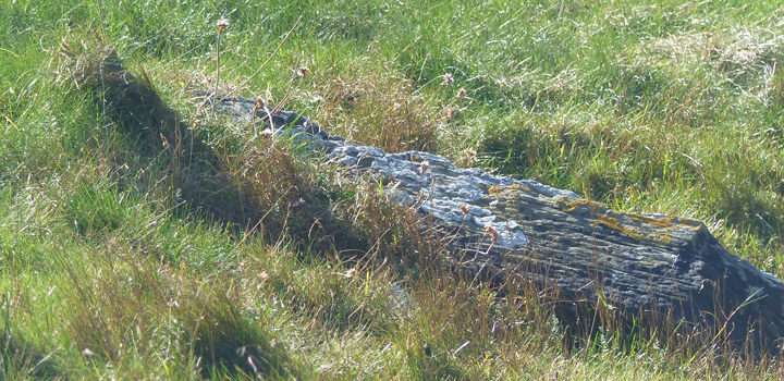
layered stone near pond – just geology ?
One day I manaaged to walk from the pier on Rousay as far as Scockness. After navigating a field gate I followed the irregular shoreline to reach one of those enigmatic traditional ‘Picts underground houses’, which sits on a spit of land between Mae Sand and a tidal pond. From my visit it looks like as if it has been excavated at least once, with a slight hollow on the top and the pond-side rather too regular for simple erosion to my mind, and I fondly imagine the removal of a rectangular feature.
On the other side of the hill, by the N end of the Loch of Scockness, and only seperated from the sea by South Sand storm beach, is the Taft o’ Faraclett Broch excavated in 1857. And up on the hill at Scockness Farm in 1994 an excavator hole showed that the chapel and burial ground had been built on a settlement mound also probably Iron Age. The Yetnasteeen standing stone is on the opposite hillside, a hill topped by the Faraclett mound that may be simply ‘natural’.
Only the south side of RCAHMS record no. HY45SE 2, a grass-covered mound of gravel and small stones, survives due to erosion at the N and W part. It is 1.3m high and 12.5m E/W by 8m, thought not large enough for a broch so either a settlement or perhaps what’s left of a cairn. Not a burnt mound they believe, owing to the absence of burnt material.

Yernasteen and Faraclett Mound seen from Scockness

stone with the place it was quarried from


beginning of lower chamber entrance seen from inside


