

wideford


overview of house from top of track looking norwestwards
Image credit: wideford

BA house seen from SE at end of track
Image credit: wideford

BA house viewed diagonally from NW
Image credit: wideford

trough near centre of structure
Image credit: wideford

BA ‘house’ gully (IIRC, otherwise a cell)
Image credit: wideford

exposed burnt mound section by west of house showing layers
Image credit: wideford

vertical look at one end of exposed face to show burnt material
Image credit: wideford
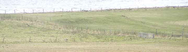
To reach it take the road that runs through South Ronaldsay to Burwick pier, following the signs for the Tomb of The Eagles just before the latter. This is a private site but is included in the price for the tomb. They give a very good talk at the interpretation centre and their information on the various parts of the house make things clear when you arrive at the site. This is quite close to the farmhouse (a very short half kilometre) and is as well displayed as the Barnhouse settlement, though of course much smaller. The final length of track approaches from the north downhill with the site on the left. As you come down look to the field boundary beyond, and to the right where a fieldfence starts uphill is an unexcavated partner mound. I could see Liddle II, ND38SE 5, as a line of dry blonde grass when I went, although it seemed easier to see the slight rise itself as I came back from the tomb. Two orthostats were removed from here and supposed to be gravestones, which makes me think on Mussaquoy. At the north end, past the trough, is the “flag-lined gully leading to a floored [and presently flooded to boot] hollow”. Looking back uphill, the successive laters of stone in the ‘“face’ of the mound at your right are plain as day. Looking clockwise there are four wooden stakes exposed in the ground. Nothing to do with the archaeology, they are much much too close together for a fence and make me think of a fish-trap or simple weir – but why here ?
RCAHMS NMRS record no. ND48SE 2 at ND46468411 is a two metre high burnt mound with an Early or Middle Bronze Age ‘house’ at the NE, the latter being a probably 6.5x4m oval structure with cells in a 4’ wide wall and a tank in the middle. At one time a secondary wall lent itself to a walkway before this was covered itself. The same gentleman that gave us the Tomb of The Eagles further along discovered this excellent site fortuitously, after digging through a fair portion of the eastern half of the mound to disclose the stonework. The remainder of the mound has a lovely cut face by the B.A. house and Hedges claimed that entire this would have been the greatest burnt mound in Orkney – having seen Pickaquoy I’m not so sure. The mound as excavated comprises many deposits of burnt stone, peat ash and some ‘cramp’.


To reach this site go along the main Kirkwall-Stomness road until you reach the Harray junction, turn up towards Dounby and the follow the directions for Corrigall Farm Museum on the east side of the road. The farmroad is very long and windy. At the museum you can see the mound just a little behind the the farmyard itself, to the right of a broad steep track going up the ways. Unfortunately the persistent rain tipping down prevented my approach to any nearer than the fieldgate beween the museum and the farmhouse (and my brother that drove me is not even into mounds, never mind a brochaholic, so wouldn’t stay), but if you have transport it is well worth a visit if ruinous mounds are your thing. Best ask at Corrigall Farm Museum or the farmhouse for permission I think.
RCAHMS NMRS record no. HY31NW 33 at HY32351937 is sheltered by the deep defile of the Burn of Corrigall at the south of the site but has been extensively (though fortunately not thoroughly) quarried in parts. The ground plan’s asymmetry resembles broch villages such as Aikerness (Gurness) and Lingro on a slightly smaller scale – on the order of Round Howe in overall size. The external diameter is in the region of 53’ with an estimated eight foot thick wall. Where the ditch about the broch is deeper, six drystane courses 4’6” high with an apparently completely vertical inner wall-face can still be seen over an 8’ stretch, elsewhere the foundations survive in a couple of places. At one time a fairly extensive passage 2’ wide came to light during farm works – the farmer having removed the stone infill then replaced this. A 33’ wide ditch appears to surround about half the central broch, being 40’ from it. This ditch is deeper at the north and north-west then comes to a sharp halt at the NE due to agricultural processes having levelled the ground. On its western lip an earthen bank still stands from 2’6”-5’6”, and now spreads about 9’ across. Between broch and ditch at all sides but the south are indeterminate walls, mutilation and ground disturbance obscuring the nature of the auxillary buildings there.
This can be found in a church alongside the road to Burwick pier where the short sea ferry crossings take place in the tourist season). It is now in a back room at the church, and the key can be had from the lady who runs the local P.O. As this is on the 1:25,000 but unsignposted it is probably best to enquire at the Tomb of the Eagles in order to avoid disappointment outside of its limited post office hours.

best view of ‘footprints’ – if you go take several different angles as at some these only look like wedges
Image credit: wideford

Visible as curving earthworks line to the east just past the field fence arcing for the sea. Splendid view from atop the cairn, then slide down the back of the mound. Whee !


Grave viewed from the north, bulk of surviving mound behind this.
Image credit: wideford


Found the other end of the possible cist. The distance between the orthostats inner faces is 1.56m and they are offset, the south end of that at the right being in line with the centre of the left-hand one. Measurements are as follows :-
LH 0.56x0.08m, protruding 0.12m from the soil at either end and 0.27m in the middle. RH has disparate edges, the whole being 0.46x0.15m protruding 0.13m, the reduced face 0.33x0.05m showing 0.08m.
The latter, also has a stone lying down against it, only 0.6x0.26m compared to the other’s 1x max. 0.48m. But there is at least one other stone between the slabs so they would appear to date from a later period rather than being co-eval.
It seems curious to me that this mound is in such an odd-shaped ‘field’, even more so as this is only half of larger section of similarly strange shaped ‘field’. Though the eastern half appears fairly level, but I do wonder if it too once produced archaeological finds, as in Orkney farmers often keep odd pieces of land out of cultivation because at some time in the (often forgotten) past there was a reason for so doing – only occasionally do we find what site was at these places.
In his eighth Munro lecture Gordon Childe “discussed the so-called inscription found on the edge of the bed in hut 7, but despite the presence of a burial under the bed, he now doubted whether it was really epigraphic.”


The site lies either side of the road going down to Mine Howe. Part of it lies by the plantation and looks fairly intact, but as everything is hidden under huge grass tussocks it is unrevealing, and only one trench was placed here. Might have done better to strip just the turf back over the whole area this side of the road.
There is a long straight looking bank maybe a metre high, roughly parallel to the road, and then a further bank or banks behind this ‘pushing’ the plantation back in a curve. If this is the ‘embankment’ then the gap between the end of the arms should be towards the far end of what you see. In the plantation behind is a remaining section of natural burn. Before you reach the main body of the site a wide water channel goes under the road.
On the Langskaill side the far bank the part by the road incorporating larger stones seems to have excessive height for the present usage, and might have been associated with Round Howe or be re-used stones from it. This RH side of the road is where the owners dug in 1946. Over the mid-19th century drystane wall from the roadside the workers left a cut alongside the wall. Perhaps one could still find part of the entrance to the broch (or that in the mound) close by this cut. Climbed a fieldgate onto the site. The start of the ‘arms’ should be about the lower right region as you look at it – on my last visit the land between here and the channel was water-logged. Trench remains complicate the viewing and the “Mine Howe location map” shows earthworks over an 150m wide area (unfortunately the geophysics has no scale in the Mine Howe publication).
Away from the mound what looks like an inner bank is re-deposited material and the rise to the north is natural. You can still see the level area between mound and enclosure easily. There are several stumpy earthwork sections at the Round Howe end of Lang Howe which may properly belong to this site.
In 1862 Petrie dug this tumulus (RCAHMS NMRS record no. HY50NW 8) and found the low (2’ to 2’ 6”) remains of a broch measuring 19’ 8” internally, with walls varying from 8-10’ across containing two 1’11’-2’ wide (one had a short 3’ entrance at right angle) by 2’ high passages in them. There was a wallface surrounding the broch at 2’ distance and the whole stood on a 90’ diameter mound. Both had entrance gaps ~ENE but slightly offset. All this stood within two banked arms with a western gap of 15’ and a large obstruction blocking the east end (total enclesd area 225’ by 175’ according to Hedges, banks 24’ by 2’6” high). Between broch and embankment varied from 66-78’ With its surrounding banked enclosure the nearest parallel is between here and Dingishowe where the Campston/Venikelday site is a broch with ring-ditch on current thinking. There are passages on Petrie’s plans but no guard cells, which means either it survived to the base of the 2nd level as Hedges thought or only remained to the bare minimum below where they would have been. Shortly before 1880 the modern road passed through the site, though locals spoke yet of passages beneath the road. The 1946 excavation on the Langskaill side found a “tomb with burnt bones” without saying if it came from the broch or the mound it stood on, but would have said if this were a cist, so what was it – The Howe had a Neolithic grave turned into a souterrain. From the extensive geophysics even outside of the enclosure the site seems extensive and probably multi-period, and the (2.8 by 0.7m) LBA flat-bottomed ditch dug at the mound’s base this century reminds me that antiquarians thought Campston to be a henge on account of its similarity to the Ring of Bookan. Easiest to call it a broch really!
Highly unusual for us not to know the overall dimensions of a broch – if I’d known I’d ‘ave done it mi sen. So this is likely the cairn below Cumminess mentioned on 1907. Described as amorphous, however viewed from several directions it supplies the standard broch profile even if most of the west side has been lost to the sea and a planty creugh [also planti-crû or planticru, used to shelter young plants] built into the east. A few feet south of the highest surviving point of the mound is a 2m high cut (mound top less than a metre higher if that) measuring 25m by 14m is seen extending out to the seaward side. A curving broch wall 6m in length (in 1966 leastways) survives to eight courses of middling blocks in the western half of its northern edge, with more walling and slabs carrying on to the eastern end. Opinion is undecided as to what feature this represents – outer wall-face [of the tower presumably], intra-mural cell or a gallery’s inner face. In 1966 Ordance Survey believed there might be further traces of this wall to the north. Though the cut is ascribed to coastal erosion I would not rule out an unrecorded trench (or possibly even accidental survival of an original space) because it is such a regular shape. Sometime between 1846 and 1966 other features by here – consisting of a small structure and a very short passage – have either been lost or subsumed by vegetation. The passage, about 0.6m long and 1.12m in height, “adjoined” the seaward end of the wall. This led into a structure (perhaps later in date) 3m N/S by 2.4m E/W shaped like part of a circle.
Though this is unlikely to be a broch settlement mention should be made of Gorrie Knowe between here and the Brig o’Waithe. HY21SE 76 at HY28091059 appears in the Orkney Name Book as a house but the site is a circular/sub-oval structure originally 10m across surviving to three courses as a curving wall fragment. And given that The Howe had a Viking Era settlement an aerial survey found two rectangular cropmarks, HY21SE 101 at HY28101061, not yet located on the ground.
An S.W.R.I. talk in 1936 mentions the same site [“The Orcadian” 17/9/36]. Coming from the Newark direction, a short distance from reaching the Peedie Castle rock stack two graves found in the mound Howe Hurcus “at one time” led to the attempt to dig it away being abandoned.
So perhaps two short cists rather than a long cist.
NOT A LISTED SITE
First came across this as a stone row described as being on Milldoe Hill, but site is shown on old-maps in the Breck of Elicant far downslope at HY36702037. On the 1:25,000 this locates it west of an irregular round enclosure below the 37 legend.
Further info from “The Orkney Herald” of May 4th 1932 :-
Seven stones projecting 3-12” from a two foot thick peat moss. Each is aligned E/W though the whole runs approximately NE-SW. The closest two are six feet apart but the otherwise at greater distances from one another. Though folklore mentions a man taking fright when he uncovered bones in the mossy soil the only one ever opened (by another local on more serious intent) proved completely bereft of materials.
The article says that they are 22 chains SW of Queenamidda on a line taking in that farmhouse and Hayan, though a more direct route goes through Blubbersdale and Quanterness farmhouses.
When looking at the well picture it as first excavated, at the base of a 15’ stairway with 18 steps between the top and bottom landings. In 1932 they had to crawl in backwards ! Removal of two unbonded steps revealed a hidden chamber – is this the kind of thing one should expect at Mine Howe perhaps ?
The 1798 and 1842 Statistical Accounts describe this as semi-circular and 140 yards across, having walls 12’ high and 9’ thick. If there were internal compartments these were filled with rubbish at that time. Unfortunately the site was heavily ‘quarried’ for stone in order to make the glebe wall i.e. that around the minister’s land. They believed the site might have once been used in part for burials. There were further walls on the outside of the “great wall”. In the various compartments were found “peat ashes” along with animal bones (including deer horn), shells and small bone rings.
In 1931 a cist and some prehistoric fragments were excavated here (notes accompanying photo of ongoing excavations, no follow-up article found). Probably the cist is the ‘box’ I found.
In “The Archaeological Sites and Monuments of Scotland , 27...” by Raymond Lamb it is said this site is akin to Bretta Ness in Rousay, which upon excavation was found to be a crannog. As water levels have risen by a meter and it still isn’t cut off from the land I somehow doubt this. But perhaps like Wasdale this is a possible causewayed island dun?
From RCAHMS I would add that there are several rectangular banks under a foot high to the S and W and that one of these connects to one of two probable defensive walls at 27m and 42m from the centre.

downhill at left, uphill at right, WWII buildings at top of picture
Image credit: wideford

loose burnt and other stones exposed on surface
Image credit: wideford
The main part of the burnt mound is somewhat over two metres across and reasonably level despite the slight scoop of excavation on the downhill portion, with a few middling stones and quite a number of flattish burnt stones in various hues. Close up I see that this central portion is probably less than the whole. Downhill there is a steeper slope to it (with at least one slightly projecting orthostat by the base) and behind it a long tail. Tempted to call it tadpole-shaped but its really more of a ramp, reminding me of a very tiny Hawell with most of the stone gone.