

pic from road again – did go see but ‘lost’ digital camera batteries and slide films yet to go – tip of Ness of Setter in background

Orkneyjar’s report here ow.ly/1eGbP – much clearer pics than “The Orcadian”.
As the only other NMRS for Damsay is a site the excavator thought to be a Norse castle but is now believed to have been a broch it is probable that the orthostats in one photo could relate to this. Though a short talk was given on preliminary Rising Tide findings beside these nowt has appeared in print or in the report, so from memory the Bay of Firth has in it likely chambered mounds and (one or more) stone circles
Hedges regards the semi-circular structure with passage as perhaps Pictish
from Sigurd Towrie
orkneyjar.com/archaeology/oicfunding2010.htm
photo ID required if using Northlink Ferries or coming via Loganair (though a visitor found British Airways did not need this some of their routes use Loganair planes at times), so be warned using Scrabster-Stromness or Kirkwall Airport


tomb dwarfed by Heddle Hill and quarry behind

On the steep climb to the tomb you are grateful for a few flattish bits but don’t pay much attention. Yesterday, however, whilst taking shots from Wideford Hill it was evident that these result from a couple of very large ‘platforms’ (seen in outline on the north side of the images). First thought was that these are connected with the tomb, which they dwarf almost as much as Heddle Hill. Second thought is cultivation terraces related to the nearby Neolithic settlements.
Prepared to be shot down in flames.
This site could have been important long before the henge as cones from postholes outside of this provided the unusually early date of 6000 BCE, long before Mona was settled
loads of photos taken from the new RCAHMS book of aerial photos, plenty to drool over
Leaving the Ring of Brodgar the next feature is the Dyke of Sean, the old Stenness-Sandwick boundary down to the loch – on the other side of the accompanying burn the Wasbister disc barrow sits in the far corner of a usually rather damp field. Looking up to the north look for the big green mound on the skyline in the uphill field. This is the Bookan tomb. Take note of the field as this isn’t seen when you approach the fieldgate. Follow the field edge up to the tomb and just beyond take the track right that goes by the west side of the quarry with the various [?lesser] Bookan cairns along its sides. Leaving these looking northward and slightly downhill you see the Skae Frue mound. Above this is the field containing the Ring of Bookan. You reach the gate before coming to Skae Frue. Follow the track that passes east through two erect stones and in a few minutes the ring appears to your left. The easiest way into the surrounding ditch is on the right where this meets the field edge and then on the east side is the lower side of the mound. From on top you have a complete view of all the hills comprising the ‘rim’ of the ‘bowl’ within which the “Great Sacred Monuments” sit. More properly from any high point on the ‘rim’ the Ring of Bookan is visible, even when the monuments aren’t. Ante- or post-quem, eh !


winter version of view from Brodgar road to south, with Bookan mounds on skyline
This is NOT visible from the Ring of Bookan, the skyline is the Bookan tomb with the mounds (The Brecks) about the old quarry.
The beggars have boxed it in, trying the old direct route but instead had to do a circular one through three fieldgates before entering by one almost opposite Skae Frue. Alas, though the Comet Stone points to it the Warbuster hill hides the valley below even if you took away the Bookan cairns from around the old quarry. No, it is Bookan tomb that dominates the view of the monuments below. On the other hand you can see why they built here – from on top you can see an unobscured 360deg panorama of the hills.
In a book on the Breckness Estate there is a quote from 1830 of “a mound of stones on the sea beach, called the Castle of Sneusgarth” which means the castle is either this mound or (more likely) the broch [unless there was a now lost mound at the taing]. The castle is a moveable feast whichever way you read things.
At an OAS set of talks tonight audience shown an aerial photograph showing a cropmark [nearer Bockan than Buckan it looked] in a field on the opposite side of the road to the Ring of Bookan and being a circular feature of much the same dimensions to it. Given as a possibilty that this relates to a recorded flint scatter hereabouts, presumably a reference to the small brown & yellow mottled ground flint hammer from Bockan (NMRS record HY21SE 52). More to the point is that Bockan house was part of traditions centred round the two great circles and used to have some idols [possibly Iron Age, like those at e.g. Brecks of Netherbrough and Dale souterrain, rather than Neolithic ?]
There were once two mounds by the ring, excavated away by James Farrar in 1861 [or the remains flattened later]. Though he placed these at the west and east sides he more specifically locates them at the NW and NE extremities. An indication of their height is that his men dug 22’ deep vertical trenches into the subsoil, the former nine feet square and the latter thereabouts. The only finds from the mounds themselves were animal bones, mostly in the upper parts, but deeply embedded stones were found around the bases.
source : July 27th 1861 “The Orcadian”

from “lesser wall of Brodgar” with alignment to Staney Hill long cairn chambered tomb
The fieldgate at the south had barbed wire either side of the top and the way there is spongy – so go through the farm. A small area of stones exposed in the eastern side has no order apparent unless the top few are a real line.
Finally able to have a good look at the cut in the northern end (no compass so, mound very roughly aligned with long axis NS but probably only following [present] cliff edge). Not even superficially a quarry, and Orkney has some decidedly rum bits mapped as this. Slightly more circular than rectangular when you’re in it. Not sure if the back is a continuous arc, more like angled stone lines either side. And if these are a wall still unsure if truly curved or straight walls distorted by erosion. Probably artefact of unrecorded prior excavation or else resulting from digging out circular feature such as a round cairn
What I thought to be a decorated stone is more likely to be natural. Behind the cut is the reported 15m depression that has led to its identification as a possible broch. Then I was on top of the cut and not far from this is an orthostat seen from the coast. And it is part of a feature highly reminiscent of that at the top end of the round cairn inserted into Head of Work, which Davidson and Henshall contend is likely the top of a chamber. even if this is incorrect it is definitely nothing a Brochaholic would accept as to do with a roundhouse. What you first note are two orthostats of a size on order with that at the top of the cut – maybe half-a-metre or so high – and three feet across the pair, with a jumble of flat stones of various sizes tumbled in front for about five feet and layered. If these are the backstops the chamber is roughly aligned EW and running at right angles to the long axis- so unlike the Head of Work in this respect too. On closer inspection there are further orthostats a couple of inches behind the ‘backstops’, though rather than something like packing these may be more of the backstops themselves heavily fragmented, indicating depth to my mind.
There’s the top of a long rectangular stone that looks to form most of the southern edge, with a longitudinal split that indicated it goes down a fair piece – to the feature’s floor perhaps. There are several other thick stones exposed, flat on the mound but partially buried nevertheless. Two of these solidly sunken near the eastern side, not flat but the tops of probable orthostats. These look to be at right angles to each other. Though they are exposed two or three inches away one from another they could well form a real pair under the earth.


‘chamber’ looking westerly [tape out to 0.5m, width across back 2 stones 3’]

view from Clouston road above Kirkwall-Stromness road, the lesser mounds in shot

view from Clouston road above Kirkwall-Stromness road

view from Clouston road above Kirkwall-Stromness road, ‘satellite’ to left is Skae Frue
An absolute pig to get to, and even for me not worth the bother – it actually looks better at a distance, and I only found one of the stones, its like nothing’s stopped growing yet. A complete jumble of grassy depressions and peaks, none distinct as to form or function.
In a talk today Euan MacKie mentioned that two of the Ring of Brodgar stones align almost exactly N/S, which is the same as the central hearth of the Standing Stones of Stenness. In neither case do these point to other archaeological sites.
Access to the site has been improved and it is now part of the West Coast Walk (the Viking Heaths project is out of booklets at the moment), still from Yesnaby car park – though there is as yet no signpost for the walk at this.
DO NOT park on the grass anywhere
Sigurd’s article on latest discoveries
The trial excavation here for the Ness of Brodgar dig has uncovered another ‘great wall’ and it is interesting to note that this is at right angles to the standing stone pair, ‘pointing’ across the gap (centrally ?)
Being the last week of this year’s dig, with today the last predicted dry weather, took my final visit. Finally minded to visit the trial excavation on the other side of Lochview. Disappointingly only one face of the feature has been exposed so far. What they haven’t mentioned yet is that the ‘new’ “great wall” is at right angles to the Lochview/Brodgar stones, possibly bisecting the gap between the pair. If this does mark the southern edge of the site that would put the likely chambered tomb on the putative ‘living’ side, which would raise several interesting questions.


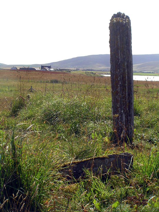
chance survival, family group, head clan.
Group hug ;-)


It’s in a terrible state, what were rabbit scrapes is now an extensive burrow system – it would be better excavated before it becomes a complete unstratifiable mess
This site shows how size isn’t everything. There was a complicated set of ceremonies surrounding matrimony involving all three rings and another Bookan site. Though nothing is recorded for this place, if the early name of Ulie Stane comes from dialect ullie ‘oil’ might I suggest a reference to chrism and perhaps ceremonies surrounding childbirth ? Note that this was the way to the Ring of Brodgar on the old track that ran through the “sacred monuments”, making it a gatekeeper kind-of – in the 19th century gentlemen still doffed their caps to it.
[My stone measurements are likely accurate but the distances between them and across the mound are as near as I could manage alone. {NMRS converted to metric} ]
The Comet Stone aligns NW/SE and sits in a depression presently measuring 2.7m by 2.3m and 20cm deep. The main stone stands 1.88m at the SE end {1.75m} and 1.97m at the NW, depth 27-28cm {29cm}, width 70cm at base increasing to 73 {76cm}. Measured height differs enough from NMRS to indicate surface erosion [there is a long scrape in the northern half too]. “Lines on the Landscape, Circles from the Sky” by Trevor Garnham gives an alignment to Maes Howe. but unless my compass reading is absolutely useless is incorrect this is not so, explaining why the meticulous antiquarians would miss such a thing- the alignment would seem, rather, to carry on to the Ring of Bookan [though this is on the hillslope invisible from here unless it stood higher formerly or had a superstructure such as a stone ring or posts] and perhaps ? to something roughly in the Dowsgarth region in the other direction. This NW/SE alignment is shared by the Stanerandy Tumulus (for a long while thought to be standing stones) and the Deepdale Stones, both on Mainland, and the Langsteeen on Rousay – we know so few s.s. orientations that there could well be more. The relationship with the recorded ‘stubs’ is striking, forming a geometric unequal tee-formation. Following the alignment 2.97m {2.67m} brings you to the western edge of Stub i and from that 2.75m takes you to the eastern edge of Stub ii. These define the mound’s axes. Axis A , defined by Comet to Stub i ‘W’, is perpendicular to Axis B which is along the line of the two stubs (a NE/SW alignment shared with the Watch Stone stump and the Spurdagrove s.s. pair). Using ‘mound’ for the area currently left rough then the mound is 16~16.5m along Axis A and ~11m along Axis B – NMRS gives approximate size of 13.7x12.8 and ~80cm high. At the edge, 6.5m from the Comet Stone’s SE end only a few inches away [
Looking along the Comet Stone with stub i the Ness of Brodgar is perfectly framed, like looking down the barrel of a gun.

view SE along Axis A and across Axis B stones
Axis A across Stub i to Comet Stone and beyond (Ness of Brodgar excavation visible to left of Commet Stone)

