
eastern side of south pillar – skulls found by right side here
Image credit: wideford
eastern side of south pillar – skulls found by right side here


RH side; N pillar, niche, E pillar, double niche [lower part my ‘slot’]


inner end of passage showing bedrock chamber cuts into


chamber from passage, L-R; north and east pillars, skull niche, south and west pillars

RCAHMS NMRS record no. HY31SW 3 at HY39731260. This site came to light on a Friday afternoon when a steam threshing mill broke through the surface and became stuck. John Mooney and WilliamTraill came the same day for a look over and on the next Traill and Dr.Marwick gave “a more thorough examination”. Its walls are a mix of large ?natural boulders and small quarried stones. The corbelled roof sits on four stones a yard apart, slightly over a foot from the walls and and roughly foursquare [that they are unequal in height suggests to me a possible origin as standing stones]. This oval gallery chamber is 15’3” NW/SE by 8’6”, with a 27"x30” passage running approximately 10’ from the NW end that is lintelled by oversized untooled slabs. In the walls there are several rectangular niches [including a slot near the floor on the RH side] all of which were empty except for a skull in that opposite the entrance [I assume the one behind the ladder]. More skulls were found about the inner side of the “south pillar”. A mass of other bones were also found. At the outer end of the passage was shell midden material [ritual sealing ?]. All of this from report in “The Orkney Herald” of November 17th 1926. Viewed from the new entrance running clockwise the stones are southerly [LH near], westerly [LH far], northerly [RH far], easterly [RH near].
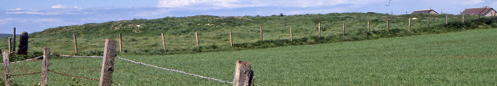
Must stress again [after what I saw today] that this is no walk-in, no incline or few steps but a narrow metal ladder going down. Gate no longer stiff. Coming along the farm road you can look across to the remains of Ingshowe broch. At low tide the shallowness of the inlet means it hasn’t been that long archaeologically since it was dry land.


Come up the minor road alongside Maes Howe [marked Fursbreck Pottery] up and past Hybreck until you reach the Grimeston road junction. Pass along the Grimeston road to a fieldgate on the left. Here I entered the place where the standing stone is, striking a diagonal by a small dry burn (these being all over and about Staney Hill I imagine one can rule out glacial deposition for the big rocks ?). From the Staney Hill road you can see the stone behind a ledge like a very low cliff, and then coming this way it reveals itself to be standing above one end of a long wiggly quarry
history, pics and blog
this season’s dig has begun and they now have 30 ox skulls in the foundations for which they can find nothing similar in Scotland [though J.W. Cursiter mentions the 1901 uncovering by storm near Skara Brae of a 3’ deep ox midden 100’ long, beneath which another storm two years later disclosed a building].
“This site has more than 420 stones is considered one of the most important of Central Brittany. Its construction dates back to more than 1,500 years. In 1989, after excavations, the majority of the standing at half-buried in the Heath there was discovered. The site extends over 7 hectares. Some stones weighing over 35 tons and can measure up to 5 meters”
Aubrey Burl has 22 schist stones (with three still standing) in two intersecting rows 55m N/S and 78m WSW/ENE [rather ragged on his plan]
viewed from main road with equivalent of 520mm lens it is obvious my possible quarry (unmapped ever) is the mound. On the one hand you can see why someone there might think this a burnt mound i.e. crescent-shaped and by water. But from these images it is obvious this is the remains of a large circular mound eaten by the bay.


Had been thought to be Bronze Age but according to Dr. Kenneth Brophy in a talk tonight the C14 dates came back Fiday and place it in the Neolithic with dates in the range 3000-2800 B.C.E. pre-dating the henge and the timber circle

Brodgar E end of parish boundary at left ad end of Seean at right with structural remains
? S end of stepping stones [Watch Stone top left] a rather wavy line and shoreside stones would appear to be a modern extension. As a causeway would most likely connect to holed sentinel and thence the Barnhouse Settlement

from W end of new coastal path with edge of Ring of Brodgar far right, folk sitting on top for ?picnic


Fresh Knowe to Plumcake Mound from E end of parish boundary
Low had a little excavate but found nothing
Brand 1703 “the Minister of Sandwick’s Manse is said to have been the residence of one of the kings of Picts... to this day called Koningsgar or the King’s House... tho now kept in some repair... The figure thereof and the contrivance of its two Rooms or Chambers one above and one below, of narrow dimensions, and antick, and the Building hath been but coarse.”
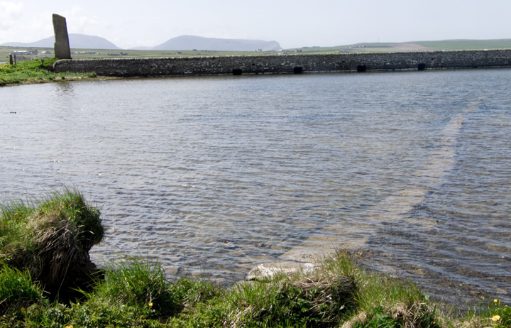
Twice I have opted to go from the Stenness parish kirk through the fields to the Stones of Stenness but instead had to follow the fence running NE-SW south of it. And each time I have looked at the stump of the old field wall that this follows. Apart from this both times I have cause to note several large stone fragments near the line that aren’t from a wall and each time have mistakenly looked for a gate or other entrance. Now I have the explanation because Pococke’s location for a holed stone, 124 yards west of a stone 18 yards south-east of the circle. Further I identify this with the stone depicted by Lady Stafford : tall and shaggy, cleft from the top to ground level, having an angled top (not slanted) and with a central hole near to the base. It is even possible that Dr.R.Henry’s description of the stone having a hole 3’ up, rather than five, is a reference to this rather than a lapsus pennae.I believe it to have been possibly the size and even age of the Watch Stone
So there were two holed stones near the Stones of Stenness. Of the sentinel stones in Pococke’s drawing along the shore the one (?’stone of sacrifice’) that isn’t the Watch Stone (’stone of power’) is described as having a stone in the middle of it. It is roughly diamond shaped and matches well with the stone doublet of Stanley’s 1789 drawing (admittedly the latter is a shade more rectangular). Walden’s map of 1772 shows a single stone, but this is shown as having just been cleaved in two and the other half of the doublet could be the stone lying flat under the breaking instrument but is more likely from this Stone of Odin. If the former was this heaved out of the shallow hole shown or is that the result of an excavation having taken place ? A hundred and fifty yards N of the stones brings it close to the shore as Pococke shows [~HY30671275], near where Odin Cottage is now.
BROUGH OF BIRSAY SAFE CROSSING
Radio Orkney has discontinued their early morning tide times for tourists to reach the Brough of Birsay. Their system took three-and-a-half hours off the Kirkwall low tide and then allowed five hours for safe crossing. Ocassionally this proved conservative but on very rare occasions folk still got stuck. The reports will be resumed when/if a more reliable method is found.
In 1849 the Stone of Odin, smashed in 1814, is reported as having been 150 yards to the N of the Stones of Stenness. Trouble is Pococke has it 124 yards E of a stone that was 18 yards to the SE of the circle and William Aberdeen’s perspective drawing slightly later depicts it to the E and south of the circle too. Pococke’s drawing of the the lesser circle from the north shows other stones to its E and perhaps a block between it and the henge but no holed stone.
Low ~1774 “[Stones of Stenness] not ditched about like ... [Ring of Brodgar]..but surrounded with a raised mound partly raised on the live earth, as the other was cut from it”
Wilson 1842 ” the completer... circle of the... Stones of Stennis... as you approach them you pass here and there a solitary stone or broken remnant, as if there had been... a connecting range or approach, all the way from the bridge to the great circle. The latter is encompassed by a still entire mound, surrounded by a foss [sic], and there is a filling up of the foss and a lowering of the mound, just at two entrance places, opposite each other, north and south.”
1760 Pococke’s drawing shows a second stone on the opposite side of the road a little further away from the roadside. This is longer than it is tall and resembles a recumbent [though I suppose it could be a very large natural boulder like the Savile Stone]. The ‘companion’ stone is actually a diamond shape which if to the same scale as the Watch Stone would come oot as some 14’ high and wide ! As far as I can tell from Pococke’s drawing it would have been about grid ref HY30671275.
Wilson 1842 “Close to either side of the southern end of the bridge... stands a great sentinel stone...
...as you approach [the Ring of Brodgar] you pass here and there a solitary stone or broken remnant, as if there had been... a connecting range or approach, all the way from the bridge to the great circle”
William Wilson was told in the 1840s that the stones had been moved here by the mytes [sic]. He believed these to be spirits, and I think mytes is a reference to the bible’s “Mighty that were of old” in the plural.
There were once more stones than those in the circle
1760 “There are two standing to the South, one is wanting, and there are two stones standing, a third lying down, then three are wanting, there being a space of 27 yards so that there were eight in all : Eighteen yards South East from the circle is a single stone, and 124 yards to the East of that is another [Odin Stone] with a hole in one side towards the bottom, from which going to the circle is another [stone] 73 yards from the fossee [sic], the outer part of which fossee is 16 yards from the circle” and as this was summertime I guess stumps lay hidden in the grass.
Low ~1774 “”[Stones of Stenness] The drawing shows the stones in their present state, which is four entire and one broken [??recumbent]. It is not ditched about like ... [Ring of Brodgar]..but surrounded with a raised mound partly raised on the live earth, as the other was cut from it... near the circle are several stones set on end without any regular order, or several of them so much broken, hinder us as to the design of them.“”
It seems that sometime between 1760 and 1842 several were nudged and then between 1842 and Thomas visit several were destroyed as described. His disbelief arises because he only knew of the circle itself. One of the external stones was a companion to the Watchstone on the other side of the road and further from it, a fat ?recumbent still there in 1842.
1842 “Stones of Stennis... in one case in a vast circle surrounded by a mount, in the other in insulated groups of two or three together, either forming parts of an approach to the circle, or themselves the sole remnants of other corresponding circles...
none of them is very thick in proportion to its height and breadth... The summits are generally diagonal... and they seem also in many cases to be imbedded in the earth by a corresponding sloping corner. Their original position was no doubt perpendicular although others are leaning to their fall, and not a few are lying flat upon the ground...
Although the gigantic remnants near the Kirkwall road are too few in number to indicate the circular form, yet that... is sufficiently manifested by the distinct traces of a large green mound in which they are enclosed... almost continuous semicircle... the other segment having been ploughrd up... One of the largest of these stones now lies flat... having been loosened it is said... by the plough, and soon after blown over by a gale”

looking over Fairy Well from top of bank with stones extending it back

Fairy Well coming down onto shore with old fence post roughly same height
