As seen in ‘Inscribed Rocks...’ 1865.
Image credit: J Collingwood Bruce
As seen in ‘Inscribed Rocks...’ 1865.

As seen in ‘Inscribed Rocks...’ 1865.

As seen in ‘Inscribed Rocks...’ 1865.

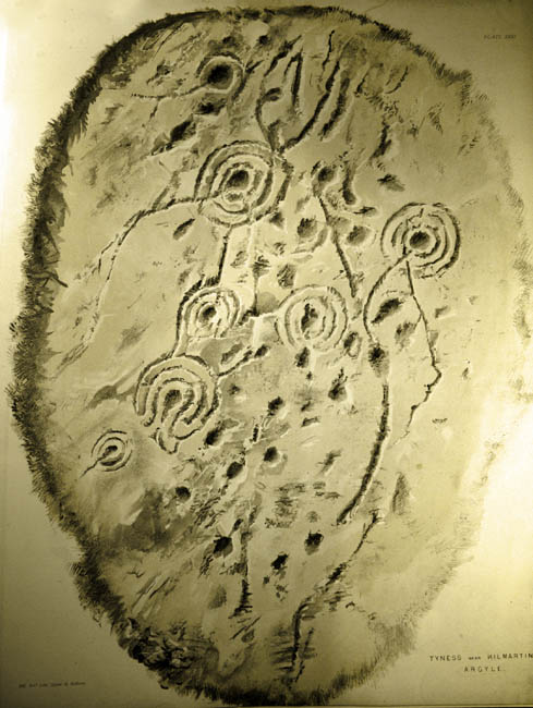
From ‘On ancient sculpturings of cups and concentric rings‘
PSAN Vol VI 1864-5

From ‘On ancient sculpturings of cups and concentric rings‘
PSAN Vol VI 1864-5

From ‘On ancient sculpturings of cups and concentric rings‘
PSAN Vol VI 1864-5
According to Colin Richardson, this cup marked stone is thought to have once been upright, and accumulated cairn material about it’s base afterwards. Presumably this material was removed during the excavation. Dating was inconclusive, though the usual late Neolithic/early bronze age period was assumed.
Excavations on a cup-&-ring marked boulder on Tortie Hill.
(Transactions of the Cumberland and Westmorland Antiquarian & Archaeological Society, 92, 1992, 7–11, ISSN 0309-7986):


Itinerarium Curiosum 1776


Itinerarium Curiosum 1776

Itinerarium Curiosum 1776

Itinerarium Curiosum 1776


Itinerarium Curiosum 1776

Itinerarium Curiosum 1776

Itinerarium Curiosum 1776

Itinerarium Curiosum 1776
Some sparse details, but with a nice close up pic, and some references.

From The Proceedings of the Society of Antiquaries of Scotland
Volume 6 (1864-5), Appendix.
A .pdf file detailing four cup marked stones.
By A. Marshall
From the Transactions of the Bristol and Gloucestershire Archaeological Society 1986, Vol. 104, 220-225
Courtesy of the University of Gloucestershire website.
What a remarkable thing!
A cup and ring marked stone? In Gloucestershire? Written up by that stalwart of the Scots CnR fraternity R.W.B. Morris? In 1983?
Apparently so.
A tidy account of this OOPPRA* provided courstesy of the Bristol and Gloucestershire Archaeological Society. Via the University of Gloucestershire website.
(*out-of-place-portable-rock-art. I just made that term up. It’s utter tosh really, as the stone found was made of local oolite, so it’s not out of place. Which actually makes it seem all the more remarkable as you do not get CnRs down south. everyone knows that...)
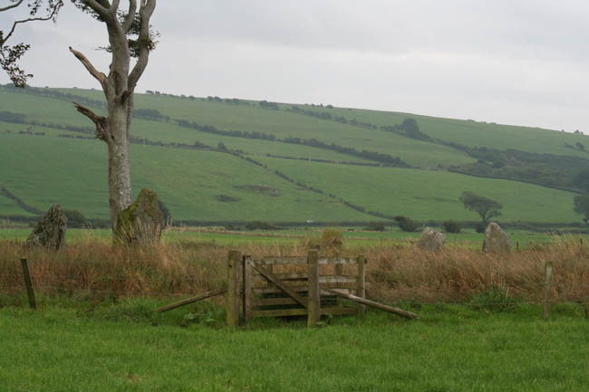
If you’re heading for this panel, whatever you do, don’t rely on the OSmap (like we did), the explorer map shows a track leading from Slockaullin to Tayness, heading south, then doubling back after a mile or so. This track turns into a total bog (we slogged through it). Not worth the bother. Instead, follow Greywether’s directions, and use the newer track heading uphill to your right as you walk up from the road to Slockavullin, it’s not on the map, but it’ll get you right up there to where you want to go, we used it to get back down, much better.
Tidily mown inside the fence, completely wild and woolly outside. The panel itself is nice. A frequently made observation seems to be regarding how the motifs are clustered together on the rock surface, with a big gap around the edge. No-one knows if this was a deliberate choice or simply because the carvings are on the part that was exposed back when the carvings were pecked.
Possibly due to the uneven water table, we found that sunset at Ballygowan to be a very midge infested time.
Visited August 2006
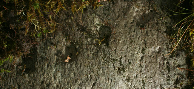
Line of small cups to the lower end of the outcrop, next to the track, roughly corresponding with Naddair’s ‘Panel D’.

Not easy to get a decent pic of these shallow, but decidedly artificial cup marks. Not so sure if the ‘axe head’ is an axe head though. It could be a later addition.

The outcrop bearing the slab with cups and an ‘axe head’ carving. Pretty strange axe if you ask me.

You can just about make out the circular plan of some kind of structure. I don’t think it’s a ‘banked stone circle’ as I was told by a chap nearby.

Standing stone? More likely one of the grounders of a structure in a settlement.
I feel a bit embarrassed about posting this site as rock art, as I feel it’s more of a settlement. It’s the lumpy outcroppy bit to the north of the village of Slockavullin. It’s got traces of circular structures, one of which was described to me by a local grockle as a ‘banked stone circle’. It might have been, it is an earthen bank, and it has stones in it, but it’s not very likely to be honest. I think they are more likely to have been grounding stones of a building, only one of them was standing, and then only to a height of about 80cms. I couldn’t help but wonder if the 18thC buildings which constitute the current village was built on top of a much older site, mostly for the same reasons, it’s flat, but no good for farming, but it has a good water source and is close to the good farming bits. If trees weren’t there, it would be a 20m walk to a point where you’d be able to see all of the monuments from Ballymeanoch to Glebe Cairn, and from the outcrop, you could easily throw a stone into the centre of Templewood.
Quite frankly, the rock art is a bit rubbish. In retrospect, I wasted far too much time here (probably in excess of 15 hours over the space of a week) that could have been much better spent further uphill around Loch Michean.
Visited August 2006
The scanty details on RCAHMS can be found here .


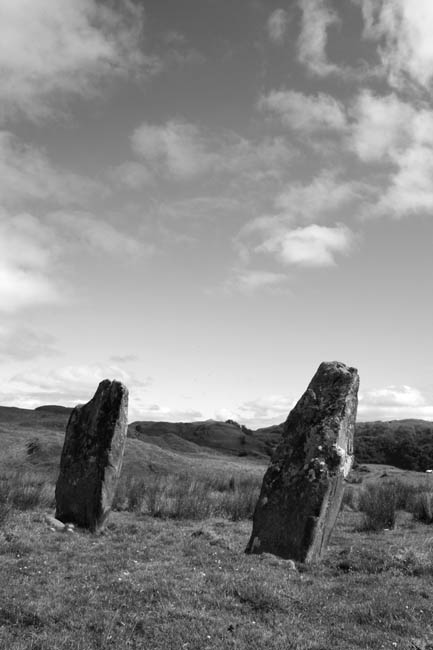
We visited these two as part of an abortive attempt to see if we could get to Ormaigwith the kids in tow. Didn’t get to Ormaig, but it was still worth the walk, goodly sized, stately stones, and a nice view.
From the look of things, it could be a bit of a faff to get here from the castle car park. The ‘pasture’ field that you have to cross is no longer pasture, and I couldn’t see a gate anywhere. The path that leads up from the south was no bother at all.
Visited August 2006