


The burial mound in the field immediately to the east of the stone.


This stone is greeeeeeen. It also has bits of offerings on the top. In the form of coins, ribbons and a pebble with the word ‘Futhark’, written all runey.
No sign of any of the alleged missing stones, but on the edge of the trees, a very clear view of the silhouette of Simonside is visible. In this bit of the world, no prehistoric monument is complete without close proximity such a view. Shame the trees block it from the stone.

Never mind the possible eroded cups with the red stuff, what’s that thing in the background?

Is there the faint trace of a second ring around that cup? Or is it just me being over-keen to see something that’s not really there?
August 2006
Went and had a look a few times this year, over the space of a week, but can’t convince myself about the second ring I thought I’d seen previously, despite a number of different lighting conditions, both natural and artificial.
August 2005
Wheelchair/buggy access here is very good (as it is at most of the main Kilmartin sites). The dedicated parking space is only a few hundred metres away, the ground is fairly flat, with no big bumps, gates are sensible, and there is a nice even bridge over the stream.
It seems to get a bit busy though, even on weekdays, we hung about for an hour or so, and spotted at least 7 groups of other visitors, most of whom were in a bit of a hurry. It’s quite fun to watch folk doing the circuit from here to Nether Largie south, via Temlpewood, it looked like quite a nice little walk. So we eventually got up and did the same.
It’s a nice way to see these 3 sites, as it gives you the chance to see the X from a number of perspectives, but isn’t strenuous in the least.
I got the idea into my head that there are two rings around one of the cups, but it could just be a trick of the light. There are’t any double rings on any of the diagrams I’ve seen.


This is high quality rock art. Interestingy different motifs, from the kind found in Argyle or Galloway, a distinct Arran style? Emphasis on the double channels leading down-slope from the cups and rings. It left me hoping that there must be more on the island somewhere. The motifs even percolated into my dreams the night after visiting.
Perhaps one of the most intriguing things is the possible anthropomorphic carving. Fans of The Sons of TC Lethridge are directed towards the track ‘A Pilot’s Eyes’, which mentions the site and the possibilities of sightlines being formed via avenues cut through the trees. Goat Fell would probably be a contender for such an sightline avenue, but of course there’s no hard evidence for such, but it’s an appealling idea nonetheless.
We found the site with no bother, you just follow the track, it’s the only outcrop, difficult to miss, just over the brow of the hill.
The trees are a bit densely planted, but despite this don’t seem too oppressive. Shame about the effect on the view though.
Access for wheelchairs and/or buggies, like most of the high profile monuments in Kilmartin, is pretty good, no awkward kissing gates, decent going on the paths.
Beware wary if encouraging small children to stick their heads out of the gap at the front of the chamber to shout hello at their Mum. My daughter did this, and nearly gave the fella sitting on top of the cairn a heart attack.


I’m not 100% sure, but I think this is another portable from Dod Law. It’s now in the Museum of Antiquities at Newcastle Uni.

Portable from Dod Law, now in the care of the Newcastle University Museum of Antiquities.
By D.W. Harding:
This paper reviews progress in Atlantic Scottish Iron Age studies over the past twenty years, with particular reference to a long-term programme of fieldwork in west Lewis undertaken by the University of Edinburgh. It deprecates the survival and revival of older conventional models for defining and dating the major field monuments of the period and region in the face of accumulating evidence for the origins of Atlantic roundhouses in the mid-first millennium BC, and discusses important new evidence for the first-millennium AD sequence of occupation and material culture. The material assemblages of the Hebridean Iron Age are contrasted with the impoverished and relatively aceramic material culture of lowland Scotland and northern England, and the importance of the western seaways in later prehistoric and early historic times as a distinctive cultural region is emphasised.
“Underwater archaeologists in Perthshire have made the incredible discovery of a drowned forest, thought to date from the neolithic period some 5000 years ago.”


Greywether’s directions are effective. Found the carvings without problems, sans gps despite high undergrowth and the moss on the outcrop.
Looking at rockartUK’s photos and comparing them with Greywether’s, and then with what I found, I’d say the moss is still creeping over these carvings. I visited just over a year after GW, and there was a noticeable increase in the amount of the carvings covered. The temptation to have a scrub of the moss was strong, but I figured it should be left to do it’s thing.

Access for wheelchairs/buggies isn’t too bad. There are no kissing gates, and the two gates that you must go through are quite straightforward.
There’s few hundred metres of fairly rough ground though, not too boggy, but a bit bumpy. Wheeled contrivances would need about 4-5 inches clearance below the axle.
The size difference between the central stone and those surrounding it prompted my daughter to inform me that this was a school for rocks, and that the one in the middle was the teacher, and the small ones in a circle around it were the children, she wouldn’t elucidate as to what the lesson was about.

Large, slightly conical cup, about 8 inches in diameter, found at Weetwood Bridge.

As it sits now, in good company, in the warm, away from the elements, with a little cardboard tag tied on with string.
There is a tale of an otherworldly being known as a ‘Dunnie’, who haunted the area between here and Chatton, who was often heard at night lamenting the fact that he could not return to the realm from which he came,
“Ah’ve lost the key to the Bowden Doors, Alas I’ll ne’er gan hame nae more...”
A couple of versions of this tale are kicking about, at least one of which links the Dunnie to the spirit of a Border Reiver, but the one relating it directly to The Bowden doors seems to be the oldest, dredged from ‘The Denham Tracts’.

A small part of the top ridge. Mesolithic stuff found here.

Big natural (it must be natural) cup. It’s about 50cm diameter, there’s a quid coin in the photo to give the scale.


Possible cup marks on the vertical surface of the Bowden Doors.
The Bowden Doors are a double ridge of cliffs on the NE side of the Till valley. They run roughly SSW to NNW and are quite visible from many (if not all) of the main panels of rock art in the area. In particular, they may have some sort of bearing on the slightly odd placement of the stone circle at Doddington Moor.
Almost every other ridge in the area has rock art, yet this prominent and eminently suitable outcrop seems to have none. This, and the unusual nature of it’s contours on the map, originally drew my attention to this site.
It’s suitability for inclusion on TMA is a bit tenuous, but is provenanced by the finding of mesolithic artifacts at the base of the upper cliff. It could be classified as a rock shelter, as there are a number of spots along the ridges that would fit the bill perfectly, however pinpointing them isn’t yet possible, as no excavations have been done (and it would seem a lessening of the sense of place were this to happen). Even a quick visit here is sufficient to appreciate it’s suitability as a site for hunter-gatherer types. It’s nicely sheltered, yet strangely manages to also afford excellent views over the both Cheviot to the west, and east to the coast, in particular to Lindisfarne and Bamburgh. The ridges also overlook bucketloads of rock art sites.
The place also has some of the finest crazy rock weathering I’ve yet seen in Northumberland, with unusual features including a gigantic ‘cup-mark’ and a strange ‘pulpit’ feature, as well as some of the strange vein-like patterns seen in the cave below Dod Law. ‘Tis very special place, with a powerful sense of presence.
The cliffs have been popular with climbers, and some of these have told me that there was once an excavation of some mounds which found remains of burials. I’ve searched and searched, but haven’t yet found any references to this.
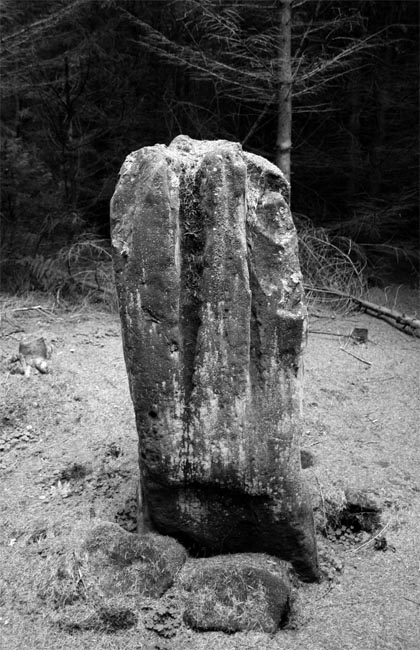
The other possible point of interest (from a megalithic perspective), is the fluted outcrop at Raven Crag, just in front of the lower ridge. This natural feature is very conspicuous, and in my mind makes the place a possible candidate for a quarry site for some of the fluted standing stones which are found in this bit of Northumberland, such as Duddo circle. It is stretching things a tad to suggest that the stones of Duddo may have come from The Bowden Doors, but the Raven Crag outcrop gives a nice example of what the standing stones may have looked like before they were quarried for use in monuments.


Both are in a great place to be noticed by anyone coming inland. Anyone doing so may have easily noticed the cairns silhouetted against the sky, perhaps they would then continue up into the rock art strewn landscape to the north, maybe even eventually arriving at Glenquickan. It would be great to have the time to walk such a route, but it would probably be a bit bleak and boggy these days.
Overall, I think it’s nice as it is now, that toothy jaggedyness isn’t quite as oppressive as I’d thought it would be from looking at photos. And there’s even rock art. Hoorah!
I was also chuffed that the chamber in Cairnholy2 is big enough to be able to stick your head in and look through to the sea. I dunno why, but I still am.
Martin’s comments on the scary road are spot on. Steep hairpin bends to make your toes curl.
But if you’re on Skye, it’s possible to get here via the rather unique turntable ferry at Kylerhea (sp?) just up from Glenelg. It’s a short hop, only about 5 mins on the ferry. Alternatively, if you are heading to Skye, and are prepared to brave the road from Shiel Bridge, this is an excellent spot to stop off and have a break in Glen Beag before getting the ferry over to Skye.
