Castlerigg stone circle, viewed from the top of Latrigg. Looking from the NW. Stacks of people could be seen, bristling within the stones, so I was glad I was looking at it from a distance. Get up Latrigg if you can – the view will bring tears to your eyes.
TE.

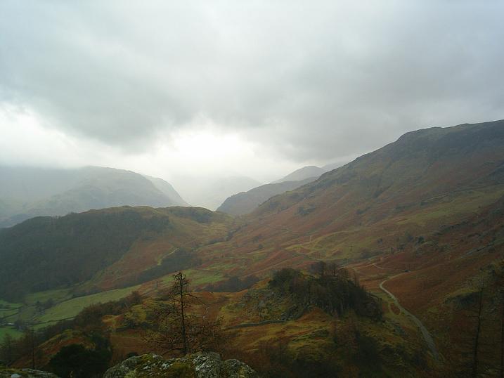
Some Great Langdale stone axe factory sites, viewed from Bow Fell (view from the W). Copt Howe in the distance.

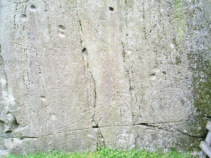
Cup mark details. Rock slab, about 10/12 feet in height, on the right hand side of the road, just before Copt Howe when approaching from Ambleside. Cup marks – natural or man-made?

Cup mark details. Rock slab, about 10/12 feet in height, on the right hand side of the road, just before Copt Howe when approaching from Ambleside. Cup marks – natural or man-made?

Cup mark details. Rock slab, about 10/12 feet in height, on the right hand side of the road, just before Copt Howe when approaching from Ambleside.

Cup mark detail. Rock slab, about 10/12 feet in height, on the right hand side of the road, just before Copt Howe when approaching from Ambleside.

Rock slab, about 10/12 feet in height, on the right hand side of the road, just before Copt Howe when approaching from Ambleside. Cup marks – natural or man-made? I think some are definitely natural, but perhaps some are man-made copies, imitations of the natural. Similar to the cup marks on the Copt Howe rocks. Some have evidence of polishing, due to climbers.

Rock slab, about 10/12 feet in height, on the right hand side of the road, just before Copt Howe when approaching from Ambleside. Cup marks – natural or man-made? I think some are definitely natural, but perhaps some are man-made copies, imitations of the natural. Similar to the cup marks on the Copt Howe rocks. Some have evidence of polishing, due to climbers.

Copt Howe in glorious Great Langdale, and its relation to the Pike of Stickle axe factory.

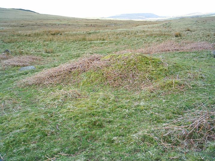
Second big rock from the gate. Close detail 4.

Second big rock from the gate. Close detail 3.

Second big rock from the gate. Close detail 2.

Second big rock from the gate. Close detail 1.
Second big rock from the gate – general detail.

Second big rock from the gate – main decorative wall.


First big rock from the gate. So obviously pecked, like all the rock art at Copt Howe. Recent chalk on the rock shows that bouldering is still taking place, but this rock wouldn’t be obviously carved to anyone uninterested in prehistory.


Looking back NW to Swarth Fell stone circle from the SE.


From the S edge of Swarth Fell stone circle looking NE.

From outside SE of Swarth Fell stone circle looking NNW.

From outside NE of Swarth Fell stone circle looking SW


The siting of Castle Crags Iron Age hillfort, Mardale, in its landscape. Haweswater stretches eastwards towards Shap.
In the foreground, the long-suffering Mrs.The Eternal grins and bears the rain and wind belting in from the west. Mr.The Eternal, the genius behind the camera, adds encouraging sounds, such as “Don’t be su bloody soft woman, it’s only a bit o’ watter.”


Looking E from Castle Crag hillfort, showing the low bank.

Looking NE from Castle Crag hillfort, with low bank.

View from Grange in Borrowdale, looking south to Castle Crag, in the centre. The hillfort is on the summit of the central fell.

From Mickleden, looking up to the scree debris of the stone axe factory. Pike of Stickle on the left, the classic rock climbing area of Gimmer Crag on the right.