|
    
|
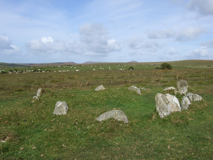
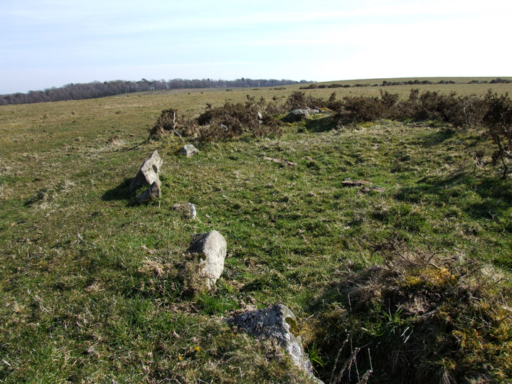
Just above the settlement in a field to the north are three cairns marked on the OS map. They have been robbed out and now lie very low to the ground.
Their position on the hilltop would suggest that in the past they would have been prominent from some distance, alas now they are hard to see even from close by.
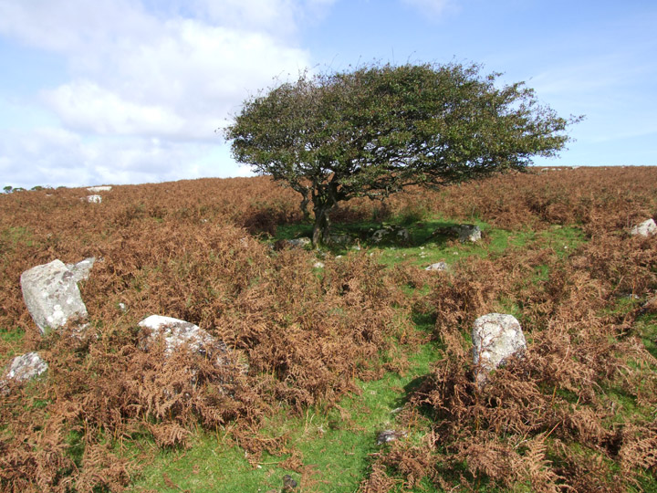
A forth cairn sits just downslope to the west. At least i think it is a cairn...either that or a very small stone circle!
The question I ask myself is How come the other cairns are so ruined but this one survives?
|
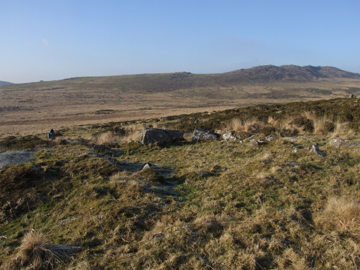
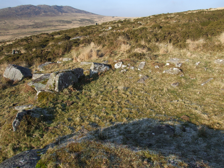
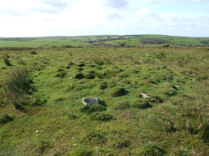
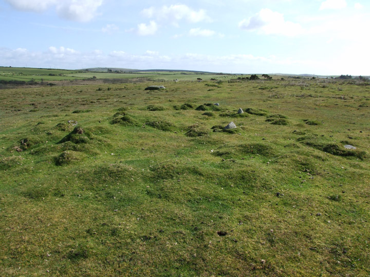
Approached from Temple Bridge, just south of the A30, this complex of 94 huts and enclosures is possibly best visited in the spring, before the bracken covers it. I found it quite hard to make out things in amongst the autumnal undergrowth. There are loads of upright stones..presumably all doorways..you get to the point where you have seen half a dozen why go looking for more.
Don't think many people get out on this bit of the moor...
|
 
|
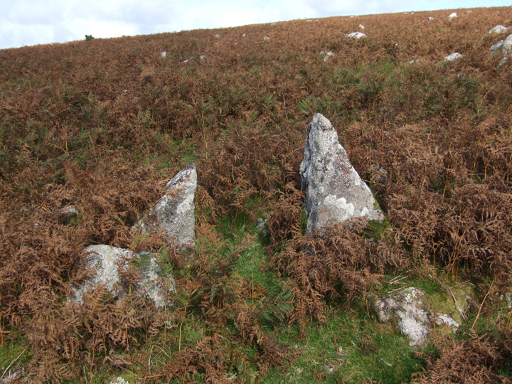
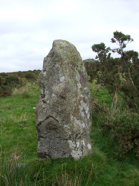
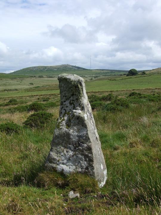
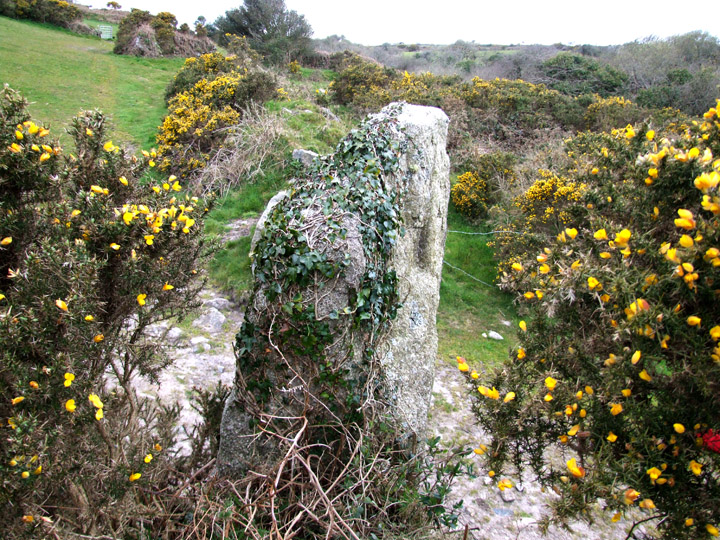
Well I don't know about a mischievous pixie...but this stone enjoys playing hide and seek. Standing on the tor above there are a couple of other 'standing' stones that could easily fool you. This one is nearly hidden behind a large gorse bush...it can just be seen to the right.
Enjoy the hunt!
|
 
|
Found this whilst trying to get to Goodaver Stone Circle..see fieldnotes...it sits on the summit of a hill known as Smiths Moor (Smiths farm was once just to the east). Because of the long grass it was not easy to see but there was a large round raised platform about 30ft across that would have been visable from a good distance before the conifer plantations were planted and the area abandoned by grazing animals. It is alo on the high point of the ridge running south to Goodaver.
Can find no archaeological records for it.
|

|
    
|
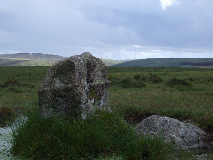
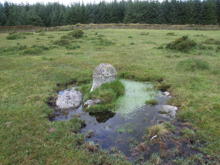
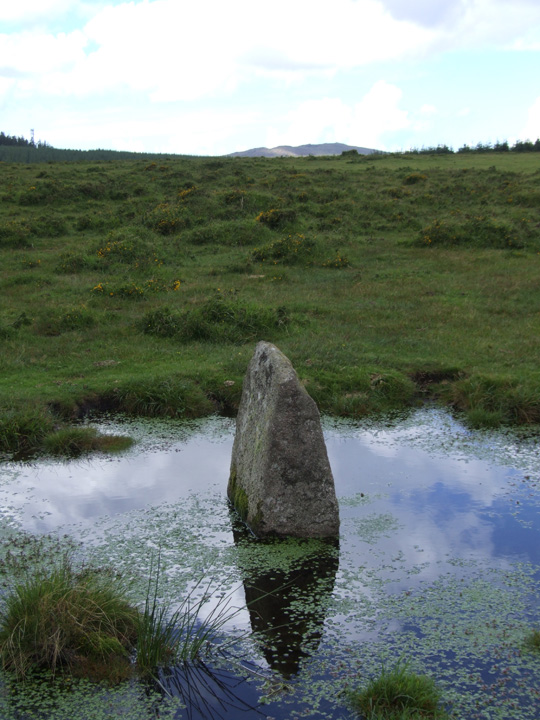
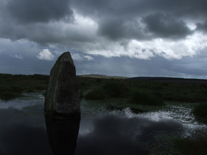
This featureless bit of moorland has not seen much archaeological research carried out according to the latest Bodmin Moor book published by English Heritage. Which is why i thought I would take a look...
To be honest there ain't much to look at, I approached via the large conifer plantations that sit just south of the A30 east of Jamaica Inn. You could come via the Nine Stones but its a long walk across some pretty soggy ground.
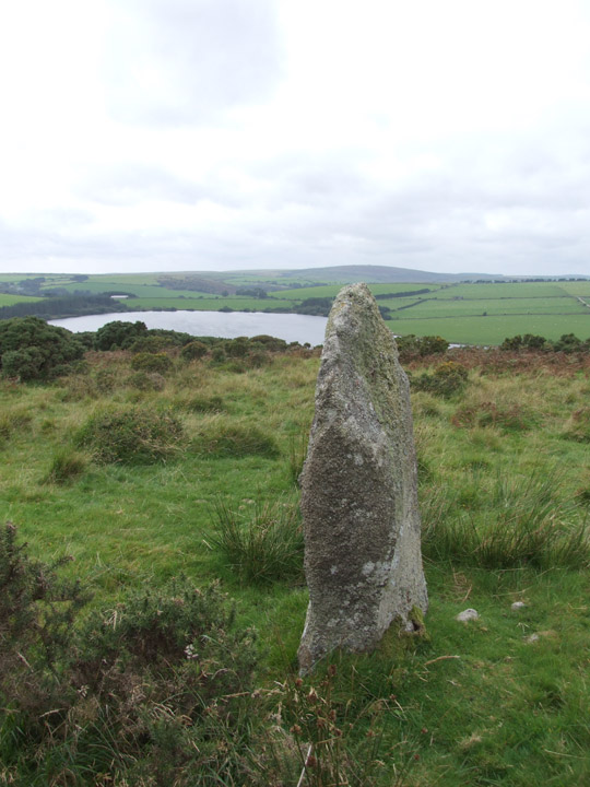
Anyway i didn't expect to find much but did spot these two upright stones, both surrounded by water. One is roughly at SX214777, the other at SX217771. They stand no more than 3 ft tall but like the East Moor menhir posted by Martin Bull do look the part.
Perhaps one day someone in the know will get up there and have a look?
|
Spent all afternoon yesterday trying to get to this circle via open access land...without success. Barbed wire, conifer plantations and knee high grass and gorse plus quite a lot of marshland were all put in my way.
Phil's suggestion back in 2001 may still be possible but you would need to ask permission at the farm.
|
Cist uncovered at North Cornwall beauty spot
Heard about this on local radio...not sure how accessible it is to the general public.
http://www.bbc.co.uk/cornwall/content/articles/2008/08/07/marinewatch_hs_coastalerosion_feature.shtml
and this from the Western Morning News 16/08/2008
A WALKER strolling along a beach made an amazing find when he stumbled across the remains of a Bronze Age tribal chieftain protruding from the ground.
The discovery of the middle-aged man's skeleton and cisk – or burial casket – was made by amateur archaeologist Trevor Renals on Constantine Island, on the North Cornwall coast.
He noticed that fragments of what appeared to be human bone had become exposed owing to coastal erosion.
Experts were so excited by the find that they performed an emergency week-long excavation of the site to extract it in a race against coastal erosion and storms.
The Middle Bronze Age find is thought to be of an important man, possibly a chieftain, and is very unusual because cremation, not burial, was popular in the period and other skeletons are not normally found so well-preserved.
Click here!
Mr Renals said: "I was walking along the coast – it is a particularly rich area for remains – and I was actually looking for flint and there was one area that was particularly eroded from pedestrian access.
"While searching one particular area I found a front tooth and another piece of bone and I looked to see where it had come from.
"I could see from the bit of flint sticking out of the ground that it was actually a stone-lined cisk.
"When I realised it was actually a burial I got in contact with the county archaeologist."
Mr Renals said he also identified the base of the spine, pelvis and femur.
In a race against time and the elements experts from Cornwall County Council Historic Environments Service and the National Trust began an excavation of the site after it was discovered.
The trust, which owns the land where the skeleton was found, said Constantine Island was once part of the mainland.
A spokesman said: "It is rare because it is a skeleton – they were cremated or the bones didn't survive.
"As soon as we found out we had to make arrangements for it to be excavated because of the danger of it going into the sea. We knew that storms were coming and we had to get it removed."
It is believed that the man was from the Middle Bronze Age of about 1380-1100BC and may have been an important member of his community.
The spokesman said: "We think he was probably a middle-aged male.
"We don't know how tall he would have been because the long bones were fragmented. We know he had quite small teeth for a man.
"Little is known about the man but he may have been of importance to the small community that he would have come from as it appears that special care was taken over his burial.
"To build a cisk and cover him with stones and possibly, turf on top wouldn't have been done with everyone."
The cisk and remains are with Cornwall County Council's historic environments service.
Mr Renals, 42, an ecologist working for the Environment Agency, said he was excited to identify the site and said that walkers on the coastal path had not noticed it – despite sitting on and walking over the ancient casket.
"The cisk was right on a quite popular path and people had been sitting on it and walking over it and not realised they were inches away from an ancient skeleton," he said.
"I feel very privileged, more than anything. I didn't just treat it like animal remains. I was very cautious to show him respect."
Mr Renals, from Wadebridge, North Cornwall, said the man had been buried in a crouching position typical of pagan rituals.
"It's clearly a pagan burial because it is a north-south alignment which is a pagan alignment
"And the body is looking out west towards the sea."
Mr Renals added that the site had been excavated just in time as in winter storms would lash the tidal Constantine Island, destroying the site.
|
 
|
   
|
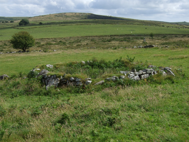
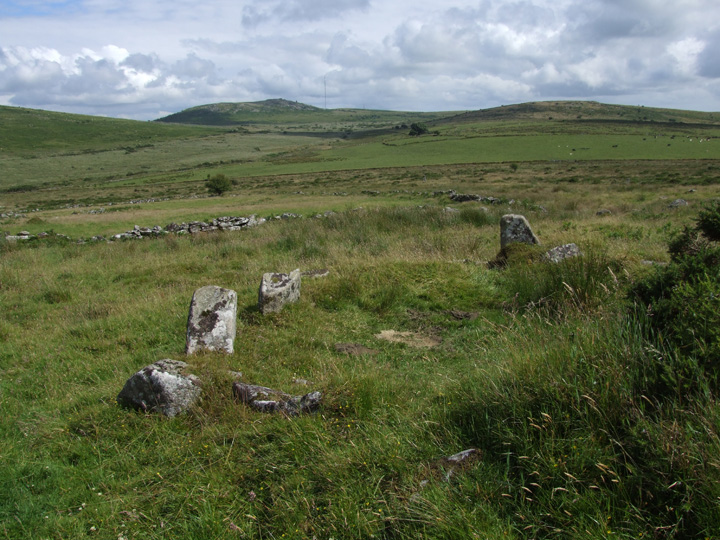
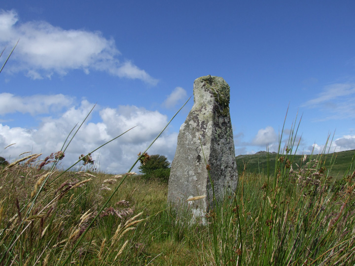
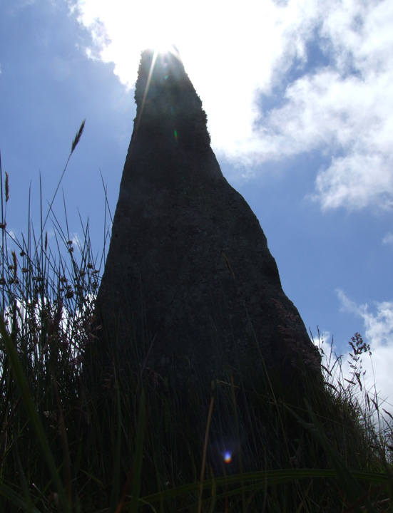
After many years of thinking about it I finally got out to this stone this week. It takes a bit of doing and there are plenty of interesting diversions along the way. I parked at the Hurlers and took the track north that leads out to Golddiggings Quarry (passing Craddock circle). Once at the Quarry I dropped down to a lower level and followed a very rough track along the side of the Witheybrook marsh. This brings you to a gate which allows the only access into a section of open access land that is well fenced off with horizontal barbed wire all along its boundary.
Keeping low you have to follow the edge of the marsh, avoiding the wet bits, to reach the area known as Newell Tor. (this does include going through small areas that are not open access, so you do it off your own backs and don't quote me if you get approached by landowners telling you to bugger off!)
The stone sits at the west end of the enclosed fields that make up the mediaeval settlement area on the slope of Newell Tor, it stands proud and is easily seen from below. On the hillside behind it are several hut circles including one circular enclosure inside the field to the right. I was unsure if this was an 'antiquity', it is undoubtedly old but there was no sign of a doorway...
I did not venture far up the hillside and I am sure there is more to explore. As far as I know a detailed survey of the area has not been undertaken and so there could be other sites lurking.
Despite the fact that the hill is within site of the Cheesewring it is a difficult place to get to. I would not recommend it to the casual visitor but I will endeavour to get out there again and explore further.
|
|
Leaze remains off limits to the casual visitor to the moor. I have found an easy way in but with the fields full of lambs at the moment I was not going to trespass. At least now I have a decent lens I can get a photo of the circle from both the east and west.
|
 
|
Dozmare Pool is, next to Loe Pool, the largest
sheet of sweet water in Cornwall. It abounds in
fish, and was formerly a great resort of the worker
in flint, as innumerable traces of the industry testify.
Arrow- and spear-heads, scrapers, and an almost
unlimited amount of chips and flakes may be found
near it. In the lake is a cranogue, or subaqueous
cairn, on which was formerly a palafite dwelling.
The bottom of the pool is certain to richly repay
exploration.
(S Baring Gould, Book of Cornwall 1899)
|
|
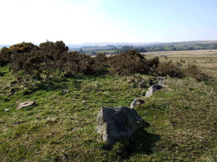
This robbed out cairn is about five mins walk south of the Soussons circle and is just off the Two Moors way. A nice low ring of stones encircle the messy centre which is over grown with gorse. There is quite a lot of quartz scattered around the cairn...perhaps it was originally topped with a shining white layer?
|
  
|
|
The strange name of Ephraim's Pinch is attached to a spot a little south east of the circle and is the result of a wager many years ago when a man named Ephraim bet that he could carry a sack of corn from Widecombe to Postbridge without putting it down en route, a distance of some 5 miles. It was at the nearby bend in the road that he finally felt the 'pinch' of his heavy load on his back and had to drop the sack.
|
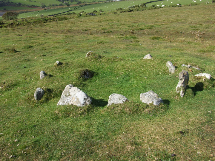
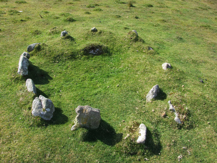
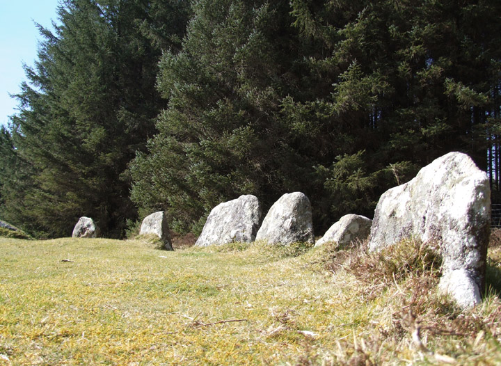
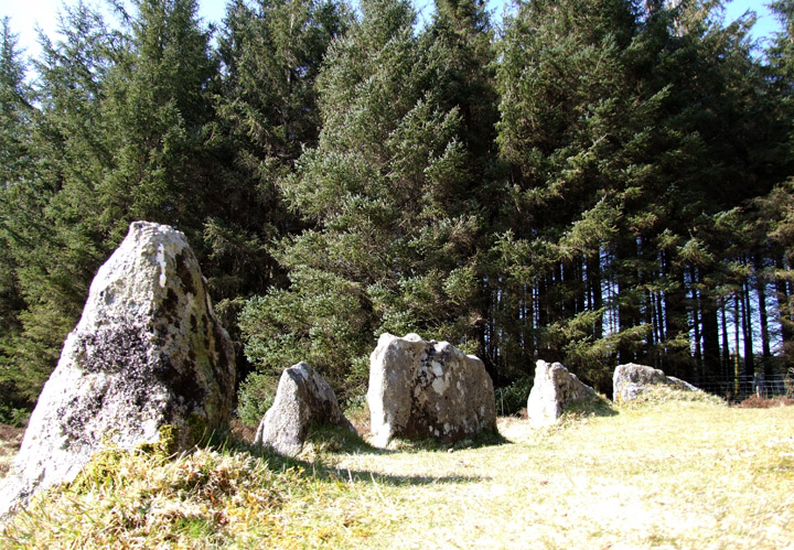
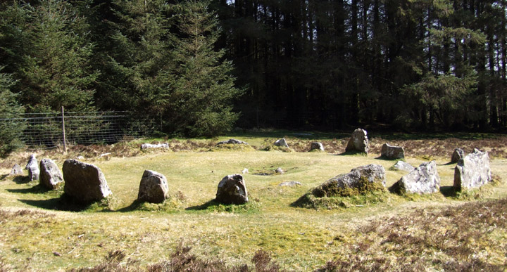
A nice little sanitised 'circle', easily accessible from the main Mortonhampsted to Twobridges rd.
The other name I have for it is Runnage Circle. The central kist was badly damaged by campers lighting a fire within it in 1993 and has since been in filled with turf to prevent any similar incidents.
|
  
|
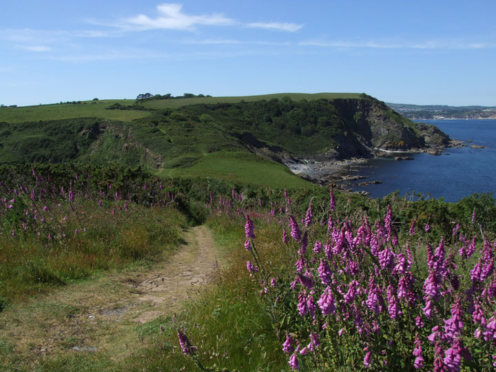
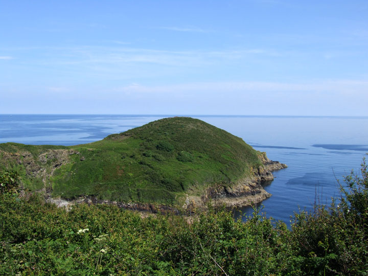
Black Head juts out into St Austell bay on its west side. Very little remains of any antiquity except two high banks and one deep ditch on the east side of the istmus.
The headland can be reached via the SWCP from a car park at Trenarren, but it is still at least half a mile away...great views on a good day!
|
|