The Modern Antiquarian. Stone Circles, Ancient Sites, Neolithic Monuments, Ancient Monuments, Prehistoric Sites, Megalithic MysteriesThe Modern Antiquarian

Get the TMA Images feed
jimit's Latest Posts

Latest Posts
Previous 50 | Showing 101-150 of 506 posts. Most recent first | Next 50

Stonehenge Palisade (Ancient Village / Settlement / Misc. Earthwork) — Images (click to view fullsize)

<b>Stonehenge Palisade</b>Posted by jimit<b>Stonehenge Palisade</b>Posted by jimit<b>Stonehenge Palisade</b>Posted by jimit

The Stonehenge Cursus — Images

<b>The Stonehenge Cursus</b>Posted by jimit<b>The Stonehenge Cursus</b>Posted by jimit<b>The Stonehenge Cursus</b>Posted by jimit

Gate Ditch (Ancient Village / Settlement / Misc. Earthwork) — Fieldnotes

Atkinson found this enigmatic feature in the 1950s.
It seems to lead NNE from the first elbow in the Avenue. Any more information will be welcome. It will be invisible after the excavation.

Gate Ditch (Ancient Village / Settlement / Misc. Earthwork) — Images

<b>Gate Ditch</b>Posted by jimit<b>Gate Ditch</b>Posted by jimit

Cursus Longbarrow (Long Barrow) — Images

<b>Cursus Longbarrow</b>Posted by jimit<b>Cursus Longbarrow</b>Posted by jimit<b>Cursus Longbarrow</b>Posted by jimit<b>Cursus Longbarrow</b>Posted by jimit<b>Cursus Longbarrow</b>Posted by jimit<b>Cursus Longbarrow</b>Posted by jimit

Winterbourne Stoke Group (Round Barrow(s)) — Images

<b>Winterbourne Stoke Group</b>Posted by jimit<b>Winterbourne Stoke Group</b>Posted by jimit<b>Winterbourne Stoke Group</b>Posted by jimit

The Avenue (Ancient Trackway) — Images

<b>The Avenue</b>Posted by jimit<b>The Avenue</b>Posted by jimit<b>The Avenue</b>Posted by jimit<b>The Avenue</b>Posted by jimit

Stonehenge Palisade (Ancient Village / Settlement / Misc. Earthwork) — Fieldnotes

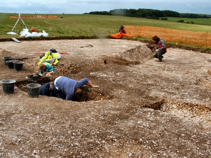
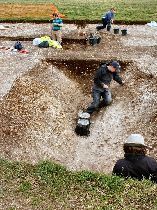
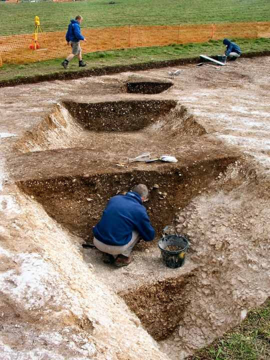
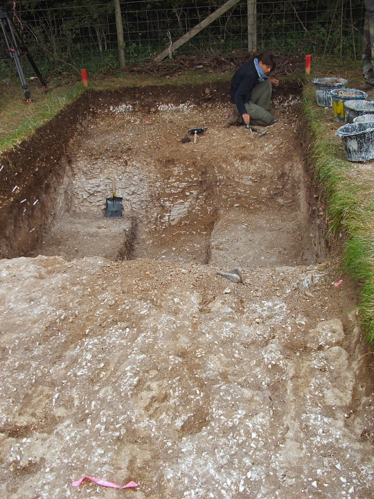
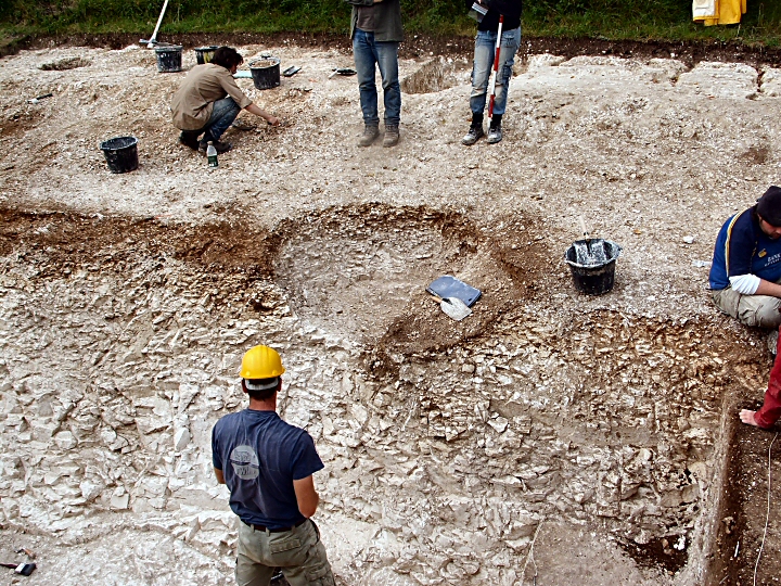
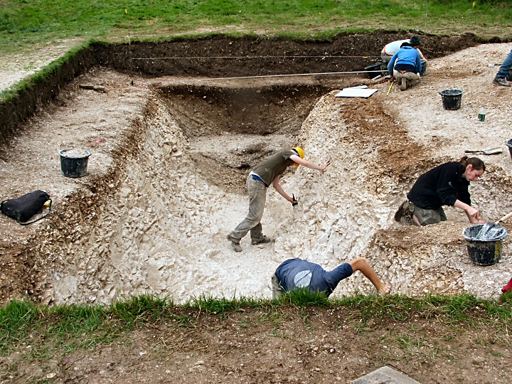
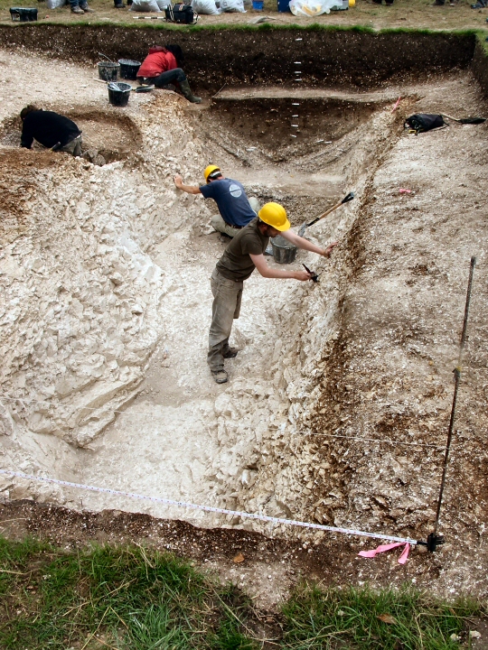
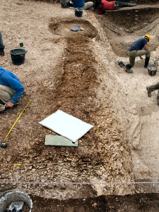
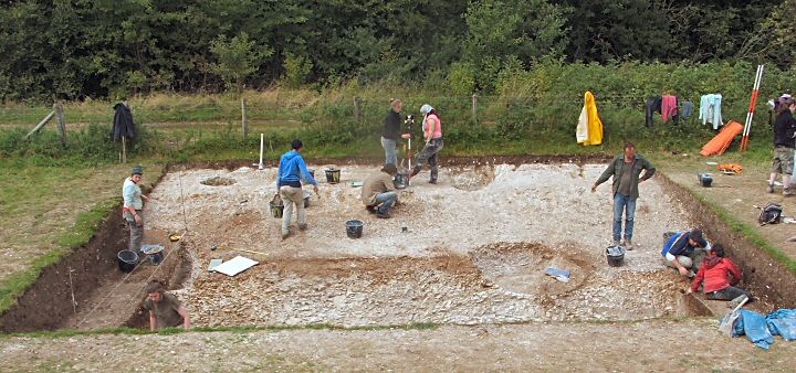
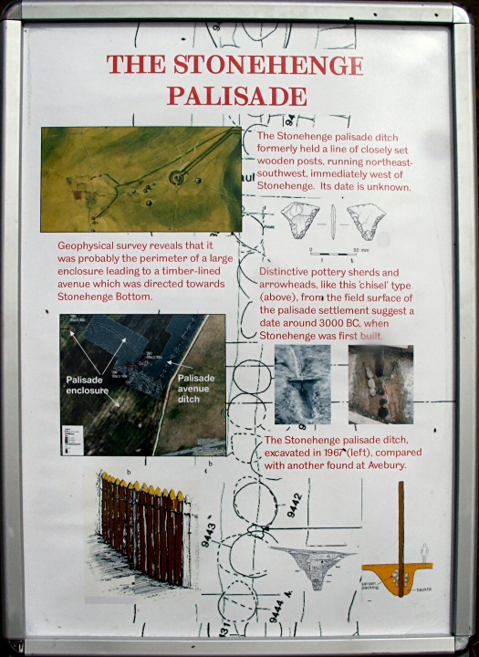
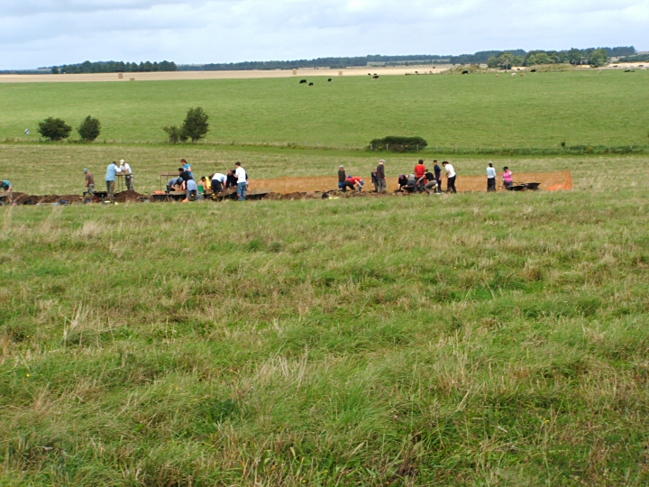
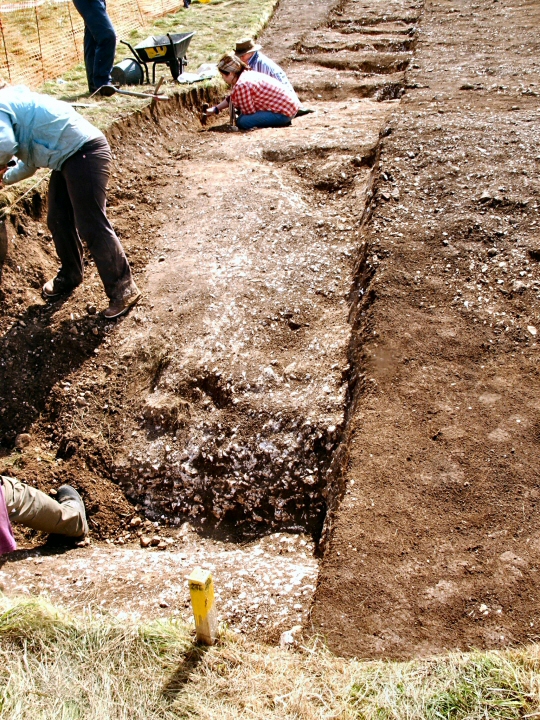
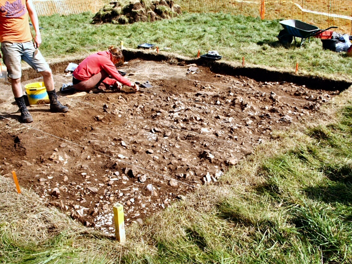
Aerial photography and geophiz found a line of postholes and it was suspected there was a large enclosure here with a timber lined avenue leading to Stonehenge Bottom. Field walking found pottery and tools and the present excavations (Stonehenge Riverside Aug 08) are designed to discover if there was a settlement here about 3000BCE.
Jim.

Stonehenge Palisade (Ancient Village / Settlement / Misc. Earthwork) — Images

<b>Stonehenge Palisade</b>Posted by jimit<b>Stonehenge Palisade</b>Posted by jimit

The Avenue (Ancient Trackway) — Images

<b>The Avenue</b>Posted by jimit<b>The Avenue</b>Posted by jimit<b>The Avenue</b>Posted by jimit

Ladle Hill (Hillfort) — Images

<b>Ladle Hill</b>Posted by jimit<b>Ladle Hill</b>Posted by jimit<b>Ladle Hill</b>Posted by jimit<b>Ladle Hill</b>Posted by jimit<b>Ladle Hill</b>Posted by jimit<b>Ladle Hill</b>Posted by jimit

Ladle Hill (Hillfort) — Fieldnotes

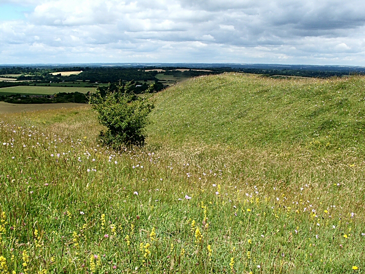
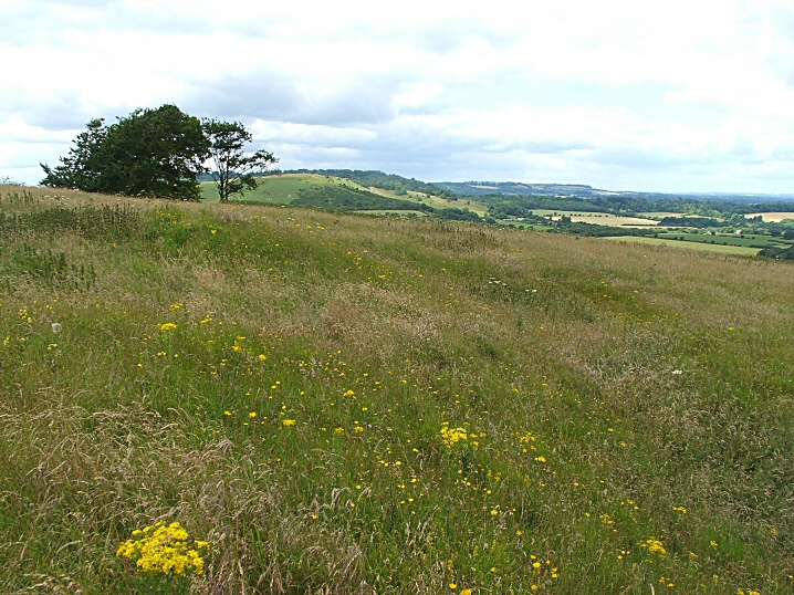
What a surprise and delight and what a curious site.
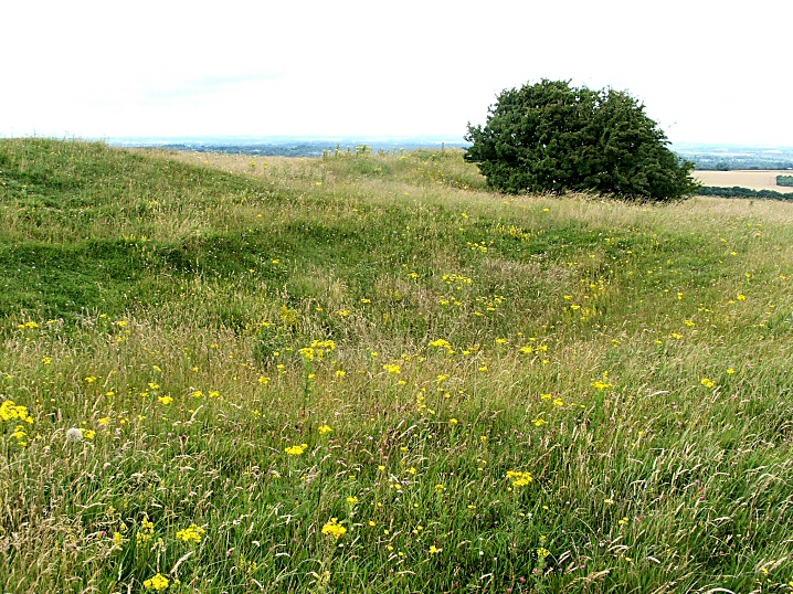
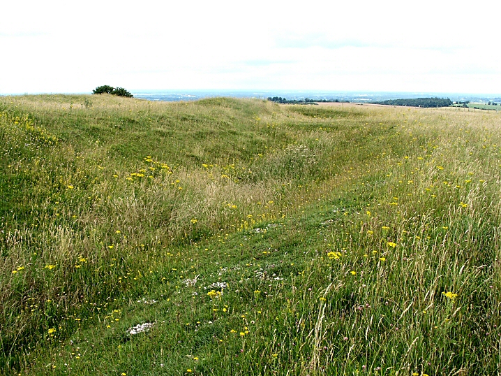
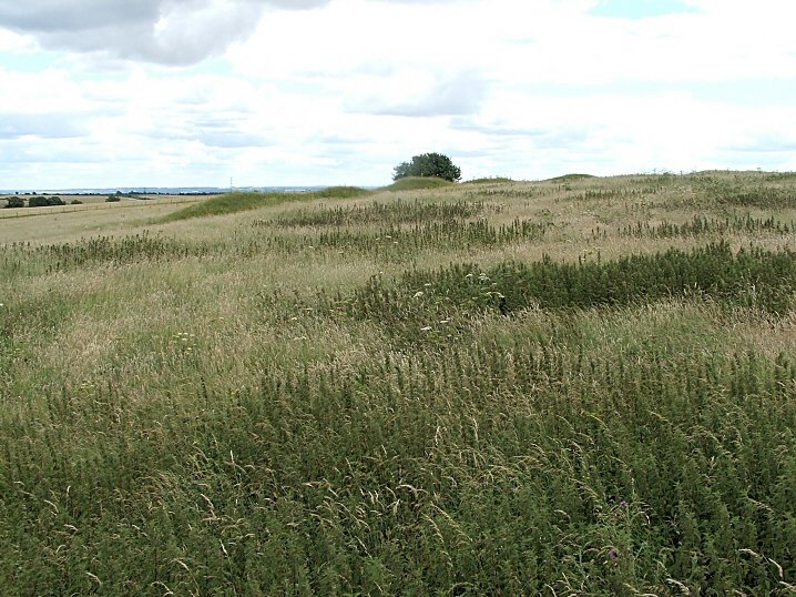
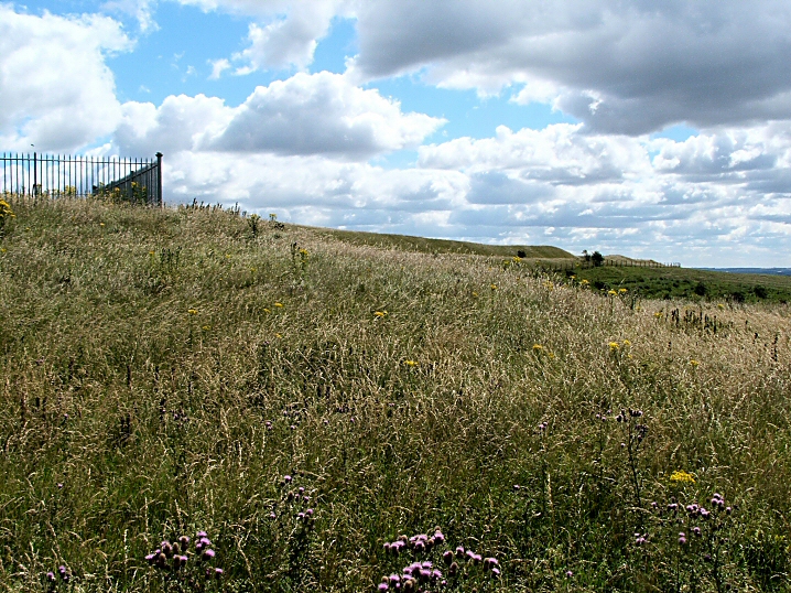
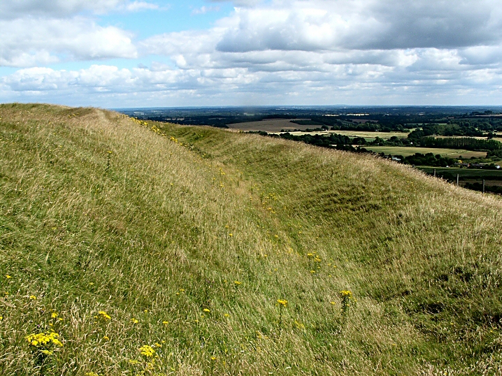
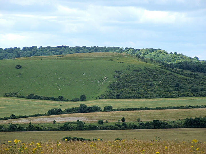
As noted in the fieldnotes elsewhere, this fort/settlement/refuge was never finished. This is plainly obvious when walking around it. In some places the ditch and bank are nicely finished and contoured, then there is a break, a sort of causeway, and the next bit is quite different: a shallower ditch, a less "finished" profile and dumps of earth on top which have had no attempt to make them into a profiled bank.
It looks just like a building site when everybody has just knocked off for tea! There is the strong feeling that if you were to wait a bit they'll be back.

Archaeologists have suggested that each section might have been constructed by a different family. What a source of competition/arguments/backbiting that arrangement could have been!

Anyway it was abandoned when almost finished. Why? Did Big Brother (Sister?) across the valley, Beacon Hill, tell them to stop/join forces/out perform them/enslave them?

Internal and other external features are difficult to see as waist high grass and nettles obscure them.
A winter visit might be in order.

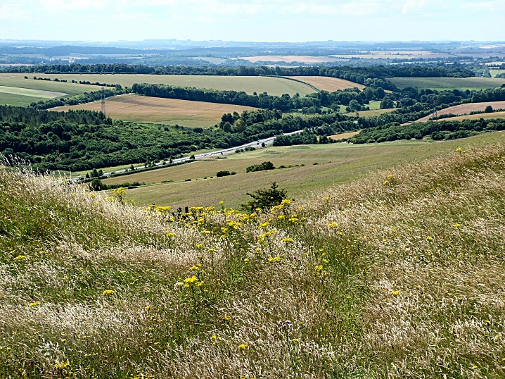
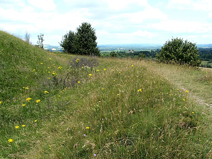
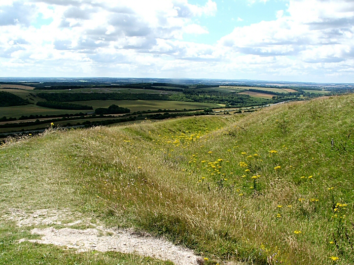
The site is not visited much and there are no worn paths anywhere. Skylarks and buzzards while I was there and it is much quieter than Beacon Hill with very little noise from the A34. Although not as high it probably has better views and is much easier to get to the top.

A site for the imagination.

Access
Take signposts off A34 to Old Burghclere, go through village and at T junction to the left (N) park on verge on right. (2/3 cars?) Take bridleway (S), level if muddy path along valley floor, with diversions. Gentle slope right to the top. At iron gate take sharp dog-leg to the left, follow field boundary to 5-bar gate. (Private land?)

Beacon Hill (Hillfort) — Images

<b>Beacon Hill</b>Posted by jimit<b>Beacon Hill</b>Posted by jimit<b>Beacon Hill</b>Posted by jimit<b>Beacon Hill</b>Posted by jimit<b>Beacon Hill</b>Posted by jimit<b>Beacon Hill</b>Posted by jimit<b>Beacon Hill</b>Posted by jimit<b>Beacon Hill</b>Posted by jimit<b>Beacon Hill</b>Posted by jimit

Beacon Hill (Hillfort) — Fieldnotes

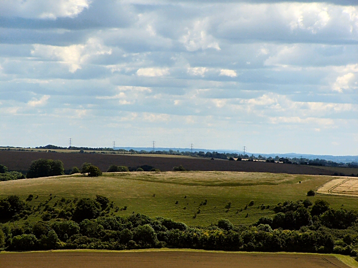
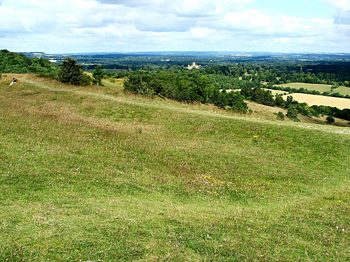
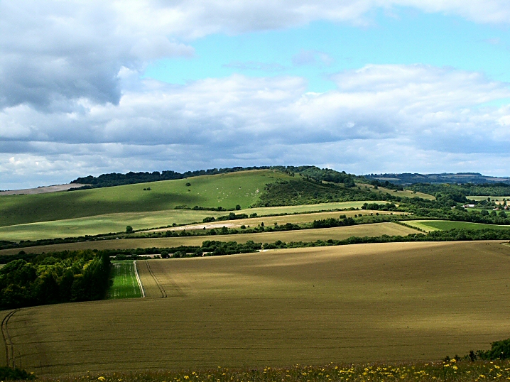
This site is familiar to anyone traveling between Southampton and Oxford on the A34,
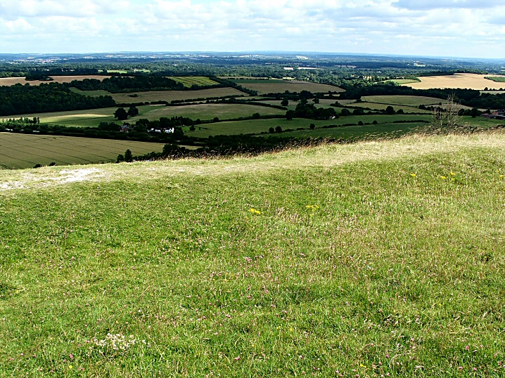
A great rounded hill on the W of the gap in the N Hants Downs.
The "fort" is not that obvious from below but after a very stiff climb (with many pauses for breath) the banks and ditches are revealed. They are all very well preserved and of impressive dimensions and some views reminded me of Maiden Castle although smaller. It's a rather peculiar shape being like an hour glass with the top chopped off, a result of following the contours I suspect.
In the NW corner (not SW as MAGIC has it) is the tomb of the 5th Earl of Carnarvon, the sponsor and co-discoverer with Howard Carter of Tutankhamen.
Extensive views except to the NW with Ladle Hill to the E and plenty of chalk flora and fauna.
The only downside is that the roar of traffic from the A34 below is difficult to avoid. Otherwise a very worthwhile site to visit.

Access
Small car park at base signposted from A34.
Very steep climb to top with many steps.

West Kennett Avenue (Multiple Stone Rows / Avenue) — Images

<b>West Kennett Avenue</b>Posted by jimit

Avebury (Circle henge) — Images

<b>Avebury</b>Posted by jimit<b>Avebury</b>Posted by jimit<b>Avebury</b>Posted by jimit

Stonehenge (Circle henge) — News

Solving Stonehenge


A new book on the geometry of Stonehenge and the author seems to have simplified the setting out of the stones, Aubrey Holes etc using techniques available at the time.
Experimental archaeology was used at a site in Oxfordshire to check out the feasibility of the theories.
It seems to be a well researched and sober account.

http://www.timesonline.co.uk/tol/life_and_style/court_and_social/article4003818.ece

http://www.independent.co.uk/news/uk/this-britain/stonehenge-builders-had-geometry-skills-to-rival-pythagoras-834313.html

Jim.

P.S. I have to declare an interest. A picture I took at the Winter Solstice appears on the front cover and on page 258.

http://www.themodernantiquarian.com/post/42545/images/stonehenge.html
Previous 50 | Showing 101-150 of 506 posts. Most recent first | Next 50
The pic should be interpreted correctly!!! It's a game played in our local to show how experienced cavers, myself included, can crawl through tight spaces. As the pub has a distinct lack of thick limestone in it, bar stools have to do. Honest.....
TMA re-kindled my interest in ancient history when I got my first PC and went on line early in 2002.
Other interests; architecture, natural history ( I'm a Landscape Gardener), parachuting (I used to be an instructor), and chatting in pubs.

My TMA Content: