

Standing stones both guarding the individual cairns and forming a row across the burial site, the theme of sails and ships and the concept of a journey very strong here

Huge site including stone circles, standing stones, cairns, stone ships, stone rows and believed to have been in near constant use through Neolithic to modern (0-500AD).

The fallen stones behind the row seem to indicate that these stones were part of some structure rather than a row, however, too many stones missing to make any guesses

Described as standing stones, however, looks more like the walls of a dismantled dolmen which in turn would be out of character with other monuments on the island so have to label it as unknown for now


May look like a picture of a windmill, however, would like you to look at its base which is in fact an iron age circular grave, they simply built the windmill on top of it to catch the wind (as Donovan would say)

Although collapsed there appeared to be two chambers within the cairn and a beautiful stone standing guard

Strandtorp is another multi site location including standing stones, stone circle and cairns scattered over a low hill and looking out to sea.

This stone ship sits alongside the road as do many of the monuments to be found on Orland perhaps older trackways now main roads

The stones used to create the cairn are of an unusually large size. Although they look grey on the photo they were a beautiful dark blue, almost black when viewed

Nestled in a clearing on the outskirts of Borgholm this huge cairn was ‘glowing’ blue in the sunlight

Described as ‘Tortoise on the march’ it is an interesting place to spend time.

Spread over a large area these mini dolmens are believed to be iron age through modern

The stone ship signifying the onward journey of life through death, a common feature of the sites on Orland

Believed to be early Viking this complex of graves, cairns, stone circles and standing stones is suitably located on the shore looking out to sea
Difficult to date these stone circles (ships) as the tradition continued through to more modern tomes (0 to 500 AD)


Even in the height of the July tourist season you get this wonderful site all to yourself

4 chamber dolmen, outer kerbstones can still be traced. Nice woodland setting (now), a retreat from the crowds at Carnac

Interesting menhir from one angle looks like a whale leaping out the water. More importantly points the way to the dolmen hidden in the gorse behind. Rich farmland, surprised it has managed to survive so long

Slowly losing this one to the gorse and bracken, however, worth the scratches with a clear view over to the Tumulus St Michel. Shorts and t shirt great for heatwave not so good for visiting this wonderful dolmen.

Dramatic and mysterious, however, is it real or a figment of someone’s imagination. What form of construction would require the stones to be placed like this, who decided where the stones originally lay? Guess pretty superfluous after 5000 years, just enjoy

Decided to walk in from the North West starting at Penrhyndeudraeth rather than the usual way in from the South. 1300 feet of climb made for fabulous walk as well as visiting the cairn

No photography allowed inside to protect the beautiful and intricate carvings along the passageway, the inner chamber, the floor and the ceilings

Only 20 people allowed on the island at any one time (19 too many, being rather selfish)

First glimpse of the cairn as you approach from the sea (short 15min boat ride)

A lot of the internal carvings are believed to have been added at a much later date possibly around 2k years ago


There are 2 remaining chambers, one accessed from within the concrete bunker itself and this one with an external entrance and some rather interesting stones discovered during reconstruction

The Germans built a concrete bunker right in the centre of the cairn completely destroying 1 of the 3 passages and chambers within the cairn. You can see the concrete on the upper right and the blocked off passage also on the right

The site majors on school education with trail boards, summer workshops and village life reconstruction and as such loses a lot of its excitement and mystery.

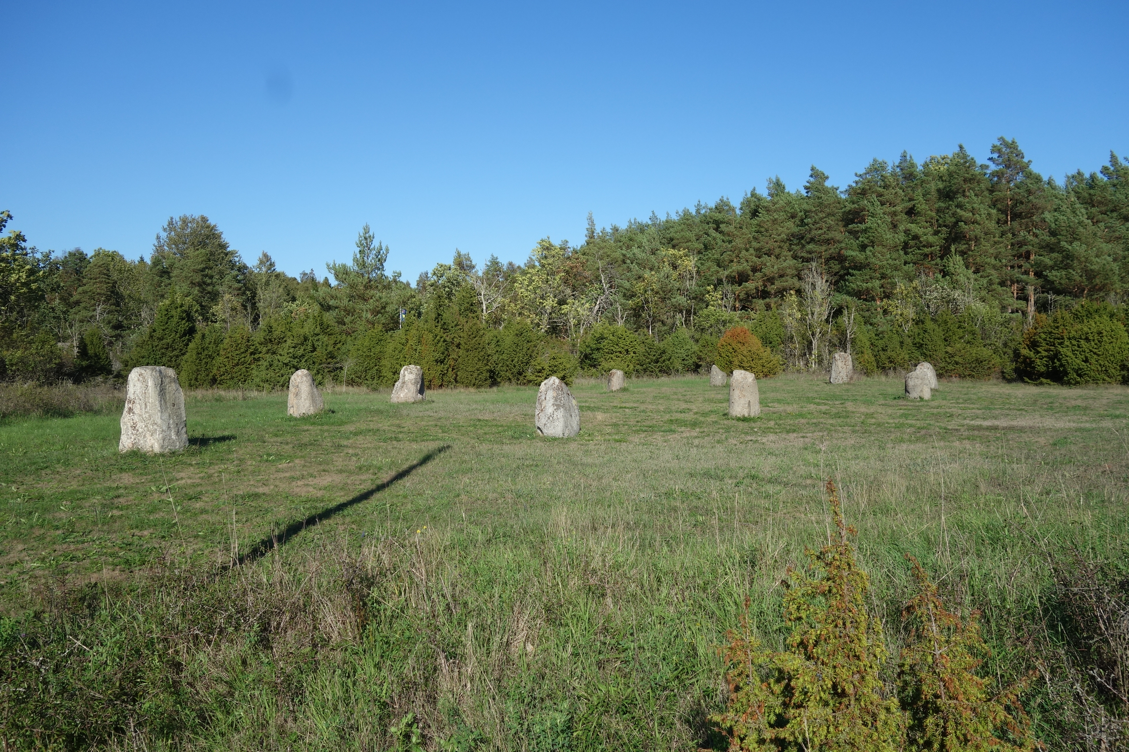
Passed this site a number of times on my way down to the coast, finally stopped and was slightly taken aback by the scale of both the site and the stones within it

So many stones on this site, in what at times appears to be randomly placed, that often difficult to understand if you are within a circle or intersecting stone alignments. Certainly spend a lot of time here pondering what the site may have originally looked like

Simple pleasures of life, its not raining, I have boots on instead of wellies, all is well in the world

Quite ruined, however, still very interesting site not least because of its location at the base of Dunnideer Hill
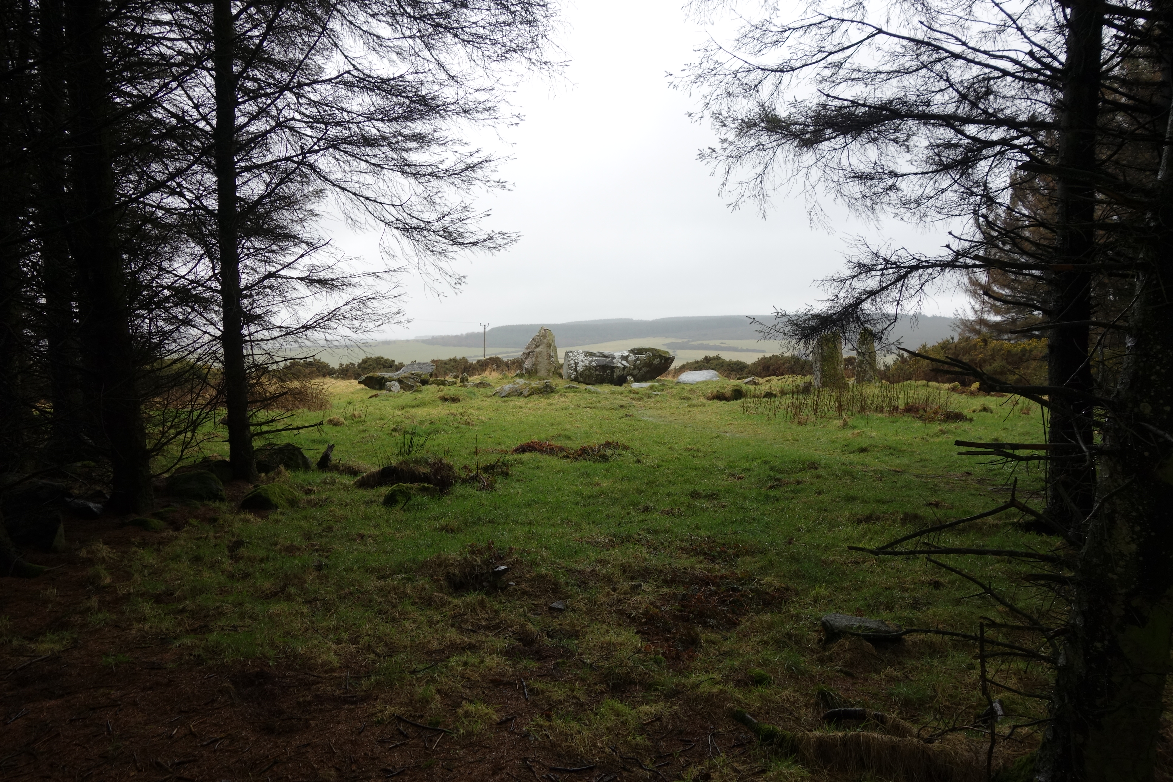
Not going to mention the weather again just to say I was so pleased this site is bordered by close set woodland, very pleasant place to sit and watch from waiting for a break in the rain


