


Not really much to see at this barrow – a slight hump in the field is all that left.


This picture from around 1890 appears in C. Phillips study of Lincolnshire published in 1932


Picture taken from slightly below the level of the cave to get the whole of the fissure in shot.
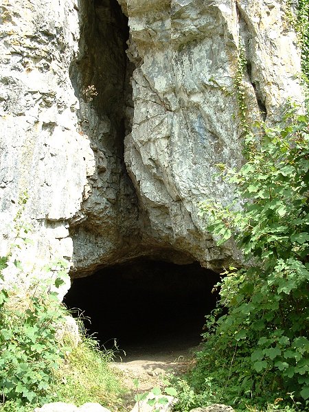

Entrance to the cave. From memory I think it extends about 20 feet back into the darkness.


The barrow seen from a lower level as the land falls away slightly.

The barrow seen from roughly the same level. The top looks to have been slightly flattened.


The three banks, the inner in on the bottom right of the picture. Looking West.

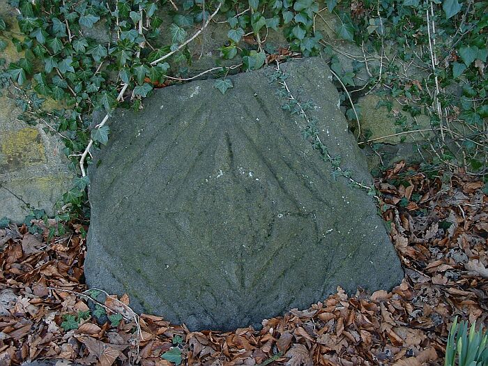
Could be nothing, but . . . on the east side of the monolith and at about shoulder/head height is this small groove (I’m guessing about 6-8 inches long). It could be natural but the fault lines on the stone run from top left to bottom right on this side and this mark is vertical and looks quite different. Was it caused by the tip of a stone axe?

The large boulder with possible cup marks. The flat ‘front’ faces into the circle.


The south and west ditch and bank. Grassington village is to the top right of the picture.

Part of what could have been a double ring on the northwest of the circle.


The largest stone in the ring also seems to the be one nearest the river – was this placement significant?


Taken from the opposite direction to Stubob’s photo, showing the gutter that follows the edge of the stone and the raised ‘boss’ at top of picture.


