The northmost barrow
The northmost barrow
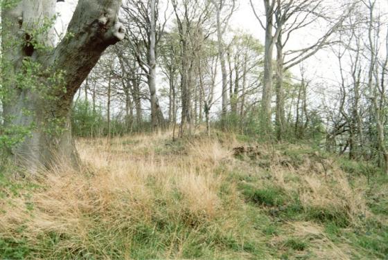
The grid reference given for this site is the northmost and most prominent of the 2 round barrows, which isn’t marked on the OS map. The barrow to the south at TF215845, which is marked on the map, is just about lost on the edge of a small copse and likely to vanish even more as the tree cover increases.
The northern barrow stands in isolation in a field and has three large trees growing from the mound which measures about 14 metres in diameter and just over a metre tall. The southern barrow is larger at around 22 metres in diameter but is lower at under a metre in height. Both of these monuments are less than a hundred metres from the prehistoric trackway now know as High Street and less than half a mile south from Burgh on Bain long barrow. At this point on the trackway the land slopes down on either side – to a tributary of the River Witham on the west and to the River Bain on the east.