According to the East Lothian Courier, the grassland on top of Traprain Law was ablaze last weekend. The fire was believed to have been started by a dropped cigarette end. Archaeologists are apparently currently excavating the site, and were this week trying to decide how much damage had been caused to the hill fort. One hopes that the fire and the presence of archaeologists who smoke are unconnected.

Rhiannon
Fitzcoraldo’s account mentions the classic motif that once the man had crossed ‘the first beck’ and put moving water between himself and the hobs, he was safe. Grinsell notes a version of the story, which was told to Raymond Hayes by a local in 1938. The important point here is that the beck was specifically named as the Gypsey Race. Rather grossly, when the man got there the fairies were just catching up with him, and they cut off the back half of the horse, which hadn’t quite crossed the stream. He escaped clinging to the forequarters, which managed to struggle ashore!
The Gypsey Race is right by Willy Howe, so our hero didn’t have far to go, luckily!
I hope Fitzcoraldo won’t mind me reiterating the folklore he’s recorded, because I was fascinated with the extra bit I found out. Apparently the story originally comes from something written by William Newburgh – and considering he died in 1198, that’s proof that the story is pretty old. Often tales were only written down in the Victorian era, and then you can say they’re only Victorian romanticism – but this time it suggests that stories with the same themes and motifs go back a long way. It’s interesting that the Gypsey Race should get first billing. The ‘unknown material’ of the goblet is also interesting and even reminds me of modern tales of alien abduction rather than fairy abduction.
The famous antiquarian John Aubrey (1626-97) began his interest in prehistoric monuments when he was inspired by unexpectedly seeing Avebury while out hunting in 1648.
“I was wonderfully surprised at these vast stones, of which I had never heard before, as also the mighty bank and graff about it.. I left my company a while, entertaining myself with a more delightful indagation.”
(taken from R Whitlock’s 1976 ‘The folklore of Wiltshire’)
This stone was thrown by the giant of Papa Stour at the giant of Mavis Grind. It weighs about 20 tons.
(from Grinsell’s folklore of prehistoric sites)
Sir Walter Scott visited the stone in 1814. He mentions it in chapter 19 of The Pirate:
“The lonely shepherd avoids the place, for at sunrise, high noon, or sunset, the misshapen form of the necromantic owner may sometimes wtill be seen sitting by the Dwarfie Stone.”
Later in the book he describes the ‘witch’ Norna’s visits to it to communicate with the troll who lives there.
In the 17th century at least, it was considered to be the home of a giant and his wife, with the stone inside their bed, and a hollowed area in it showing where the pregnant wife slept. Though judging by the size of it, a ‘dwarfie’ would fit better than a giant!
A late 16th century tradition suggested that the hole in the roof was gnawed by a giant who was trapped inside, after another giant blocked the entrance with a stone.
(info from Grinsell’s folklore of prehistoric sites)
An echo is called, in Icelandic, ‘dverg-mal’ or dwarf-talk, and there is said to be a fine echo from under the Dwarfie Hamars. Then there is Trowie (Troll’s) Glen to the westward of the stone. A troll or trow in old Icelandic lore is a huge creature or giant, mostly in an evil sense. Mr Heddle states that Trowie Glen is still considered an uncanny spot, and that people will go a mile or two out of their way rather than pass it after dark. In Jamieson’s Scottish Dictionary, under Hill-Trows, it is stated that the superstitious in some places endeavour to bribe the trows by leaving an offering of food for them every night, being persuaded that otherwise they would destroy the family before morning. Probably this accounts for the offerings mentioned by Dr. Clouston as being left in the Dwarfie Stone.
From Alfred W Johnston’s ‘The ‘Dwarfie Stone’ of Hoy, Orkney’ in the Reliquary for April 1896.
And speaking of echoes, the ones in the tomb itself don’t sound much better: check out the tale at the bottom of this Everything2 page
everything2.com/index.pl?node_id=1524143&lastnode_id=1372629
More folklore connected with Callanish is that it was a traditional place to exchange betrothal vows. Any marriage consummated amongst the stones would be especially happy.
(from Grinsell’s collected folklore of prehistoric sites)
TomBo’s story below is very reminiscent of the story told at Mitchell’s Fold.
In ‘the Secret Country’ the Bords add the weird information that the white cow (white with red ears perhaps – a typical otherworldly animal) appeared ‘in the sea’ at this time of famine. It politely interrupted a woman who was so desperate she was intent on drowning herself – telling her to go to the Callanish stones with her neighbours and a couple of pails. I wonder why it should have originated in the sea?
Clach an Trushal might mean ‘stone of compassion’, or maybe ‘stone of gathering’. It’s the largest standing stone on Lewis at 5.8m high and allegedly was erected to mark a victory by the Morisons of Ness over their enemies the MacAulays of Uig.
(I probably read this in Mr Grinsell’s ‘Folklore of Prehistoric Sites in Britain’ (1976)).
The Odin stone, long the favorite trysting-place in summer twilights of Orkney lovers, was demolished in 1814 by a sacrilegious farmer, who used its material to assist him in the erection of a cowhouse. this misguided man was a Ferry-Louper (the name formerly given to strangers from the south), and his wanton destruction of the consecrated stone stirred so strongly the resentment of the peasantry in the district that various unsuccessful attempts were made to burn his house and holdings about his ears.
(County Folk-Lore, vol. 3: Examples of Printed Folk-Lore Concerning the Orkney & Shetland Islands, collected by G. F. Black and edited by Northcote W. Thomas (London: Folk-Lore Society, 1903).
online at pitt.edu/~dash/monuments.html
Sir Walter Scott used these beliefs in his book ‘The Pirate’ (chapters 22 and 33).
.................................................................................
At the OrkneyJar webpages
orkneyjar.com/history/historicalfigures/pirategow/
you can read about the ‘Stromness Pirate’ John Gow, who was hanged in London in 1725. It is said that he was engaged to the daughter of a Stromness merchant, and that they’d pledged their betrothal by joining hands through the Odin Stone. After he was hanged, his poor girlfriend (it is said) had to travel all the way to London, to touch his hand and so release her from the oath. What a terrible thought. You rather hope the story isn’t true.
Stukeley wrote that the country people “make merry with cakes, figs, sugar, and water fetched from the ‘Swallow head’.” (see ‘Swallowhead Springs.)
It has been suggested that this ceremony had some connexion with the gospel story of the barren fig tree, but it is much more probable that the tradition has a very early origin. As a matter of fact the cakes were mostly made with raisins which are called figs by natives of Wessex.
from Wanderings in Wessex by Edric Holmes (date?)
online at project gutenberg:
gutenberg.org/dirs/1/1/4/1/11410/11410-h/11410-h.htm
Another story connected with Tan Hill is in Kathleen Wiltshire’s book ‘Ghosts and Legends of the Wiltshire Countryside’.
She collected it in person from the woman who experienced it, a Marney Gale (nee Wiltshire – perhaps a relative?).
Around 1962 or 1963 a schoolgirl of about 12 took her dog for a walk up on the downs, near the Wansdyke on Tan Hill. She eventually came across a house, and thinking she might see the occupants and say hello she walked into the yard. Chickens were scratching around, and a horse poked its head out over a stable half-door, but she couldn’t see anybody about. When she returned home she mentioned the place to her friends, but to her surprise no-one knew where she could be talking about, ‘not even the oldest shepherds’. Confused she later went back to search for the house, but couldn’t refind it. Soon her experience was put to the back of her mind, but a few years later she had a copy of an old book, and there in one of the illustrations was the house she had seen, which had once existed up on the hill.
Kathleen Wiltshire collected the following story, which is in her ‘Ghosts and Legends of the Wiltshire Countryside’:
She heard the story from Mrs Alice Maslen, of All Cannings, in about 1940. Her grandfather, George Tasker, was a shepherd. When he was young he was up on the downs working with an older shepherd, Tod Beake, and a young lad.
This night they were looking after their flocks just north of Tan Hill. Night had fallen and they were just settling down when they heard sounds like men and horses coming towards them along the Wansdyke. This (she says) would have been unusual enough during the day. The moon shone out from behind a cloud and the two men could see a party of figures carrying torches, walking behind a wagon drawn by black horses. On the wagon they could see a coffin strapped on, and lying on top of it a golden circle, perhaps a crown. The young lad hurriedly made his exit (’and never stopped running until he reached Cannings’), but the older men bravely stayed put. When the cortege drew level with them it vanished.
The experience understandably made the shepherds’ hair stand on end: “Me fustian cap rose right off me head” George told his family.
In the light of the BBCs recent ‘treasure hunting’ (hmm) programmes I am inclined to romantically interpret the ‘golden circle’ (strange to mention it in this way, as opposed to claiming definitely that it was a crown) as a lovely golden torc.
Kathleen continues: “When telling the above story to the Marlborough Townswomen’s Guild in 1969, a member told me how her father went courting her mother, and had to pass near the Wansdyke where it runs near the village of Huish [this is also on the edge of the hill, but further east than Tan Hill, beyond Knap Hill]. One night he saw the same funeral procession as had been described by the All Cannings’ shepherds. This would have happened [around 1880].”
In the 19th century, the stone at the end of the barrow was known as ‘Little Eve’, the barrow being called ‘Old Adam’. Either way, like the older way of calling the place Woden’s (Odin’s) Barrow, it suggests that it has been there as long as time itself.
(reported by Grinsell, Folklore of Prehistoric sites)
How many stones are there at threestone burn? There aren’t three. There are supposed to be 16 of these pink granite stones, according to English Heritage’s records. But ... the circle
consisted once, tradition rumoured, of 12 stones, but only 11 of them were visible, and it was foretold that whenever the 12th was found, a fortune in money would reward the lucky discoverer. The present worthy tenant, at the head of a company of hay-makers, whose work in the adjacent haining had been interrupted by a shower, instituted a search after the missing pillar, and lo! instead of twelve there were thirteen stones. Thirteen is always an unlucky number, so his painstaking was unremunerated. Perhaps he was not aware that Druid money is only bestowed by reversion in the world to come.
From the Folklore Society’s publishing of the Denham Tracts, v2.
Mrs Cunnington told L V Grinsell that when she was excavating the site, she was told of a local belief that it contained treasure.
(Grinsell – folklore of prehistoric sites)

I liked Knap Hill. It’s not quite as exposed as its neighbour, Adam’s Grave, which is an advantage when you’re trying to eat your sandwiches without consuming mouthfuls of hair. Also, its vista is quite different. At Adam’s Grave you are compelled to look outwards – outwards, upwards, downwards, east and west. You don’t think to look backwards with such a view on offer. But Knap Hill’s different.
At least half the time I was looking at the Downs around where I was sat – Adam’s Grave and the ridge on which it lies take up a good proportion of your field of view. I was watching for people approaching, watching people climb up towards Adam’s Grave, seeing them sillouetted on its back, and following with my eye the curves of the hills and those distinctive undulating chalkland valleys. So I felt that Knaps Hill’s not all about Onward and Outward and Far Away (though it certainly has that) but it has the comfort of the land close at hand too.
Wherever I looked there were weird and wonderful chalkland flowers and fluttering butterflies. Wherever I sat was a spiky plant, but hey, it’s a small price to pay for this view. As I walked down to the road again a flock of goldfinches flew off the thistles where they’d been feeding and flashed red and gold in the sun.
In ‘Notes and Queries for Worcestershire’ (1856) John Noake explains on p204 that:
At Dudley there is a tradition that many years ago a giant lived in Dudley castle, as did also one in the castle of Birmingham. The Birmingham giant had done suit and service to the Dudley giant for many years, but growing fat he began to kick, and refused to serve the Dudley giant longer. A furious dispute thereupon broke out; the Dudley giant in his rage threw a large stone all the way from Dudley at the Birmingham giant and demolished his castle and killed him. Some of his surviving followers erected a stone in the lane as a memento of his prowess and rage and called it the War Stone, whence the name Warstone Lane.
Online at Google Books.
The stone has also been known as the Whorestone or Hoarstone.
It can be found just inside the cemetery in Warstone Lane.
These stones are the remains of five men who were cheeky enough to be digging their turnips on the Sabbath. Their leader was knocked over by the shock of being turned to stone: before the beginning of the last century you could see him lying there, but he’s since been righted.
(from Grinsell’s prehistoric folklore book, drawing on a book from 1919 which I haven’t yet tracked down. I wonder if the turnips got rather specifically incorporated because of the fame of turnips in the district – the Laing’s Improved Purple-Top, don’t you know.
books.google.co.uk/books?id=4CMaAAAAYAAJ&pg=RA2-PA7)
thisislancashire.co.uk/lancashire/lancaster/news/LANCNEWS8.html
THE Storey Gallery in Lancaster is hosting an exciting exhibition of archaeological sculpture, photography and paintings from Saturday.
The display – entitled the Segsbury Project – is a result of artist Simon Calleryís experiences of an archaeological dig at Segsbury Camp, an Iron Age hill fort in Oxfordshire.
It includes a sculpture entitled Trench 10 made by pouring plaster directly on to the surface of a 20-metre Bronze Age ditch.
The exhibition will run until November 15
Janet and Colin Bord (in ‘Atlas of Magical Britain’) describe a man who follows walkers: he has a lantern and rattles a bag of gold coins.
news.bbc.co.uk/1/hi/england/wiltshire/3081532.stm
Thursday is the deadline for people to express their views over a proposed £193m road development around Stonehenge. It is hoped that the re-routing of the A303 road, and a £57m visitor centre, will rescue the World Heritage site from its label as “a national disgrace”. More than 1,000 people have already made their views known and a public inquiry is to be held early next year.
But the National Trust, while supporting the overall scheme, has reiterated its call for the 2.1 km tunnel proposed by the government, to be lengthened. Speaking in June, trust territory director Martyn Heighton said: “We are not convinced that the plan for a 2.1km tunnel will adequately safeguard the integrity of the site. There are strong archaeological and curatorial reasons for building as long a tunnel as possible, to preserve and enhance the qualities of the site.”
Landowners the National Trust, monument keepers English Heritage and the Highways Agency are working together on the scheme.
The publishing of the report sets off a 12-week public consultation period.
Work will start by 2005 if the scheme is approved.
Despite the story that it can’t be shifted, actually it has been moved, probably several times. Originally at SP172258 it was part of a chambered barrow, and bones were found under it in the 19th century. In 1880 someone (presumably the vicar) took it upon themselves to move it to the paddock of Lower Swell vicarage (SP173253). And judging by baza’s photos it looks as though it’s been moved yet again?
From a horrifying letter from a W Parry to W Stukeley himself, just before Christmas 1742:
” I have, as hundreds have done before me, carried off a bit from the King, his Knights, and Soldiers, which I intend to send or keep for you.”
Notes and Queries from May 14th 1859 perhaps illuminates this odious habit further:
“My guide told me that it was daily diminishing in size, ” because people from Wales kept chipping off bits to keep the devil off,” and that he could remember it much larger. My guide was born half a mile off, at Long Compton, and had, he said, lived there “all his days.“”
People From Wales!! The cheeky bleeder!! It’s MILES away from Wales. Classic anti-Welsh sentiment if you ask me! Oops. Parry’s a Welsh name, isn’t it.. And the road going past the stones is a drovers’ road from Wales. Oh well.
And another example from ‘Folklore’ vol 6, no 1, p23- from yet another Welsh sounding traitor, Arthur J Evans.
Chips were taken from the King-stone “for luck,” and by soldiers “to be good for England in battle.” Betsy Hughes told me that her son, who had gone to India as a soldier, had taken a chip with him, “but it brought him no luck, for he died of typhus.” A man told me that he had been offered as much as a pound for a chip at Faringdon Fair; and the Welsh drovers, who used to trench the road with their cattle before the railway was made, used continually to be chipping off pieces, so that formerly the stone was much bigger than it is now. A man at Great Rollright gave me a chip that he had kept in his house for years.
Notwithstanding the prevalence of this practice there were many who held that to do an injury to the stones was fraught with danger. In Wales one of the most frequent punishments that falls upon those who thus transgress against the stones is the breaking down of the transgressor’s wagon, and this belief still survives at Rowldrich. A ploughman informed me that one day a man who was driving along the road from Banbury swore to a friend who was with him that he would carry off a chip of the King-stone “though his wheel locked.” He got down from his cart and chipped off a piece of the stone, but when he tried to drive on he found that one wheel was locked in such a way that nothing he could do would make it go round again.
Dragon Hill, the flat hillock below the white horse, is where St George (or King Jarge, as he might be known locally) uncharitably killed the Dragon. Where the mortally wounded dragon’s blood fell, it is said no plants will grow.
The name of this round barrow tends to suggest people thought there was treasure within it – or maybe they did actually find some. Whatever, these etymological speculations pale beside the following story, gathered by Grinsell from one of his many dusty tomes.
As you can see from a map, a path runs right by the tumulus. It’s said that on the night of Bisley Feast, two men from Chalford were returning home towards France Lynch. They were near the barrow when they spotted some people up ahead of them. Assuming they were some friends who’d also been to the festivities they hurried up to catch them. As they came closer they realised that the figures were men with no heads! As Grinsell quotes: “The consequent fright had an abiding effect on the men.”
As it well might.
Much more famous than “Ragged Jonathan”* is a perforated menhir about a mile to the east of Minchinhampton. It was formerly surrounded by the Common arable fields, to one of which it gave the name of “Longstone Field.” Once, when they were ploughing there with oxen, they yoked a good many together, and tried to pull the Longstone out of the ground, but “something” held it firm. [..] Further, “when the Longstone hears the clock strike twelve, it runs round the field,” as almost every child in the place will tell you. Within living memory, children with whooping-cough and rickets used to be put through one of the holes in the stone. Traditions of bloodshed also cling round the Longstone; some say that it marks the burial place of a Danish chief killed in a battle at “Woeful Danes’ Bottom,” about half a mile distant, where “the blood ran as high as the wheels of a cart,” and the victory was won by women who gave the Danes poisoned pancakes to eat. At the battle of “Woeful Danes’ Bottom,” which is much talked about, “the solders shot through the holes of the Longstone”; and all the tumuli or “tumps” in the neighbourhood are held to be “the soldiers’ graves.”
From: Cotswold Place-Lore and Customs, by J. B. Partridge, in Folklore, Vol. 23, No. 3. (Sep., 1912), pp. 332-342.
It’s also been said that a hellhound-style black dog has been seen in the stone’s vicinity. Not that you’ll probably see the black dog at midnight – bar its nasty red glowing eyes. In the ‘alternative approaches to folklore bibliography’ at
hoap.co.uk/aatf1.doc
it specifically mentions Woefuldane Bottom as the location of the spectral dog – this appears to be the road that the stone lies next to.
In ‘A history of the parishes of Minchinhampton and Avening’ by Arthur Twisden Playne (1915) it’s mentioned that the Danes marched in here via the Daneway and met the Saxons at Woefuldane bottom. The slaughter of the Danes was so great that ‘the blood came up over the fetlocks of the Saxon horses’. But then Playne ruins it all: “I am sorry to throw doubt on so picturesque a legend” – he says Daneway is from ‘Dene Way’ or valley way, and Woeful from ‘Wulfflaed’, a personal name.
The ‘Ragged Jonathan’ mentioned above is explained as follows (also in the Folklore article):
Two menhirs, “Cob Stone” and “Picked Stone,” were destroyed on or near Minchinhampton Common, about seventy years ago. Still standing is the curious “Ragged Jonathan” or “Holey Stone” about 5 ft. high, pitted all over with small regular cup-like depressions. It has been used at some time as a milestone; but one old inhabitant says he thinks it came from the Devil’s Churchyard, while another says that children used to be lifted over it to cure whooping-cough. I have also been told that the holes in the stone were made by Oliver Cromwell’s guns.
At the beginning of the 19th century, a Mr Fenton (friend of R Colt-Hoare) excavated (or more likely, demolished) ‘a low mound’ and found the crouched skeletons of a large man and a ‘younger person’. Near the left side of the man was a copper dagger, a slate wrist guard, a bone tool, and a beaker.
Two round discs were found, 1 1/8th inches in diameter, and made of thinly beaten gold. They each had a cross design and two holes in the centre. sound a bit like buttons! I think they (or copies) might be in the Devizes museum – the illustration I saw seemed to ring a bell.*
gleaned from ‘An introduction to the archaeology of Wiltshire’ by M E Cunnington 1933.
*a similar gold disc was found further north at Jug’s Grave.
Aubrey in the 17th century, and Stukeley in the 18th both described the Kennett Avenue as leading from Avebury to Kennet, and then ascending Overton Hill where it ended in two concentric rings of standing stones. Stukeley, with a nice turn of phrase records the destruction of these rings in the winter of 1724 “in order to clear the ground for ploughing and so gain a little dirty profit”.He also said that “[The country people] call it the Sanctuary.”
With the site’s destruction its location was lost until Maud Cunnington managed to locate it from Stukeley’s descriptions. Her excavations found the many holes in which the two circles of stone had stood were found, but also and totally unexpectedly, six concentric circles of holes which had held timbers. The book below claims that one of the deeper postholes contained a piece of lava rock from Niedermendig in the Rhine district, which was often used for ‘mealing stones’ – it was certainly later imported by the romans for millstones. Whether this still holds or whether the find has been reinterpreted I don’t know.
Gleaned from Mrs M E Cunnington’s 1933 ‘Introduction to the archaeology of Wiltshire’.
Aubrey Burl (in ‘Prehistoric Avebury’) states that the Sanctuary was used at least at some point as a mortuary house, where the bodies of particular elite persons were stored until their bones were clean and ready for interring elsewhere.
He also discusses the controversy about whether the sanctuary was roofed or not at any time – whether it was a building or just an arrangement of posts. Certain shells were found in the excavations which belonged to snail species found in marshy areas, perhaps lending weight to the theory that the structure was thatched with reeds at some point.
Ok, so they’re doing it for their own ends, because they might have to dredge some of it. But they could find all sorts of Prehistoric Stuff.
royal-navy.mod.uk/rn/content.php3?page=1&article=725
Wrecks and ‘drowned’ prehistoric settlements may be among the mysteries of the Solent that could be discovered during the most scientifically advanced survey of the area, being undertaken by the Royal Navy.
New hi-tech equipment is being used to produce pictures of what is on and below the seabed in an area that will have to be dredged if it is chosen as the new route into Portsmouth Naval Base for the navy’s new and much larger generation of aircraft carriers.
The geophysical survey – part of a £150-£200 million Portsmouth regeneration scheme – is being conducted by the RN Hydrographic surveying squadron’s smallest vessel, the 35ft long HM Survey Motor Launch (HMSML) Gleaner. With her small crew under the command of Lieutenant Commander Matt Syrett, the Gleaner started her survey task on Monday (September 1) and will continue the work until September 12.
Working under contract to the ministry of defence, the commercial company Wessex Archaeology is assisting the survey which will be carried out using a multi-beam echo-sounder, high-frequency sonar which can detect small items on or below the seabed and, for the first time, a computer-controlled camera system known as Remus.
Also new will be a Canadian-developed system – Caris – which will be used to process the data at the end of the operation. That data, which should be ready before the end of the year, will be provided to the organisations being consulted as part of an environmental impact assessment already announced.
Among the organisations being consulted are local authorities in the area, English heritage and the Mary Rose trust, who have a keen interest in the results of Gleaner’s survey of the Mary Rose wreck site, where the ship’s bow castle is thought to be lying under the seabed.
An initial assessment provided for mod by Wessex Archaeology has found that there are 174 known and documented wrecks and seabed obstructions in the Solent, including the remains of the Portsdown steam ferry which lies on the route of the navy’s preferred channel.
Much earlier wrecks could also be found as the Romans used the Solent sea routes. Other artefacts and structures may date back to the stone and bronze ages as 18,000 years ago the Solent was dry land that gradually became inundated.
Visiting on a Bank Holiday Monday I half expected the Avenue to be swarming with people. But of course it wasn’t! I think part of the reason is because only a couple of stones are immediately visible from the henge end, so people don’t think to walk down it. This is definitely their loss.
I had driven from the direction of West Kennett, and parked in the little layby just where the stones start, so I had a lovely walk into the circle and back – not to deprive the NT of their new ticket-machine monies, but personally this is the route I’d recommend if you fancy a bit of peace. I don’t know for sure which direction the avenue was ‘supposed to be used’, but I do know that the way you experience reaching the main henge with the banks rising up in front of you is much more enlightening than the sudden way you enter it from the NT carpark.
Another advantage of this direction is that from lots of directions Windmill Hill doesn’t look like much, which has always surprised me considering it’s the Original site, older than Avebury. But walking towards it down the Avenue the Hill looks big and important: it clearly overarches the henge. Surely this must have been a consideration when this Avenue was put up?
Another thing that struck me was the way the Avenue is bordered by Avebury Down on one side, and Waden Hill on the other. You get the impression it is nestling between them, but take away the stones – yes, it would be a natural route, but somehow the stones highlight it. I really felt that the stones weren’t Competing with the landscape, they weren’t imposing on it. Some of them are pretty massive, but they’re nothing compared to the surrounding landscape, nor I felt were they trying to be. You know how at some sites the stones feel the centre of attention (Long Meg feels like this to me) but here I didn’t think they were. Neither were they echoing their surroundings like I felt at Castlerigg. They just ‘show you the way’. Probably a bit obvious as it’s an avenue? But it’s not an enclosing, single minded ‘This Way’ sort of avenue. If you see what I mean.
I’d never walked down here before and so was pleasantly taken by its curving lines – it certainly feels profoundly un roman or christian! I thought it was quite funny that some of the stones are or should be on the opposite side of the road as the S swings round – typical that the road should develop straight from A to B through them. The S-shape reinforced to me how it’s not a ‘This Way, People, Hurry Up’ kind of device. The journey is important – it’s not just about funnelling people from one place to another.
Driving back past the Avenue and out towards the Beckington roundabout, Silbury Hill quickly appeared. I admit I’d kind of forgotten about it being so close, so it was quite surprising. I remembered that Waden Hill is the hill that plays the ‘Silbury Game’. Everything is so linked here; the landscape is so full of ‘monuments’ and each one was added (one imagines in a meaningful way) onto a layout already in existence. There’s so much we don’t know and can probably never know, and wandering about in this landscape is so tantalising; it’s like having a phrase on the tip of your tongue but just not being able to remember it.
If the link’s still working you can see them: do they have beaky faces like the Uffington horse? They’re facing the right way. Though horses do have to face one way or the other, I admit.
Hoard of golden coins found at dig site
August 14, 2003 08:20
By any stretch of the imagination, it is an unusual moneybox. But some 2000 years ago, this mud-filled end of a cow’s leg bone became the storage place for a hoard of Gallo Belgic Es gold coins, or staters, which date from around 60-50 BC.It has come to light just a few days before the end of the eighth season of the Sedgeford Historical and Archaeological Research Project (SHARP), which aims ultimately to build up a full history of the village, near Hunstanton.
Each summer sees a continuation of an extensive excavation of a Saxon cemetery in the valley of the Heacham River, which has so far unearthed around 200 skeletons and evidence of an Iron Age settlement.The discovery of the hoard by metal detectorist Kevin Woodward is being hailed as the most significant find in the dig’s history and is expected to generate considerable interest in the archaeological world.
“It was in a pit which we had followed down over several years, knowing we might get to something. It was underneath a whole mixture of later gullies cut during the medieval and Saxon periods, bearing in mind it’s in the area of our Saxon cemetery.“"They are in newly minted condition – they really look superb.”
also see the SHARP site:
sharp.org.uk/ironage/hoard.htm
Great.
From thisisoxfordshire.co.uk
Arsonists have destroyed the site headquarters of a major archeological dig in Oxfordshire.
The temporary building was set up next to Castle Hill, the site of an Iron Age fort at Wittenham Clumps -- where archaeologists are carrying out the first excavation of one of the two beech-capped hills at Little Wittenham.
Hugo Lamdin-Whymark, an Oxford Archaeology project officer, said the cabin was mainly used as a tea room and office for archaeologists and volunteers, who are excavating trenches at the hill fort site.
The fire happened between 5pm on Tuesday and 8am on August 13, when the smouldering remains of the building were discovered by a warden at the Northmoor Trust, which owns the Clumps.
Firefighters from Didcot attended. Ian Rowland-Hill, chief executive of the Northmoor Trust, described the fires as “wanton vandalism”.
Article on Gardom’s Edge as Neolithic trading centre.
Short article about the replica rock art at the site.
This flat-topped round barrow caps Airy Hill. It was originally surrounded by a kerb of stones, one of which had six cup marks. However, the stones have either been buried by slipped soil, or have been taken away. There are quite a few barrows that incorporate rock art in this area, along the North and East periphery of the North York Moors.
The rock art suggests that the barrow is from the late Neolithic, or the early Bronze age – and therefore earlier than many similar barrows on the Central moor. I wonder where the majority of ‘ordinary’ on-a-crag rock art is in this area?
The centre of the mound has a dent where it’s been dug into in the past. At the south edge there is a hedge – beyond this the mound has been totally ploughed out. To the west there was another barrow (and there may have been more) but this has been ploughed out completely.
(information gleaned from EH’s scheduled monuments record)
At Airy Hill Farm, near the interestingly named ‘Boosbeck’.
From thisisthenortheast.co.uk/the_north_east/east_cleveland/news/NEWS1.html
CONCERN has been voiced by archaeologists over plans to site a mobile phone tower near a Bronze Age monument. Planning officers recommended Redcar and Cleveland Borough Council planning committee approve the mast at Airy Hill Farm, Boosbeck, near Guisborough.
It would be sited 40 metres from a burial ground dating back to about 1800BC, which has national protection. Robin Daniels, from interest group Tees Archaeology, said: “We want to ensure that this scheduled monument survives and we are concerned that if planning permission is granted for this mobile mast that further masts may also be built near it in the future.
“We are happy for this mast to be built 40 metres away from the site, but we are worried any future masts may creep closer to the site. “By the time three or four more masts have been built, that 40 metres can soon be eroded. We often see the proliferation of these things once one has been built.”
The site is protected under national legislation by the Ancient Monument and Archaeological Areas Act 1979. Permission would have to be sought from the Secretary of State for any building which was less than 40 metres away from the site.
Mr Daniels said: “This burial mound has not been excavated, but the pattern you see is that mounds such as these have the cremation urn of an important person from the local area at the base and often secondary urns were inserted later. The mounds acted both as burial grounds and as territorial markers and were found round the edges of boundaries.”
Mobile phone company Orange PCS submitted the application for the mast. It would be a 20-metre lattice tower supporting three antennae and two microwave dishes. Equipment cabinets would also have to be built next to the mast. The site is close to an existing mast and a pylon, both owned by Northern Electric, but Orange has found it impossible to reach an agreement to share the structures.
The planning committee will decide whether to approve an application to build the mast on Thursday.
I’ve since read that the planning application has been refused – but I haven’t got any more details because the website has since removed the story.
As the EH Schedule says:
“The failure of the workers on the artillery castle to topple this
standing stone for use in their structure demonstrates a respect for such
antiquities that has sometimes persisted in the folklore of recent
communities.
The stone’s survival is also considered to reflect its useful
siting as a navigational aid for seamen entering St Mary’s Pool, a role now superseded by the modern marker adjacent to the standing stone.”
Harry’s Walls is a 16th century (unfinished) artillery castle on the summit of Mount Flagon, overlooking St Mary’s Pool. The castle is to the south east of a standing stone. (Do you like that? I thought I’d put it deliberately that way round. After all, the Stone Was There First). Seven standing stones are known on the Isles of Scilly, all of which are considered by EH to be ‘of national importance.‘
The following information is taken from the MAGIC.gov website:
The prehistoric standing stone is situated near the summit of the hill, just half a metre beyond the castle’s rock cut ditch. It’s a granite slab 2.75m high, set in concreted rubble. It’s 80cm by 30cm at the bottom, tapering to about half that at the top. It’s heavily weathered and each face bears a little pit, the relatively recent result of an attempt to perforate the slab.
The stone is situated on a slight rise, which EH’s schedule calls a ‘sub-circular cairn’ – it’s believed to be artificial. A modern navigation post also stands on the cairn to the NW of the standing stone. The stone’s situation on a small cairn is rare and the antiquity of this association receives unusually early confirmation in its mention by the antiquary Borlase in 1756, as `on a little tumulus near Harry’s Battery’.
August 5, 2003 06:30 – from the EDP24 site
Seahenge could go on public display for the first time in the summer of 2005, it emerged last night.
The future of the 4000-year-old Bronze Age timber circle has been the subject of fierce debate since its controversial excavation from the beach at Holme, near Hunstanton, in 1999.
County councillors have now decided the internationally-important find should form the focal point of a £800,000 redevelopment of Lynn Museum at King’s Lynn.
Norfolk’s museums and archaeology service is making a bid for Lottery cash towards the scheme and, if all goes to plan, work could start towards the end of next year.
English Heritage is in the process of choosing a specialist firm to carry out the conservation of the structure, which is being kept at the Flag Fen Bronze Age site near Peterborough.
Originally, it was thought that only a third or about 20 of the timber posts could be included in the display, but there are now plans to accommodate more than half of them.
“The smaller timber posts should be conserved by the middle of 2005,” said Norfolk Archaeological Unit’s archaeology and environment officer, Brian Ayers.
“We always knew the larger central tree was far too big to do by then – nobody in the world has conserved anything as big as that. It’s going to take a lot longer, so at the moment we are discussing a replica for the tree, which will go on display until it can be replaced by the original.”
The role of Seahenge in the new-look museum, which is expected to re-open to visitors around mid-summer, 2005, was explained to a public meeting at Holme Village Hall.
“There were a lot of folk who would like to see the whole thing on display, but there was a general consensus that it was a move forward – we did stress it could be put on full display at a later date,” said Mr Ayers.
“It does get it on display back in West Norfolk, within a stable environment and, importantly, within one which is already a focus for activity. It should be good.”
A mobile exhibition charting the remarkable story of Seahenge is touring a series of venues in north-west Norfolk.
Historic artefacts, August 4th 2003
icwestlothian.icnetwork.co.uk/news/
A NEW exhibition is showcasing historic artefacts that have not been seen in public in West Lothian for over 5000 years.
Monuments in a Landscape Objects from Cairnpapple was officially opened in Broxburn Library last week.
The display shows historic artefacts on loan from the National Museums of Scotland (NMS), some of which have never been on public view in West Lothian since they were discovered.
The exhibition was opened by Councillor Bert Gamble, West Lothian Council spokesman on Arts and Culture, with special guest MP Tam Dalyell, whose mother played a part in encouraging the original excavation of Cairnpapple Hill in the Bathgate Hills.
Councillor Gamble said: “I’m absolutely delighted to see these artefacts on display for the people of West Lothian. I hope it encourages local young people and schools to go and view this fascinating exhibition.
“It’s a history that’s never been shown before, and it raises the cultural profile of West Lothian.
“We’d like to thank Doctor Alison Sheridan from the NMS for all her hard work in making this exhibition happen.”
The display has been organised by West Lothian Council Museums Service, in partnership with the Archaeology Department of the NMS and Historic Scotland.
Dr Alison Sheridan from the NMS Archaeology department has provided fascinating explanations of the objects on show, some of which will go to the Cairnpapple Hill visitor centre after the exhibition.
Cairnpapple is recognised as one of Scotland’s most important prehistoric sites.
The hill was used as a funeral site at various times, beginning from the neolithic period around 2800 BC, through the Bronze and early Iron Ages, to early Christian times around 400 AD.
Since the site was excavated in the 1940s, visitors can see the remnants of a neolithic wooden henge, and enter the striking cairn centrepiece, reconstructed after the excavation.
The Objects from Cairnpapple exhibition runs until November 8th 2003, in Broxburn Library, West Main Street, during library opening hours.
From The Old Stones of Rollright and District by Paul Bennett & Tom Wilson (and gratuitously recopied from ‘Megalithic Mysteries’)
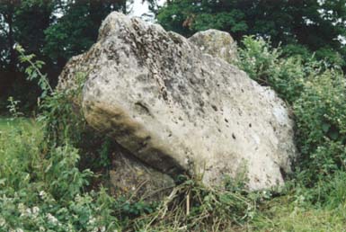
“It is said that the Goose stones are petrified Geese turned into stone for grazing Chastleton Common illicitly. Their owner or guardian, an old lady, used to drive them down Grey Goose Lane to graze. Despite being warned about this she continued the practice and the stones are all that are left of her geese. What happened to her is unknown; the stones however have been dragged away to adorn a local landowners garden.
All that remains are a few loose oolites scattered across the common, and a possible monolith. The location commands a good view of the valley to the north west of the site and is located close to Adlestrop hill site of several now overgrown and abused long barrows. ”
Sand Point is rather like Brean Down, and sticks out into the Severn Estuary just north of Weston super Mare. If you are equipped with a decent map you will easily be able to avoid paying 70p on the toll road, not to mention avoid going through the seething heart of Weston. But anyway, by the time you’ve driven out along Sand Bay all this will be long behind you and you can park in the surprisingly free NT carpark right at the end.
We walked out along the salt marsh and finally had to make a perilous scramble up the cliff to the top of the point, which was bedecked in various limestone grassland plants like the weird carline thistle. It was as peaceful as could be with the distant sound of the lapping waves, and the sun beating down on our heads. It really was very quiet and I felt remote from things (especially the throngs in Weston – it is incredible that two such dissimilar places could be so near to each other). The rocks are all jagged, though there are easily negotiated paths (assuming the sun hasn’t got to you too much) and plenty of grassy places to sit. The end of the point is about a kilometre out, but as usual most people don’t get quite this far away from their cars (or the icecream van, and who can blame them).
Returning along the top we saw some strange bumps in the ground – there turns out to be a bowl barrow here (this is where the os trig point is) and slightly to the east, the remains of a disc barrow. Disc barrows are pretty unusual; there are only a couple of hundred in the country, most in Wessex, so perhaps this would have been one of the most westerly examples? It’s been suggested that they’re usually burials of important women (though it’s not proven).
Whatever, don’t get too excited because there’s not exactly a lot to see of the barrows. In fact if anything you may get confused by the nearby earthworks of a more recent motte and bailey castle. But it’s a lovely place on a sunny day. And if you’re into birdwatching apparently unusual migrants are often spotted from here.
Article by Kevin L Callaghan.
Paul Ashbee’s article on the stones, especially with reference to the Coffin Stone.


From Yorkshiretoday.co.uk
THE discovery of 12,000-year-old artwork on the walls of a North Derbyshire cave could spur on a bid for World Heritage Site status.
The momentous find at Creswell Crags is believed to give the clearest evidence yet of how far north man had travelled during the ice ages. But while archaeologists are still in raptures over the images, mostly depicting animals, trust chiefs running the site believe it could spell great things for the area.
Nigel Mills, of Creswell Heritage Trust, said the paintings – thought to be Britain’s first ever cave pictures – could mean the resurrection of an ambitious scheme to gain World Heritage Site status.
He said: “Creswell Crags is a hugely important site. The quality and the quantity of archeological evidence which has come from the site are second to none. At the time when these paintings were made the crags would have been at the very edge of the ice sheet which covered much of the North of England. The paintings are evidence that the crags were the most northerly place visited by ice age man. For these reasons the crags are unique places – and something that is so unique could form the basis of a bid to be a World Heritage Site. In 1996, a bid was put forward but was rejected. In the light of recent events it may now be appropriate to reconsider that application.”
The Creswell Crags site has come a long way in the intervening years when it was blighted by the nearby location of a sewage works and a busy road cutting through the gorge. Major progress has already been made on moving the sewage works and diverting a section of the B6042 road. The trust, set up in 1990 to safeguard the site, is leading a £14m scheme to regenerate the former coalfield area. Part of the scheme will see the construction of a £4.5m museum and visitor centre which it is hoped will secure the long-term future of the site.