


Matlock Mercury:Published on Friday 23 September 2011 09:35
A stone at the popular tourist site Gardom’s Edge in the Derbyshire Peak District may in fact be a 4,000 year old seasonal sundial, experts suggest. Academics in astronomy and landscape history from Nottingham Trent University will present the findings from a study of the site at the European Society for Astronomy in Culture conference in Portugal this week.
The project involved surveying and analysing the orientation of the single standing stone, which is linked to a nearby stone age monument, including its deterioration through erosion.
The experts have been able to make their prediction based on the stone’s orientation, the dip of its slope and the altitude of the sun at midsummer.
It is thought that late Neolithic people may have used the illumination of the slanted side of the 2.2m high stone as a marker for seasons and, crucially, seasonal migration, which was so important at the time.
Single standing stones are quite rare in the Peak District, and the possible use as a seasonal sundial is unique within the British Isles.
The univeristy’s Dr Daniel Brown said: “We know that people here moved from summer pastures on higher hills to winter retreats located in valleys.
“This single standing stone gives us an idea of how ancient man perceived the skies and how ancient monuments and landscapes can reflect this.”

09/11. “They’ve got a flyin teapot...don’t need a taxi”.....Close to the equally new spiral carving.
This barrow and its close neighbour Chatsworth Park Barrow are relatively new discoveries. Barnatt & Collis do not mention them in the barrow corpus, neither does Marsden in his earlier work on Derbyshire barrows.
It wasn’t until John Barnatt surveyed Chatsworth Park, and subsequently published a book on the estate, that they came to light.

Some of the flint tools recovered from the barrow. Sheffield Weston Park Museum.

09/11. Piece of an ‘edge’ scraper? Worked down the left hand side. Found in field 20m away from the barrow.
The stone was moved to the village of Pilsley where it was used as a pig trough....but pigs died and the landowners suffered bad luck until the stone was replaced on the barrow.

This small barrow of earth and stones, 7m x7m and below 0.5m in height, lies by the side of an ancient trackway. It has outstanding views through the valley to the hillfort/enclosure at Carl Wark.
Atop the barrow is a wayside cross base known as the Baptism Stone or Christening Stone.
Think the stones visible in the hollow on top of the barrow are in fact the remains of a lime kiln.
From Cheshire HER:-
Name: Standing stone at Ginclough 400m WSW Gin Clough Farm
SMR Number: 1606
Type of record: Monument
Map Sheet: SJ97NE
Parish: RAINOW, MACCLESFIELD, CHESHIRE EAST
Summary
Large stone or glacial erratic by track to Cutlers Farm, Rainow Road. The stone is cut away on 2 sides to create a square face on the east side The stone stands just under a metre high on the south side of the road. Standing stones are large stones of Prehistoric date that are though to have been placed upright for some sort of ceremonial purpose. They are sometimes set in pairs and are often found near other prehistoric sites including burial grounds.
Monument Types
STANDING STONE (Late Prehistoric – 4000 BC? to 42 AD)
Protected Status
Scheduled Monument 25702: Standing Stone At Ginclough 400M Wsw Of Gin Clough Farm
---------------------
Pastscape also list this stone as a reused Bronze Age standing stone.

The damaged barrow....stone in centre of photo and one to right are remaining kerbstones.

The outer rim of the barrow can just be made out by the darker green grass to the right of the photo.

With much imagination the barrow can just about be made out roughly centre of photo. The line of trees behind mark out the route of the Roman road.

The 2nd of the 2 barrows on Gratton Hill looking south towards Pea Low and Alstonefield.

Narrowdale Hill to the left...the lower slopes of Gratton Hill, where there are several cairns, to the right.


LMS Route Book No.3 The Track of the Royal Scot. 1920s.
Showing 2 other Monoliths north of Holme Head.
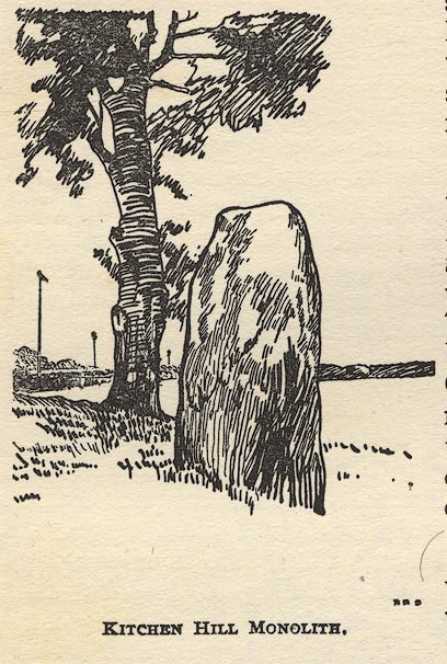
LMS Route Book No.3 The Track of the Royal Scot. 1920s.
Around 120m from the cairn Harland Edge SW (b) this circular cairn of around 6m in diameter is also overgrown and again probably related to a settlement or something below Harland Edge to the south (Harland Sick).
Unless you are walking Harland Edge then there’s not a lot to make you want to find this cairn. It’s roughly 5x4m in diameter and just visible above the scrub and heather.
From its position just below Harland Edge proper I would say it’s more than likely related to the settlement on Harewood Moor or perhaps one below the ‘edge’ itself rather than those on Beeley or Gibbet Moor.
Excellent views south over the remaining Eastern Moors to the White Peak in the south.
Small area consisting of a cairnfield and linear field clearance just about visible above the moorland grass a couple of hundred metres from the Millstone Sick. The NMR states that a house stance/platform is also visible but I couldn’t find or make that bit out for certain.
The NMR also records the possibility of a stone circle on Harewood Moor. In his books John Barnatt does not mention it however, and my search of the area has yielded nothing up to now.
In all the remains are not really worth the effort of a special journey, although the boundary stone that stands in an improved field and is known from the 16th century perambulations as Shirle Forke, approx. SK305670 and engraved with crosses is worth checking out in itself.
There are said to be 6 small cairns here, 2 of which are said to be definitely funerary because of their formal lay out i.e kerbs and dished interiors, but the area is so overgrown in thick heather or last years bracken that there is nothing to be seen on the surface.
Approximately 300m from the cairn at Fallinge Edge.
As Postman says very overgrown now...only two of the cairns remain visible and a small section of the kerbstones.
The rectangular setting nearby is now completely heather covered.


It’s not really worth the effort of the 800m or so rough and wet moorland crossing from the Raven Tor Triple Cairn to this small funerary cairn on Fallinge Edge.
It’s hard to tell whether the cairn’s been excavated at some time in the past or not. Although some of the stone has been robbed, no doubt when the nearby quarries were working, as half the cairn is only discernable from the ring of kerbstones that remain.
Around 7m in diameter and perhaps 0.4m in height.


Old postcard of the Wishing Stone.


Rainster Rocks lies near the south western end of a chain of dolomitic limestone outcrops that start in the north east at Harboro’ Rocks moving through Longcliffe Crags and finishing at Black Rocks.
Smaller in area than Harboro’ or Longcliffe the outcrop at Rainster is impressive because of its height.
With both the outcrops to the NE having a prehistory, (Harboro’ Rocks where a Neolithic passage grave was erected and a Neolithic cave burial was located along with signs of Palaeolithic activity and Longcliffe Crags where Rains Cave is sited), I’ve often wondered about Rainster Rocks and whether they were an important part of the ancient landscape.
So over the last 5 or 6 years I’ve been searching the area around the rocks for any kind of evidence. At the south side of the rocks is a Romano-British settlement and lead rake and this is noted in the NMR.
The area is also heavily marked with Medieval ridge and furrow so any chance of finding a long lost barrow wasn’t on the cards....but what there was was a prolific amount of mole hills....so I took my chance with them after successes with this method elsewhere in the Peak.
After a year or two with no success I started to take the lads up there with me to help me look....I showed them a piece of flint so they knew roughly what they were looking for and the youngest promptly went to a mole hill and recovered what looked to be a flint awl.
That was all that we found and nothing more turned up for several years until this year. Checking the mole hills this year I’ve found up to now what looks to be the rough out of a small flint axe and also a small quartzite celt (at least I think thats what they are, I’m trying to get in touch with the small finds officer at Derby’s museum to confirm my beliefs).
While I know that a couple of random finds prove nothing the rocks lie within 2 miles of the Neolithic/Mesolithic sites of Minninglow Hill and Tithe Farm, the Mesolithic site at Hoe Grange and the Neolithic sites at Roystone Rocks and Curzon Lodge.

Archaeologists have made the stunning discovery of a 5,500-year-old Stone Age village, home to Derbyshire’s first farmers and potters. Ben Johnson and his team made the ancient find during a painstaking dig in Peak District fields, near Wirksworth.


