
Watched this ring cairn/robbed cairn slowly become overgrown over the last 10years.
If it’s a ring cairn it’s a good one. And if it’s a robbed out cairn then it was a big cairn.


Fin Cop 2010 excavation report.
There’s plenty to see on Masson Hill. Crowning almost the very top is this barrow. the barrow is surrounded by caves, victorian show caverns (if you know the still open secreted entrances to them), mine shafts, mine levels, q-pits, gardens, cable cars and meres.....


The second stone mentioned in previous misc. post has now been donated to Leek Museum and is on display.

Langdale Tuff scraper found local to the axe factory; verified by several museums and others.
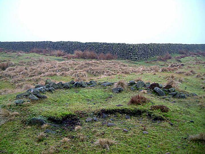
Been 8years since I last was at Offerton West. So overgrown was it back then that I wasn’t in a hurry to return.....gave it another shot today and the circle/ring cairn is quite prominent now, although the damaged western side is covered in dying bracken.
Worth a look. Photos dont really do it justice.


Now missing its centre and western side this would’ve at one time been quite an impressive cairn. It overlooks the settlement and field systems on the improved Highlow Bank.
From the standing stone, follow the wall east for a couple of hundred yards. When the wall changes direction the cairn is visible over the wall.

A Coppy Of Ye Boundaries Of Abney Lordship 12 Edward II (1317)
“.....and so to ye slack att Highlow Head and so straight over the moore to a round hill of knowle called Berching Hatt from thence to Standing Stone.”
I think Berching Hatt refers to the once large cairn at SK211 802, still on the parish boundary. Highlow Bank Cairn.

This is quite a large cairn, somewhere around 20 or so metres in diameter and less disturbed than its northern neighbour. A ring of gritstone kerbstones surround it.
SK22481 85614.
Parking at Dennis Knoll the cairn is about three quarters of a mile away on the top of Stanage Edge. The first half mile is all up hill with a final rocky scramble up to the Edge proper.
I’d left Matlock bathing in the sun under clear blue skies, but here only 20miles North, the wind howled up along Stanage Edge blowing in rain and hail storms every few minutes.
The north cairn at Crow Chin is around 20m in diameter and ringed by a gritstone kerb. Several smaller cairns from the excavation lie beyond its rim on the north side. And the stones of the dismantled cist within the cairn circumference to the south.
On a clearer day the views out over Win Hill, Lose Hill and Crook Hill would be superb.
SK22469 85614.

10/11. The larger stones are the remains of the dismantled cist, now being turned into a small walkers cairn.


10/11. The stones in the centre of the photo are the remains of the dismantled cist.


09/11. One of the better preserved house stance/hut platforms on the moor.

2004. one of the stones that might make up the enclosure of Gibbet Moor South....never got my head round this place.


This is now under an open access/right to roam area.


The Early Neolithic buildings at Lismore Fields, Buxton.
Approaching from the south along the Duke’s Drive that crosses the moor.....get to the old reservoir keepers house (now RSPB) keep to the vehicle track to the left and through the gate (as it skirts the property) 200m further on keep looking to the right, the circle is between the track and a large grassy/bracken clearing 50m from the track......there’s a quite well worn path around the circles circumference.
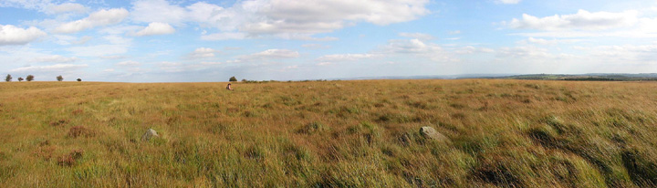
09/11. Two of the stones visible in the grass.....figure in back of pic is at back of circle.


