
IronMan


The cupmarked rock outcrop which forms part of the Torbhlaren alignment


On the path from the Carnasserie castle car park lies this hidden cist.

A view from the cairn to the standing stones – high on the horizon is the massive cairn called ‘Carn Bàn’ (indicated with an arrow).


The Carnasserie standing stones and cairn as seen from the top of the Carnasserie castle tower.


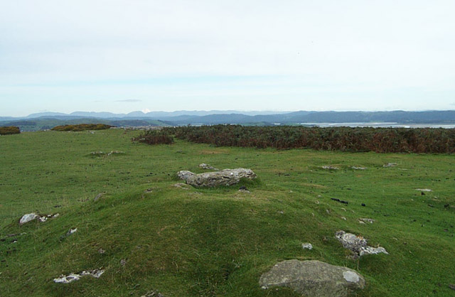
At least 11 groups of cup- and cup-and-ring markings lie in the valley to the north of Ardifuir farmhouse. Grid references, taken from RCAHMS’ “Kilmartin Prehistoric & Early Historic Monuments, an inventory of the monuments extracted from Argyll volume 6” are:
NR789970, NR789969, NR790970 (six at this reference), NR790971, NR788970 (two at this reference)
Images and description for this hidden site – gives directions, which is nice!


Black Combe as seen from Birkrigg Common, just above the Druid’s Circle of Ulverston.
I wasn’t really expecting much of this site – I’d previously seen a sketch of the chamber and was expecting more of a ruin. The chamber is in almost complete collapse, but the stones remain roughly in place so it is pretty easy to get an idea of the original construction. The setting impressed me most – oddly reminiscent of a few Welsh sites, Din Dryfol in particular, in its seclusion. Facing the site is a low, tree lined, limestone shelf with a natural break forming a kind of entrance. Here is a great example of a site obviously placed to compliment a naturally formed sacred, ritual landscape.


Opposite the monument is this small limestone plateau which must have played an important part in the rituals associated with the site.

It’s been three months since I last visited a site, for one reason and another – so I thought rather than go somewhere new with friends, I’d take myself to an old favourite, alone. I approached the site, hidden among the ferns, with some trepidation.
The last time I came here was in January and the ground was covered in frost, today’s scene was completely different – the grass still a lush green and the thick ferns just starting to turn an Autmnal colour. I stayed here at the circle for some time – taking in the view and studying the stones in detail, before setting off up the hill to the top of Birkrigg Common. I’d recommend the effort to anyone – the remains of a few burial cairns lie scattered over the moor on the way, and on reaching the top the view really opens up. The Lakeland fells, Morecambe bay and Black Combe dominate this panorama.


One of the fallen stones of the outer circle, hidden among the ferns
A view of the Lakeland fells from the top of Birkrigg Common, just above the Druid’s Circle
“Local folklore attributes Grubstones ‘to have been a Council or Moot Assembly-place’ in ages past (Collyer and Turner 1885). Considerable evidence points to the Freemasons convening here in medieval times and we are certain from historical records that members of the legendary Grand Lodge of All England (said to be ordained in the tenth century by King Athelstan) met here, or at the adjacent Great Skirtful of Stones giant cairn 400 yards east.”
‘Circles, Standing Stones and Legendary Rocks of West Yorkshire’ Paul Bennett
Image of one of the Dunamuck rows. Another image from the collection can be found here.
Images and description of these two cupmarked stones.
Images and description of the site.
When I last visited this, my ‘local’ circle, back in January, I decided to leave my next visit until a good sunny summers day, and reassess. I did just that this weekend and I’m glad I did. Last time I agreed with everything that had been said – dismal, dreary, lifeless – not lacking in atmosphere, but then again not exactly an exceptional site. With this visit, I’ve changed my mind completely. The location is perfect and best seen on a clear day.
The landscape is the key to understanding this place. The site is placed on a plateau of high ground. Three quarters of this high ground is surrounded by nearby hills – starting from the south-west (roughly) the view is made up of Smithills, Counting Hill, Winter Hill, Turton Moor (the top of Darwen Tower can just be seen rising above), Cranberry Moss, Entwistle, Edgworth Moor and finally Holcombe Moor and the victorian folly of Peel Tower. This makes up a huge horseshoe in the landscape, with the circle sat roughly in the centre. To the south the land is a flat plain for many miles – the modern towns of Bury and Bolton can be seen in the foreground with the tower blocks and grey office buildings of Manchester beyond. On the hazy horizon lies a fringe of high ground making up the Peak district. To the distant south-west, peeking out behind the bulk of Winter Hill and Smithills lie the mountains of North Wales.
This place is far from ‘bleak’ as described by Burl. It would be fair to say that in terms of a megalithic site there isn’t really anything to see, but that would be missing the point – it’s the position that’s important, and today I discovered that my local site is truly wonderful. I’ll definitely be making this journey more often.

For folks with a GPS device the 8 digit reference is NY82351423. An example of portable rock art lies nearby at NY83161466.
Within the Castle Fold Iron Age enclosure lies a cup-marked piece of sandstone. According to Stan Beckensall ‘it is debatable whether this cup-marked stone is contemporary with the site, or originates from a destroyed earlier Bronze Age cairn.‘
For anyone with a GPS device the eight digit reference is NY57127088.
There are four carved stones lying in the field near to the fence marking the edge of the military Danger Zone. A series of cairns also lie nearby (west and east).


Carreg Leidr, the “thief stone”, is said to be a thief who, having stolen a bible from the local parish church, turned to stone as he carried it away on his shoulders.
“At Llandyfrydog, in Anglesea, there is a curious stone, resembling a humpbacked man. It is said that a man who had stolen several valuable articles from the parish church at last desired to obtain the Bible from a cupboard under the altar, where it was kept locked up when not in use. The sacred volume was contained in a special cover made of carved wood, inset with precious stones and gold. It took the man several hours in the night to secure the Bible, and, under cover of the darkness, he ran away with it on his back. For this shameful theft he was turned into stone. [Rev. Elias Owen, “Welsh Folk-lore,” p. 260]”
An unlikely tradition says that this site was once part of a much larger, more complex monument – the two stones standing at the centre of a stone circle, with a burial cist between them.
This is one of a few tombs in North Wales to have a name from folklore. ‘Llety’r Filiast’ means ‘Lair of the Greyhound Bitch’, a name shared with several other tombs in Wales. There is no surviving story to explain it.
“A local tradition records that the larger ring was used as a cockpit in the 18th century, when cock fighting was very popular in this region.”
Frances Lynch, Gwynedd
Local tradition says that this stone was used in some way (?) to rid the place of a fiery dragon! The stone may have been moved in 1840, only to be returned to it’s original setting.