


breconbeacons.wordpress.com/2014/03/06/first-prehistoric-rock-art-discovered-in-the-brecon-beacons/
Very similar to the beeb story posted yesterday which I suspect was based on this. With the following at the end which may be of interest to some:
The National Trust’s Council for British Archaeology Community Archaeologist, Charlie Enright will be arranging a number of archaeological and survey days in the area in the coming weeks. He added: “This is a fantastic opportunity to get local people involved in an exciting archaeological project. They’ll be working alongside and learning from professional archaeologists and other likeminded people, acquiring new skills and contributing to our understanding of this fantastic site. If people are interested then they should contact me straight away to book – places are limited!”
Volunteers will be undertaking a range of archaeological activities including:
Recording the stone with Dr George Nash.
Conducting a geophysical survey in the area surrounding the stone to see if we can find any evidence of past human activity below the surface.
Condition monitoring and a topographical survey of the surrounding archaeology.
If you are interested in taking part – places are limited so please book by contacting Charlie Enright, Community Archaeologist at the National Trust, at: [email protected]
“HeritageTogether is an AHRC-funded project run by Bangor, Aberystwyth and Manchester Metropolitan Universities in conjunction with Gwynedd Archaeological Trust. Our aim is to use photographs of our heritage to create 3D models using a process called photogrammetry. We want to create an online library of our heritage, preserved digitally and accessible to everyone.
The project aims to provide new information about megalithic sites and their locations using 3D digital models, which can be generated from digital photographs.
The project aims to incorporate research by members of the public; we hope people will contribute to the project by uploading digital photographs of sites that they visit. Provided that the photos are taken in the correct way, from the images that people load up, we will be able to generate 3D models.
The “citizen science” aspect of the project will allow us to produce 3D models from a wide range of monuments from across North Wales. We hope that this way of gathering data will help us produce a representative (and perhaps comprehensice) catalogue of the heritage of North Wales, provide new research into the state of monument preservation, provide new views of monuments, and provide new evidence for monument use (in the form of rock art for example).
At the end of the project, the 3D models will be freely and publicly available to provide a research resource for members of the public and researchers, though the Historic Environment Record and via the Archwilio platform.
We will acknowledge the contributions of all individuals to the project, and contributors will be invited to the project exhibition, which will present the 3D modelling results. At the exhibition we will acknowledge a number of citizen scientists who we feel have made outstanding contributions to the project. ”
Stoke On Trent Museum Archaeological Society results for magnetometer and resistance surveying in the field next to the remaining stones. Also includes a brief antiquarian history of the site together with a report into a small excavation looking at anomalies in the scans.
Schulting,R., 2005. ‘… Pursuing a rabbit in Burrington Combe’: New Research on the Early Mesolithic burial cave of Aveline’s Hole. UBSS Proceedings, 23(3) , pp 171-265
Abstract: The main focus of this paper is the re-analysis of the fragmentary human skeletal assemblage from Aveline’s Hole. A brief history of the site’s discovery and excavation is presented. A minimum of 21 individuals can be identified in the extant collection, including both sexes and a wide range of ages from neonatal to older adult. Some stress markers are evident in the form of cribra orbitalia, linear enamel hypoplasia and Harris lines. Evidence for other pathologies is very limited, in part no doubt due to the poor preservation and representation of articular ends of longbones and vertebrae. Dental pathology is also low, with caries occurring on only one individual in the surviving assemblage. Interproximal grooves are present on a number of molars, and striations are also seen on some anterior teeth relating to non-dietary activities. Dental microwear analysis examines the occlusal wear on a number of molars in greater detail, provisionally suggesting a softer diet and more important role for plant foods than might have been expected for hunter-gatherers in a north-temperate environment. Stable carbon and nitrogen isotope analysis of 18 individuals shows no secure evidence for any consumption of marine foods, with implications for seasonal and lifetime mobility of the population using Aveline’s Hole. In apparent contradiction to the microwear findings, stable nitrogen values are high relative to contemporary fauna and suggest high consumption of animal protein. However, the two methods of palaeodietary analysis operate at very different time-scales, and also may emphasise different foods. Strontium isotope analysis suggests that most individuals interred at the site were drawn from the Mendips and its surrounding area, though some movement to the Chalk Downs may be indicated. AMS dating results further confirm an Early Mesolithic (10000-8500 BP) attribution to the burials, and in fact place the use of the site as a cemetery within a surprisingly brief period, between 8460 and 8140 cal BC, with a good probability that use was concentrated within a period of only 70-180 years. A brief discussion of the surviving faunal assemblage is also presented, including some new findings not noted in the original reports. Attempts to extract pollen from sediment in the medullary cavities of four long bones were partly successful, and the results consistent with an open pine-birch woodland in the area near the time of burial. The same sediments were analysed to determine their origin, which was found to be local to the cave environment. Finally, the wider significance of the site is discussed, with a tentative proposal that increased territoriality relating to rapidly rising sea levels in the early Holocene may be implicated.
Mullan,G.J., and Wilson,L.J., 2005. A Possible Mesolithic Engraving in Aveline’s Hole, Burrington Combe, North Somerset. UBSS Proceedings, 23(2) , pp 75-85
Abstract: In July 2003, a group of engraved crosses were found in Aveline’s Hole, Burrington Combe. Although it has not been possible to apply direct dating techniques to them, the evidence from their appearance and their archaeological context suggests that they may have been engraved during the early Mesolithic at a time when the cave was in use as a cemetery. Evidence for portable art from this site is also reviewed
This stone and others like it on the plateau are considered to be millstone roughs propped up with little stones. (Anglezarke and Rivington Moors – Archaeological Survey 1986)

Listed in Jodie Lewis’ The long barrows and long mounds of West Mendip (UBSS Proceedings, 24(3) , pp 187-206 Lewis,J., 2009.) this mound wasn’t discovered or noted until the 80s. Its 63m x 30m, remains up to 2.5m high and is oriented ENE/WSW.
No excavations have taken place but Jodie Lewis seems to fall on the more likely than not opinion of the site.
Lewis,J., 2009. The long barrows and long mounds of West Mendip. UBSS Proceedings, 24(3) , pp 187-206
Abstract: This article considers the evidence for Early Neolithic long barrow construction on the West Mendip plateau, Somerset. It highlights the difficulties in assigning long mounds a classification on surface evidence alone and discusses a range of earthworks which have been confused with long barrows. Eight possible long barrows are identified and their individual and group characteristics are explored and compared with national trends. Gaps in the local distribution of these monuments are assessed and it is suggested that areas of absence might have been occupied by woodland during the Neolithic. The relationship between long barrows and later round barrows is also considered.
Phillips,C.W., and Taylor,H., 1972. The Priddy Long Barrow, Mendip Hills, Somerset. UBSS Proceedings, 13(1) , pp 31-36
Abstract: The Priddy Long Barrow was partially excavated in 1928. It had been previously disturbed. Its main structure was a cairn orientated approximately N-S with the higher and wider end at the south. Primary and secondary features were found. No objects by which these features could be dated came to light. The date of its construction is an enigma. From its form and structure a late Neolithic date may be presumed.
Lewis,J., 2002. Reinterpreting the Priddy Long Barrow, Mendip Hills, Somerset.. UBSS Proceedings, 22(3) , pp 269-288
Abstract: The Priddy Long Barrow was partially excavated by UBSS in 1928, the first long barrow excavation to be undertaken by the Society. A very short report detailing some of the findings was published by Phillips and taylor in 1972 (with editor’s comments), when it was suggested to be an artificial mound containing human bone of Late Neolithic date. Few other conclusions were drawn but intriguing details suggested that this was a complex monument, worthy of re-analysis. This paper details the results of an examination of the site archive and offers a new interpretation of the monument. It is argued that the Priddy long barrow is a non-megalithic long barrow dating to the Early Neolithic period. At least four phases of activity and construction are suggested. new information on the finds, destroyed during World War II, is also given and new plans presented.


Late upper palaeolithic flint blades. Now in Buxton museum.

Mesolithic unretouched flint flake. Now in Buxton museum. This was marked as Wetton Mill rock shelter, so may be in the wrong place.

Late neolithic early bronze age flint arrow head. Now in Buxton museum.


Probable bronze age baltic amber beads. Now in Buxton museum.

Late neolithic early bronze age pottery fragments. Now in Buxton museum.


Late neolithic early bronze age flint arrow head. Now in Buxton museum.

Late neolithic early bronze age pottery fragments. Now in Buxton museum.


Plan of lismore fields extended area in Buxton museum.

Late mesolithic chert and flint waste found in the knapping area of a circular dwelling. Now in Buxton Museum.

Late mesolithic chert and flint waste found in the knapping area of a circular dwelling. Now in Buxton Museum.

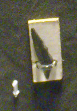
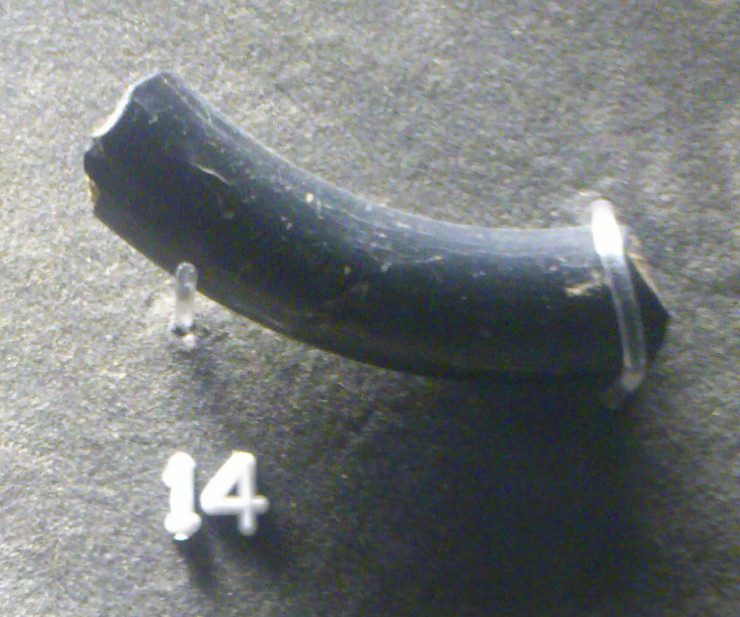
Found presumably at one of the quarries near/at King Sterndale. Its a late Bronze age bronze socketed spearhead. Currently in Buxton museum.

Late Bronze age bronze socketed axe found during work at Silverlands, Buxton. Currently in Buxton museum.

Late bronze age socketed knife found somewhere in Harpur Hill, Buxton. Currently in Buxton museum.
[visited 11/13] Out for a birthday sojourn, my actual target was the possible cup marks nearby, but it seemed churlish to ignore this so close to them. Getting here isn’t the easiest, I settled for a 20 minute trek through the heathery bog across Harland Sick from Hell Bank plantation. Not that easy but ok this late in the year. When I finally got here, it was well worth the effort.
What a weird weird site. The peaks does have a habit of unusual sites, hob hurst’s house being a km or so away, but this one may take the biscuit. From what I could tell on the ground and the HER, its basically two mounds separated by an open passage at both ends, including portal stones. I don’t know how much is left here, mounds of rocks are nearby, so this could be the bottom metre only, with the passage perhaps originally being covered turning this into one mound. All in all odd, I’ll try and get back here once I’ve found and read more reports on it...
Access is across open moorland for a km at least. The way straight across the moor from Hell Bank is easier than from Hob Hurst’s house, but still painfully awkward.
The following comment was left on “Anglezarle Misc 8” which I think describes this stone. Explains the carvings and that the stone was standing 100 odd years ago...
“Sadly, much nonsense has been talked about with regard to these stones.
There was a man called Andrew Mather who would have been about 120 if he was still alive today. Some 45-50 years ago he told me that when he was a boy, he had two friends and they called themselves ‘The Triangle Gang.‘
One of their favourite places to meet and camp was a small depression towards the southern end of Stronstrey Bank where there was a fairly tall upright stone. One of the boys carved a small triangle on the face of the rock as a symbol of their ‘club.’ Some time later, they carved a much larger triangle on the same rock.”
PRIDDY CIRCLE 1 – STATEMENT ON ARCHAEOLOGICAL MITIGATION AND REINSTATEMENT
BACKGROUND
In May 2011, large-scale unauthorised damage took place on one of the four Priddy Circles, a group of large, circular earthworks of prehistoric date which are protected as Scheduled Monuments. In October 2012, following a prosecution brought by English Heritage, the owner of Priddy Circle 1, Mr Penny, pleaded guilty to carrying out the unauthorised works. He agreed to pay for repairs to the monument and other mitigation works at a cost of around £38,000. He was also fined £2,500 by Taunton Crown Court and ordered to pay costs of £7,500.
The circle is designated and protected under the Ancient Monuments & Archaeological Areas Act 1979 and under this legislation it is a criminal offence to undertake works to a Scheduled Monument without the consent of the Secretary State (known as Scheduled Monument Consent).
In addition to a substantial fine and costs, Mr Penny signed a Voluntary Agreement committing him to funding a package of ‘reinstatement’ works, the detail of which was to be approved by English Heritage. Although we argued that some archaeological investigation should be an important part of an overall package of restorative justice works, the court was clear that the focus of the work funded by Mr Penny should be on aspects of physical reinstatement as opposed to archaeological investigation of the damaged areas.
ENGLISH HERITAGE PRESS STATEMENT
Given the national and international significance of the Priddy Circles, English Heritage felt it important that the damage caused to the monument should not be repaired without some archaeological investigation taking place. Therefore, a programme archaeological work was designed by English Heritage, focusing on the parts of the monument that had been either been damaged or disturbed. The work was commissioned to run alongside the evaluation phase of the reinstatement works, which was necessary to inform decisions on whether to restore areas of the circle that had been subject to earthmoving.
Over Spring and Summer of this year, English Heritage, together with archaeological contractors AC Archaeology, undertook a programme of assessment and evaluation, including a geophysical survey of the damaged parts of the site. The results of this work helped in the design of an archaeological excavation which was carried out in September and October 2013, and focused on an area of deep wheel-rutting caused by the creation of a track way through the site during the unauthorised works.
The fieldwork is now completed and post-excavation analysis and recording are currently underway, including the use of specialist scientific dating techniques by English Heritage at our laboratory in Portsmouth. The results will be published in due course, and it is hoped they will advance our knowledge and understanding of this rare and early monument type, in addition to helping inform management decisions for the Priddy Circles and similar monuments elsewhere.
The final part of the reinstatement works is due to take place early in the New Year, when some reconstruction of the bulldozed circle bank will take place. This is a limited piece of work with two objectives – firstly, to restore some of the form and legibility of the circle and secondly to cover over and protect important Neolithic archaeology which had been left exposed by the damage. When this work is completed, Mr Penny’s obligations under the Voluntary Agreement will have been met and the Scheduled Monument will once again be in a stable condition for posterity.
(from heritageaction.wordpress.com/2014/01/09/finally-priddy-good-news/)
Report on the 2008 excavations at the Priddy circles by Lewis, J & Mullin, D

Late neolithic early bronze age cinerary urn in Buxton museum found presumably in one of the many cairns.

Late mesolithic flint microliths found in the knapping area of a circular building, now in Buxton museum.

Late neolithic early bronze age flint artefacts and a bateman lead ticket. The flint artefacts and human remains were from secondary interments excavated by Micah Salt.

Earlier neolithic Grimston ware pottery bowl now in Buxton museum

