

This is the boulder with the quartz on top that marks the path leading to the area of the settlement

the track leading passed Moel lefn on the left towards Y gyrn with the settlement at it’s base
The Gwynedd Archaeological Trust Page
Bwlch ym Mhwll-le is the name of the gap between Moel Faban and Moel Lefn. (it means gap of the pool room?)
It’s a locally a famous feature and can be seen from a great distance.
One of the easiest ways to get here is to drive through the village of Llanllechid passing the church on the left. Then passing a farm called Cobri also on the left. Take the right hand turn which is marked as a “no through road” this leads to the old quarry.
Park up at the end of this road before the left hand bend next to a huge slate wall.
Walk up passed the the water filled quarry and then turn right down a wide dirt track with slate waste on either side.
Walk down to the metal farm gate and follow the dry stone wall up towards Lefn.
When the wall turns right you will see the path at the bottom of Moel Lefn ahead of you.
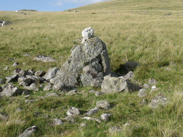
Follow this path passed the really nice dry stone sheepfold and you will see the big boulder ahead. This marks the site of the cairn to your left.
The cairn has been robbed out with a wide slice through it from the west.
It is in a great spot with excellent views of the Carneddau range to the south and the sea to the west.
You have fine views of the cairns on north slope of Moel Faban.
There is possibly another smaller cairn near by just to the north east.
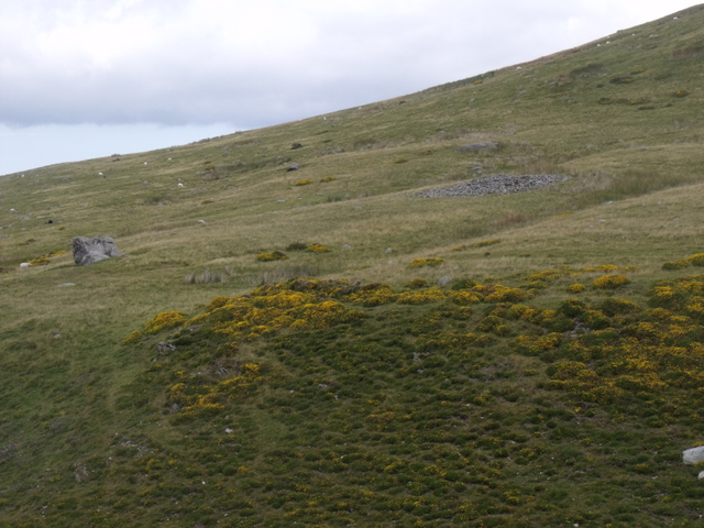
If you follow along the path to the end of Bwlch Ym Mhwll-le you come to the burnt mound and settlement of Moel Faban.

Bwlch ym Mhwll-le with Moel Faban on the left and Moel Lefn on the right.


Looking s-s-e.
The cairn was robbed out fom the west

Looking across Bwlch ym Mhwll-le from Moel Faban. Note the large natural boulder near by.


Looking south-west across Bwlch ym mhwll-le towards the cairns on Moel Faban

The Bwlch ym Mhwll-le Cairn is on the left on the south slope of Moel Lefn. The features that are possibly cairns (part of the moel faban settlement) are on the right in the foreground.
This massive out crop of rock is very close to the Rhiw Goch homestead settlement in Llanllechid.
The picture was taken from the Rhiw Goch settlement.
There are some very interesting marks on one of the stones next to it that are probably glacial marks but look like they could be man made. I will take some pics of these later.
I’ve no doubt that this massive rock would have held some significance to the people at the settlement and in any case would have acted as a marker for their settlement.

Massive natural rock feature can be seen from some distance.
On the B5025 just before the village of Llanfaethlu there is a chapel on the right hand side of the road. (Capel Soar) The road forks to the right.
On the corner of this fork is the old Black Lion pub. Now closed for business. You can easily park in front of this.
We climbed the wall.


Postmans images of this lovely stone inspired me to visit pretty much as soon as I’d seen them.
It does not disappoint. What a lovely warm pretty stone.
It shone in the sunshine.
Easy to find too. After visiting the roadside stone of Maen Addwyn from the village of the same name turn left then it’s the first left after the chapel.
The road looks like a farm track/drive. You pass a house on the right and then the stone is a little way down the road on your left. (before you get to the farm track on your right)
There is room to park on the verge and a gate into the field.
This stone is well worth a visit.


Panoramic view to the West


Looking west

The second feature is directly behind this one. Photo taken looking East


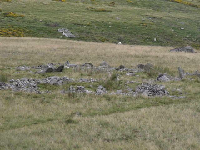
I know these features really well. I walk passed them every week while walking the dogs.
I’ve always thought that they were cairns. But I’ve looked on Coflein and GAT and found nothing about them.
They are not marked on the OS map as cairns. So I have been baffled. Clearly man made and very obvious they have had me scratching my head for a while.
Then I thought they are bound to mentioned on TMA, but no.
But then on Coflein I was reading about the settlement when I realised that the outlying structures to the North of the settlement (mentioned in Gladmans post) are these. Coflein suggest that they may be cairns.
I guess they are marked on the OS map as part of the settlement.
So I have added some pictures. They are on the North east slope of Moel faban just above the settlement.
On the A5 between Llangefni and Mona.
Just opposite the entrance to the industrial estate the stone can be seen from the road but it is easy to get into the field.
I couldn’t help but notice the rocky outccrop close by in the field.


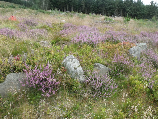
The northern arc of slabs. The Cist is in the hollow just inside.


This is the first view you get of the barrow as you approach.
The upright slabs can be seen (just about) poking out of the heather.


This is what Coflein has to say on the barrow