
The walling round the broch is around 4 metres in width and capped by well manucured turf.
Image credit: Les Hamilton
The walling round the broch is around 4 metres in width and capped by well manucured turf.

The flight of steps that led down to an intramural gallery.

Looking down the steps towards an infilled ground-level gallery at Thrumster Mains broch.

The gap in the broch wall, occupied by the ruins of a 19th century summer house.
Visited: June 25, 2019
One of the tourist attractions on Skye are the so-called Coral Beaches. But just a short walk from the car park that serves them are two megalithic relics, Claigan Dun and Claigan Souterrain.
To visit the dun, head away from the coast (east) along a well defined farm road for a shade over 500 metres, where you arrive at a metal gate. On your left is an extensive stone-built sheep fank, and on the rise beyond the gate stand the remains of Clagain. Canmore states that ”Most of the stone was robbed between 1824 and 1836 to build the sheep fank ... and some stone may also have been used in the construction of Claigan farm house and garden”.
There is not a great deal to enthuse the visitor here, although grassy ramparts hint at a few buried walling courses and a few larger blocks line a breach in the structure that presumably was the entrance passage.
Claigan souterrain lies a few metres across the fence that surrounds the dun on its south east, and is well worth searching for.


Some of the stones lining the entranceway.

The rudimentary stump of an original dun wall.

Only a few of the larger stones have survived the pillaging of this dun in the 19th century.

These grass covered ramparts presumably conceal the footings of long-vanished walling around the dun.
Visited: June 17, 2019
Stout footwear (preferably boots) is recommended for a visit to East Kinnauld broch. Although the 100 metre ascent starts along a grassy path, the final ascent is up a steep slope clad in grass and bracken. The broch itself is largely a jumble of tumbled masonry with no external walling courses in evidence although the entrance is clear to see.
That notwithstanding, there is a considerable amount of structure remaining to the discerning eye. A sizeable exposure of internal walling courses still stands, and you can still trace an intramural gallery arcing through the debris and disappearing behind this walling under a small triangular lintel. Adjacent to the entrance passage is a well proportioned guard cell.
And the views over Strath Fleet from this veritable eyrie are simply breath-taking.

There is still a semblance of orded within the ruined interior of East Kinnauld broch.

A section of internal walling courses still stands within the broch.


The well proportioned guard cell at East Kinnauld broch.

A gallery can just be discerned leading past the section of neat walling courses.

Evidence of an intramural gallery beneath the rubbls.
Visited: June 20, 2019
Carn na Mairg stands on the east bank of the River Thurso, just under a kilometre south from Westerdale. There is an excellent access path which starts 80 metres east of the bridge over the river Thurso. A new dwelling, painted blue-green, stands on your left as you walk across a concrete area to a tall fence. Pass through the gate in this fence and follow the path to the broch. The walking is excellent and the broch soon comes into view.
Carn na Mairg is a grassy mound standing at the very edge of the river. On its eastern flank, a large area of the broch wall is internittently exposed to a height of some fifteen or so courses. There is a well built entrance portal and passage on the southeast, though it was badly overgrown by nettles and on the east are the remains of defensive outworks.
But there is little to see of the interior of the broch, which is almost totally infilled. The only feature is a short section of a mural gallery which is exposed to show the neat walling courses on its inner side.

Carn na Mairg stands on the bank of the River Thurso.

Cairn na Mairg, as seen on approach from Westerdale to its north.


A thick growth of nettles all but obscures the entrance passage to Cairn na Mairg.

The entranceway at Carn na Mairg, thickly obscured by nettles.

The entrance passage and portal at Carn na Mairg.

Outer walling courses on the eastern flank of the broch.

Outer walling courses exposed at Carn na Mairg.

An exposed section of gallery at Carn na Mairg.

Visited:June 20, 2019
The third of a close group of three broch mounds on the bank of the River Thurso in Westerdale, Caithness, Tulach an Fhuarain is a featureless, fenced off grassy mound. It stands cheek by jowl with Tulach Lochain Bhraseil, just 50 metres to its northeast.

Tulach an Fhuarain, photographed from the River Thurso.
Visited: June 20, 2019
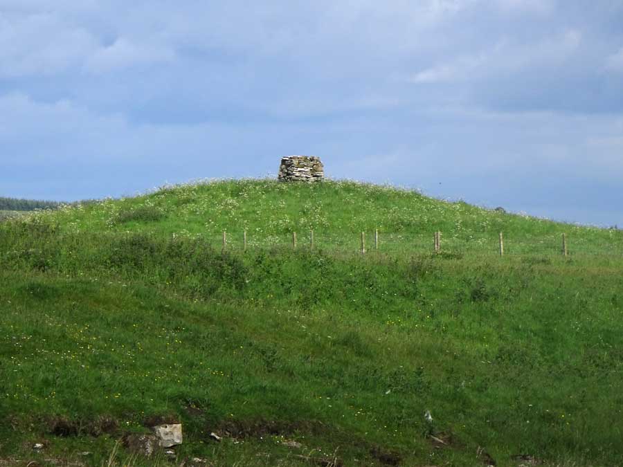
There’s not a lot to say about Tulach Lochain Bhraseil except that it is a grassy mound lying 250 metres northwest of Tulach Buaile a’Chroic Broch in Westerdale, Caithness.
Although it is understood that a broch lurks beneath the mound, absolutely no broch-like features are to be seen.
On top of the mound stands a recent man-made structure.

Tulach Lochain Bhraseil viewed from the bank of the River Thurso.

Revisited: June 18, 2019
I revisited Achvarasdal broch once more and was impressed by the improvements made since a year previously.
The entrance passage and the central court of the structure have been cleared of weeds, particularly plants of giant hogweed, and are now tastefully laid out with pink gravel chippings to create a much more pleasant visitor experience.
Members of tbe Caithness Broch Project and Caithness Countryside Volunteers are to be congratulated on their efforts, which include installing layers of geo-textile to inhibit future regrowth.
But the battle is not completely over as a number of mature hogweed plants were spotted within a few metres of the broch wall on the northwest. Hopefully work will continue to achieve total eradication of this dangerous, invasive species.
Broch Clean-up
You can read about the clean-up process in these articles from The John O’Groat Journal and Caithness Courier on April 4, 2019 and April 24, 2019


The entrance passage to Achvarasdail broch, viewed from the interior.
Visited: June 20, 2019
One of a cluster of broch mounds in Westerdale, Caithness, Tulach Buaile a’Chroic though rather bland in itself, stands in an attractive location on the bank of the River Thurso.
It has been reduced to a grass-covered mound some 3.5 metres tall, with only the minimalist evidence of masonry. A number of stones protrude from the upper southwest side of the structure, and may be remnants of a foundation course, while there is a small exposure of larger blocks on the northwest flank.
Not a broch to rave about, but the ambiance of the setting is undeniable.

In this picturesque image of Tulach Buaile a’Chroic broch, two other broch mounds are visible in the background.

The 3.5 metre tall mound of Tulach Buaile a’Chroic beside the River Thurso.

Tulach Buaile a’Chroic viewed from the south.

This small exposure on the northwest of the broch is the only visible walling.

What may be remnants of a foundation course peek out from the upper southwest flank of the broch.
Visited: June 17, 2019
North of Loch Brora, on the lip of a gorge on the Blackwater River, stands a hidden gem of a broch, Caisteal na Coille, sometimes dubbed ‘Castle Cole’. For the determined walker it would be possible to set out from the same starting point as for Carrol Broch broch. But this would mean a round trip of some 28 kilometres.
I decided to investigate a shorter alternative by driving through Brora where, immediately north of the River Brora, a minor road signposted ‘Balnacoil’ heads northwest, hugging the eastern shore of Loch Brora for 13 kilometres (8 miles). Your target is a left-hand bend on the road from which an estate road (marked by two prominent boulders, one on either side) heads to the right into a patch of woodland. There may be space for verge parking for a couple of cars here. If not, you should be able to park close to the bridge (red marker) over the River Brora, 700 metres farther on.
The estate road (yellow track on the map below) provides easy walking for just under 4 kilometres, by which time you should be level with the broch (white marker on map).
As you near your target, you will see ahead a small stand of a dozen or so mature trees just to the right of the track. By now you will see the broch and must make a decision on the best point to leave the track and start crossing towards the broch. I found no evidence of any footpath leading from the road to the broch and surmise that this is simply because it is so rarely visited.
Now comes the hard bit, crossing some 300 metres of blanket bog, firstly downhill, followed by a climb up to the mound supporting the broch. But the effort is certainly worth it ...
Caisteal na Coille stands within an almost level grassy platform on the summit of a small hill that drops vertically into the valley of the Black Water, the northern tributary of the River Brora. The broch is constructed from rectangular sandstone slabs rising to at least a dozen courses at the entrance and twenty or more on its eastern side. On the western flank, which falls down to the river as a cliff, the walling is rudimentary (unless, of course, it was never more than a low boundary wall, since an approach from that quarter would be deemed impossible?)
The entrance is capped by a massive, roughly triangular lintel not dissimilar to those at Dun Dornaigil in Sutherland and Caisteal Grugaig in Glenelg, and leads to an entrance passage almost four metres long. To the east of the entrance lies a large guard cell, now uncapped, and the rampart beyond it shows indications of an intramural gallery. A striking feature of the internal walls of Caisteal na Coille is the number of cupboard recesses on display.
This broch is very much one for the connaisseur, and a visit to it is an experience to be treasured.
Further information relating to this structure can be viewed on the Canmore website.

Caisteal na Coille broch, perched on its mound, and flanked by the gorge of the River Blackwater.

Caisteal na Coille viewed from the approach path.

Caisteal na Coille broch on its level grassy platform.


Multiple tiers of walling courses on the eastern flank of Caisteal na Coille.